Skip to main content
Mapping Globalization
Menu
Skip to content
Data and Analysis
NetMap Studies of World Trade
Network Analysis
Maps
Narratives
Empires
Alexander the Great
Byzantine Empire
Invasion of the Goths
Migration
Asia
Eurasia
Europe
The Genetics of Prehistoric Migration
Indoeuropeans
Out of Africa
Menu
Skip to content
Contact
Tag:
Fauna and Flora
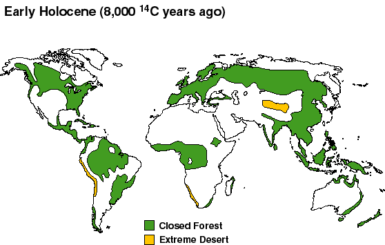
Vegetation Cover from the Early Holocene to the Present
World Soil Resources, 1993
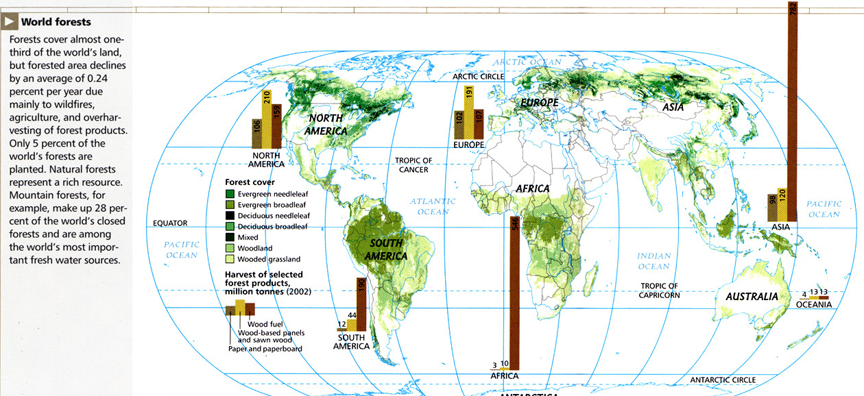
World Forests, 2005
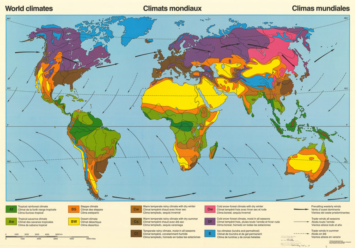
World Climates, 1984
The Fuelwood Situation in Developing Countries, 1981
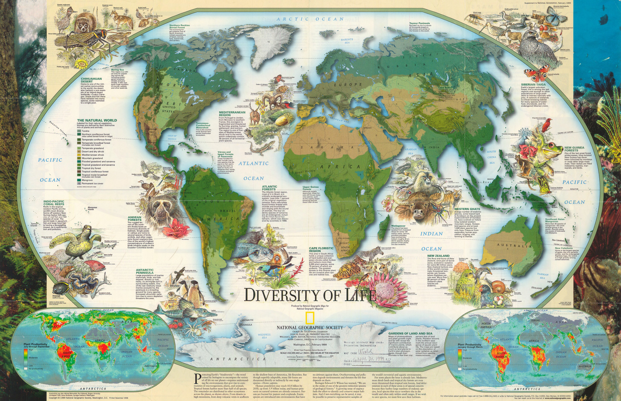
Millennium in Maps – Diversity of Life, 1999
Millennium in Maps – Biodiversity, 1999
Groundwater Resources of the World, 2006
Global Warming – Early Warning Signs, 1999
Endangered Earth, 1988
Caspian Sea, 1999
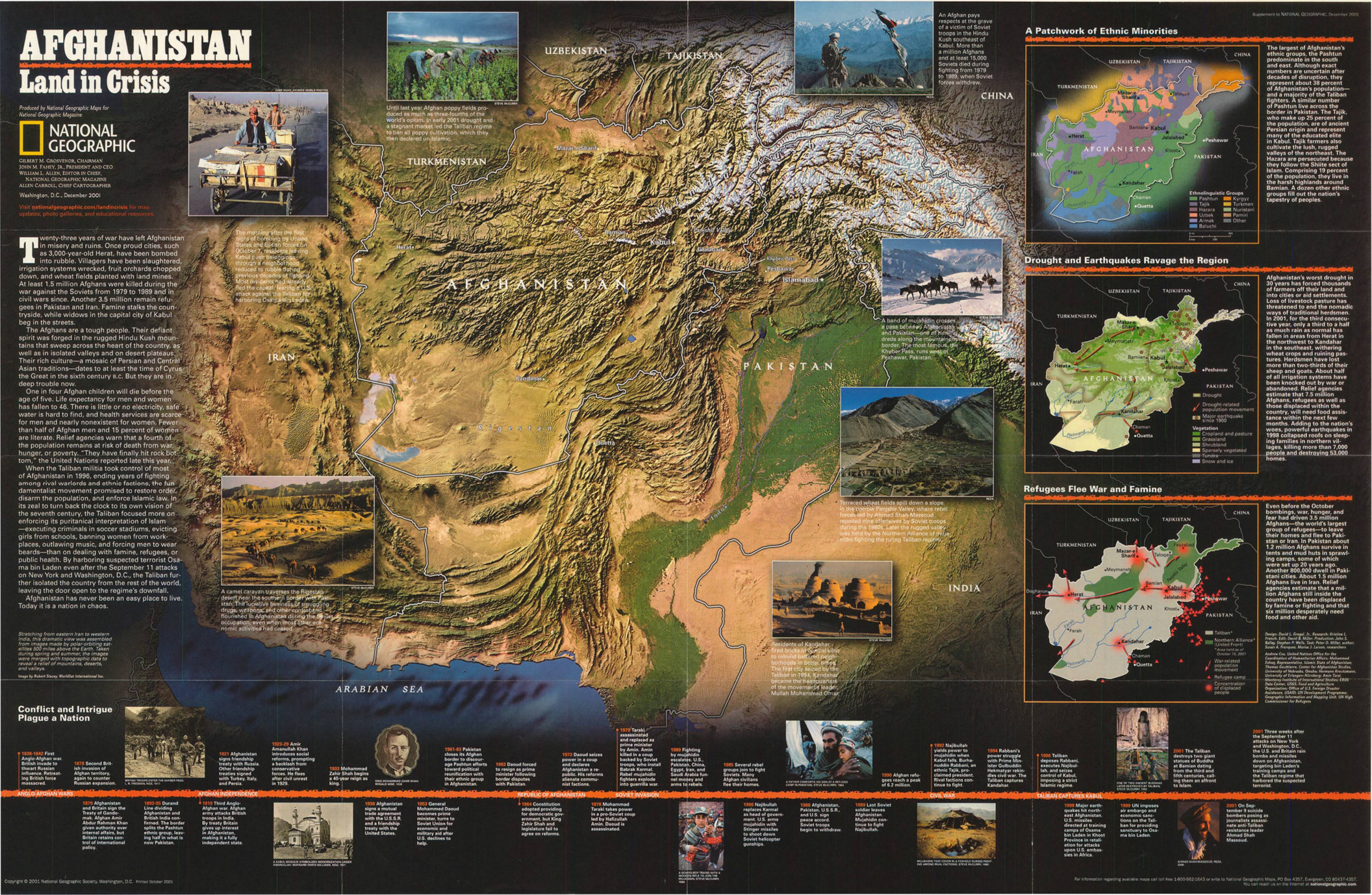
Afghanistan – Land in Crisis, 2001
The State of World’s Fisheries Inland and Marine Capture Fishery Trends, 1984 to 1998
Rainfall Map of the World – Mollweide’s Projection
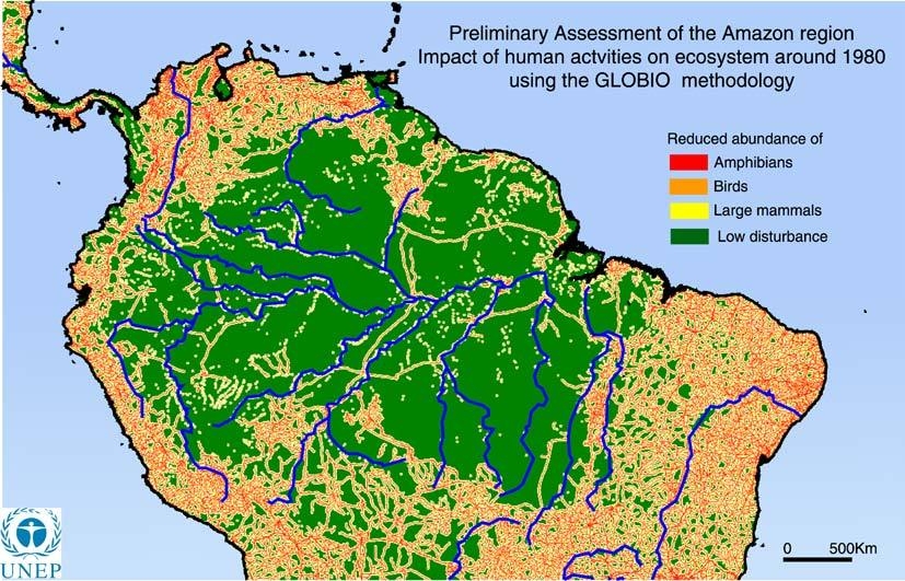
Preliminary Assessment of the Amazon region, 1980
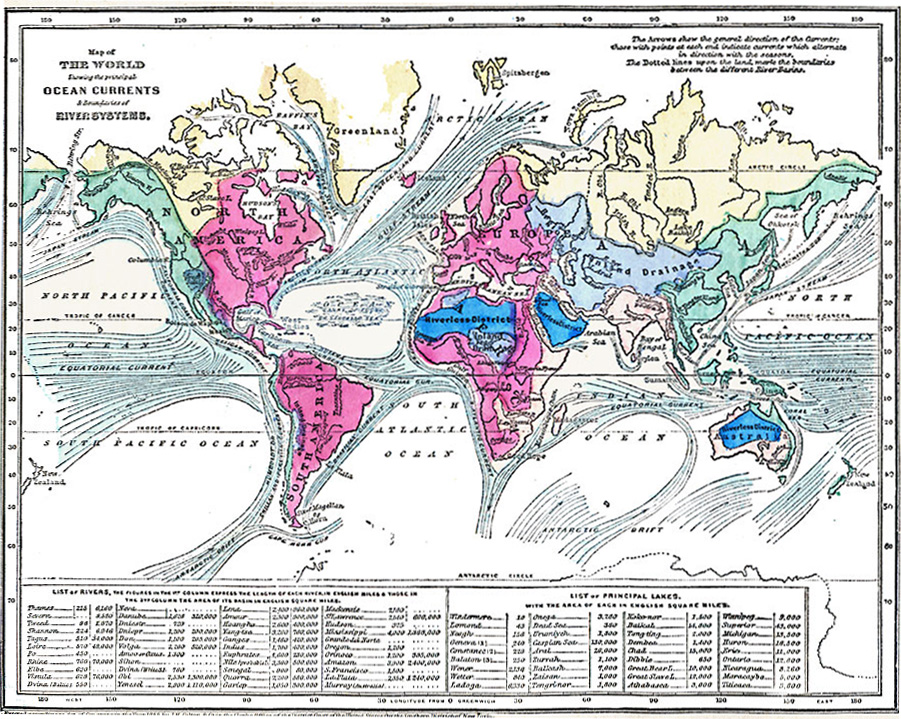
Map of World showing the principal Ocean Currents & boundaries of River Systems
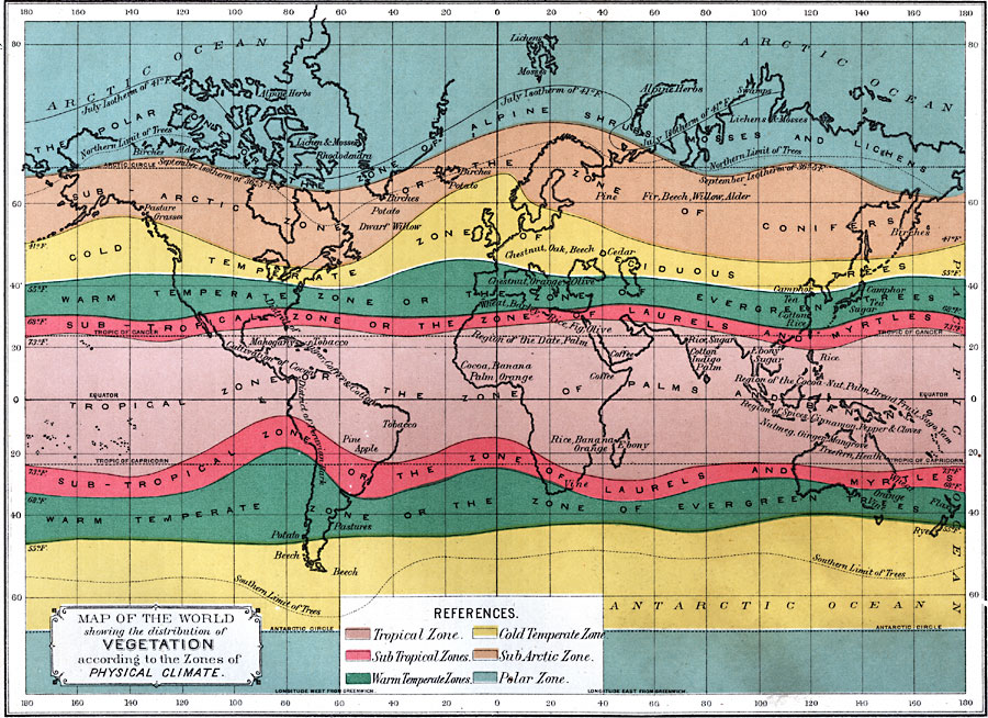
Map of the World showing the distribution of Vegetation according to the Zones of Physical Climate, 1891
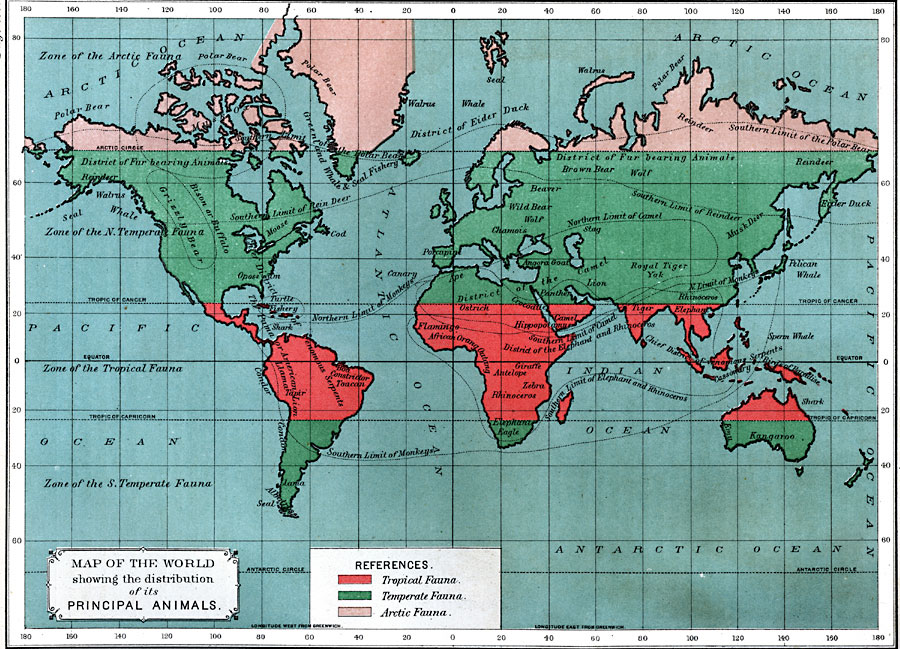
Map of the World showing the distribution of its Principal Animals, 1891
Major Global Bird Migration Routes to the Arctic, 2004
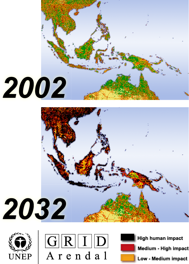
Loss of Great Ape Habitat from 2002 to 2032
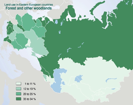
Land Use in Eastern European Countries, Forest and other Woodlands, 2000
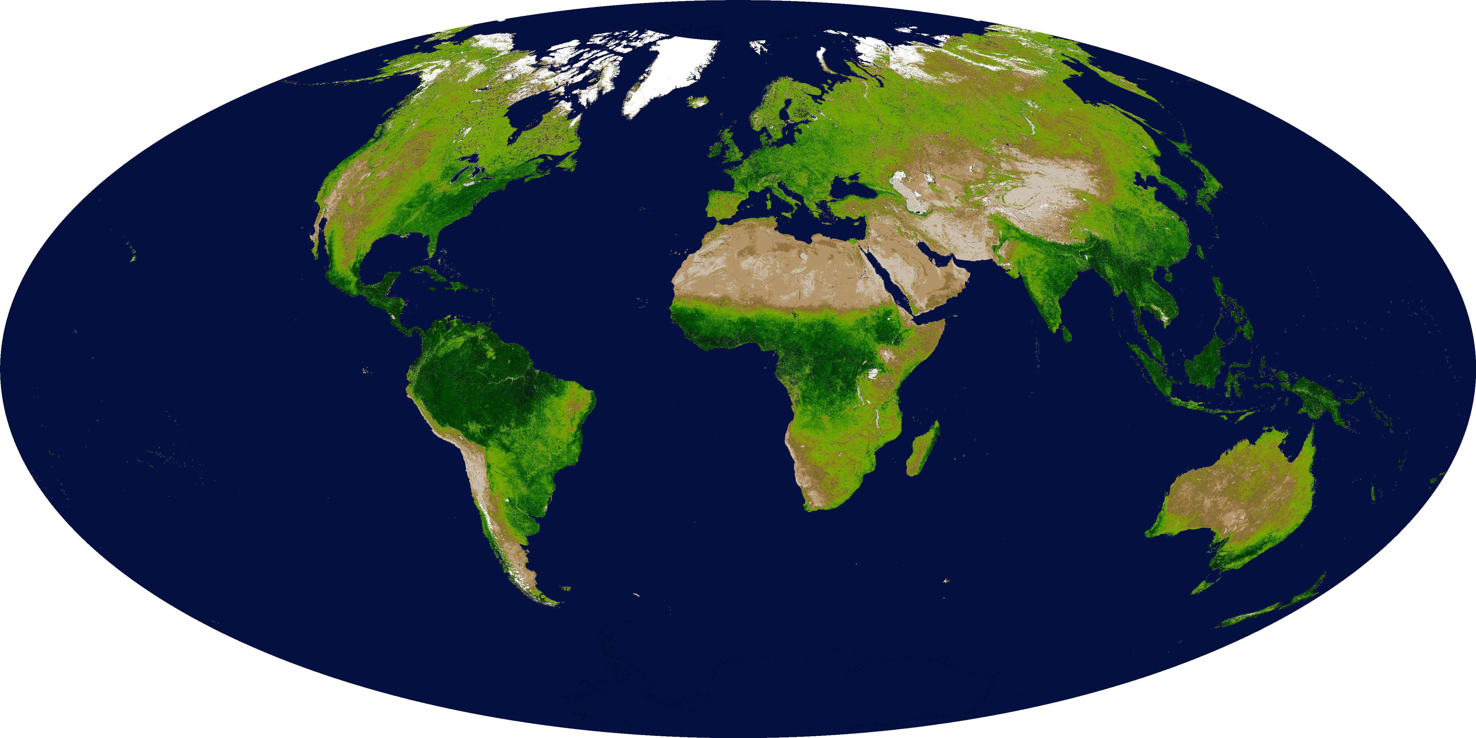
Global Enhanced Vegetation Index, 2001
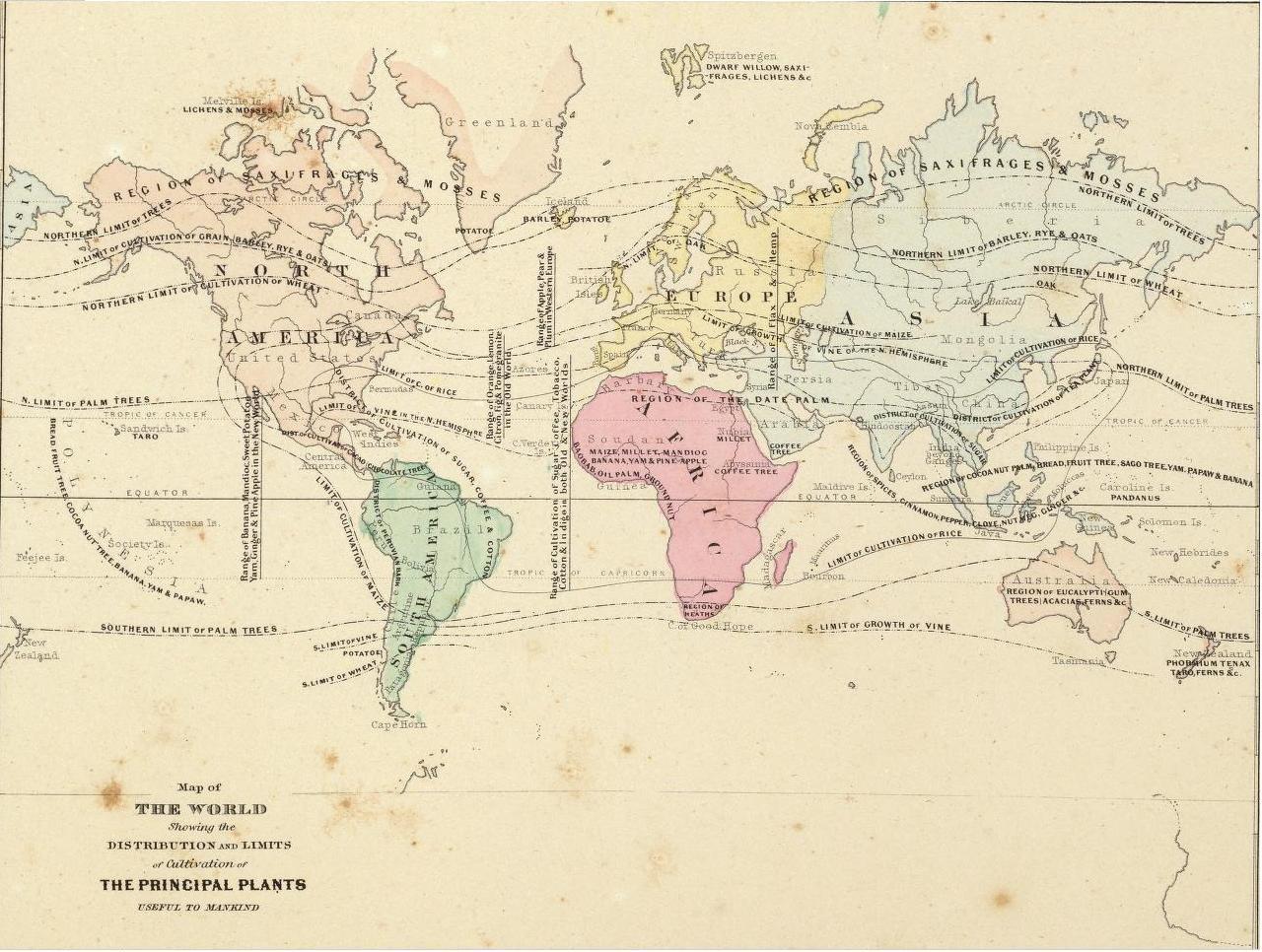
Distribution and Limits of Cultivation of the Principal Plants Useful to Mankind, 1865
Coffee Cultivation c1998
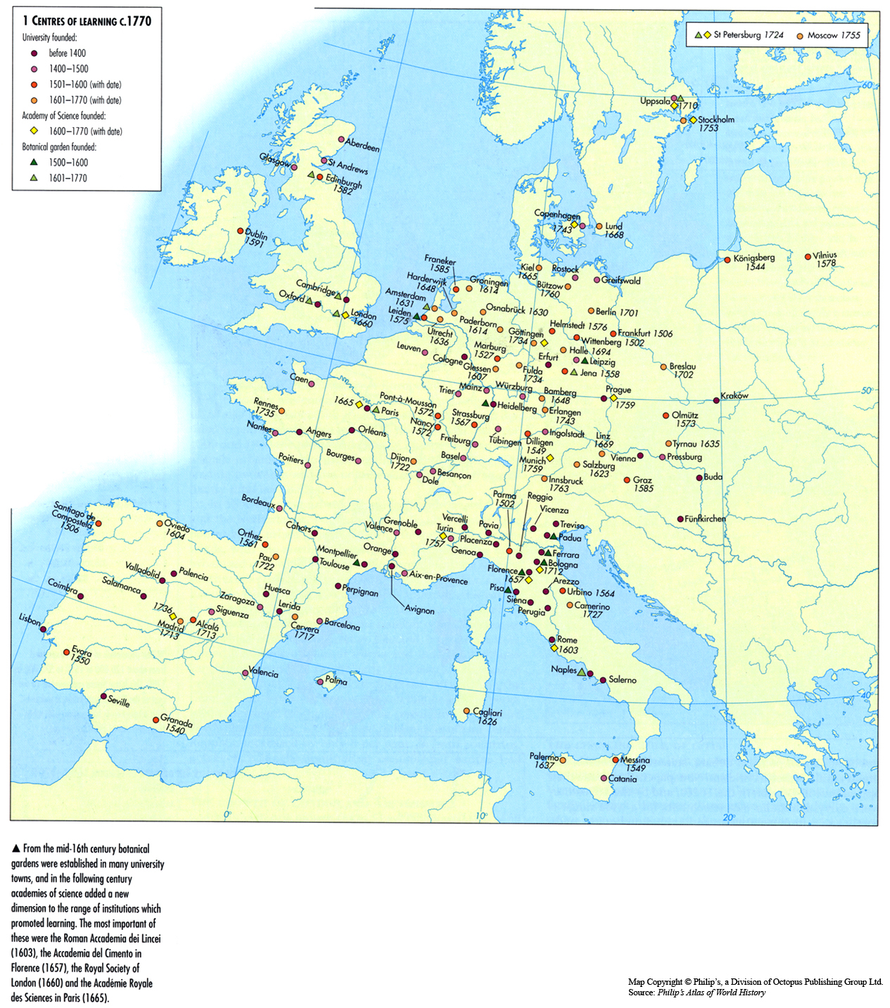
Centres of Learning c. 1770
Post navigation