
Caption
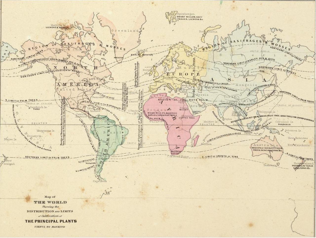
Distribution and Limits of Cultivation of the Principal Plants Useful to Mankind
Summary
The map shows the northern and southern limits of various types of plants, such as wheat, barley, maize, and rice.
Note
A zoomify version of a B&W variant of the map is also available:
Image:Distribution and Limits of Cultivation of the Principal Plants Useful to Mankind, 1868
Source
Plate No. IV on page VI of Colton’s Atlas Of The World, Illustrating Physical And Political Geography. By George W. Colton.
Complete In One Volume.
New York: J.H. Colton And Company, No. 172 William, Corner Beekman Street.
London: Trubner And Company, No. 12 Paternoster Row. 1856.
Inscription on the original map:
“Entered according to Act of Congress in the year 1855, by J.H. Colton & Co. in the Clerk’s Office of the District Court of the United States for the Southern District of New York.”
This digitized image is based on
the high resolution image of Page VI of Colton’s Atlas
in the David Rumsey Map Collection. The
high resolution image is in SID format.
Copyright
This image is in the public domain in the United States. In most cases, this means that it was first published in the United States prior to January 1, 1923 (see talk page for more cases). Other jurisdictions may have other rules, and this image might not be in the public domain outside the United States. See wikipedia:Wikipedia:Public domain and wikipedia:Wikipedia:Copyrights for more details.