
Caption
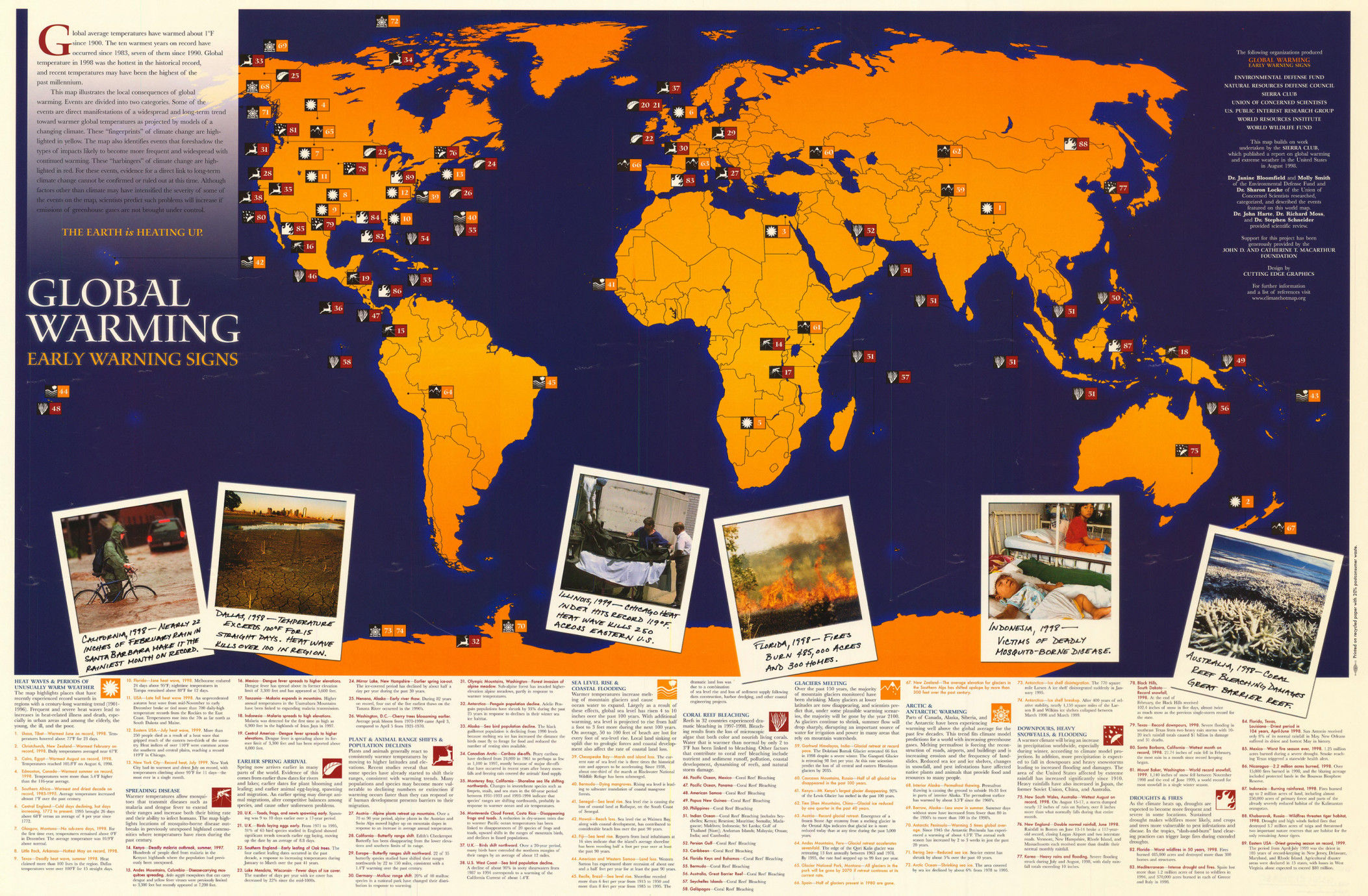
Global Warming – Early Warning Signs: The Earth is Heating Up.
Summary
This world map illustrates the local consequences of global warming by geo-referencing two kinds
of events:
- “Fingerprints” (yellow icons) indicate events that are indicative of a long-standing trend toward warmer global temperatures:
- Heat waves and periods of unusually warm weather
- Ocean warming, sea-level rise and coastal flooding
- Glaciers melting
- Arctic and Antarctic warming
- “Harbingers” (red icons) indicate events that foreshadow the types of impacts likely to become more frequent and widespread with continued warming:
- Spreading disease
- Earlier spring arrival
- Plant and animal range shifts and population changes
- Coral reef bleaching
- Downpours, heavy snowfalls, and flooding
- Droughts and fires
“Global average temperatures have warmed about 1°F since 1900. The ten warmest years on record have occurred since 1983, seven of them since 1990. Global temperature in 1998 was the hottest in the historical record, and recent temperatures may have been the highest of the past millennium.”
The map includes photographs illustrating different types of events.
Source
Natural Resources Defense Council
Union of Concerned Scientists USA (UCS)
U.S. Public Interest Research Group
World Resources Institute (WRI)
“This map builds on work undertaken by the Sierra Club, which published a report on global warming and extreme weather in the United States in August 1998.”
“Dr. Janine Bloomfield and Molly Smith of the Environmental Defense Fund and Dr. Sharon Locke of the Union of Concerned Scientists researched, categorized, and described the events featured on this world map. Dr. John Harte, Dr. Richard Moss, and Dr. Stephen Schneider provided scientific review.”
“Support for this project was generously provided by the John D. and Catherine T. Macarthur Foundation.”
Designed by Cutting Edge Graphics.
This map is in the collection of copyrighted maps of the Geosciences and Map Library, Fine Hall (B level), Princeton University.
Call number: MC G3201.C82.1999.E5
Copyright
© 1999 UCS and WRI.