
Caption
Preliminary Assessment of the Amazon region, 1980
Summary
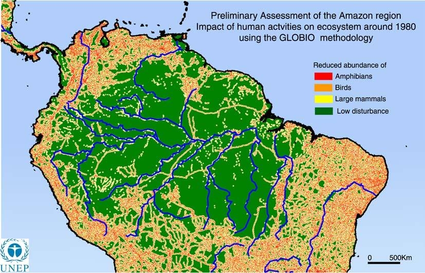
This map shows the preliminary review of the Amazon region in 1980 using the GLOBO methodology.
The map shows the reduced abundance of birds, amphibians, large mammals and low disturbance.
Source
United Nations Environment Programme / GRID-Arendal[1]
Cartographer/Designer: Maren Aschehour, UNEP/GRID-Arendal
Primary Source:
- Based on the DCW data. The layers included are: roads, railways, settlements and utilities.
Copyright
© 2006 UNEP / GRID-Arendal
Licensing
For use constraints, see [2].
Series
This map is one in a series For a listing with flyovers, see Series:UNEP / GRID-Arendal.