
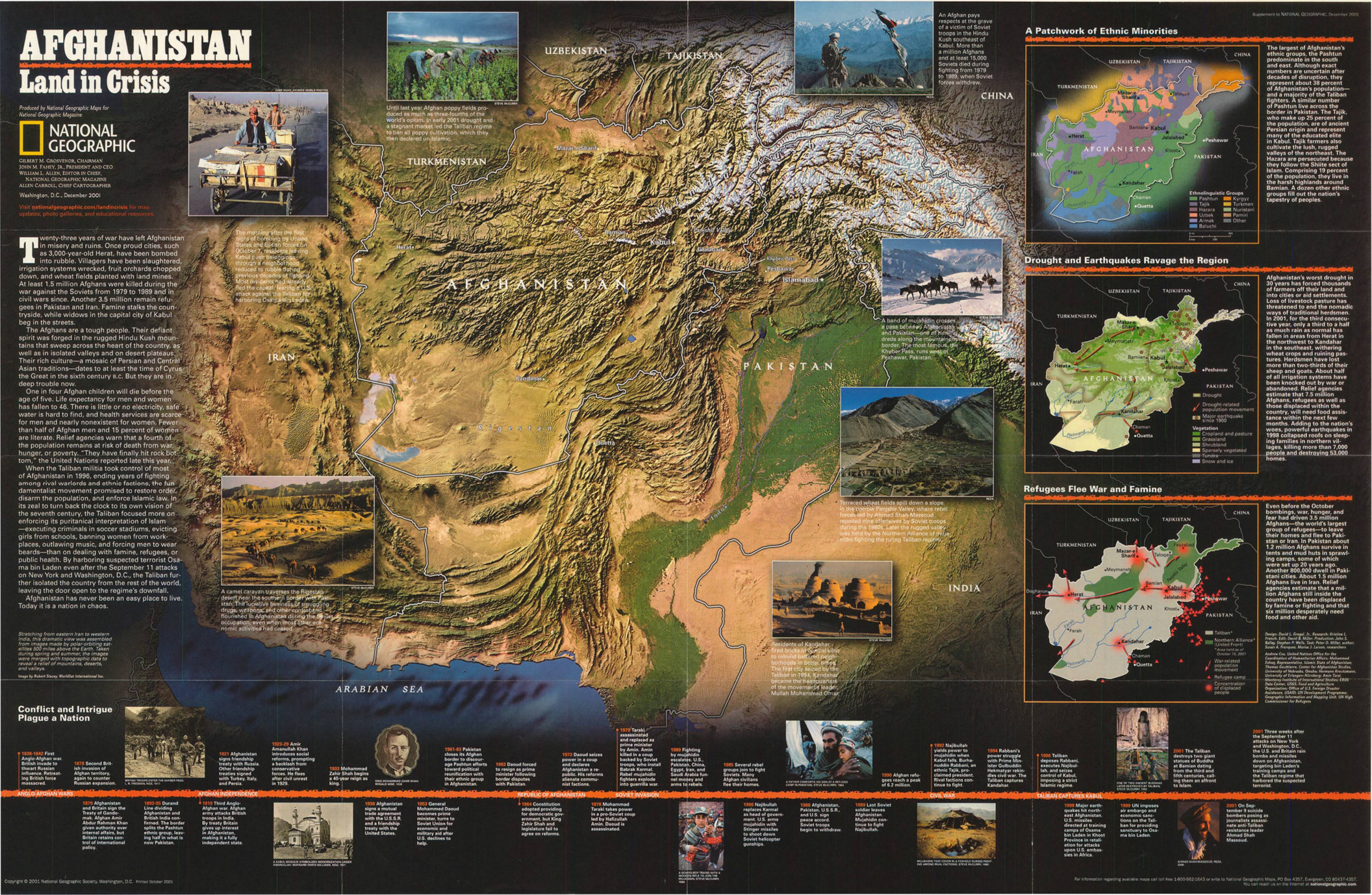
Caption
Afghanistan – Land in Crisis
Summary
This poster features a satellite view of Afghanistan with topographical information.
There are also three smaller maps:
- “A Patchwork of Ethnic Minorities,” showing regional ethnolinguistic groups.
- Legend:
- Pashtun
- Tajik
- Hazara
- Aimak
- Baluchi
- Kyrgyz
- Turkmen
- Nuristani
- Pamiri
- Other
- “Drought and Earthquakes Ravage the Region,” showing the climate-related migrations in the region.
- Legend:
- Drought
- Drought-related population movement
- Major earthquake since 1900
- “Refugees Flee War and Famine,” showing war-related population movement.
- Legend:
- Taliban territories
- Northern Alliance (United Front)
- War-related population movement
- Refugee camp
- Concentration of displaced people
An essay and a timeline from the First Anglo-Afghan War are also included.
Source
Produced by National Geographic Maps for National Geographic Magazine, Washington, D.C., 2001. Related article by Peter Miller Afghanistan: Land in Crisis.
This map is in the collection of copyrighted maps of the Geosciences and Map Library, Fine Hall (B level), Princeton University.
Call number: MC G7631.C1.2001.N3
Copyright
© 2001 National Geographic Society, Washington, D.C.