
Caption
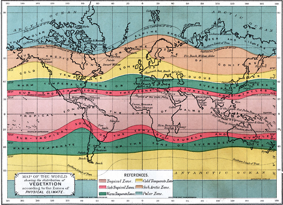
Map of the World showing the distribution of Vegetation according to the Zones of Physical Climate
Summary
This map was published Philadelphia, in 1891. It depicts a nineteenth-century classification of vegetation according to physical climate.
The legend gives this explanation of colors:
- Tropical zone: light purple – Zone of Palms and Bananas.
- Sub Tropical Zones: Pink – Zone of Laurels and Myrtles.
- Warm Temperate Zones: green – Zone of Evergreen Trees.
- Cold Temperate Zone: yellow – Zone of Deciduous Trees.
- Sub Arctic Zone: light brown – Zone of Conifers.
- Polar Zone: light blue – Zone of Alpine Schrubs Mosses and Lichens
Source
Edwin J. Houston, A. M., The Elements of Physical Geography (Philadelphia, PA: Eldredge & Brother, 1891) 121.
Map Credit: Courtesy The Private Collection of Roy Winkelman.
Courtesy of the
MAPS Technology Clearinghouse of the
Florida Center for Instructional Technology (FCIT) at the University of South Florida.
Copyright
The original map is public domain, but “Maps ETC is copyright © 2007 by the University of South Florida”.
See [2] for the license.