
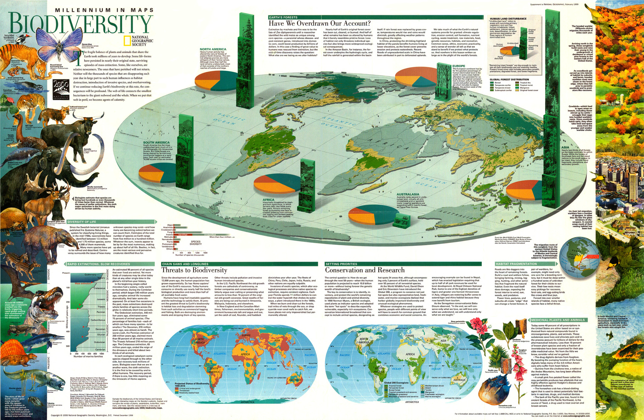
Caption
Millennium in Maps – Biodiversity, 1999
Summary
This poster includes three world maps and accompanying essays, graphs and supplemental materials.
The three principal maps depict:
- Global forest distribution
- Projected Status of Biodiversity, 1998-2018
- Global 200 Ecoregions
- Tropical Forest
- Temperate Forest
- Boreal Forest
- Tropical grassland and savanna
- Temperate grassland
- Mountain grassland and savanna
- Mediterranean shrub
- Desert
- Tundra
- Mangrove
- Freshwater ecoregion
- Marine ecoregion
The main map is labeled “Have We Overdrawn Our Account?” and also
shows pie charts on “Human Land Disturbance” depicting human
dominated, undisturbed, and partly disturbed percentages for each
continent. Vertical bar graphs show original, present and remaining
intact forest covers.
Essays:
- “Threats to Biodiversity” illustrates the degradation of biodiversity through commercial logging, fishing, pollution and invasive human-introduced species.
- “Conservation and Research” describes the need to conserve “hot spots,” representative land, freshwater, and marine ecoregions that harbor biodiversity worldwide.
Other components:
- Graphs on extinct and living species
- Information about bird migrations
- Special sections:
- “Rapid extinctions, slow recoveries”
- “Habitat Fragmentation”
- “Medicinal Plants and Animals”
Source
Produced by National Geographic Maps for National Geographic Magazine, Washington, D.C., 1999. Biodiversity: Taking Stock of Life.
This map is in the collection of copyrighted maps of the Geosciences and Map Library, Fine Hall (B level), Princeton University.
Call number: G3261.D1.1999.N3
Copyright
© 1999 National Geographic Society, Washington, D.C.
Series
This map is one in a series:
- Image:MG©Millennium in Maps – Biodiversity, 1999.djvu
- Image:MG©Millennium in Maps – Cultures, 1999.djvu
- Image:MG©Millennium in Maps – Diversity of Life, 1999.djvu
- Image:MG©Millennium in Maps – Population, 1999.djvu
- Image:MG©Cultures – Consumption and Circulation, 1999.jpg