Skip to main content
Mapping Globalization
Menu
Skip to content
Data and Analysis
NetMap Studies of World Trade
Network Analysis
Maps
Narratives
Empires
Alexander the Great
Byzantine Empire
Invasion of the Goths
Migration
Asia
Eurasia
Europe
The Genetics of Prehistoric Migration
Indoeuropeans
Out of Africa
Menu
Skip to content
Contact
Tag:
21st Century
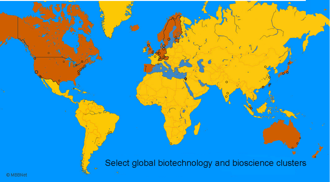
Select global biotechnology and bioscience clusters, c. 2005
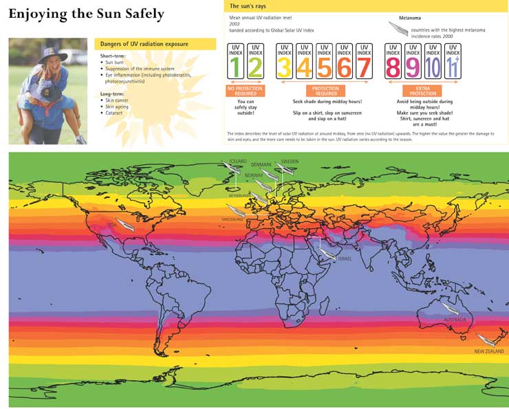
Enjoying the Sun Safely, c. 2000
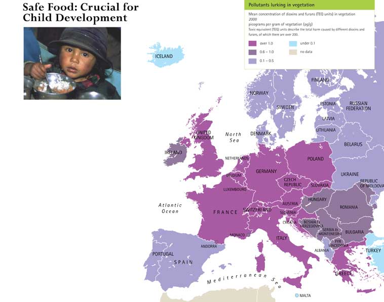
Safe Food: Crucial for Child Development, c. 2000
Outbreaks of Avian Flu in 2003-4 with Overlays of Human and Poultry Population Densities.kml
Polluted Cities: The Air Children Breathe, c. 2000
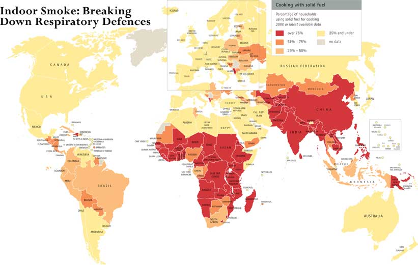
Indoor Smoke: Breaking Down Respiratory Defences, c. 2000
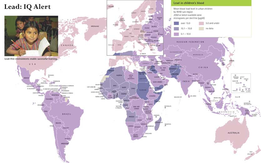
Lead: IQ Alert, c. 2002
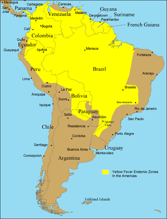
Yellow Fever Endemic Zones in South America
Yellow Fever Endemic Zones in Africa
When H5N1 was first detected
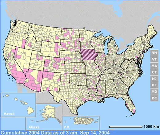
West Nile Virus Activity in the United States in 2004
Typhus Risk Areas
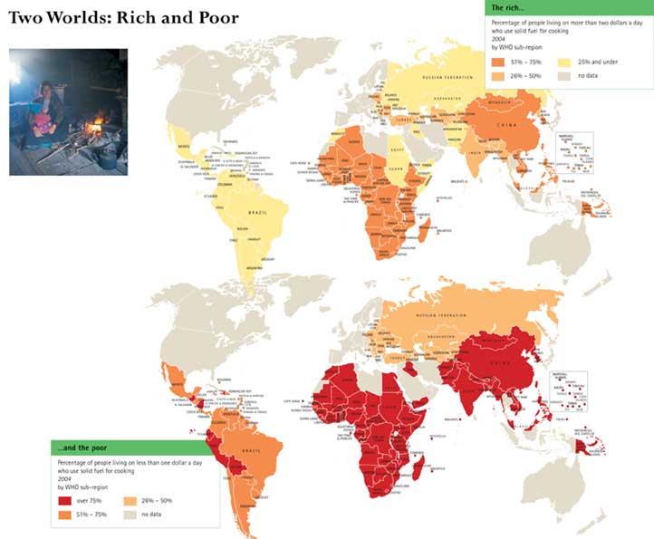
Two Worlds: Rich and Poor, 2004
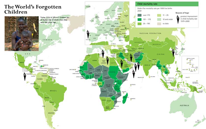
The World’s Forgotten Children, 1970-2000
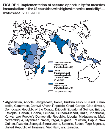
Progress in Reducing Measles Mortality – Worldwide, 2000-2003
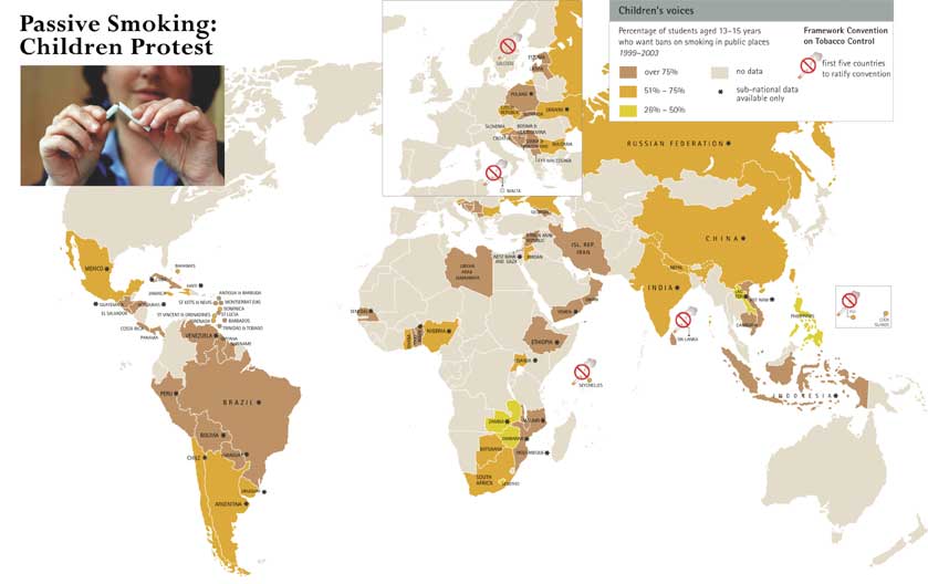
Passive Smoking: Children Protest, 1999-2003
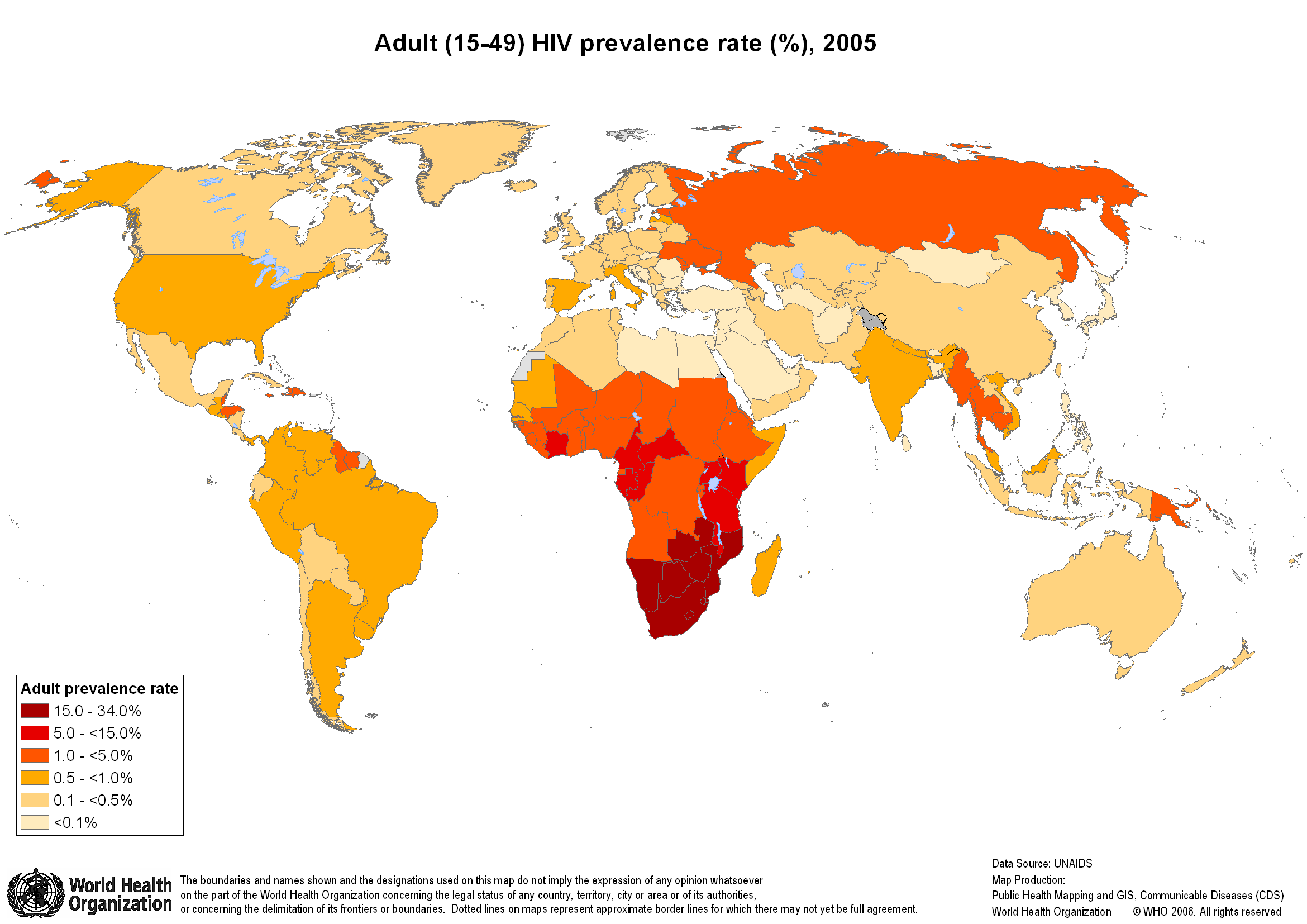
Adult (15-49) HIV prevalence rate, 2005
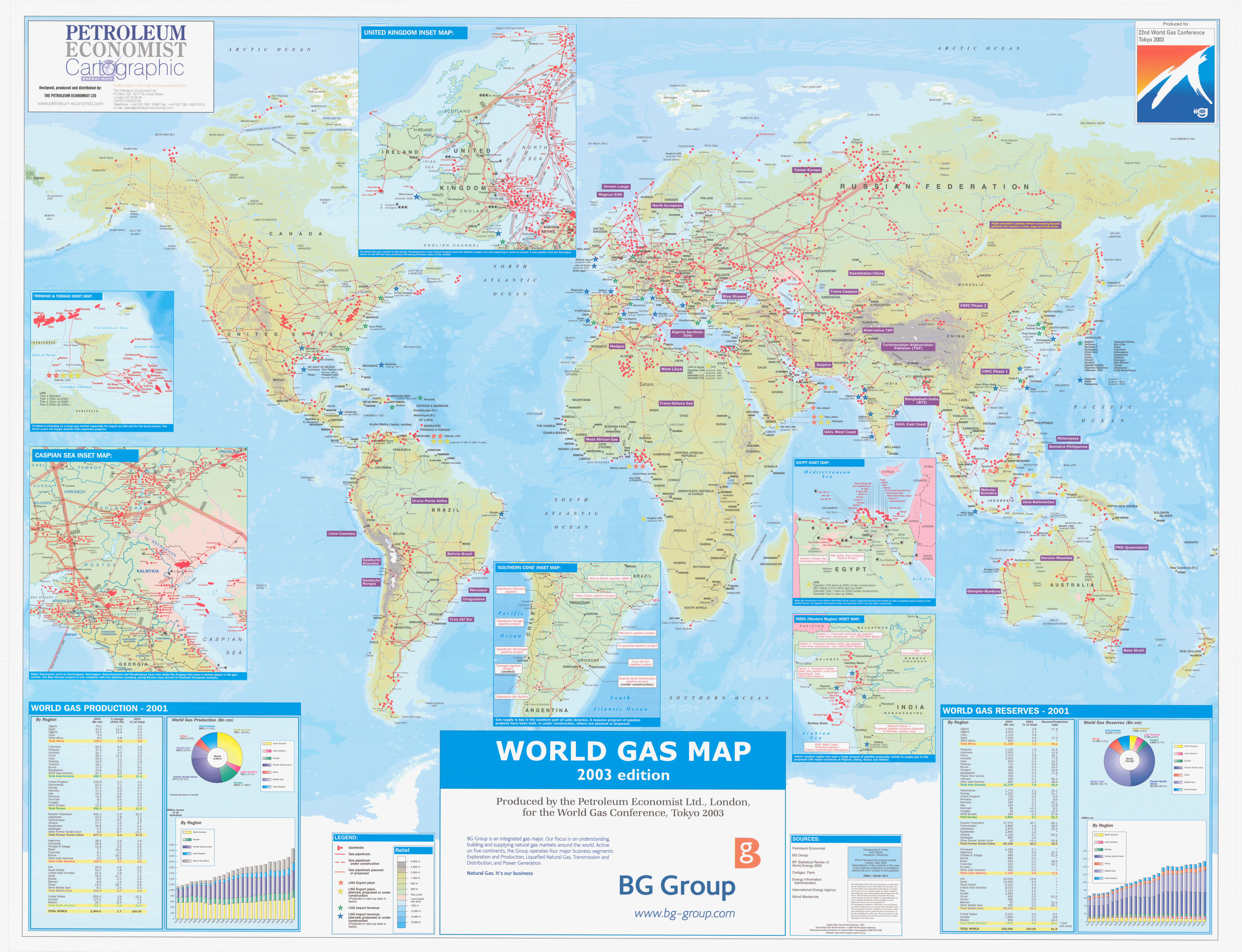
World Gas Map, 2001
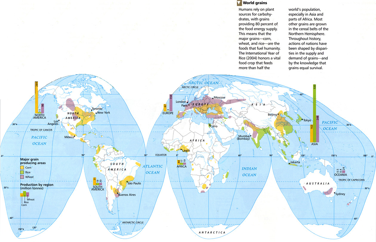
World Grains, 2005
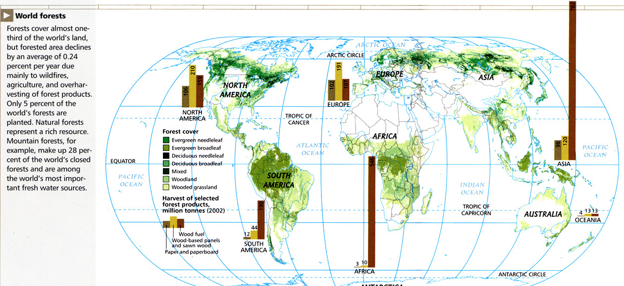
World Forests, 2005
World Debt, 2005
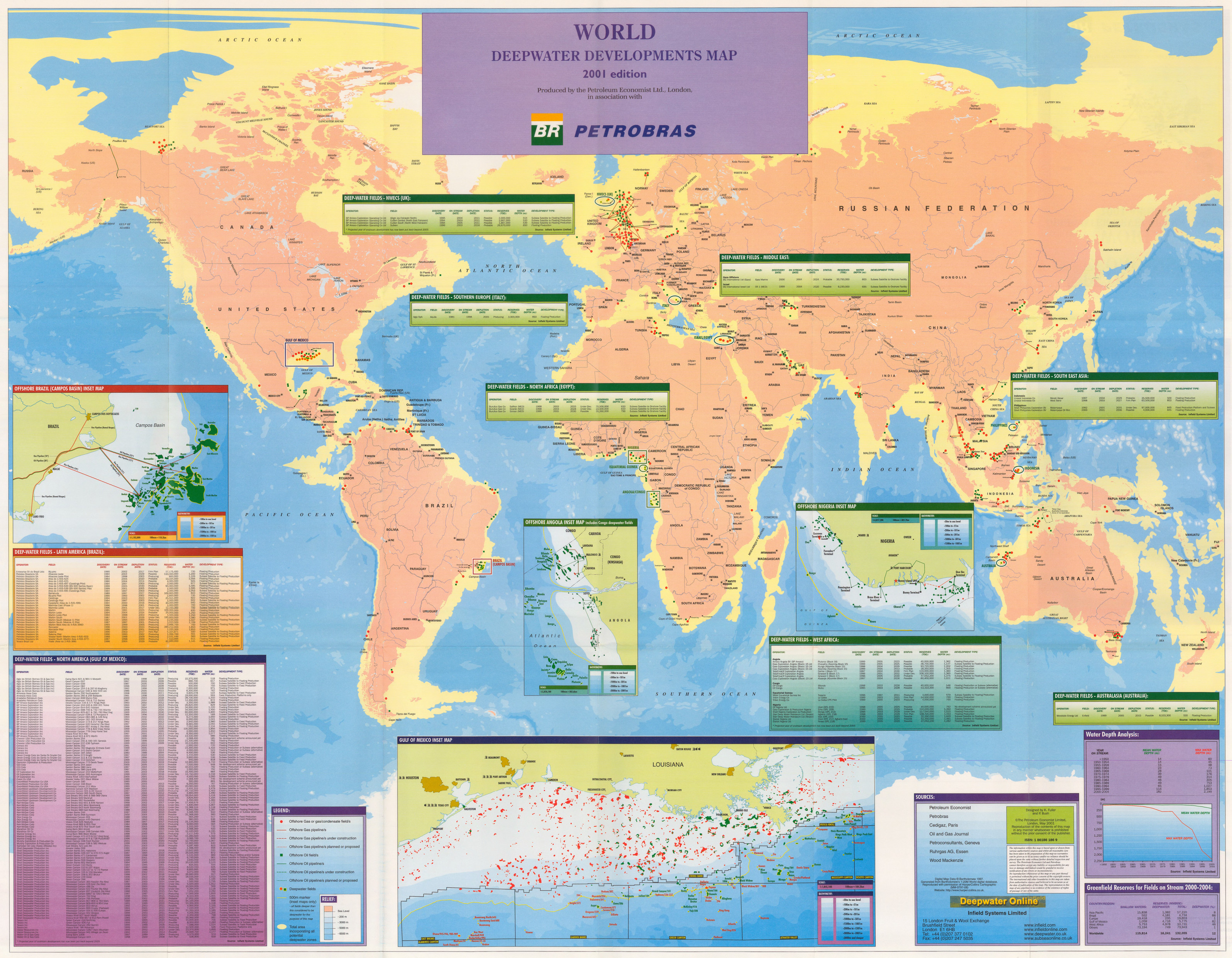
World Deepwater Developments Map, 2001
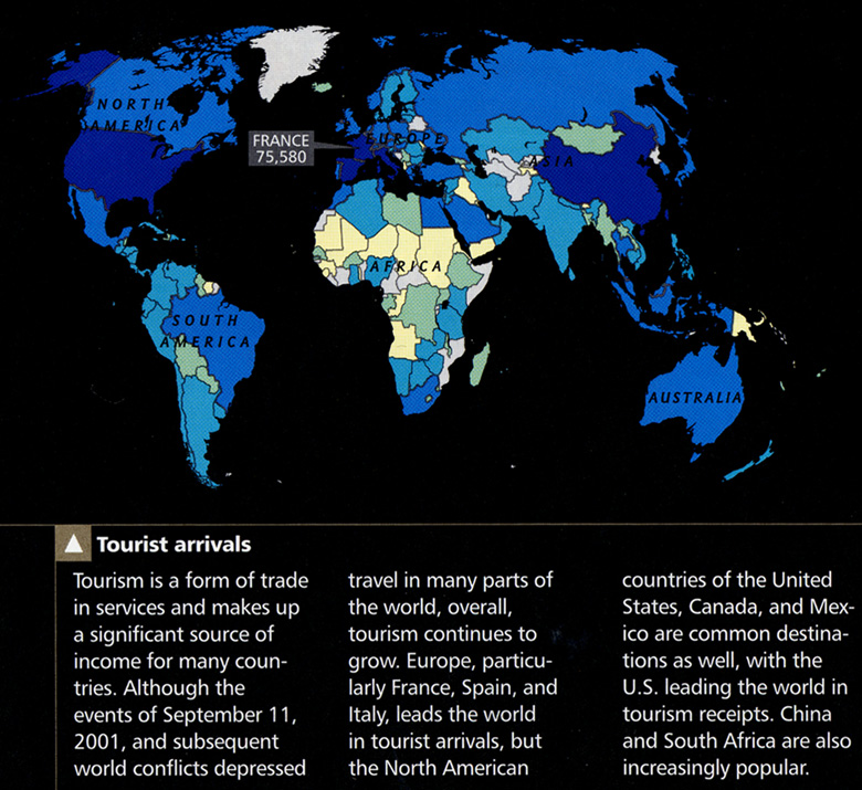
Tourist Arrivals Worldwide, 2005
The Northeast Passage and Trans-Siberian Railroad
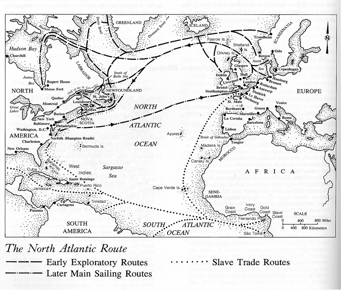
The North Atlantic Route
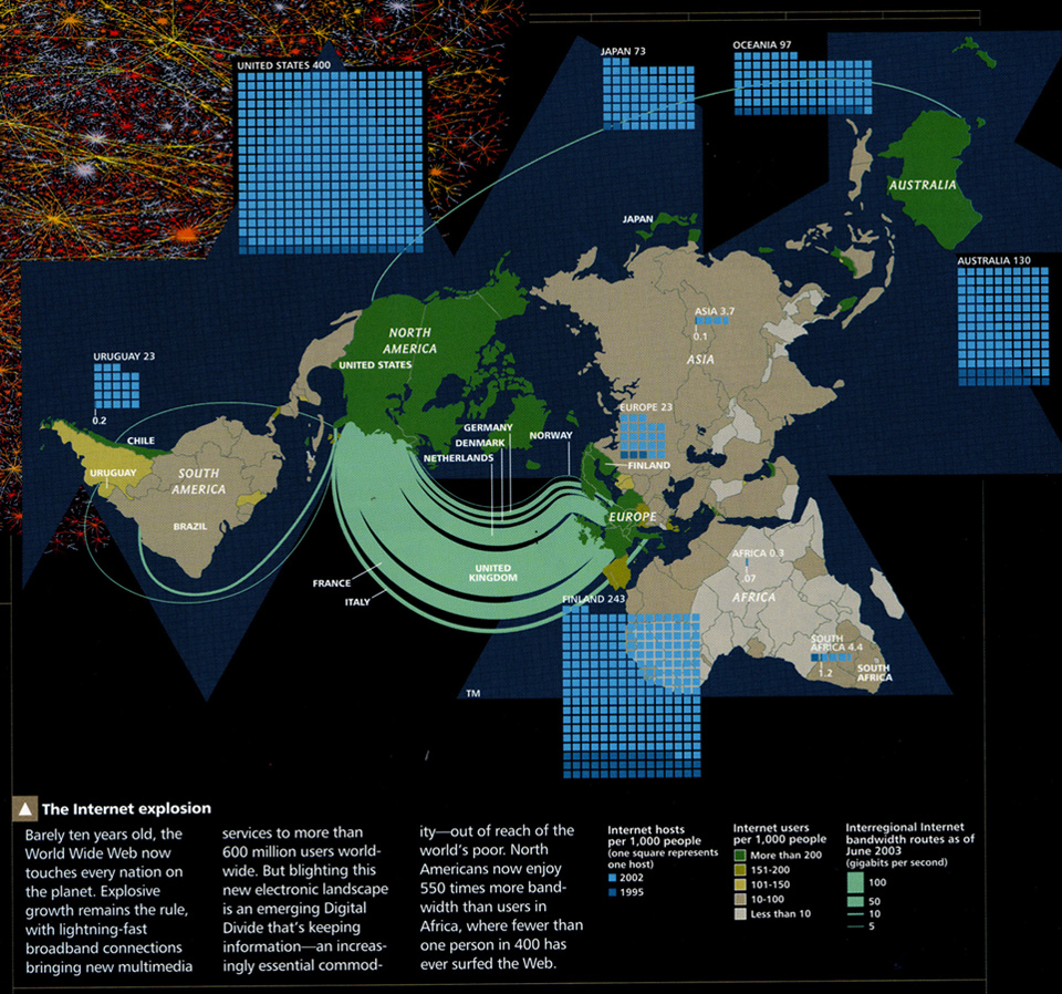
The Internet Explosion, 2003
Submarine Cable Map, 2007
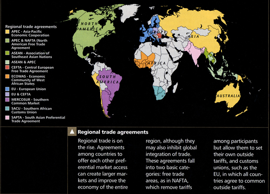
Regional Trade Agreements, 2005
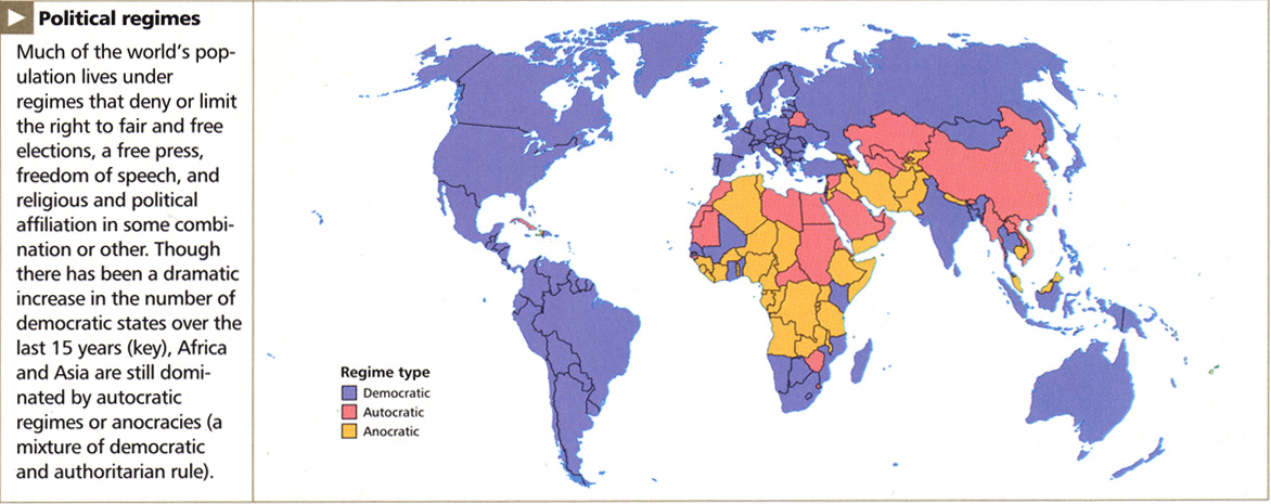
Political regimes, 2005
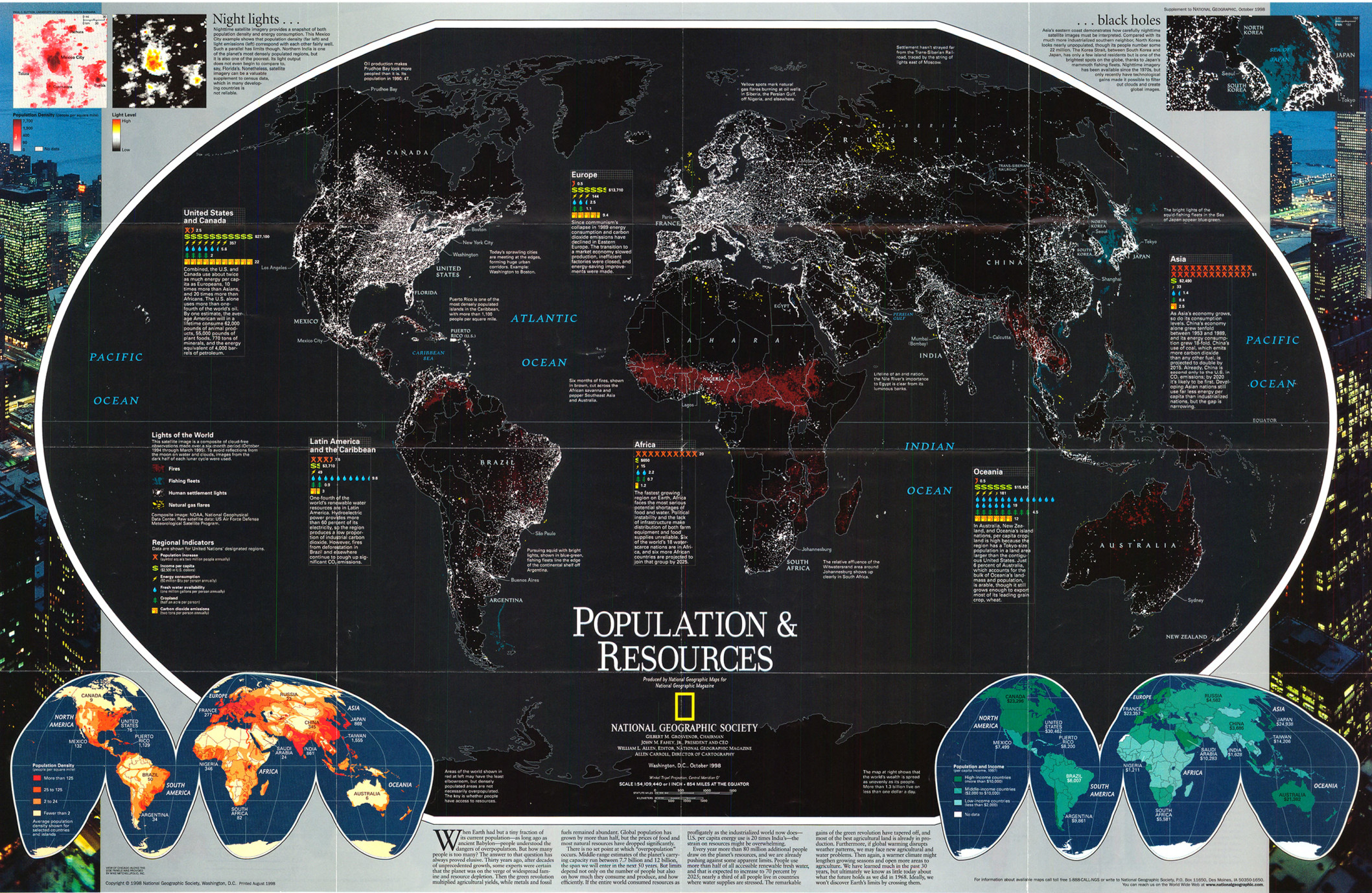
Population and Resources, 1998
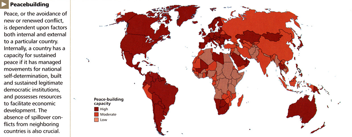
Peacebuilding, 2005
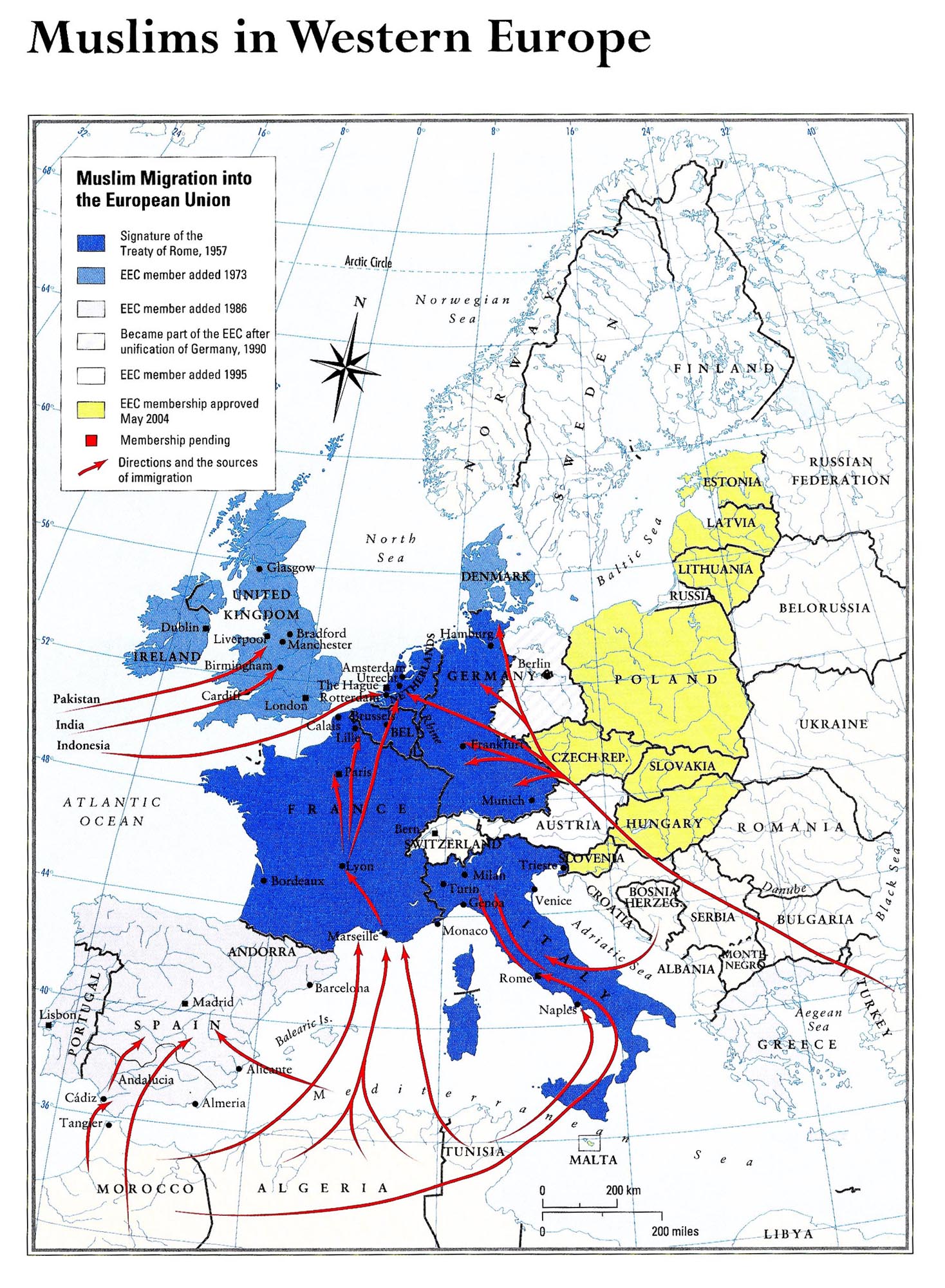
Muslim Migration into the EU, 1957 to 2004
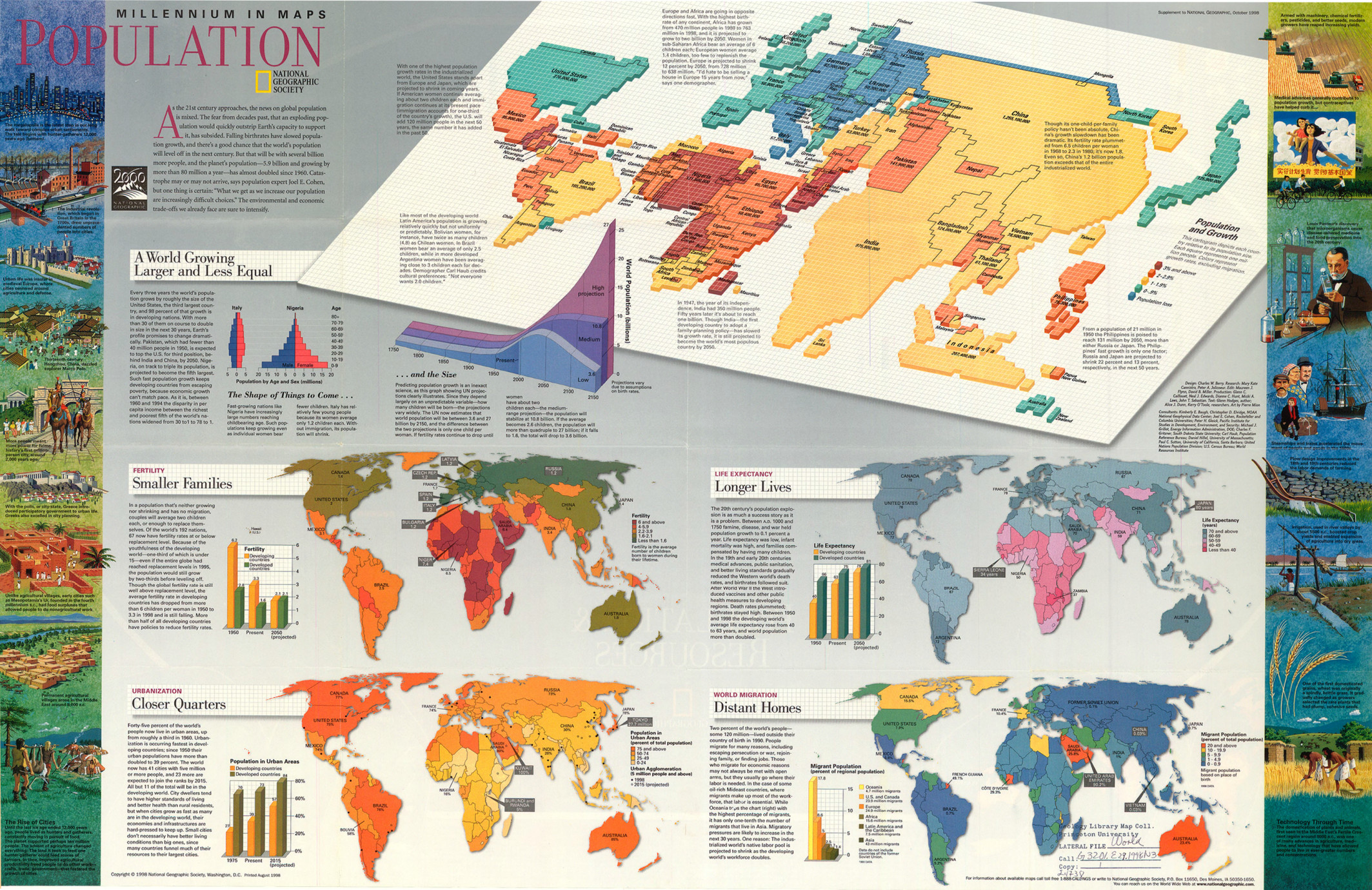
Millennium in Maps – Population, 1999
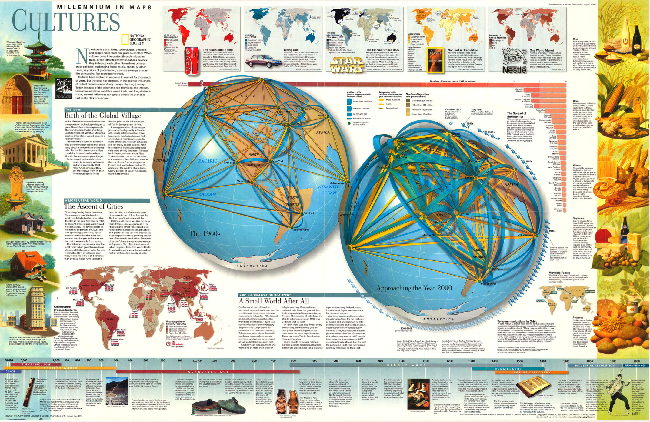
Millennium in Maps – Cultures, 1999
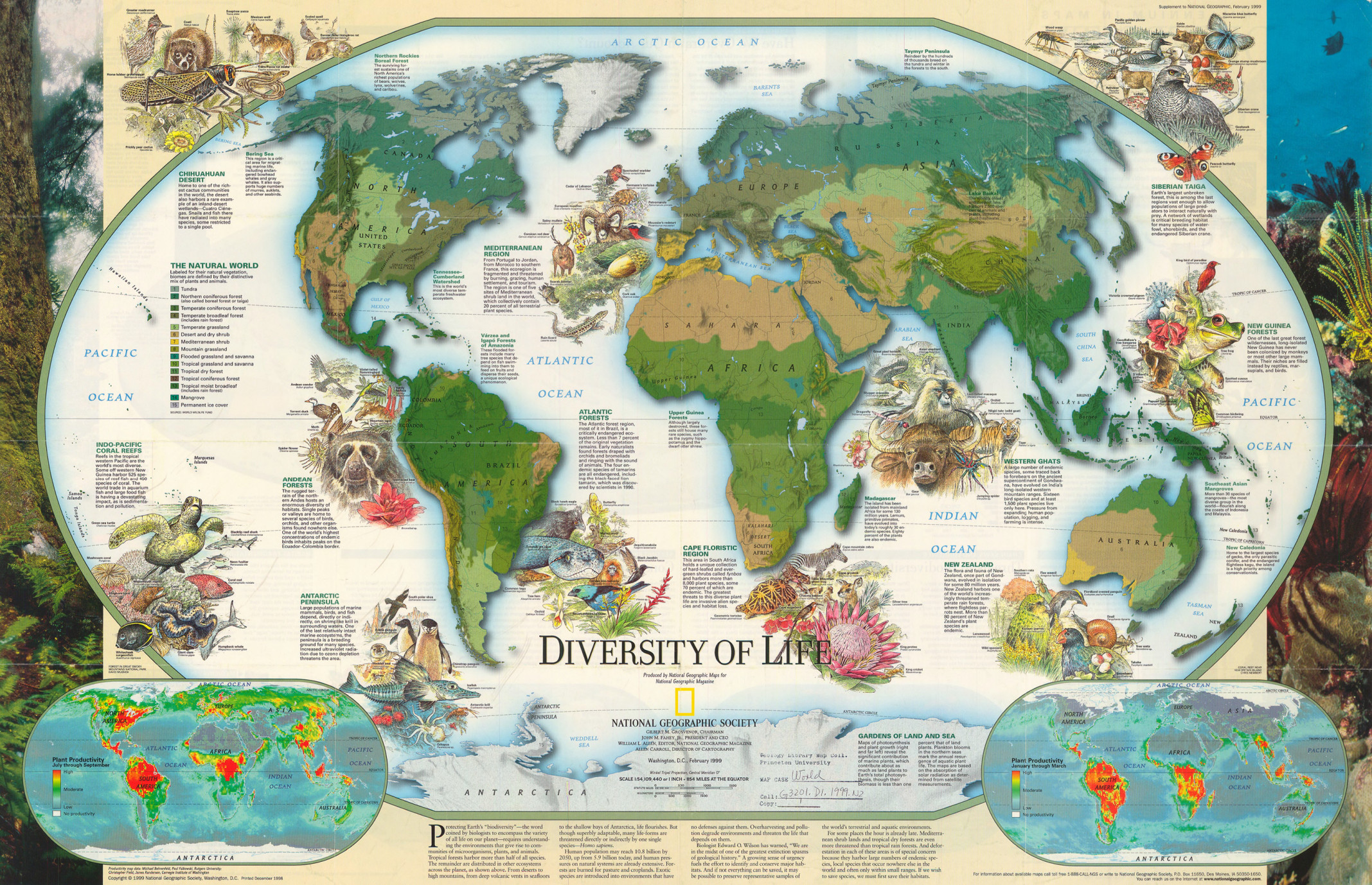
Millennium in Maps – Diversity of Life, 1999
Post navigation
1
2
3
…
5
Next