
Caption
Safe Food: Pollutants lurking in vegetation
Summary
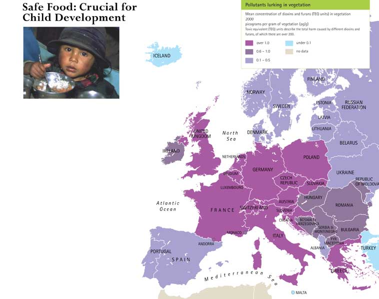
Color-coded map shows mean concentration of dioxins and furans (toxic equivalent – TEQ – units) in vegetation, measured in picograms per gram of vegetation, in 2000. The map reflects concerns with children’s exposure to microbes and hazardous chemicals in food, especially during pregnancy or at an early stage.
Legend indicates:
- Purple: Over 1.0
- Dark Violet: 0.6-1.0
- Light Violet: 0.1-0.5
- Light Blue: under 0.1
- Light Brown: no data
A more detailed version of this map:
[1]
Source
Inheriting the World: The Atlas of Children’s Health and the Environment, Part Two: Global Environmental Issues. By Bruce Gordon, Richard Mackay and Eva Rehfuess, World Health Organization, 2004.
ISBN 92 4 159156 0.
Copyright
© WHO 2004. All rights reserved.