
Caption
World Gas Map, 2003 edition
Summary
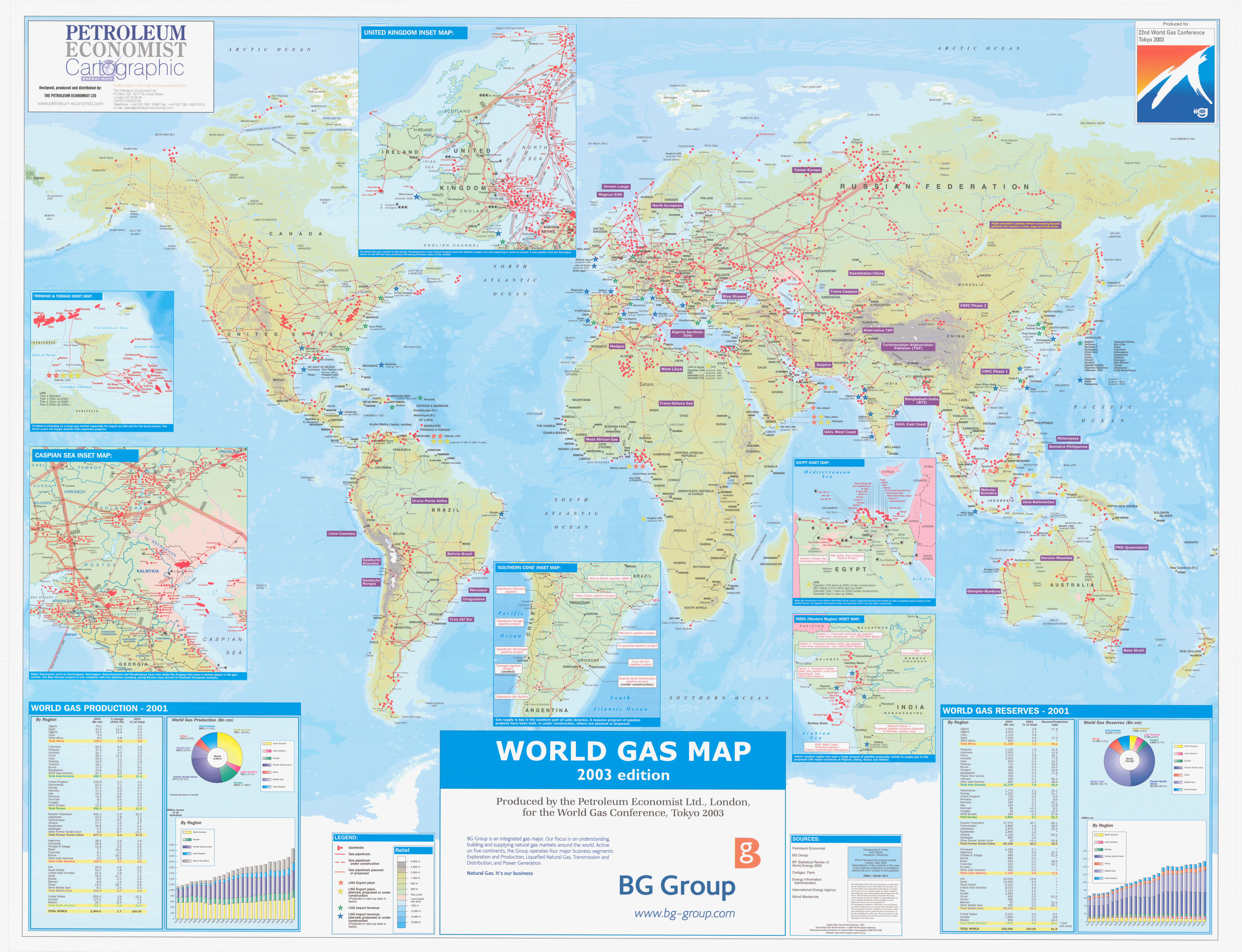
The main map shows gas fields and pipelines of the world,
and uses color to show elevations above or below sea level.
There are also inset maps giving details for the Caspian Sea, Trinidad and Tobago, the United Kingdom, the Southern Cone, South America, Egypt, India and the Western Region.
Other inset elements:
- World Gas Production – 2001 (by country and by region)
- World Gas Reserves – 2001 (by country and by region)
Legend: Symbols for gas fields; gas pipelines; gas pipelines under construction; gas pipelines planned or proposed; LNG Export plant; LNG Export plant, planned, proposed or under construction with project start dates; LNG Import terminals; LNG Import terminals planned, proposed or under construction with projected start dates.
Source
Produced by Petroleum Economist Ltd
Primary Sources:
- BG Group
- BP Statistical Review of World Energy 2002
- Cedigaz, Paris
- Energy Information Administration
- International Energy Agency
- Wood Mackenzie
This map is Map Number 1413 in the collection of copyrighted maps of the Geosciences and Map Library, Fine Hall (B level), Princeton University.
Princeton Map Library Metadata
Copyright
© May-03 The Petroleum Economist Limited