Skip to main content
Mapping Globalization
Menu
Skip to content
Data and Analysis
NetMap Studies of World Trade
Network Analysis
Maps
Narratives
Empires
Alexander the Great
Byzantine Empire
Invasion of the Goths
Migration
Asia
Eurasia
Europe
The Genetics of Prehistoric Migration
Indoeuropeans
Out of Africa
Menu
Skip to content
Contact
Tag:
19th Century
British Crown Colony in India
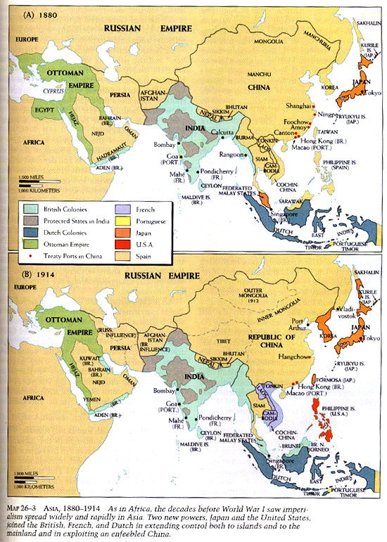
Asia 1880-1914
Africa Before Colonial Partition
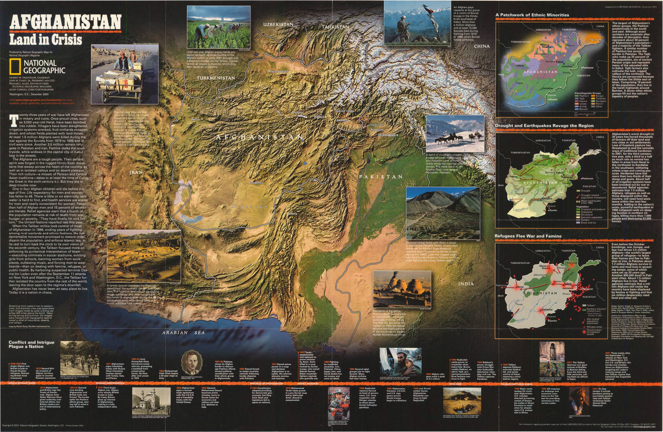
Afghanistan – Land in Crisis, 2001
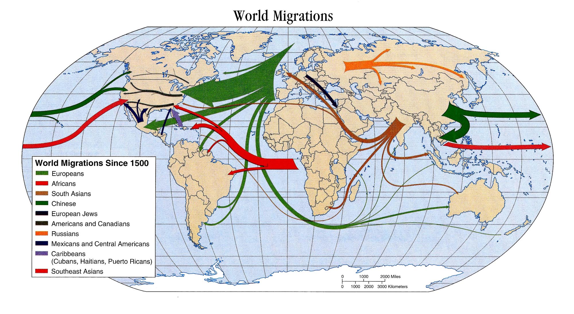
World Migrations since 1500
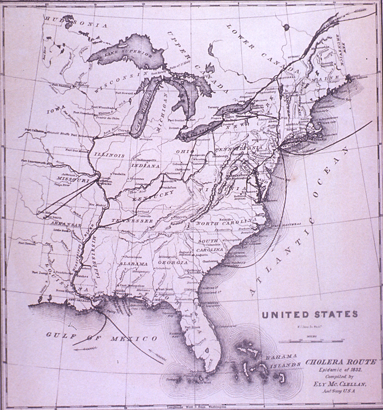
United States Cholera Route – Epidemic of 1832
Transmission Routes of Cholera, the most devastating illness of the 19th Century
Transportation Routes Between the United States and Other American Countries, 1899
The Transatlantic Slave Trade, 1601 to 1870
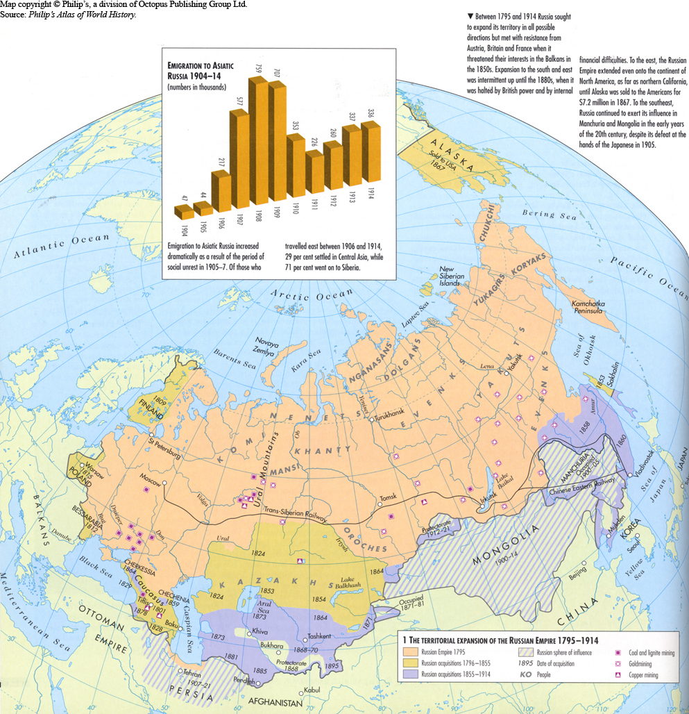
The Territorial Expansion of the Russian Empire 1795-1914
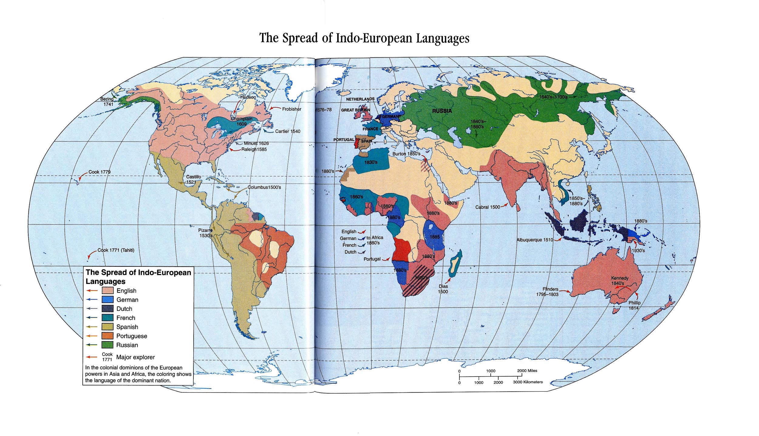
The Spread of Indo-European Languages, 1500 to 1880
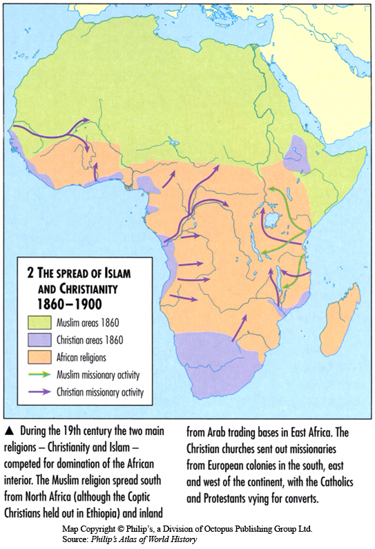
The Spread of Islam and Christianity 1860-1900
The Progress of the Spasmodic Cholera, 1832
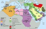
The Middle East in 1914
The March of Cholera in 1865
The Manchu Empire and the European Powers, 1644-1912 A.D.
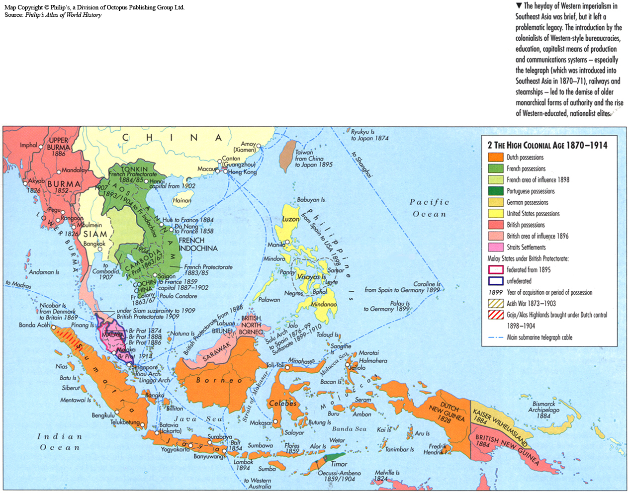
The High Colonial Age 1870-1914
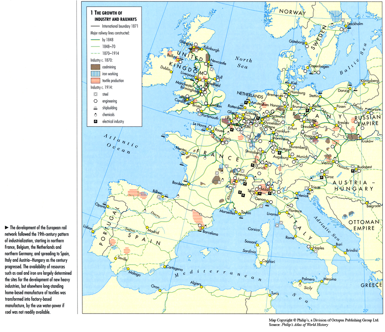
The Growth of Industry and Railways, 1848 to 1914
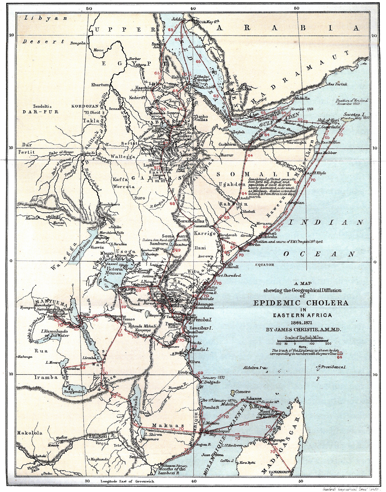
The Geographical Diffusion of Epidemic Cholera in Eastern Africa, 1864-1871
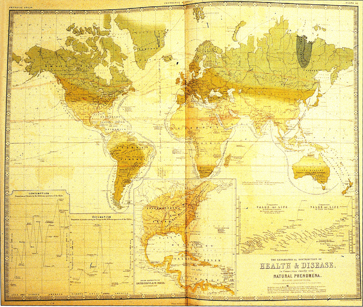
The Geographical Distribution of Health and Disease, 1856
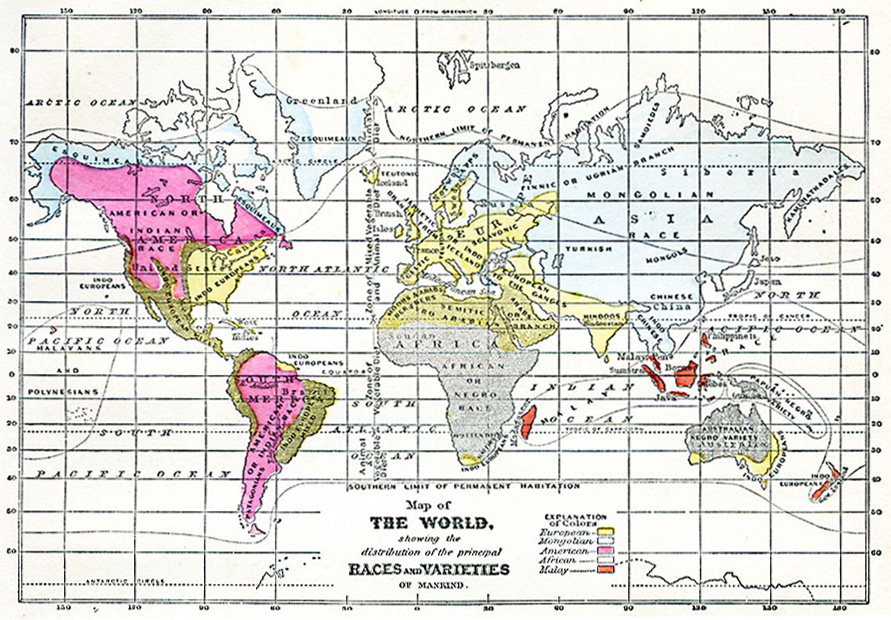
The Distribution of the Principal Races and Varieties of Mankind, 1868
Telegraph Chart – Europe and America, 1858
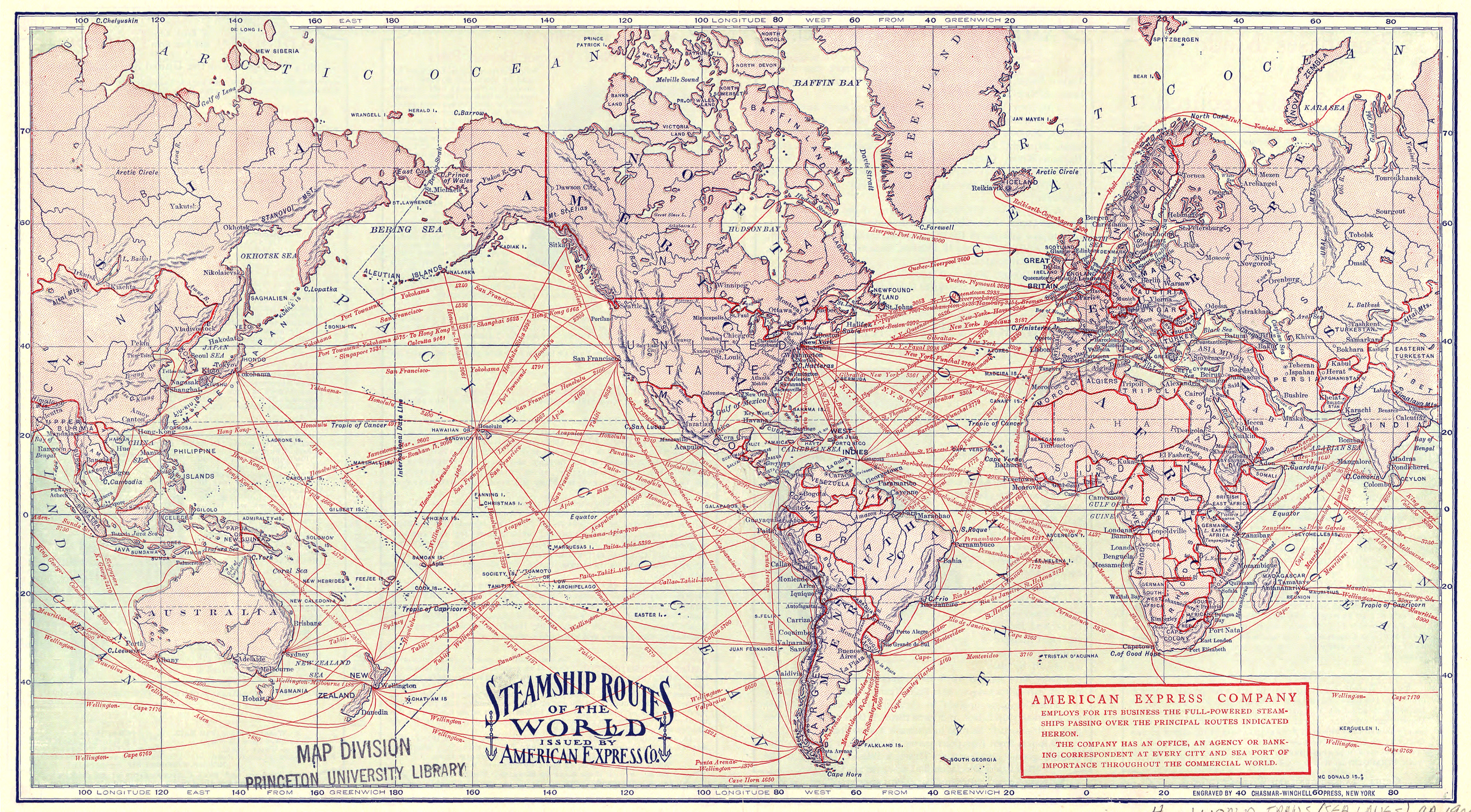
SteamshipRoutesCirca1900
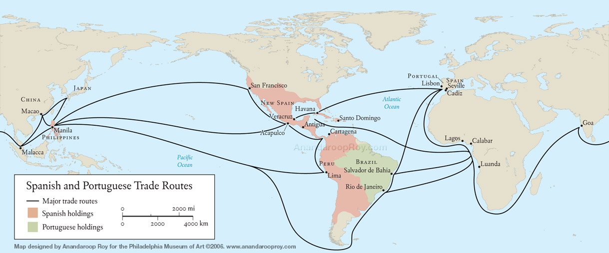
Spanish and Portuguese trade routes
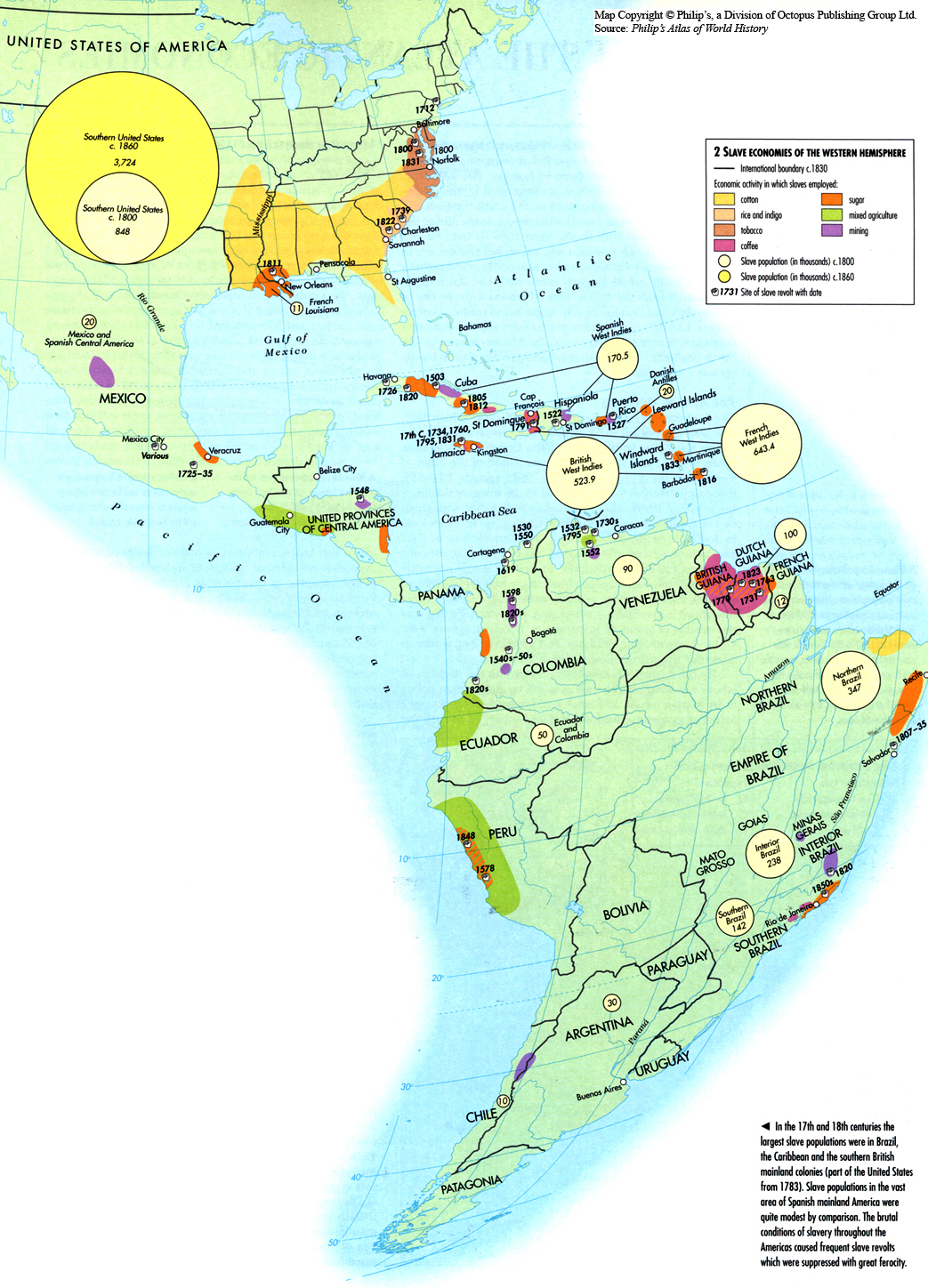
Slave Economies of the Western Hemisphere c. 1830
Routes of Asiatic Cholera (1885)
Renewed foreign power rivalry, 2000
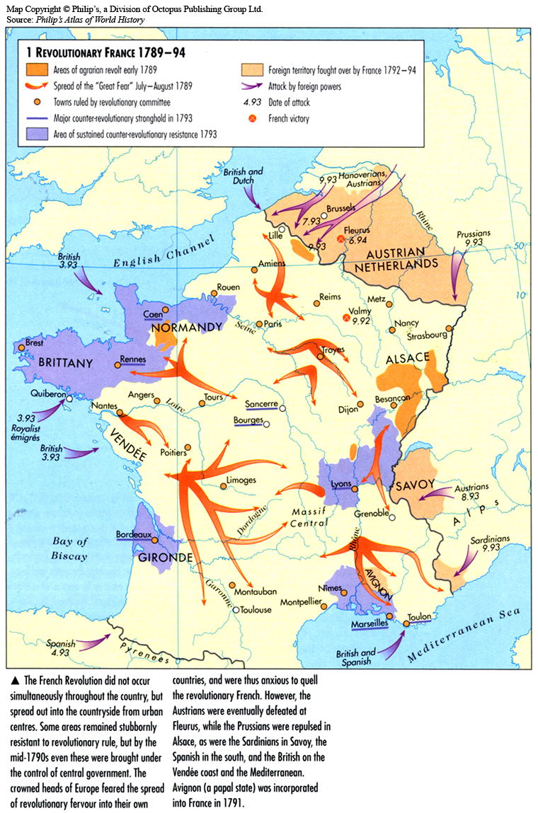
Revolutionary France 1789-94
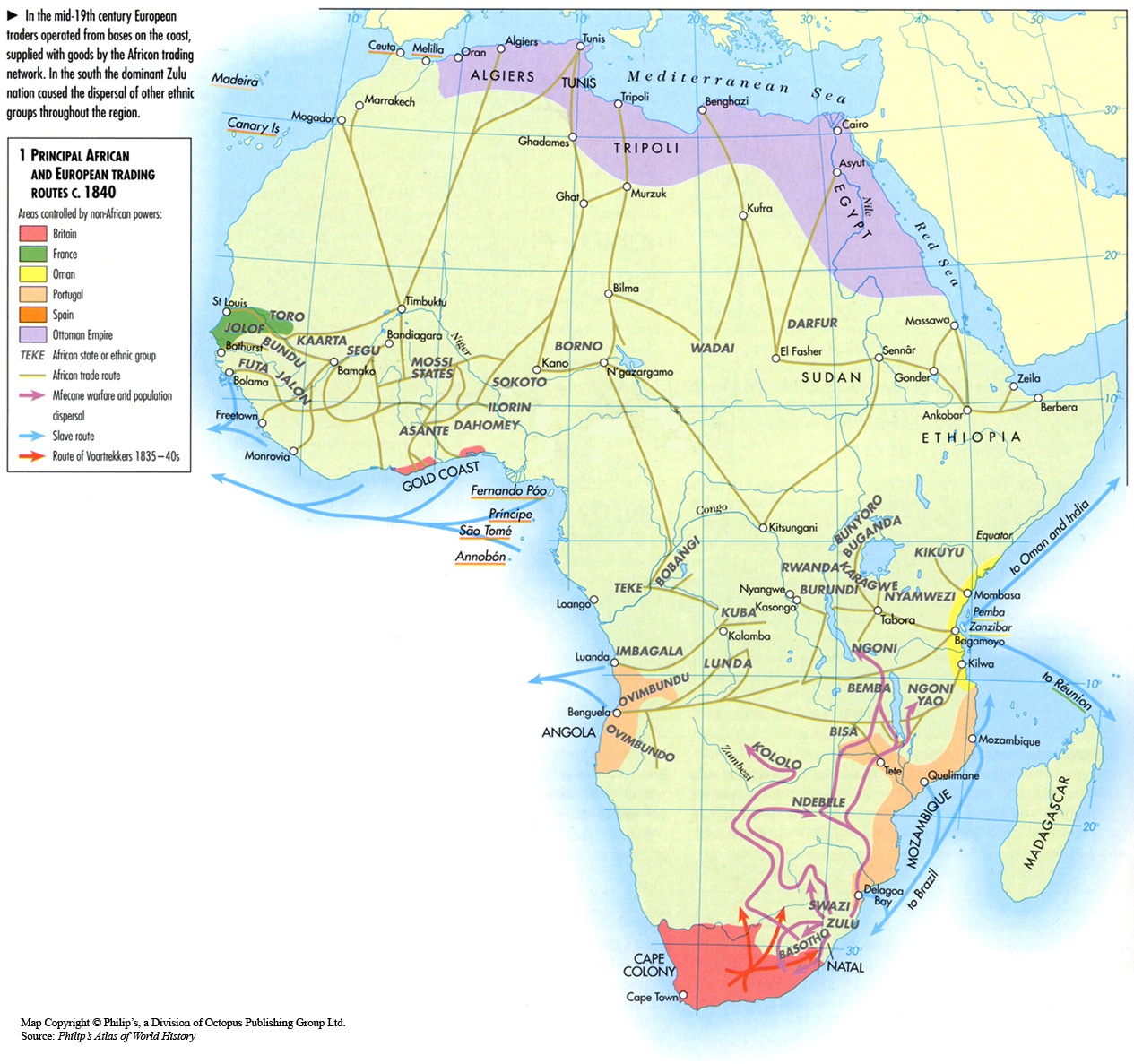
Principal African and European Trading Routes c. 1840
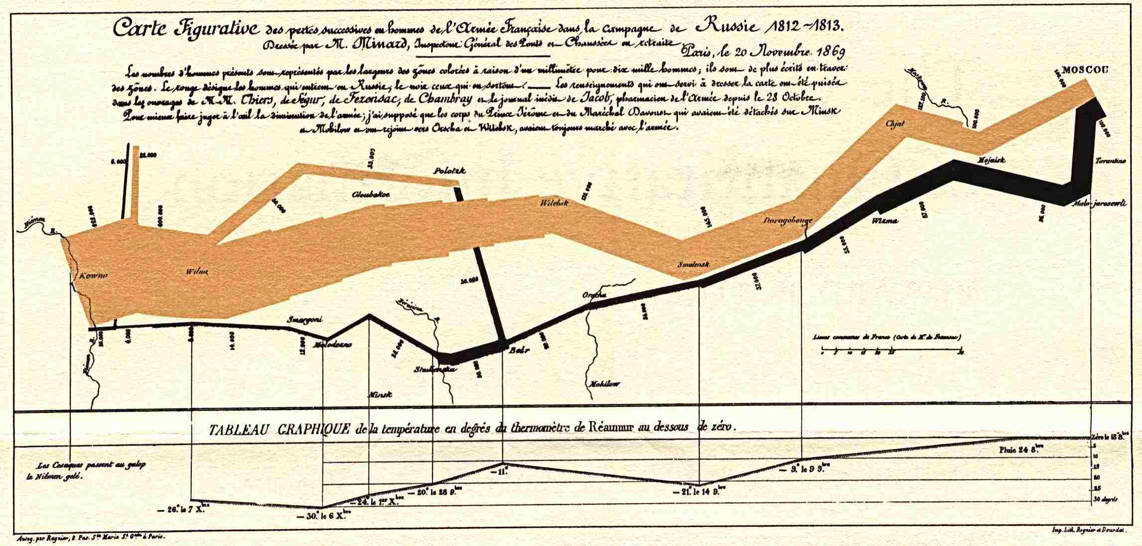
Minard carte figurative
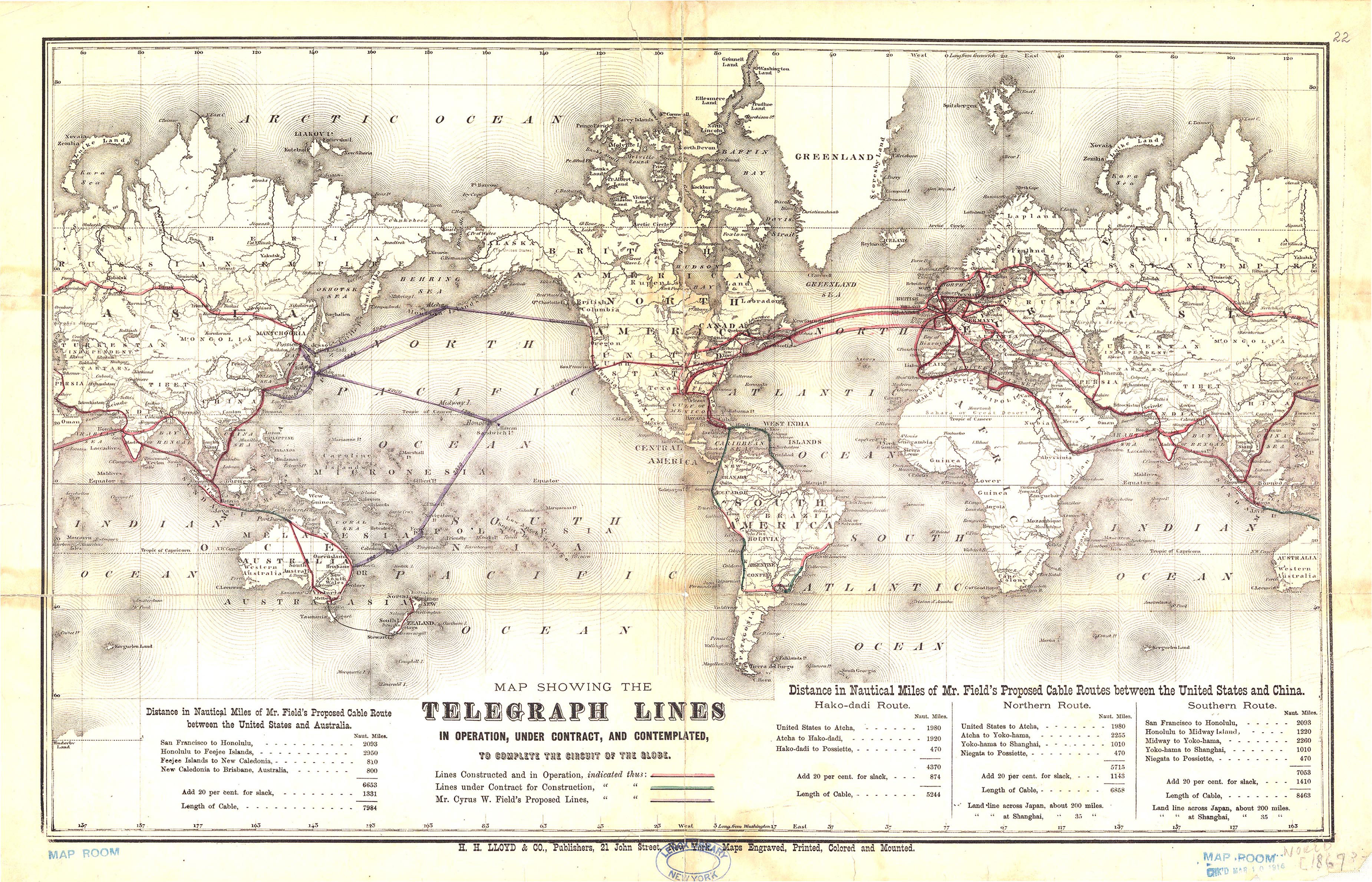
Map Showing the Telegraph Lines In Operation, Under Contract, and Contemplated to Complete the Circuit of the Globe, 1869
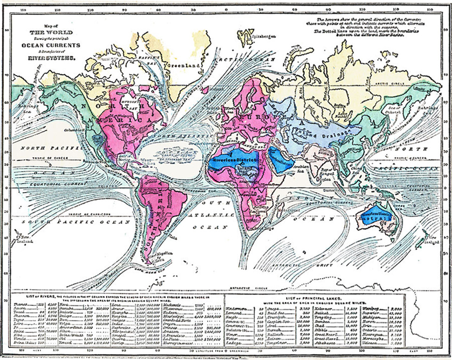
Map of World showing the principal Ocean Currents & boundaries of River Systems
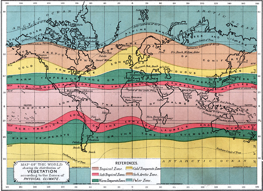
Map of the World showing the distribution of Vegetation according to the Zones of Physical Climate, 1891
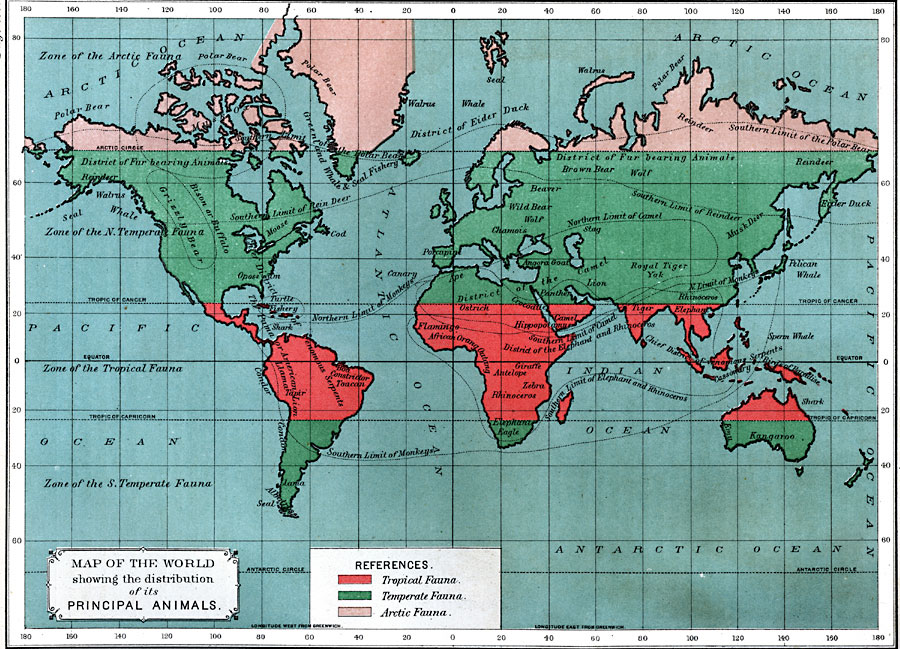
Map of the World showing the distribution of its Principal Animals, 1891
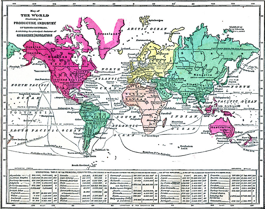
Map of the World illustrating the Productive Industry of Various Countries, 1868
Post navigation
Previous
1
2
3
4
Next


.jpg)