
Caption
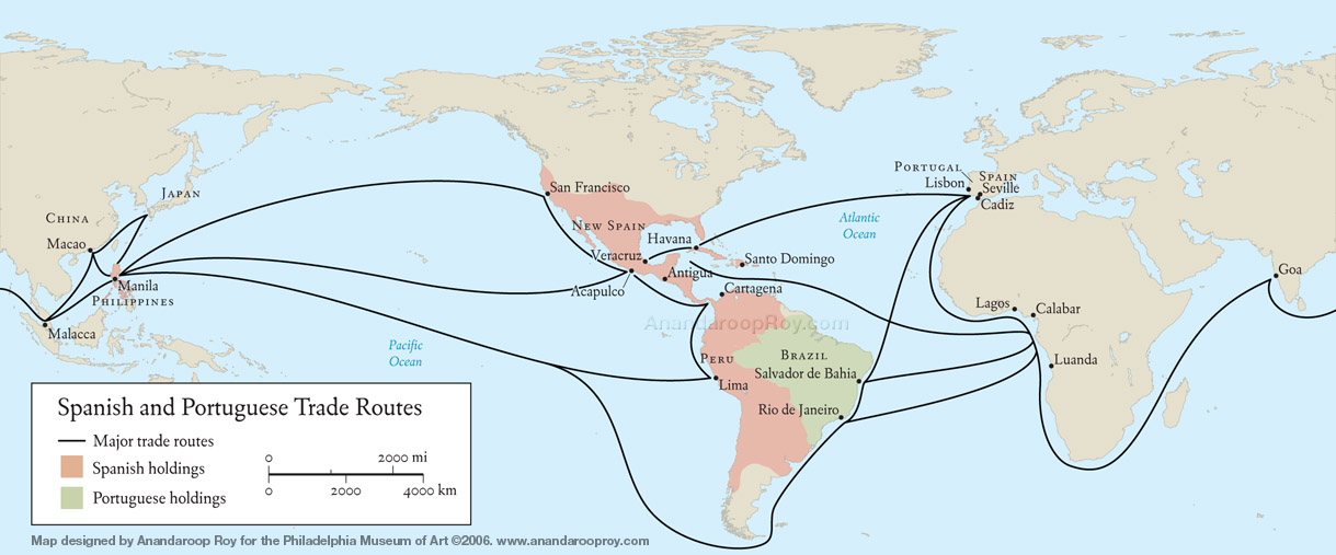
Spanish and Portuguese trade routes
Summary
This world map shows the major Spanish and Potuguese trade routes in the colonial era, indicating Spanish and Portuguese holdings in the New World and Asia.
Source
Prepared for the Mapping Globalization] project by Anandaroop Roy.
The map was originally designed for the exhibition “Tesoros/Treasures/Tesouros: The Arts in Latin America, 1492-1820”,
Philadelphia Museum of Art, July 2006 [1].
Copyright
© 2006 Anandaroop Roy
Used here with the kind permission of Anandaroop Roy (June 29, 2007).
Series
This map is one of a series:
- Viceroyalty of Peru.jpg
- Spanish and Portuguese trade routes.jpg