Skip to main content
Mapping Globalization
Menu
Skip to content
Data and Analysis
NetMap Studies of World Trade
Network Analysis
Maps
Narratives
Empires
Alexander the Great
Byzantine Empire
Invasion of the Goths
Migration
Asia
Eurasia
Europe
The Genetics of Prehistoric Migration
Indoeuropeans
Out of Africa
Menu
Skip to content
Contact
Tag:
Telecommunications
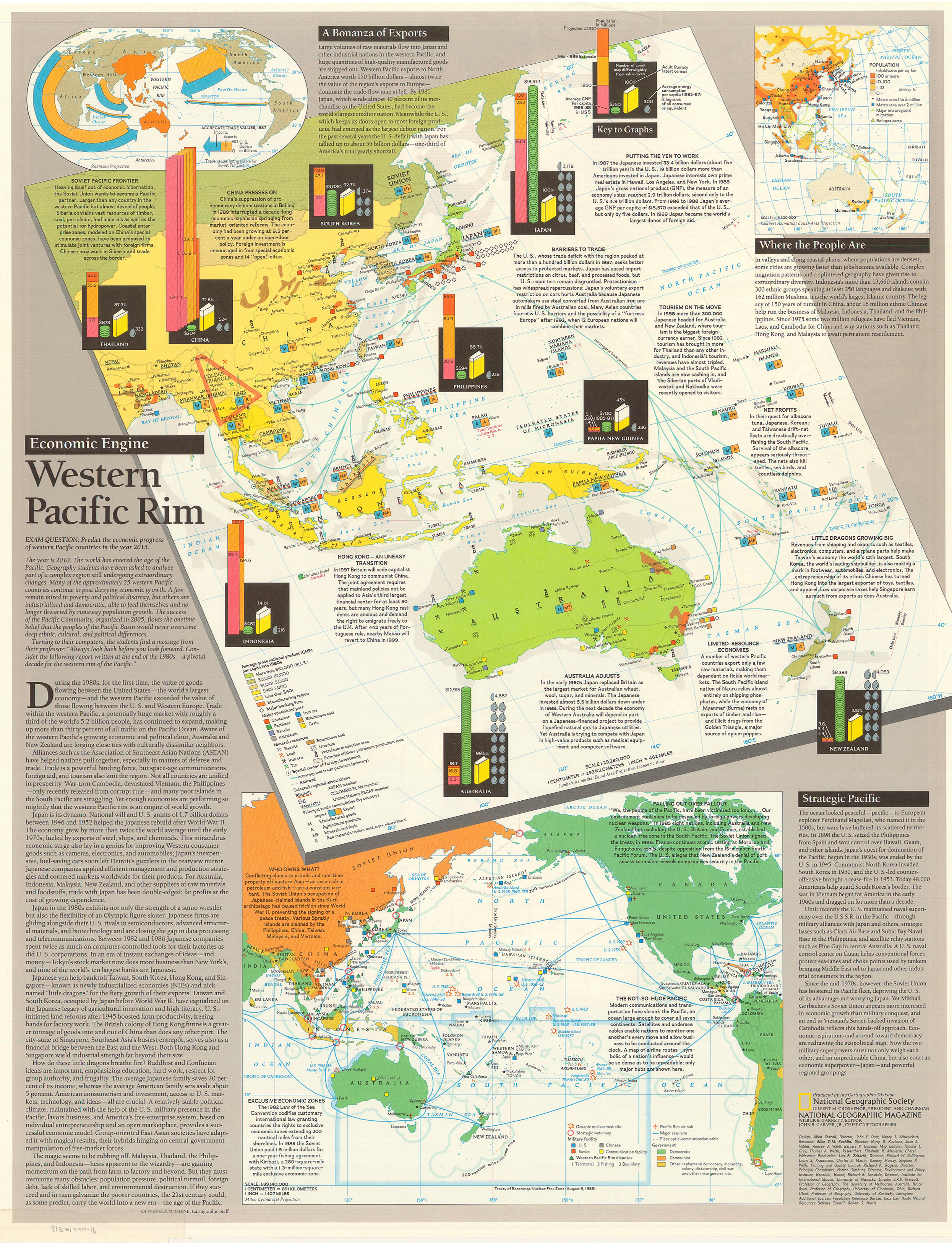
Western Pacific Rim, 1989
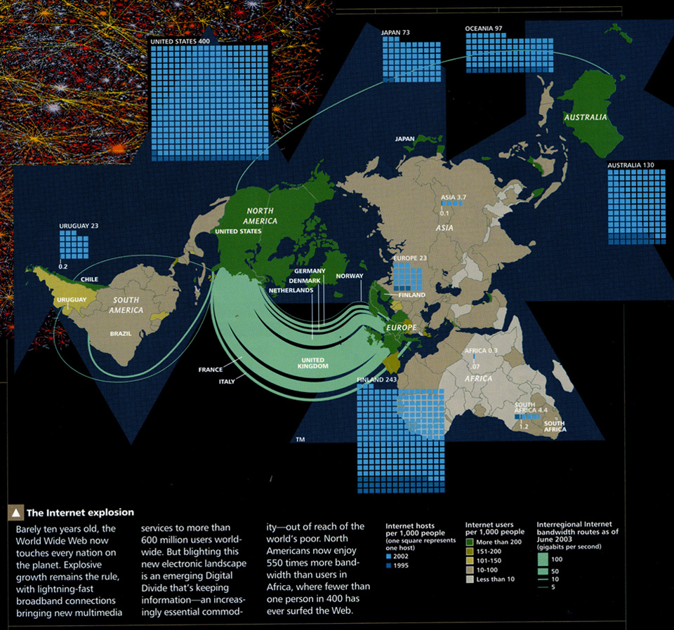
The Internet Explosion, 2003
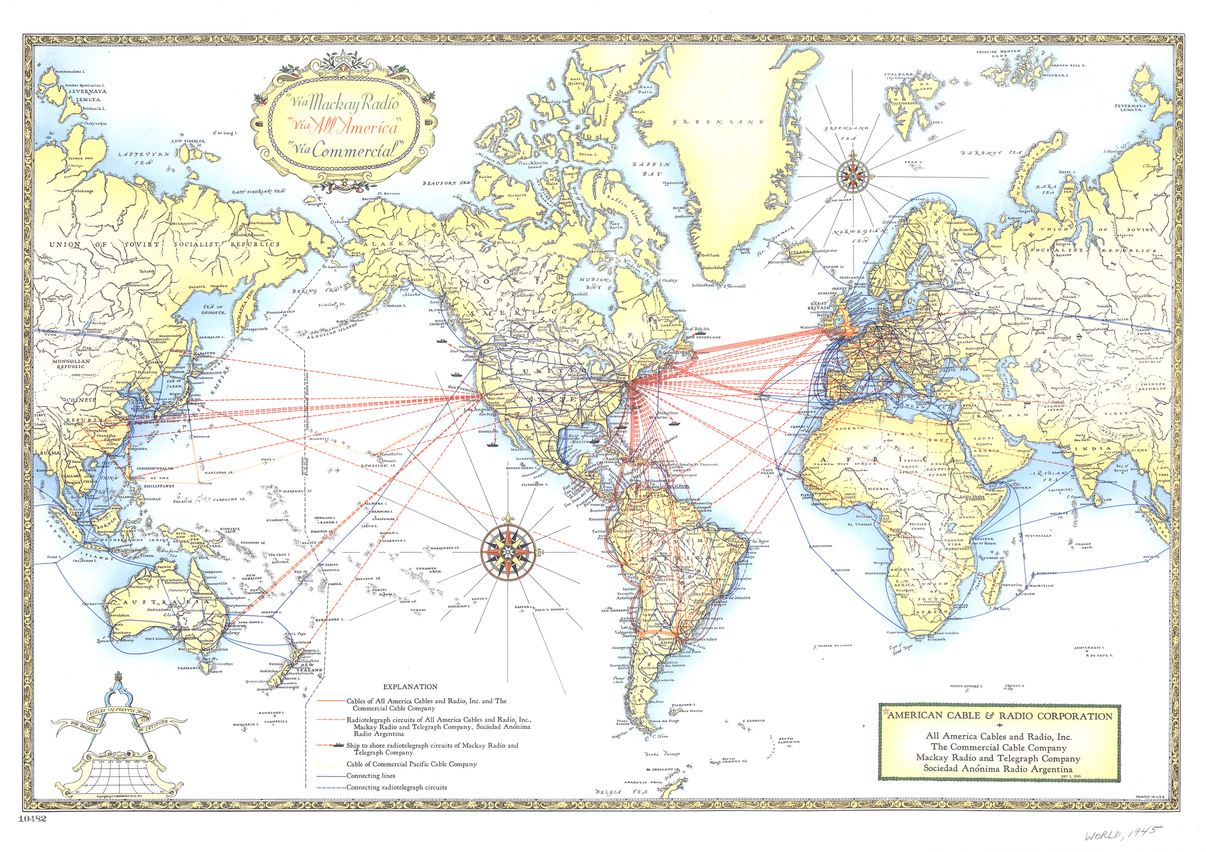
The International Cable-Radio System, 1945
Submarine Cable Map, 2007
Le Trafic Téléphonique International Vers les États-Unis
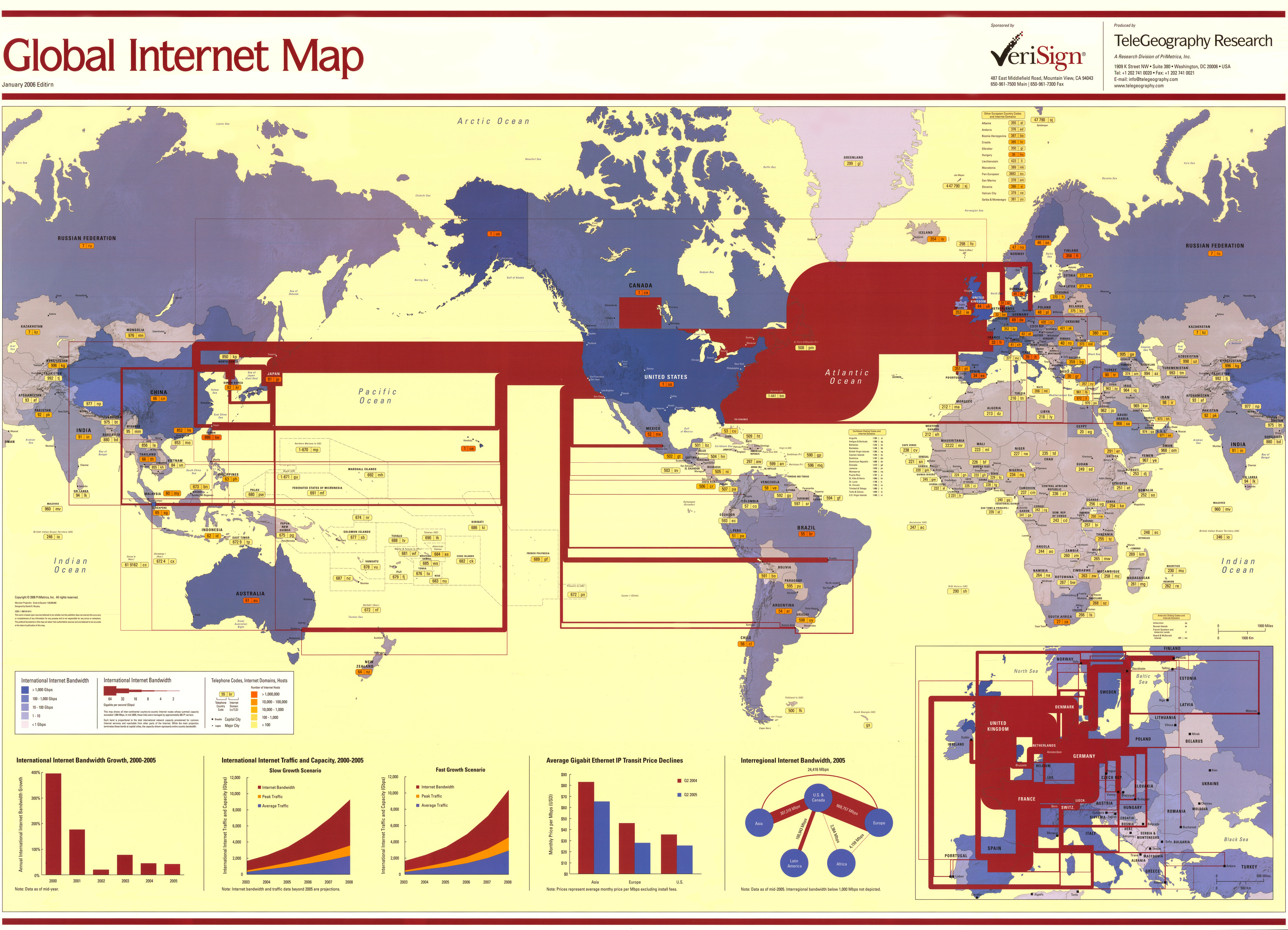
Global Internet Map, 2006
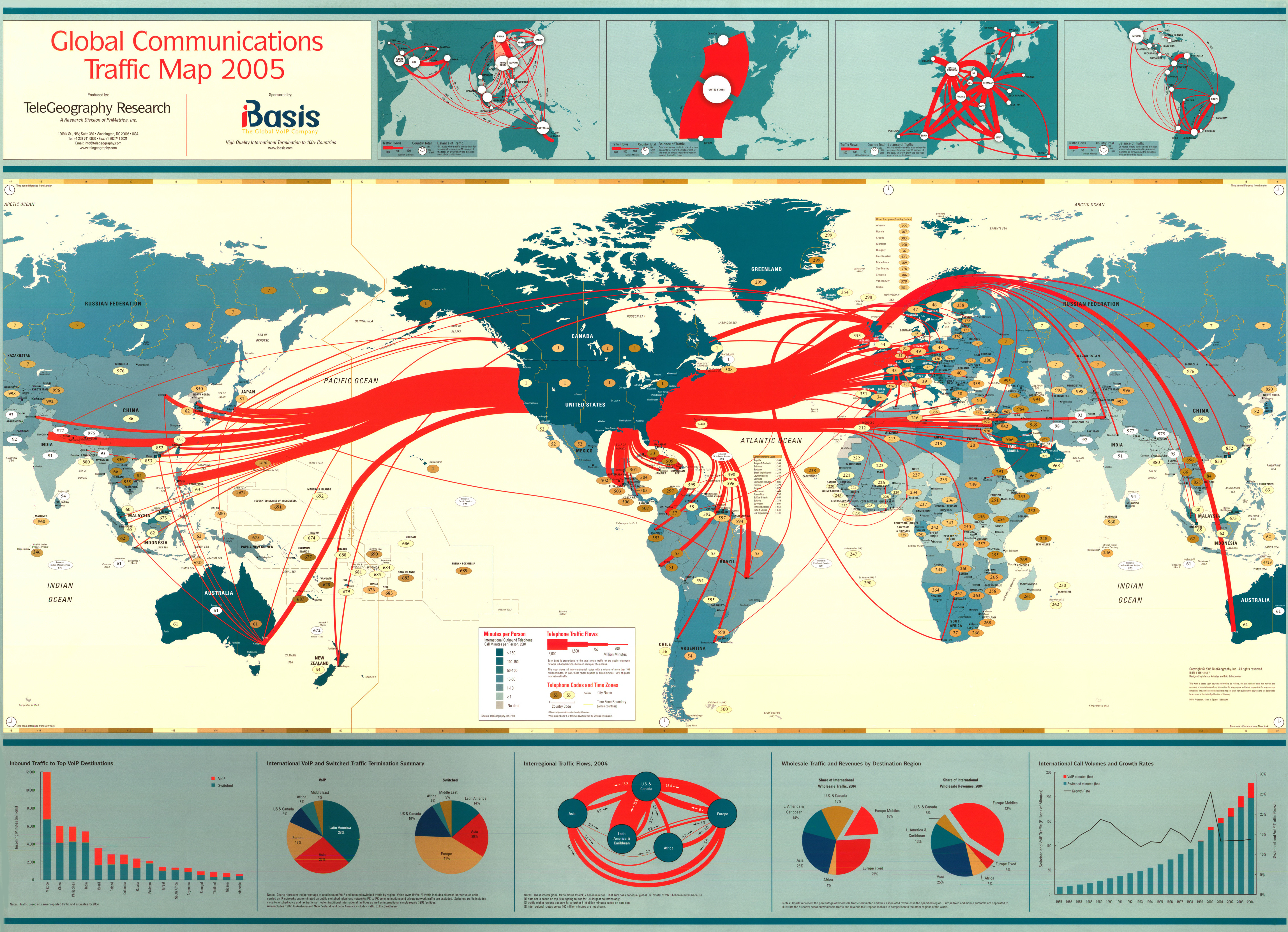
Global Communications Traffic Map, 2005
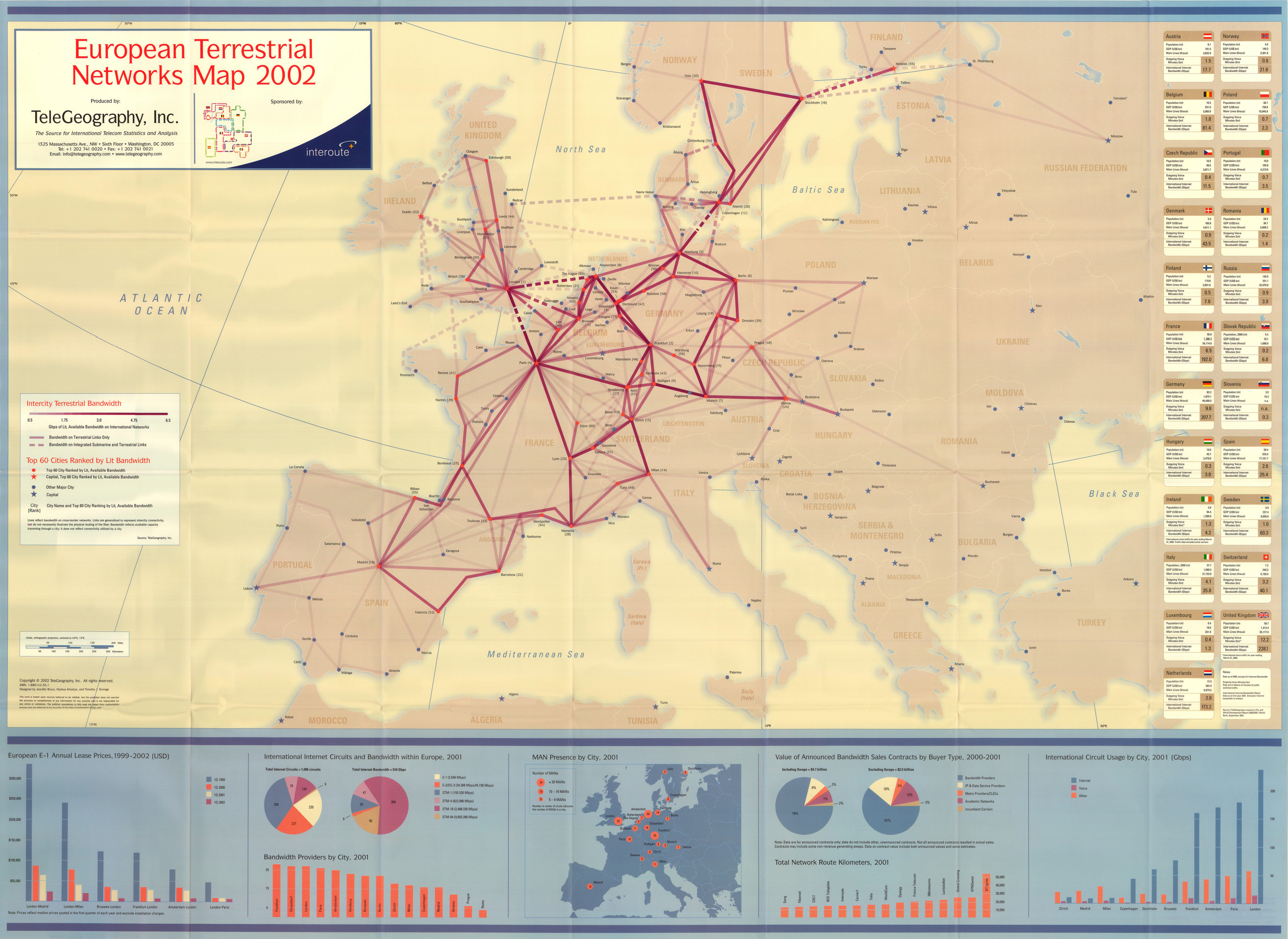
European Terrestrial Networks Map, 2002
Connecting the Planet – Cables and Satellites, 2004
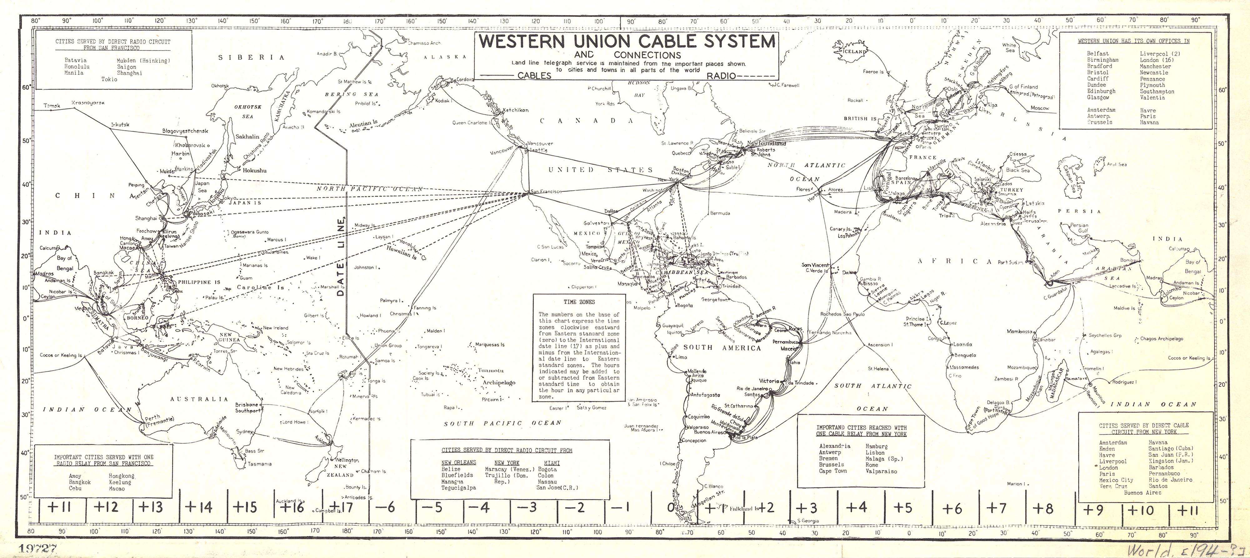
Western Union Cable System and Connections
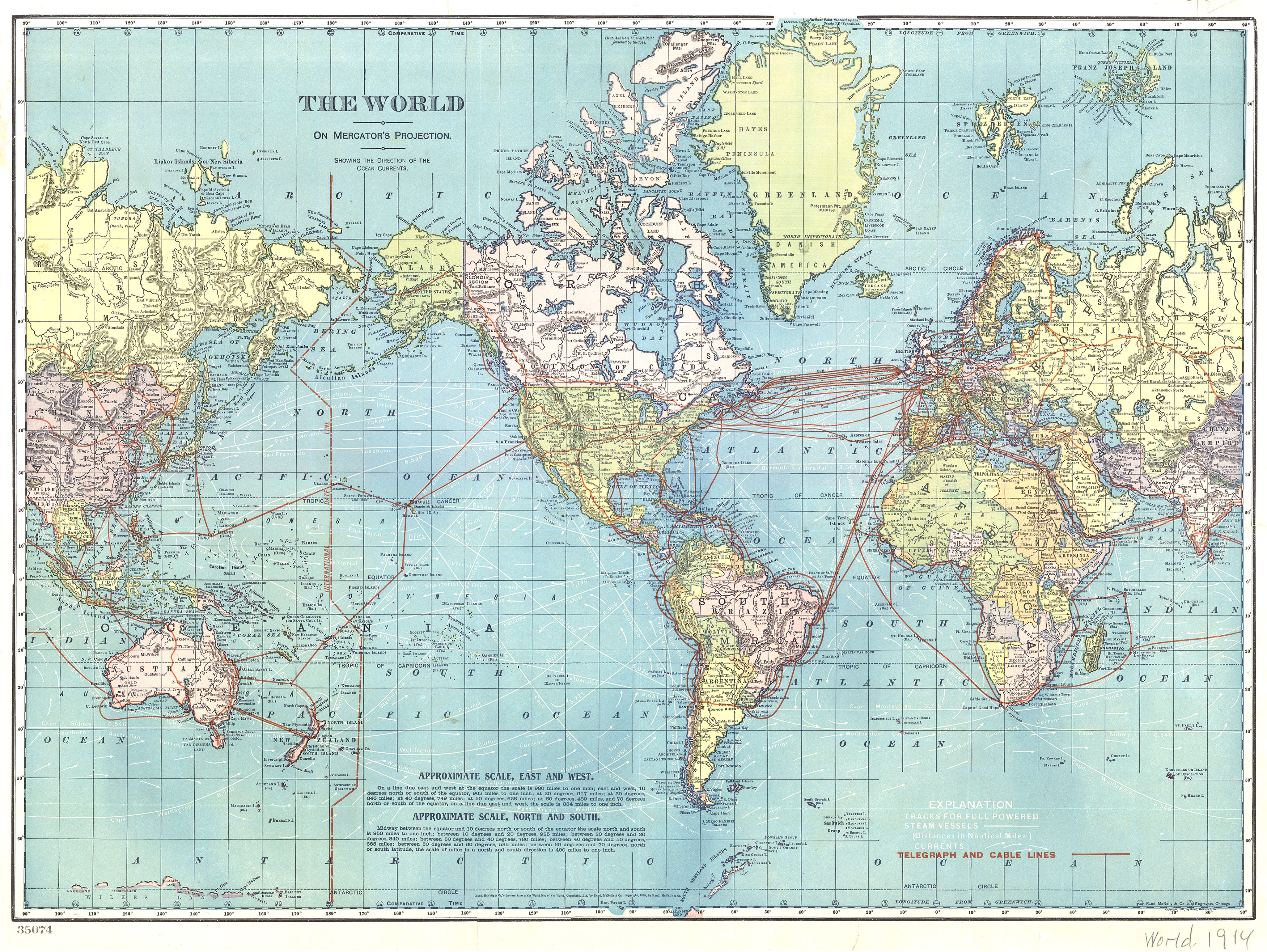
The World – Telegraph and Cable Lines, 1914
Telegraph Chart – Europe and America, 1858
Overseas Telephone Connections of the American Telephone and Telegraph Company and Associated Companies
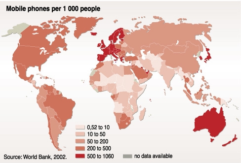
Mobile Phones per Thousand People, 2002
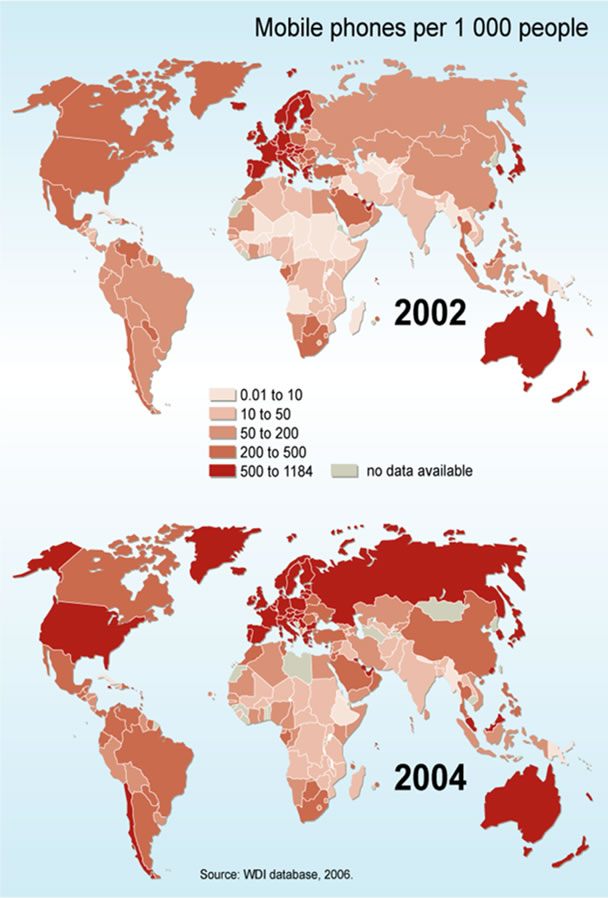
Mobile Phone Subscribers in 2002 and 2004
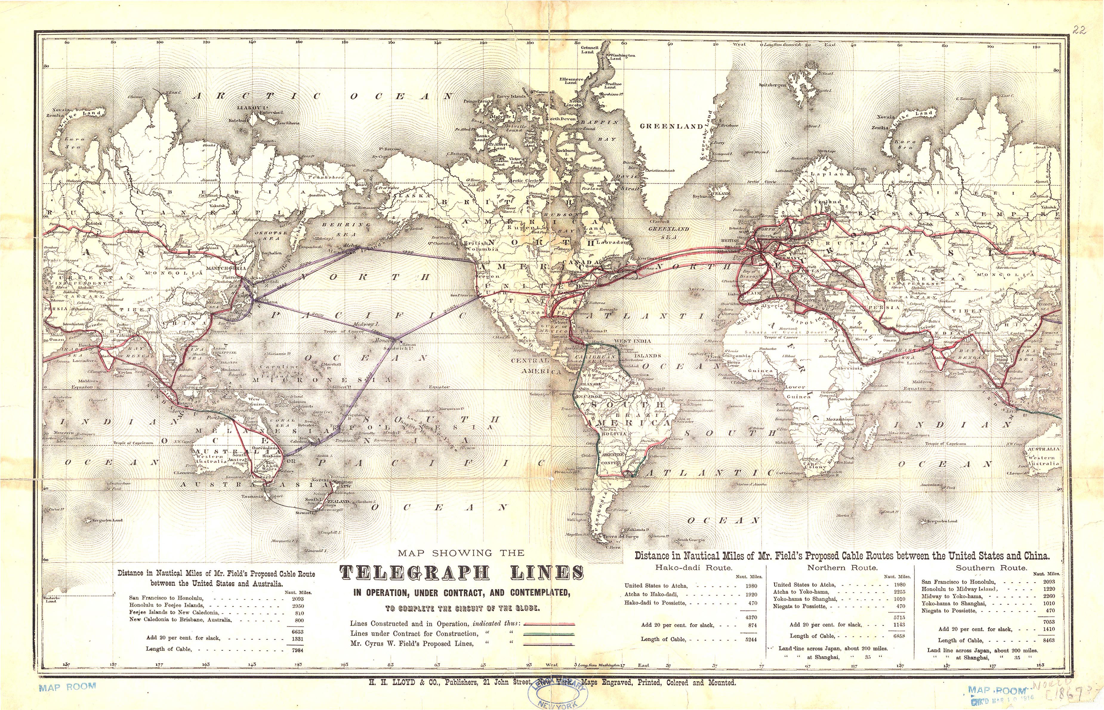
Map Showing the Telegraph Lines In Operation, Under Contract, and Contemplated to Complete the Circuit of the Globe, 1869
Map of the Internet, 22 November 2003
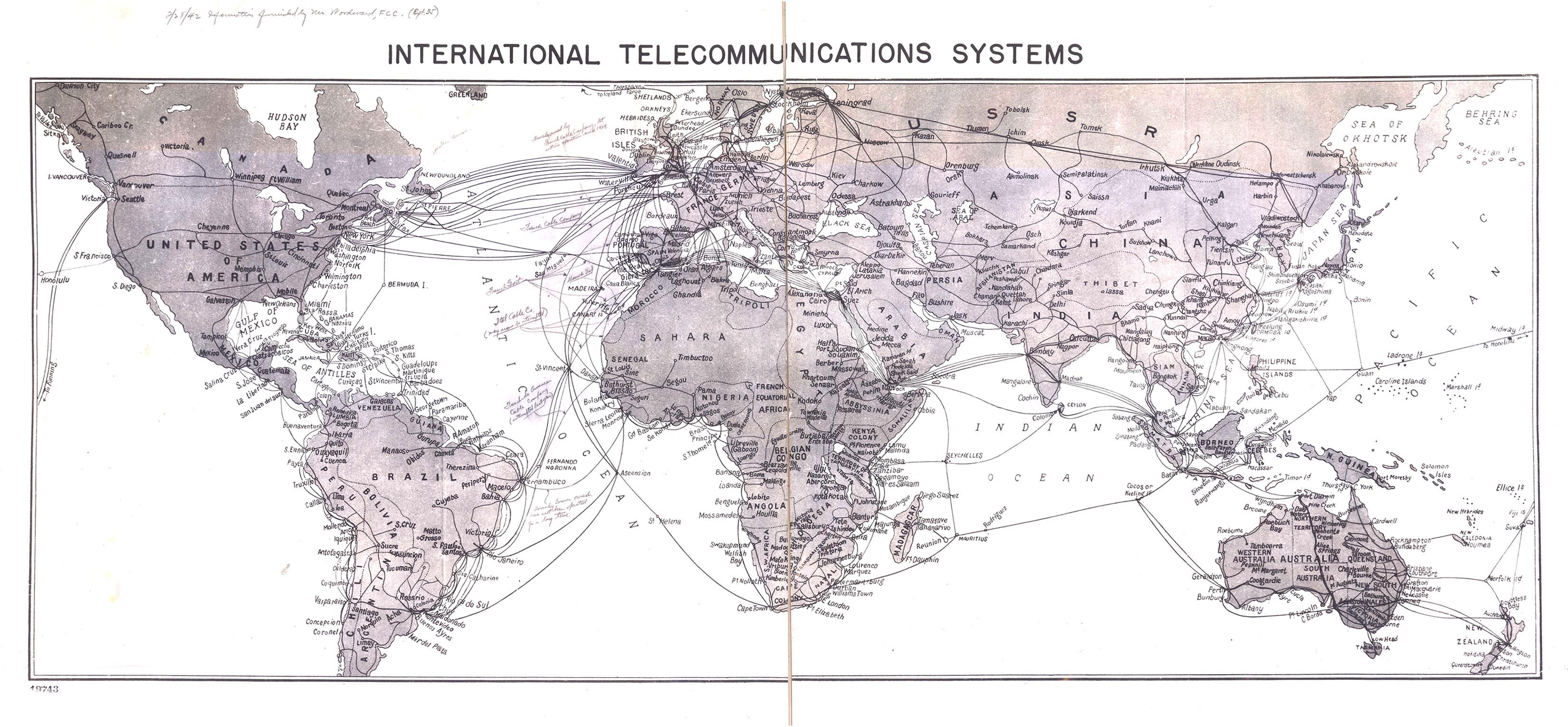
International Telecommunications Systems, 1942
International Connectivity, 1997
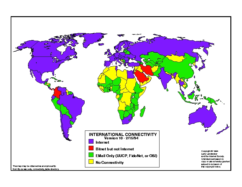
International Connectivity, 1994
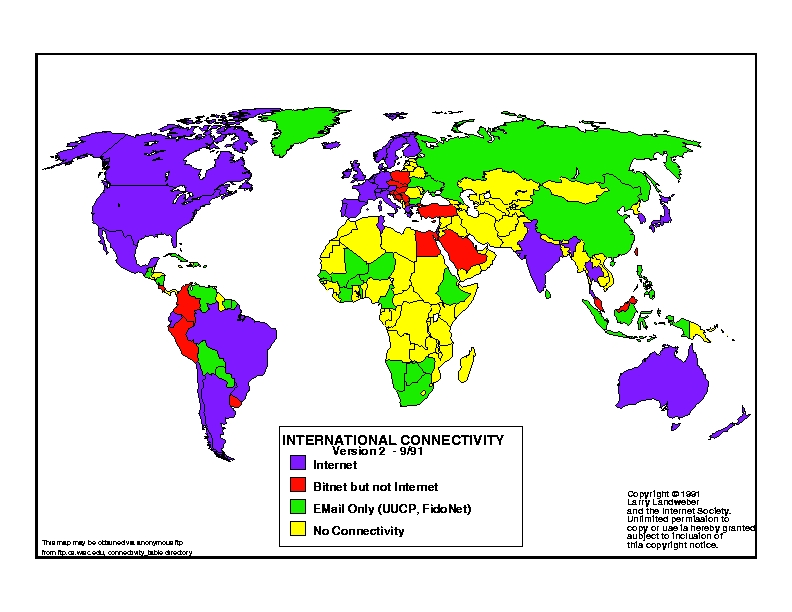
International Connectivity, 1991
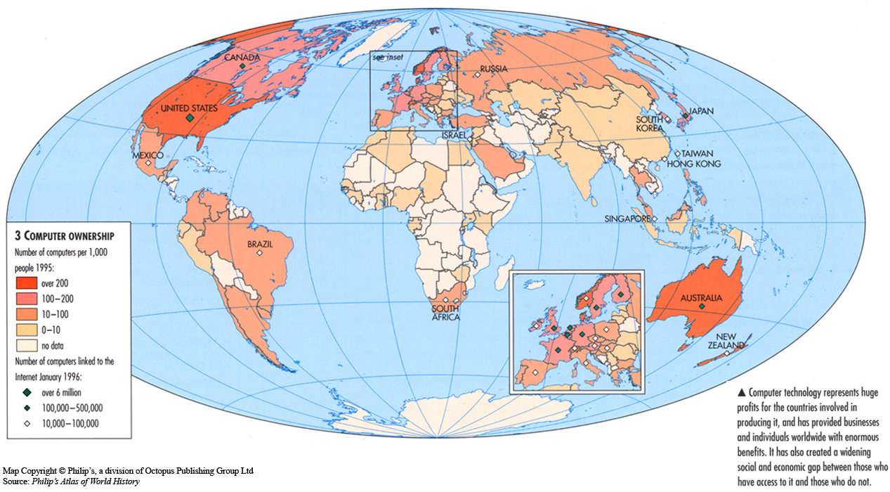
Computer Ownership, 1995
Carte Des Lignes Aeropostales (Europe and Mediterranean), 1953
Advertising expenditure, 1950-2005
Post navigation


,_1953.jpg)
