Use Online Maps and Street Views to Create “On-Site” Video
Working at a distance from your field site and your interlocutors, you can use maps and street views from sites like map.google.com to bring readers to your field site. This short video below was created to introduce The Side Unseen, a website that combines data visualizations, photography, and ethnographic storytelling.
To create this video, the author made screen recordings as she retraced her trip into North Philadelphia on google maps. As seen in the video, she recorded both aerial and a series of “street view” images, which give the impression of travel from inside a vehicle. Then, she recorded her voice-over.
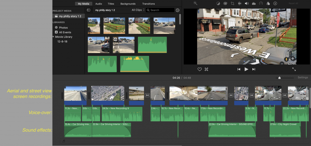
This screen shot of the editing timeline shows how the source materials were assembled. In her editing, she took the following steps:
- Add clips from her recorded voice-over on the timeline
- Add and edit the video clips to follow cues from the voice-over
- Added sound effect clips to add to the video’s immersive effect
- Adjust volume so voice is audible above background sound
While this video is a specific example using aerial and traveling footage, but there is a wide variety of ways of using street view videos as part of a variety of remote documentary stories created with the techniques described on this site.