Skip to main content
Mapping Globalization
Menu
Skip to content
Data and Analysis
NetMap Studies of World Trade
Network Analysis
Maps
Narratives
Empires
Alexander the Great
Byzantine Empire
Invasion of the Goths
Migration
Asia
Eurasia
Europe
The Genetics of Prehistoric Migration
Indoeuropeans
Out of Africa
Menu
Skip to content
Contact
Tag:
World Map
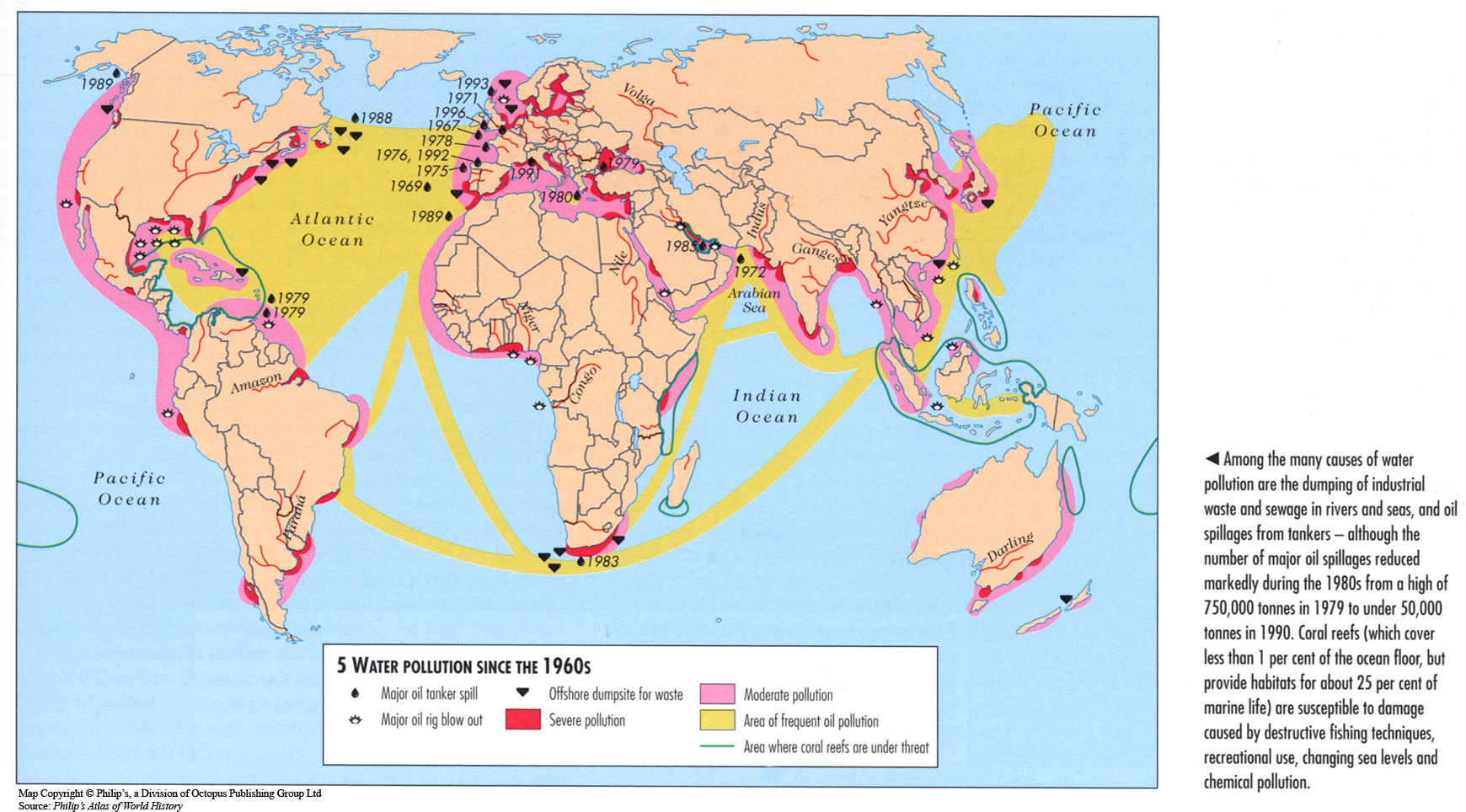
Water Pollution since the 1960s
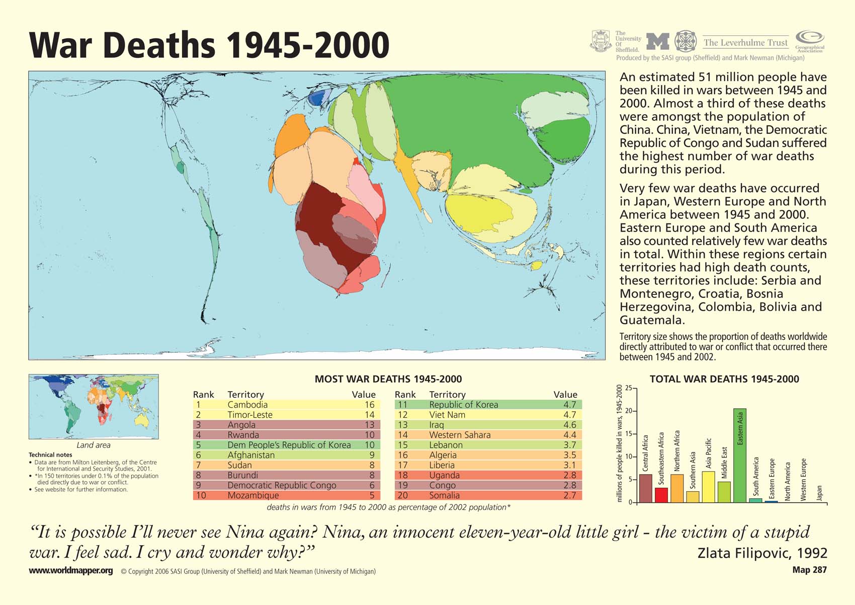
War Deaths 1945 – 2000
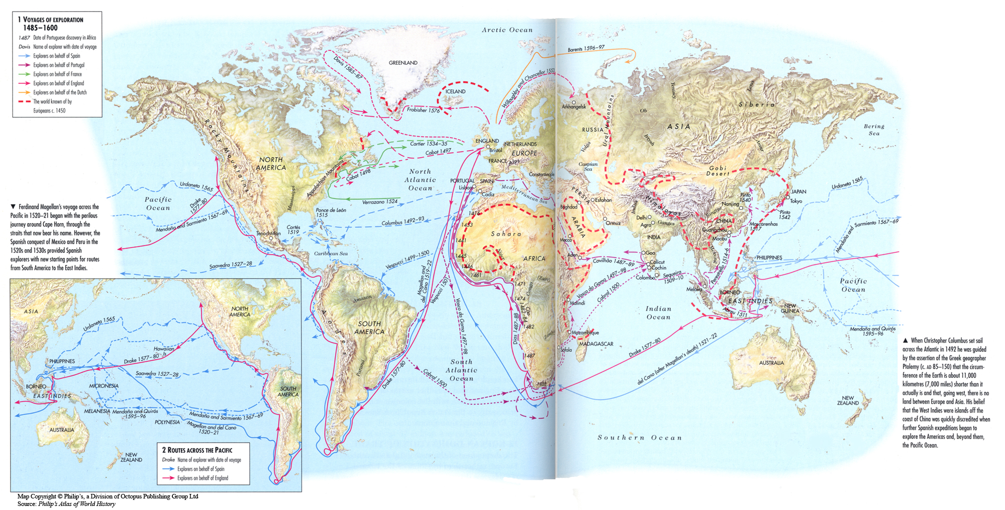
Voyages of Exploration 1485-1600
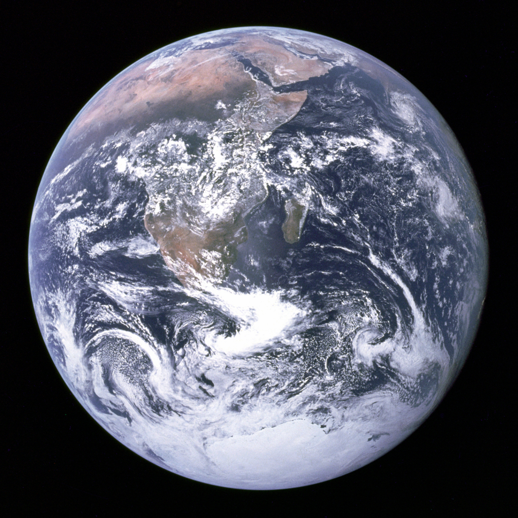
View of Earth from Apollo 17, 1972
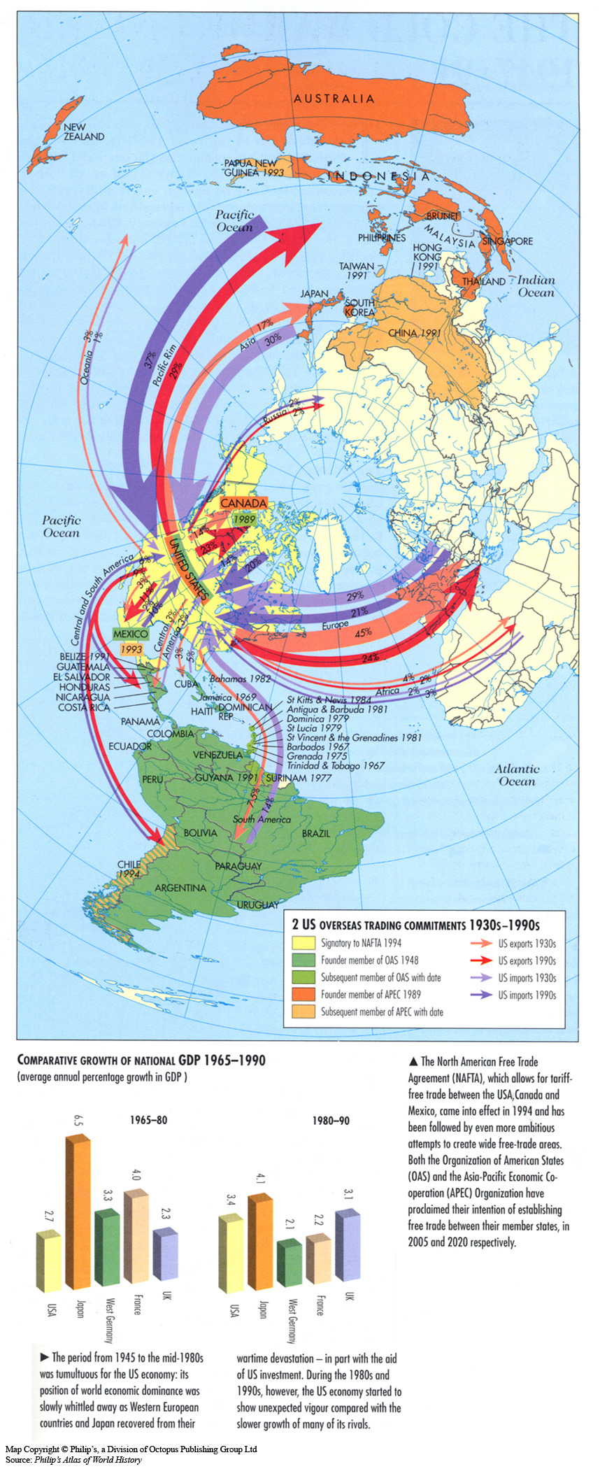
US Overseas Trading Commitments 1930s-1990s
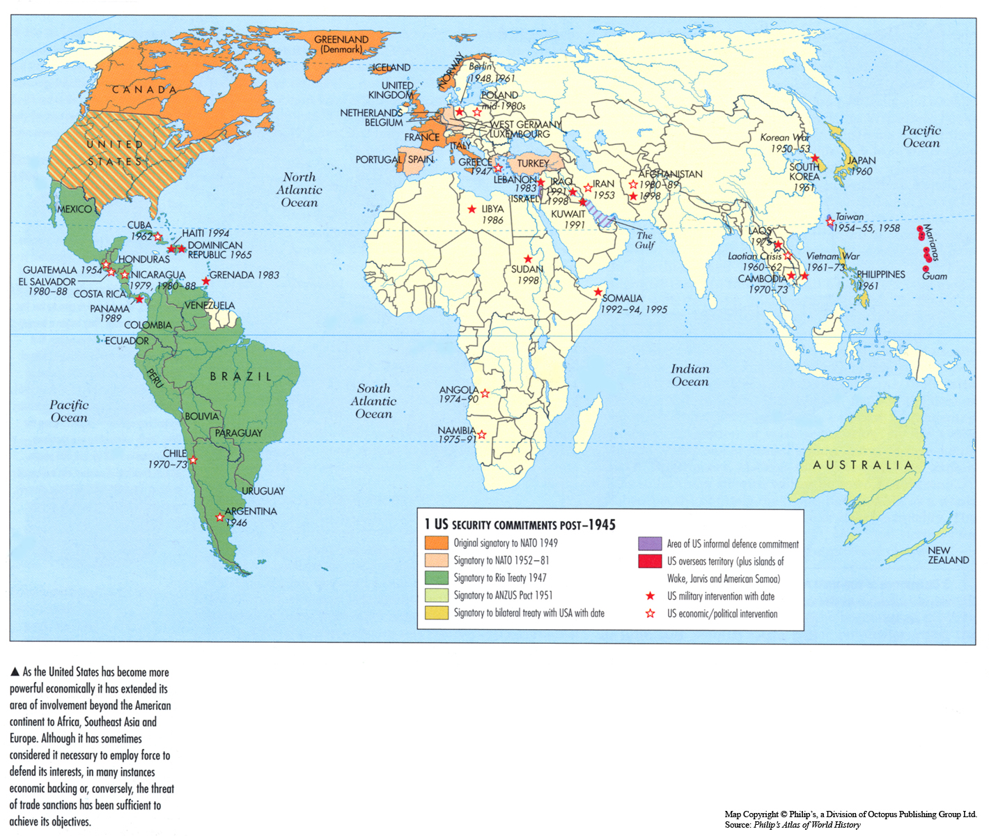
US Security Commitments post-1945
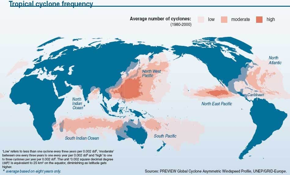
Tropical Cyclone Frequency, 1980 to 2000
UN Membership and Peacekeeping Operations, 1946 to 1986
Trafficking Waste Stories, 2006
Transmission Routes of Cholera, the most devastating illness of the 19th Century
Traditional Hazards, New Risks, c. 2002
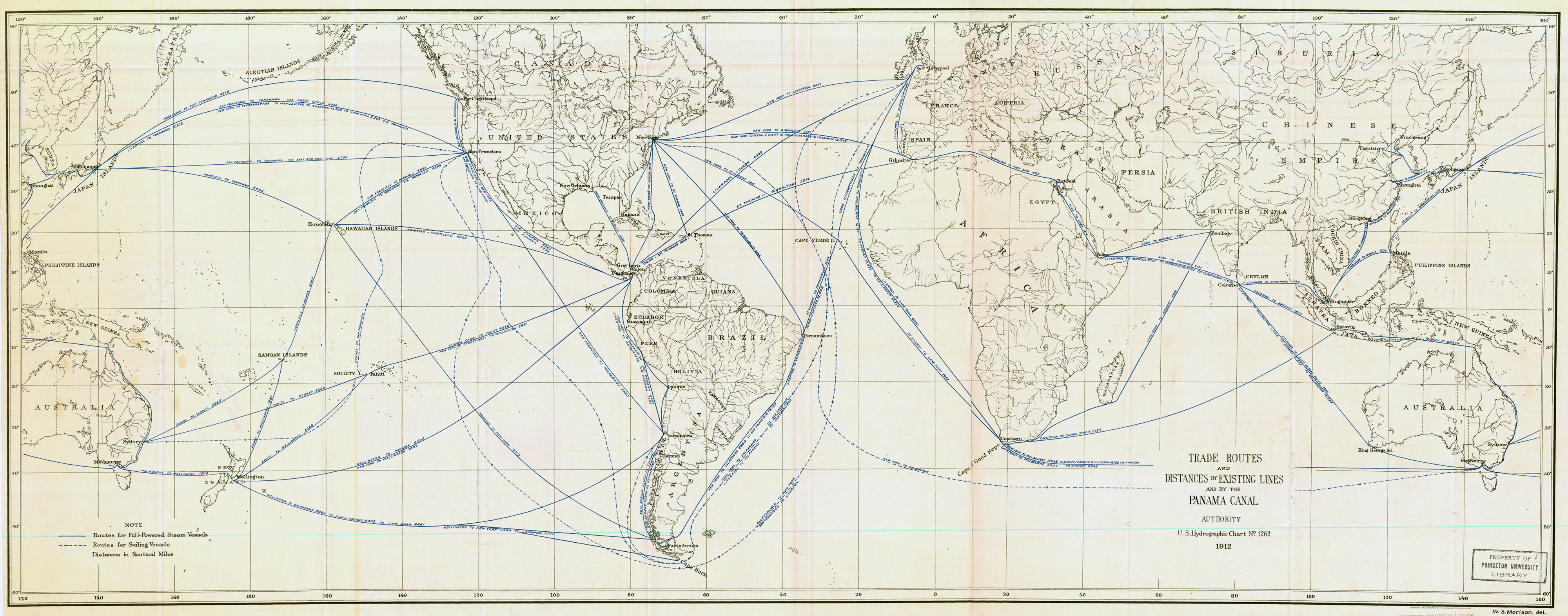
Trade Routes and Distances by Existing Lines and by the Panama Canal
Trade Routes by the Panama Canal and Japan’s Trade with the World in 1911
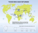
Those Who have Returned, 1999
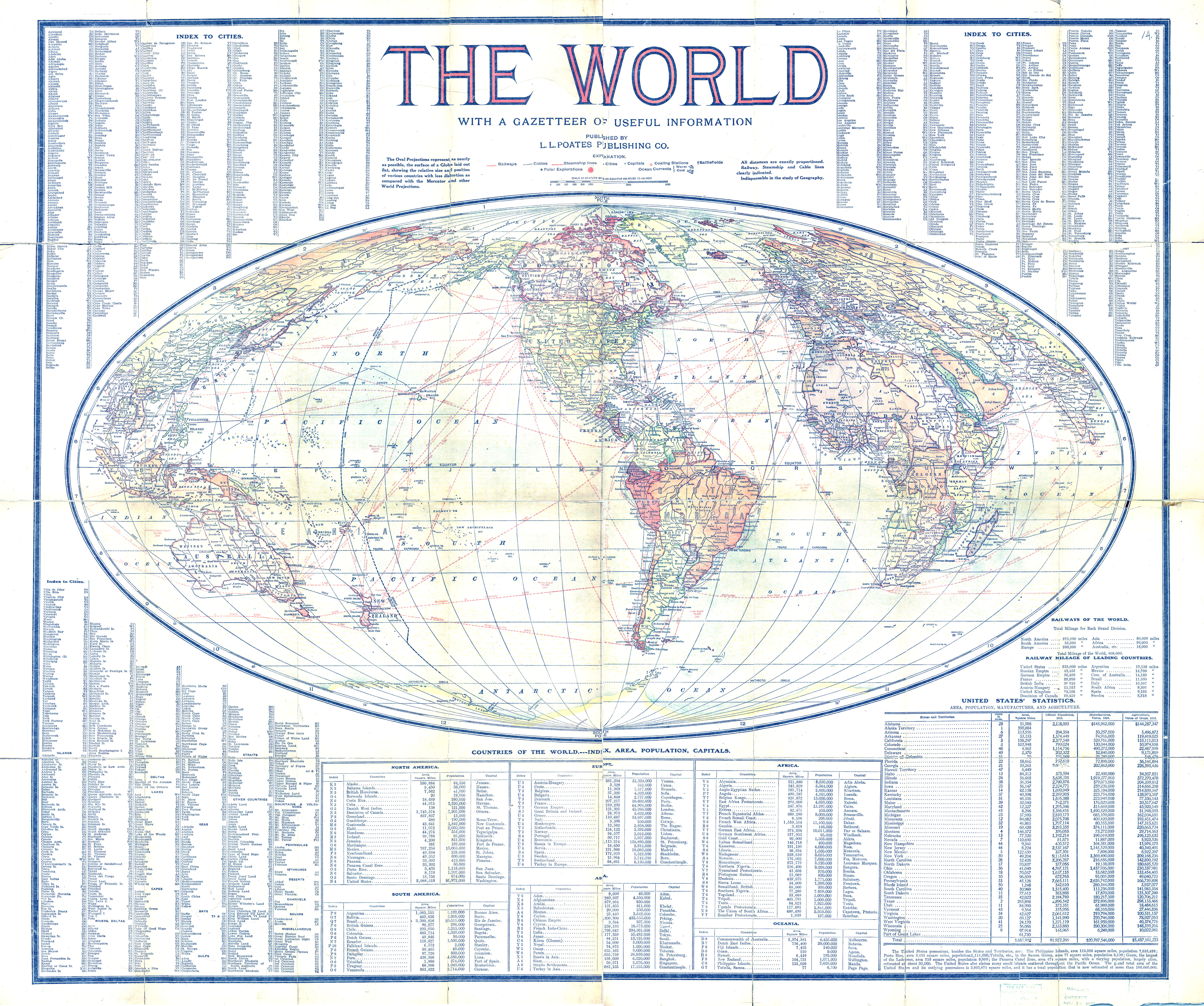
The World – With a Gazetteer of Useful Information, 1913
The Wretched Dollar (up to $1 a day), 2004
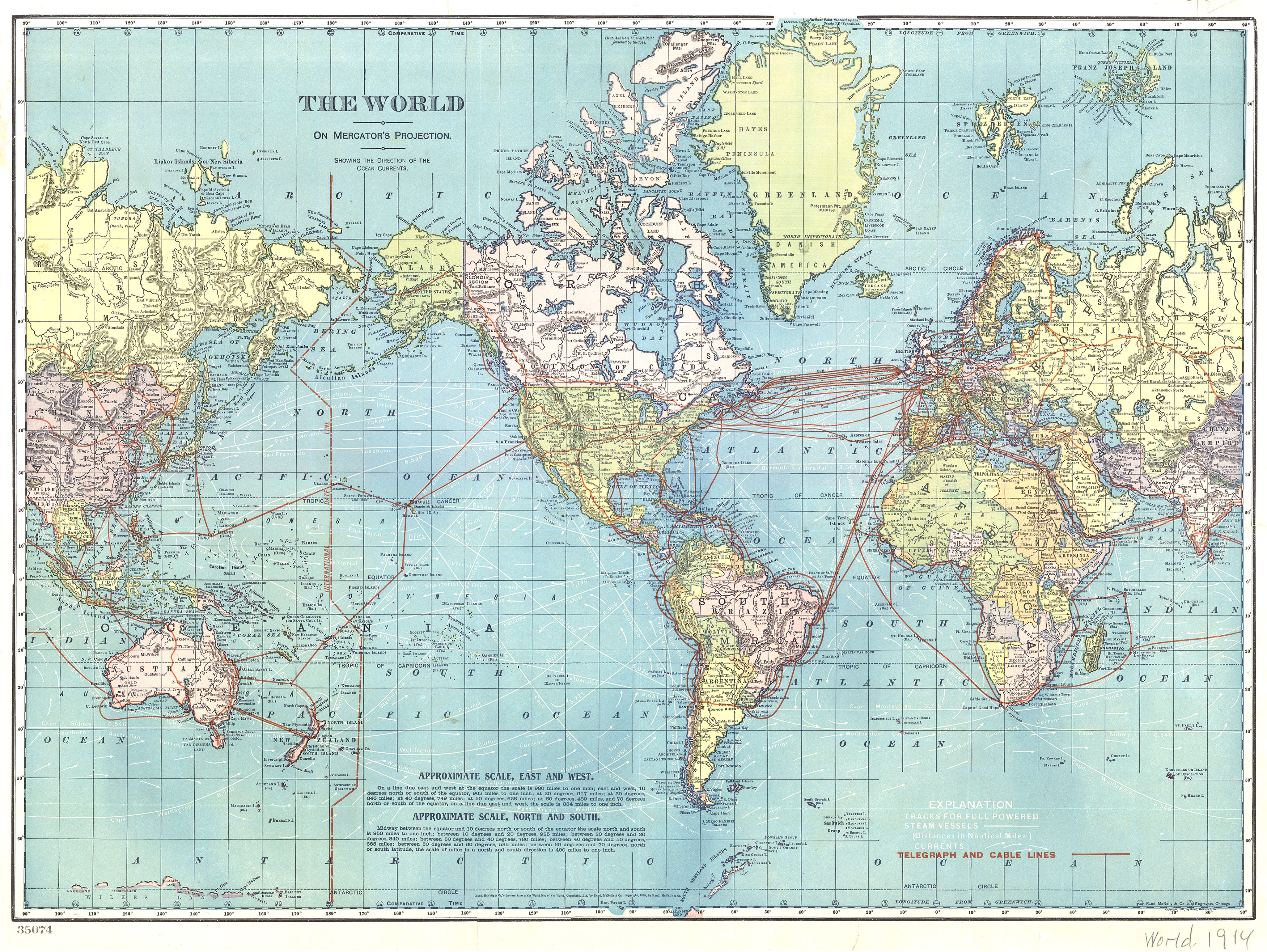
The World – Telegraph and Cable Lines, 1914
The State of World’s Fisheries Inland and Marine Capture Fishery Trends, 1984 to 1998
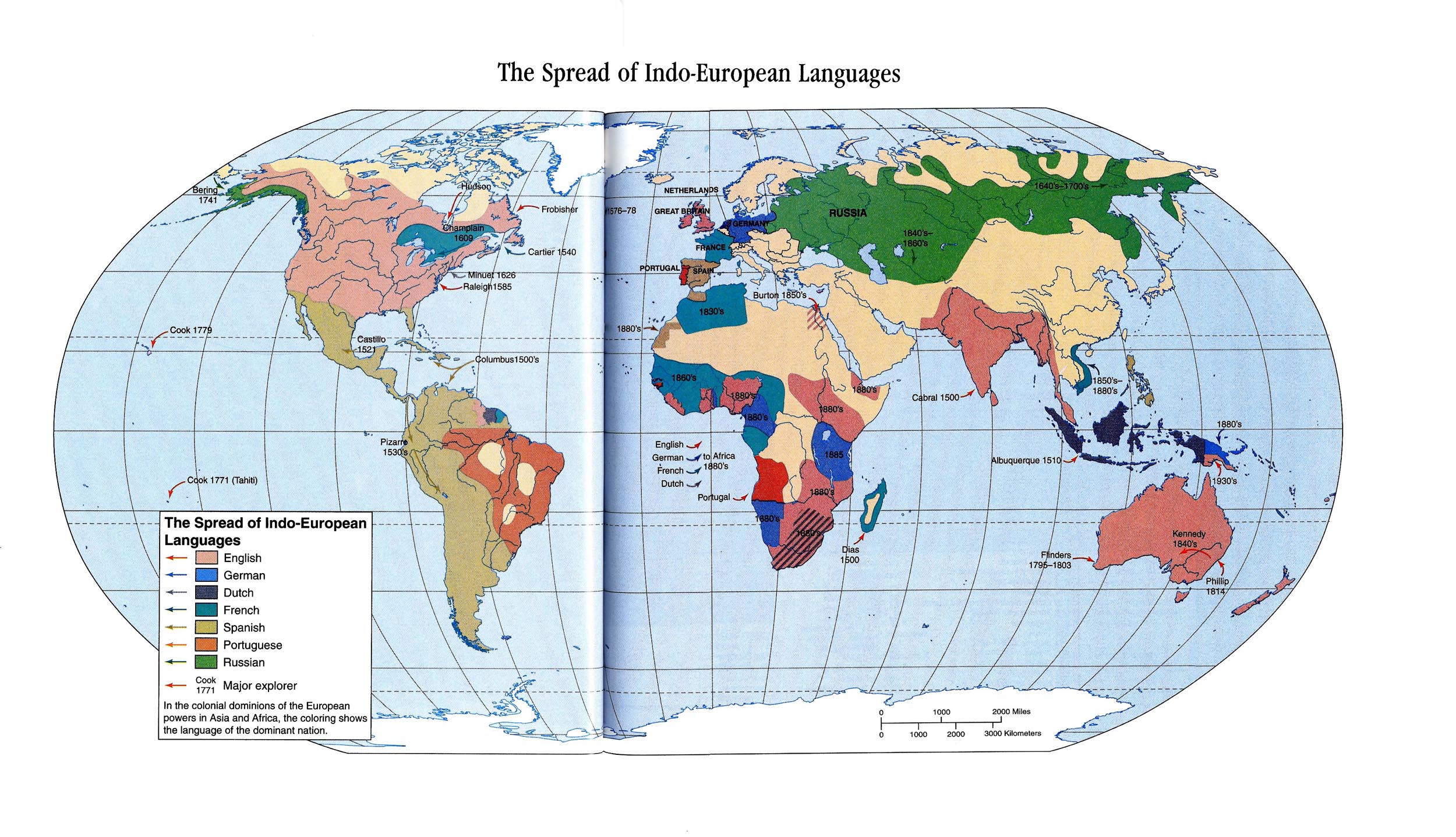
The Spread of Indo-European Languages, 1500 to 1880
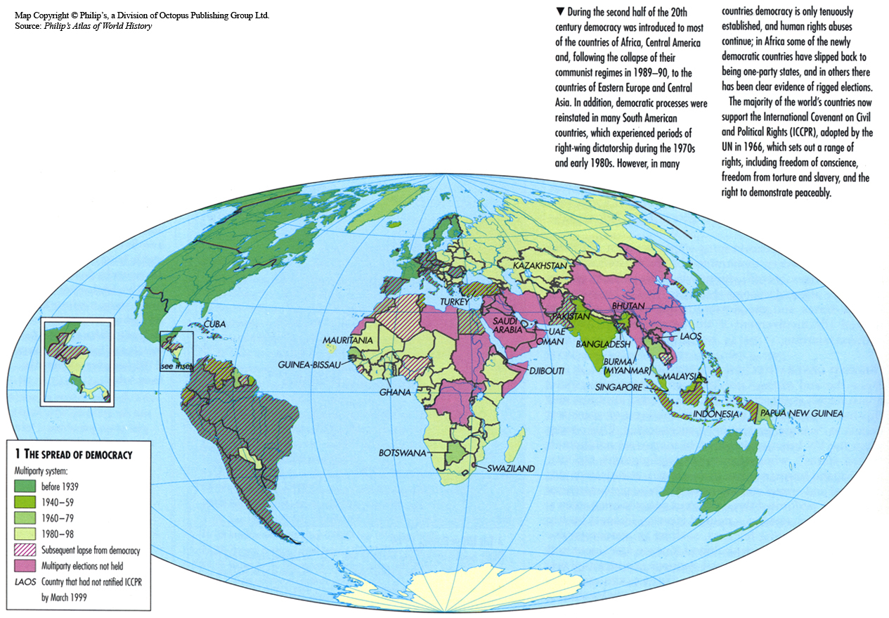
The Spread of Democracy, 1939 to 1998
The Rising Tide of Refugees, 1999
The Progress of the Spasmodic Cholera, 1832
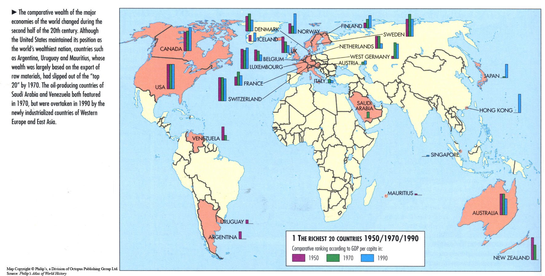
The Richest 20 Countries 1950, 1970, 1990
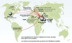
The Palestinian Diaspora, 1997
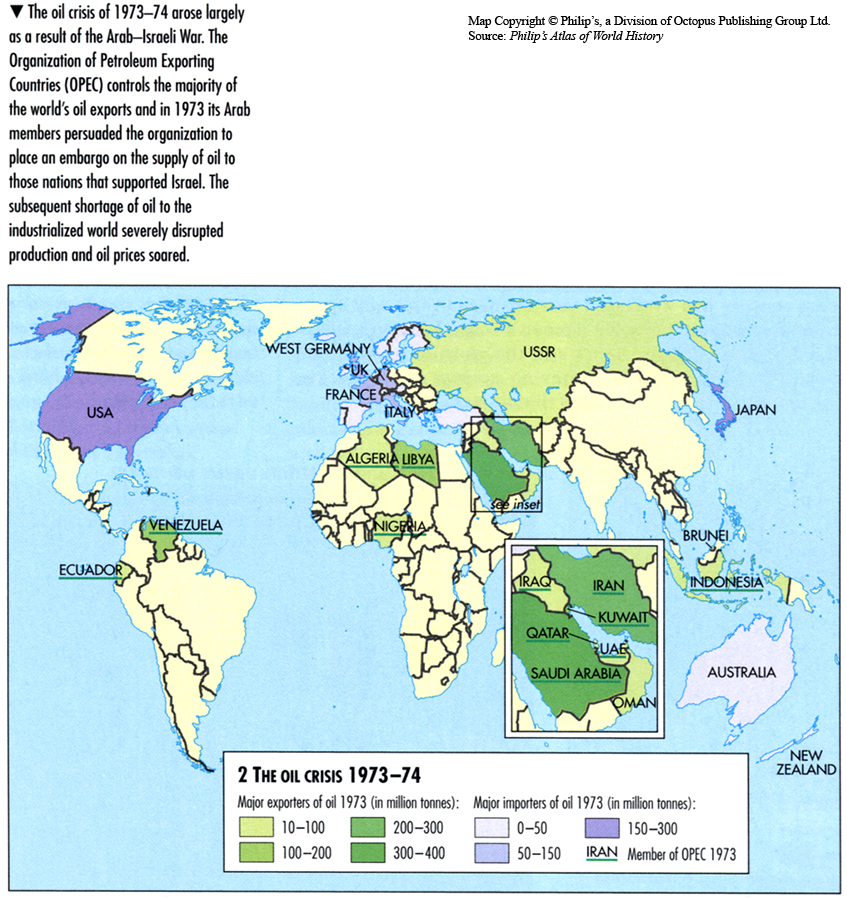
The Oil Crisis 1973-1974
The March of Cholera in 1865
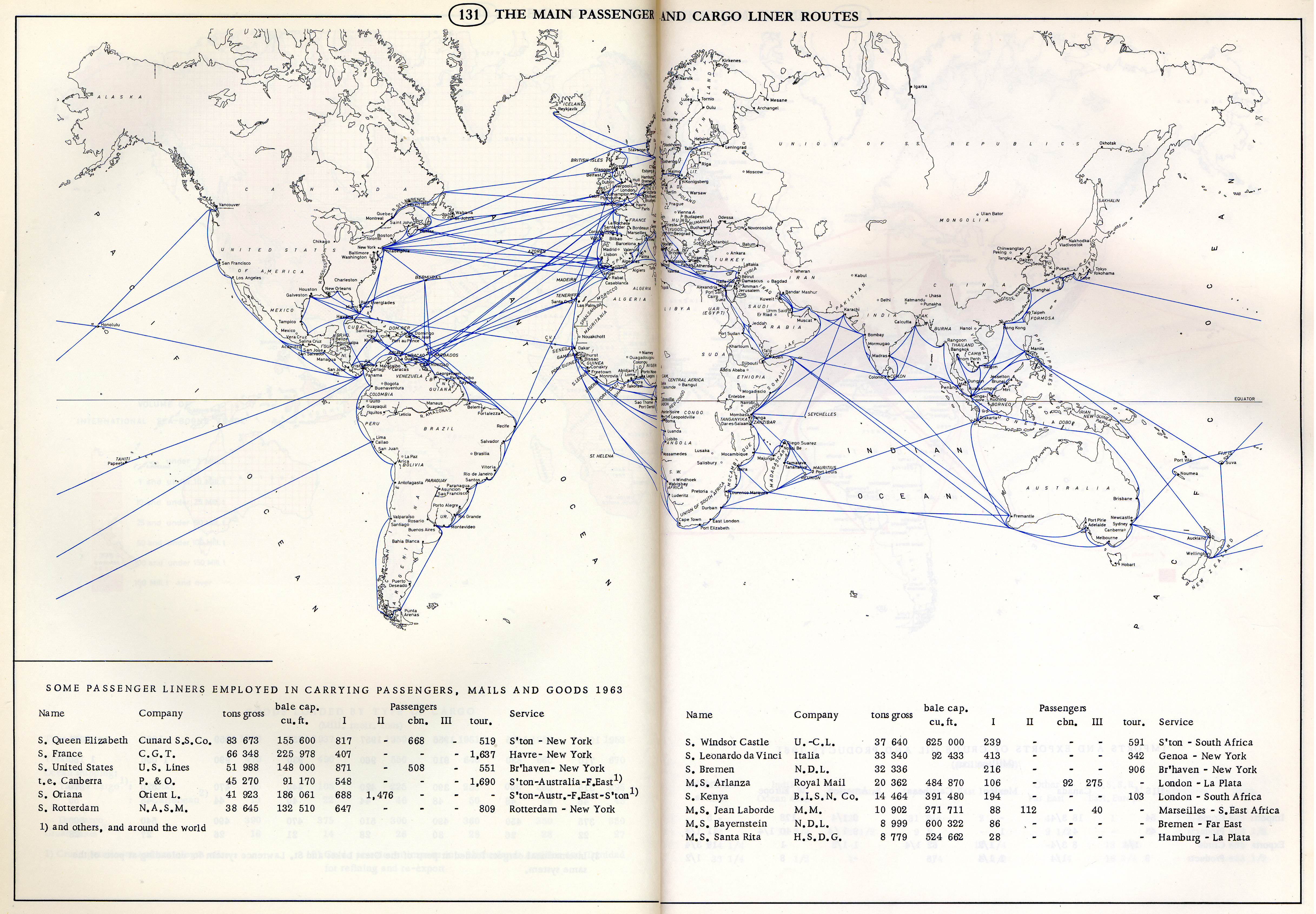
The Main Passenger and Cargo Liner Routes, 1963
The Main Conflicts of the 1990s
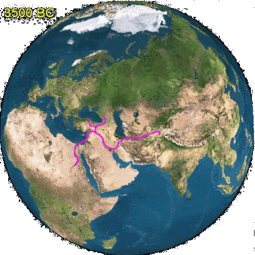
The Growth of Urban Supply Routes 3500 BC – AD 1500
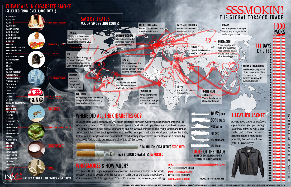
The Global Tobacco Trade
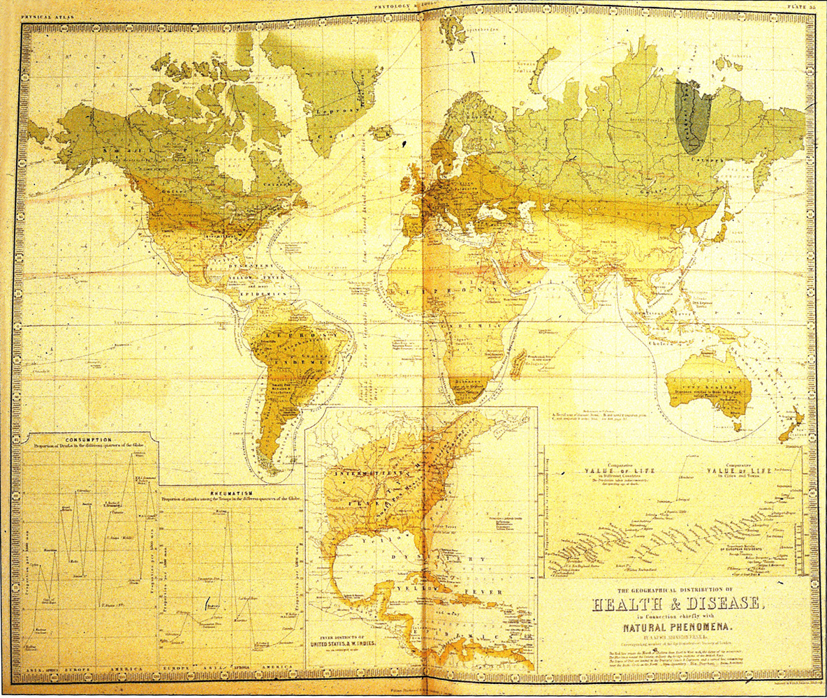
The Geographical Distribution of Health and Disease, 1856
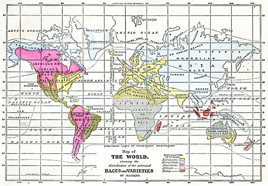
The Distribution of the Principal Races and Varieties of Mankind, 1868
Teubners Weltwirtschaftskarten III 2
Teubners Weltwirtschaftskarten III 3
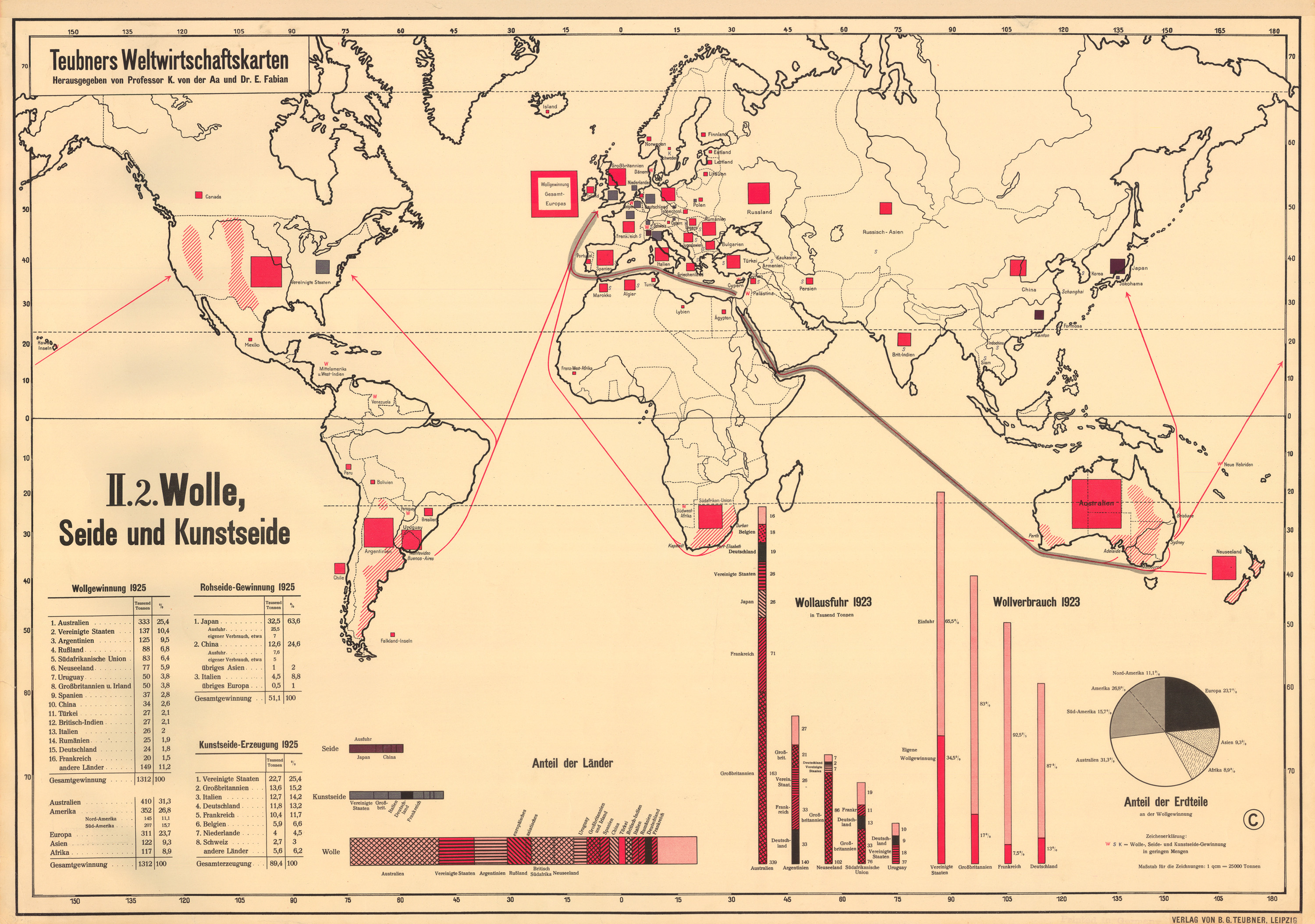
Teubners Weltwirtschaftskarten II 2 Wolle, Seide und Kunstseide, 1923-25
Post navigation
Previous
1
…
3
4
5
6
7
…
10
Next


,_2004.jpg)