
Caption
Full Earth
Summary
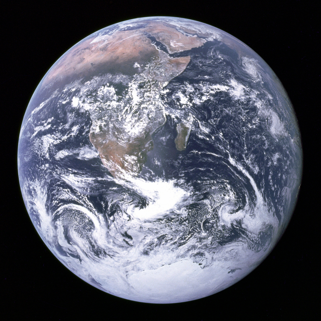
View of Earth from space.
Image AS17-148-22727. Photograph taken: 7 December, 1972.
“View of the Earth as seen by the Apollo 17 crew traveling toward the Moon.
This translunar coast photograph extends from the Mediterranean Sea area to the Antarctica South polar ice cap.
This is the first time the Apollo trajectory made it possible to photograph the South polar ice cap.
Note the heavy cloud cover in the Southern Hemisphere.
Almost the entire coastline of Africa is clearly visible. The Arabian Peninsula can be seen at the Northeastern edge of Africa. The large island off the coast of Africa is the Malagasy Republic. The Asian mainland is on the horizon toward the Northeast.” [1]
Source
NASA [2]
Copyright
| |
This work is in the public domain in the United States because it is a work of the United States Federal Government under the terms of Title 17, Chapter 1, Section 105 of the United States Code. |
 |
NASA requests that it be acknowledged as the source of its material.
See also [3].