
Caption
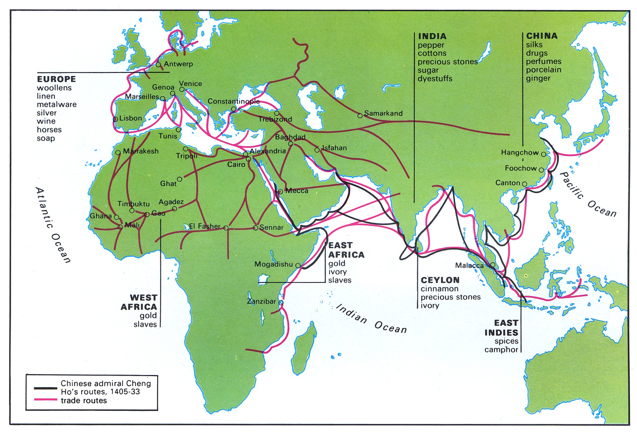
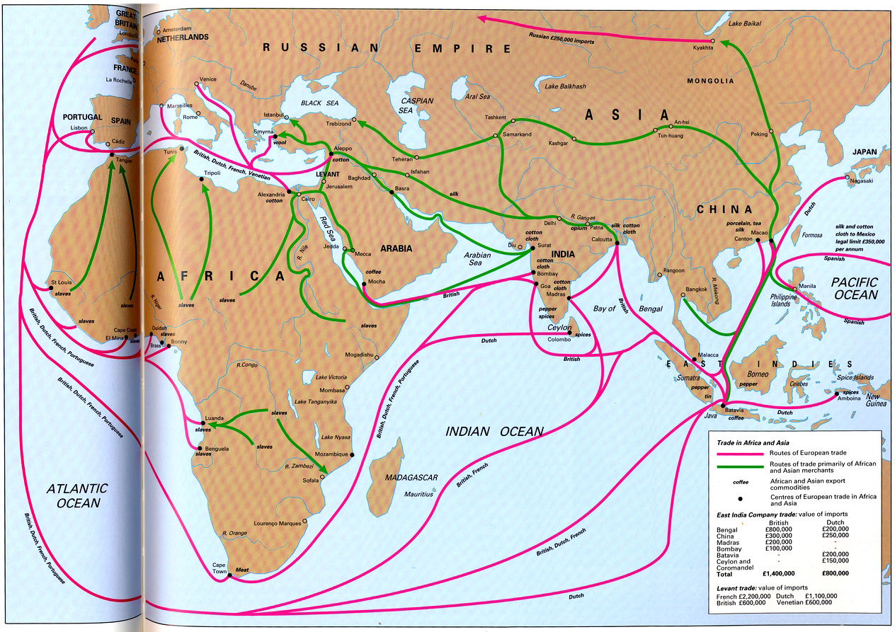
Trade Sites and Goods in the 15th Century
Summary
This map shows trade routes and goods traded from specific sites in the Old World during the 15th century, as well as the routes of Chinese admiral Cheng Ho.
Source
Geoffrey Barraclough. Times Atlas of World History (p. 150).
Times Books Division of Harper Collins Publishers, London. 4th edition, 1993.
GIS Library. Scanned at 400dpi, digitized at 300dpi.
Copyright
Geoffrey Barraclough.
This is a copyrighted work. Its use on QED is under the “Fair Use” rule.


