
Caption
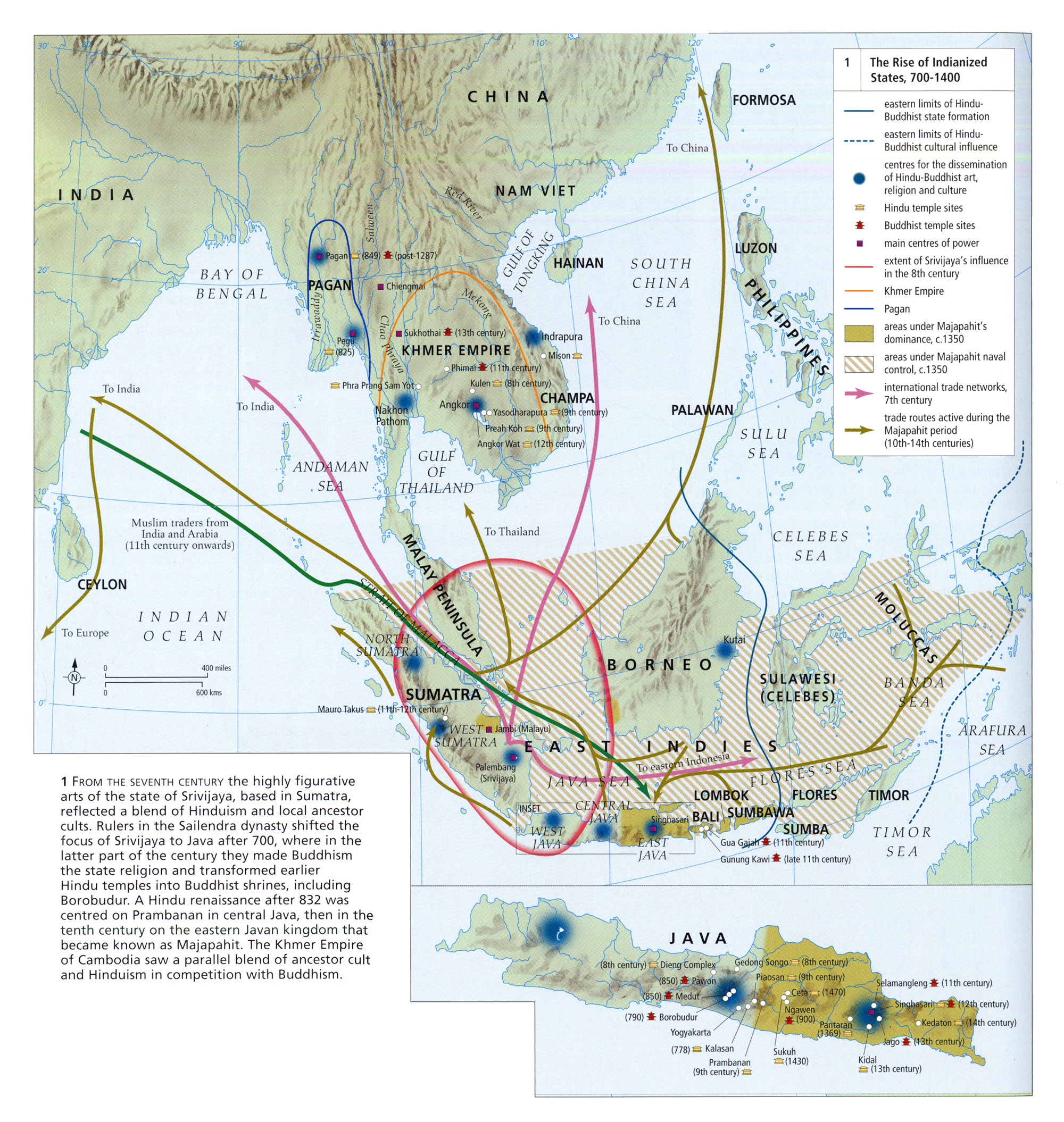
The Rise of Indianized States, 700 to 1400
Summary
This map shows the boundaries and influences of religions (Hinduism and Buddhism) and empires: Srivijaya Srivijaya, Majapahit Majapahit, and Khmer Khmer.
Additionally, main centers of power, namely correlated with the areas where the Hindu-Buddhist art and religion became widely spread, and trade routes are noted on the map. .
Source
Atlas of World Art (p. 142)
Oxford University Press
Copyright
© 2004 Laurance King Publishing


