Skip to main content
Mapping Globalization
Menu
Skip to content
Data and Analysis
NetMap Studies of World Trade
Network Analysis
Maps
Narratives
Empires
Alexander the Great
Byzantine Empire
Invasion of the Goths
Migration
Asia
Eurasia
Europe
The Genetics of Prehistoric Migration
Indoeuropeans
Out of Africa
Menu
Skip to content
Contact
Tag:
Tourism
World Risk Map, 1999
World Air Transportation – Principal Routes of Scheduled Commercial Airlines, 1951
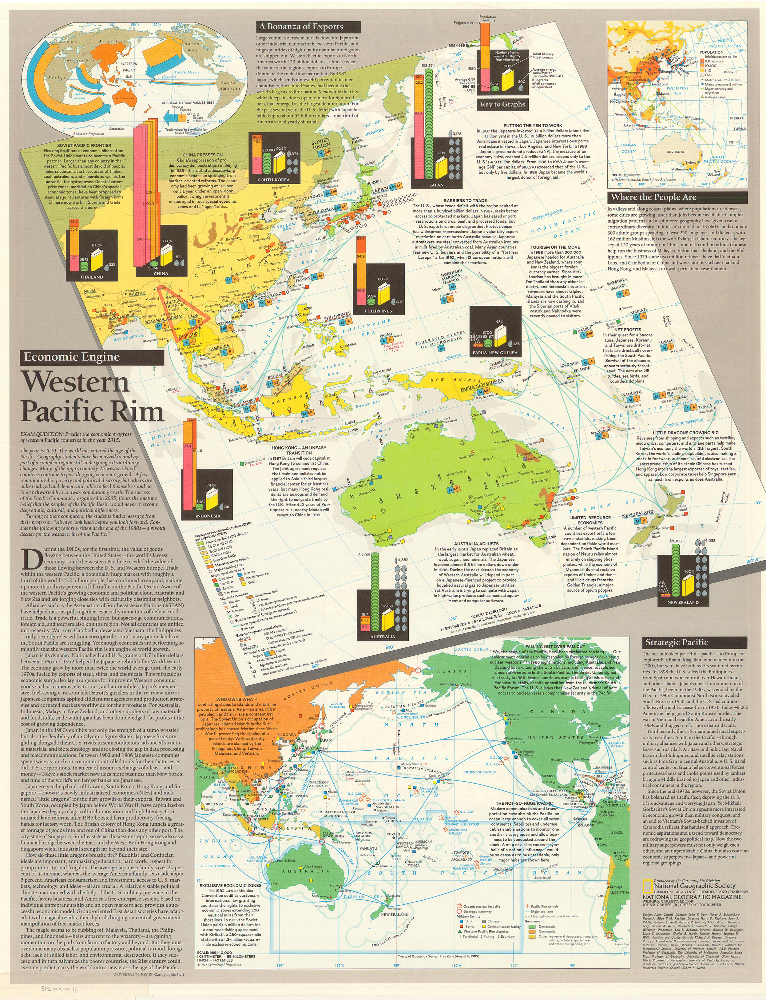
Western Pacific Rim, 1989
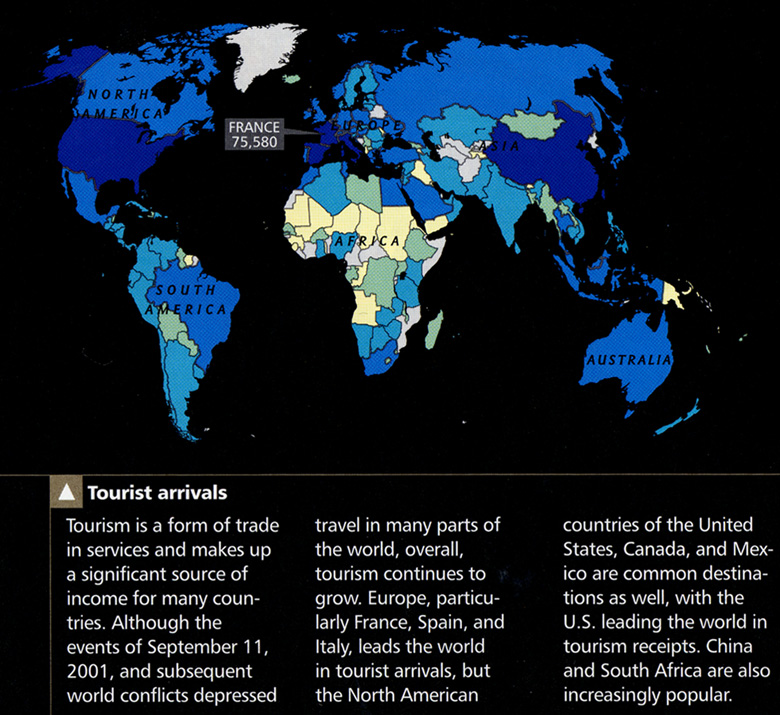
Tourist Arrivals Worldwide, 2005
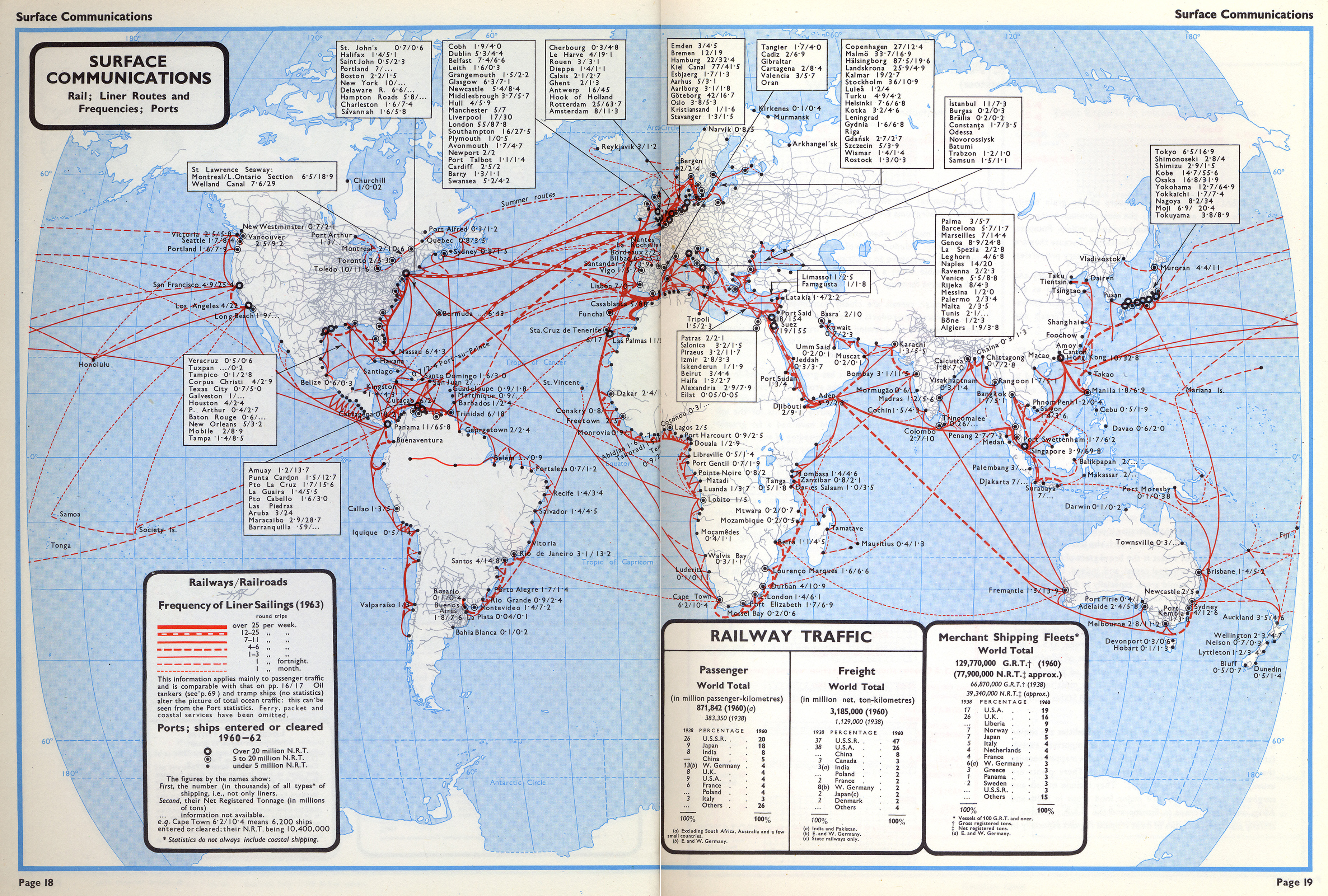
Surface Communications 2
Surface Communications 1
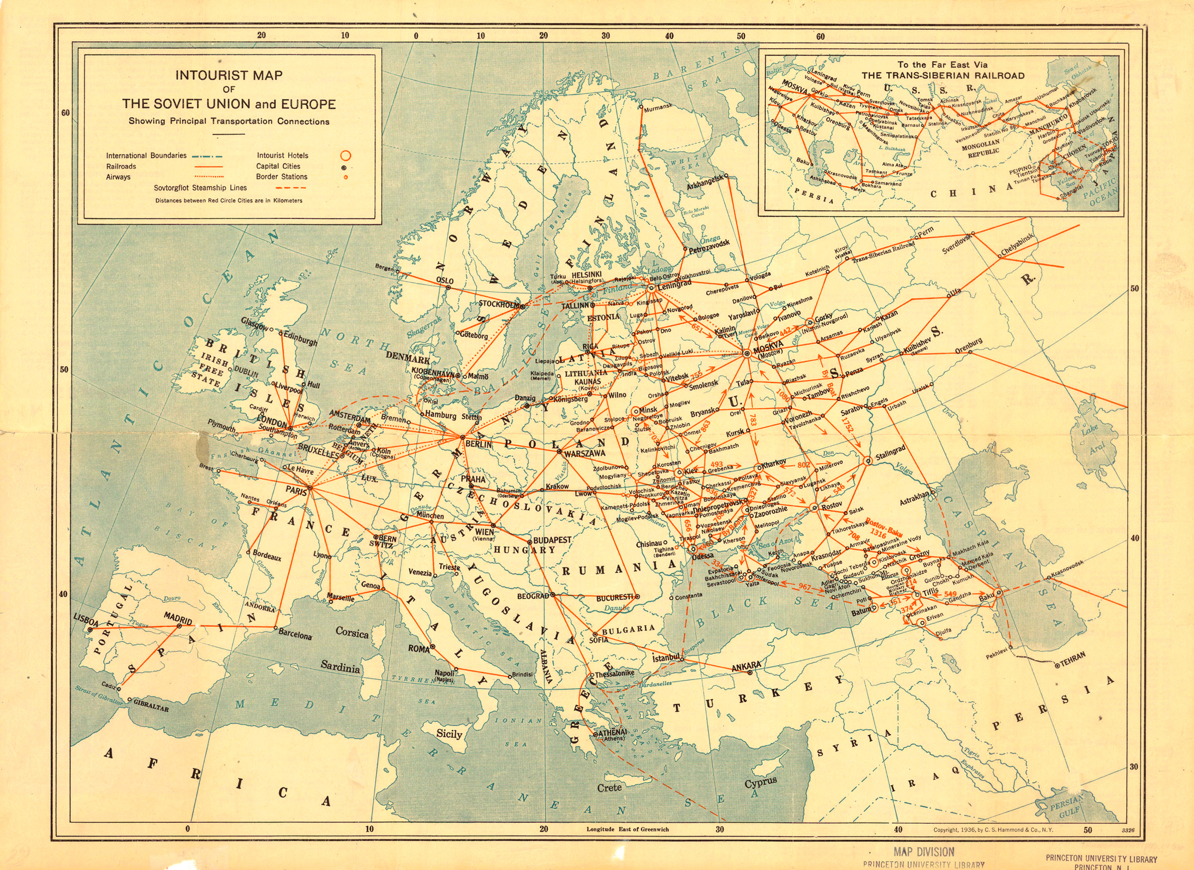
Intourist Map of the Soviet Union and Europe, 1936
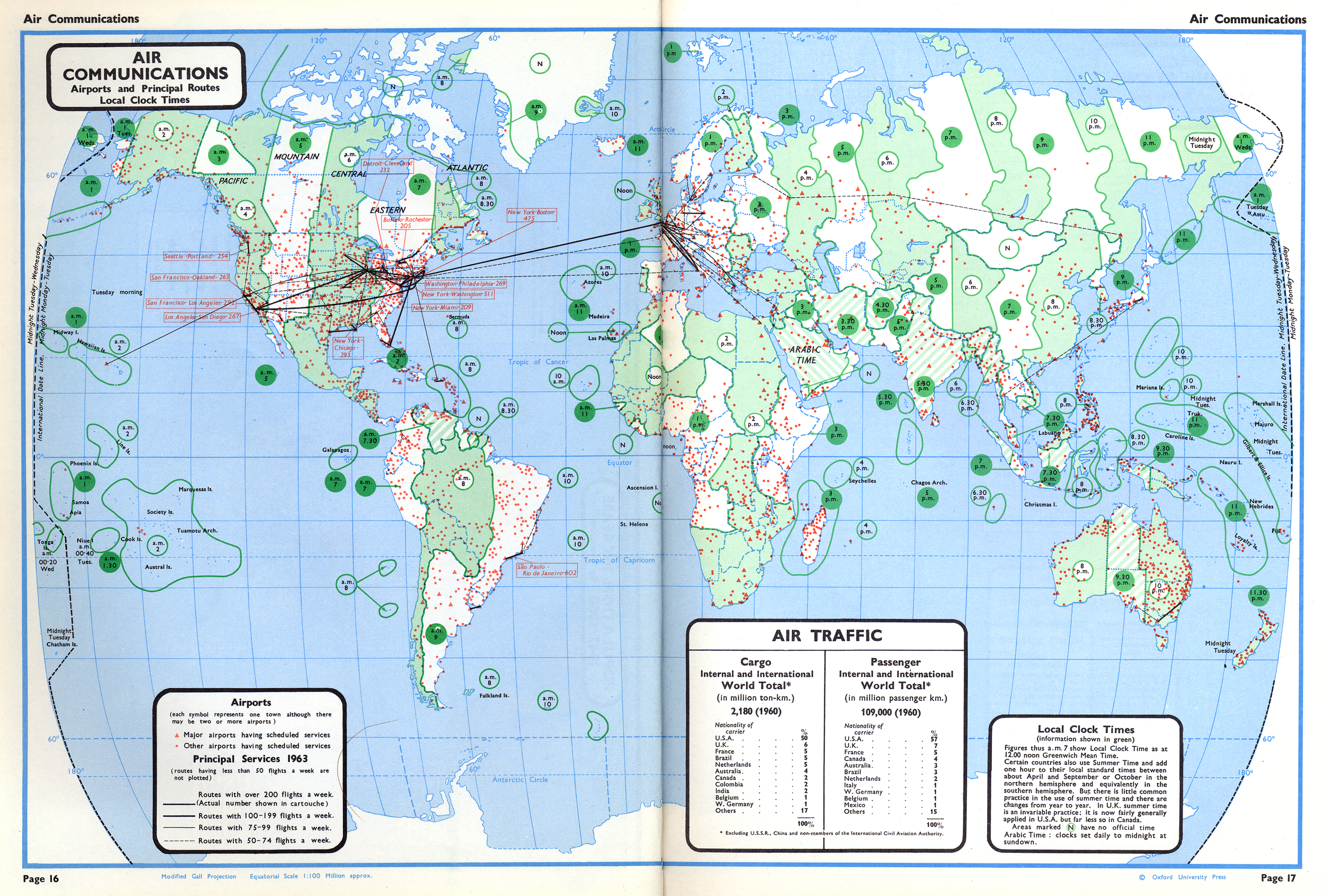
Air Communications – Airports and Principal Routes
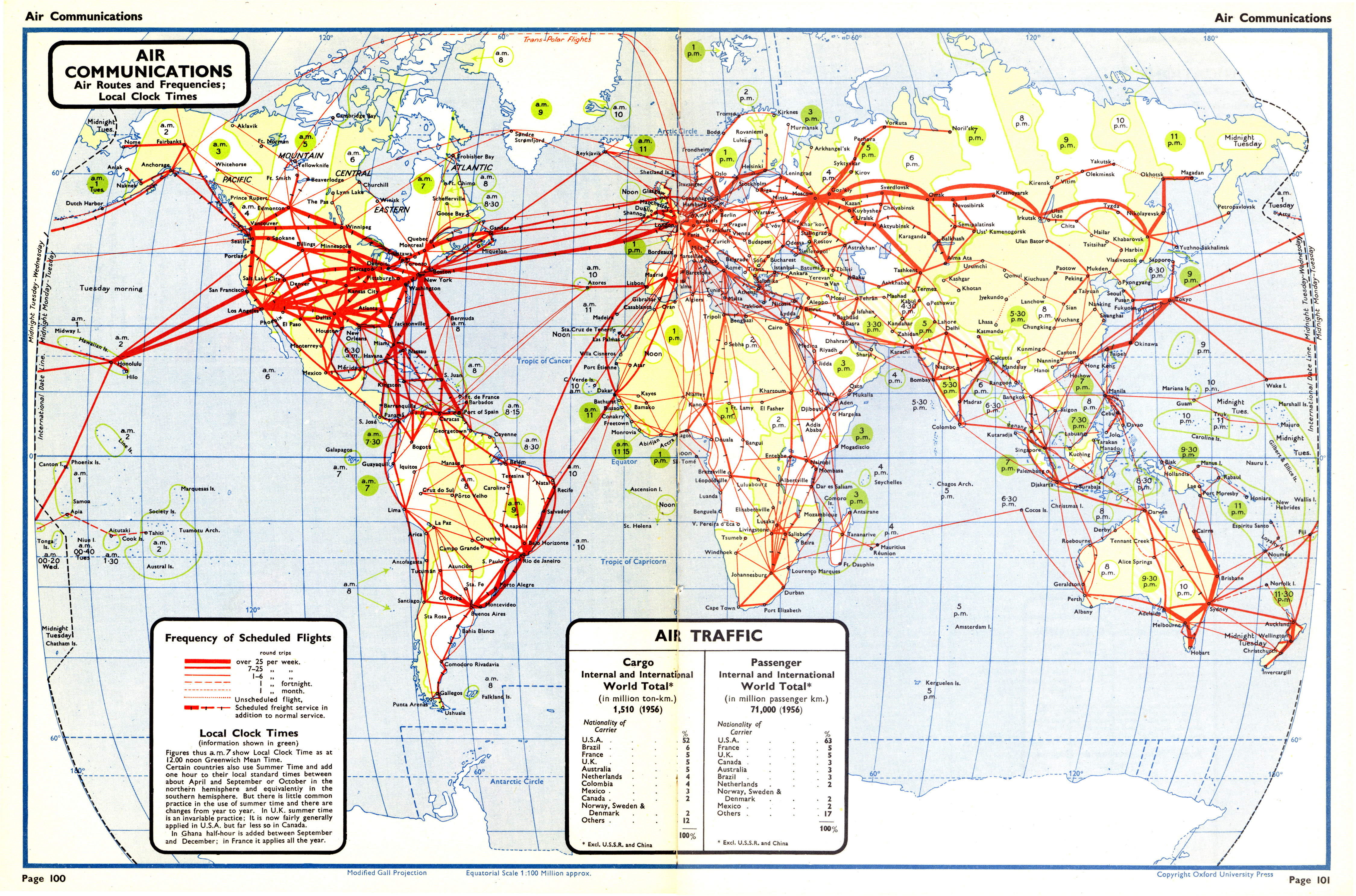
Air Communications – Air Routes and Frequencies
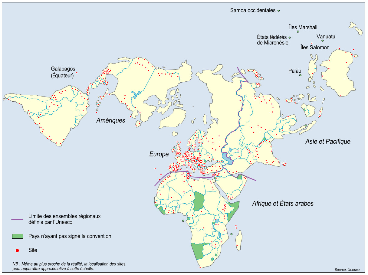
World Heritage Sites, January 2000.swf
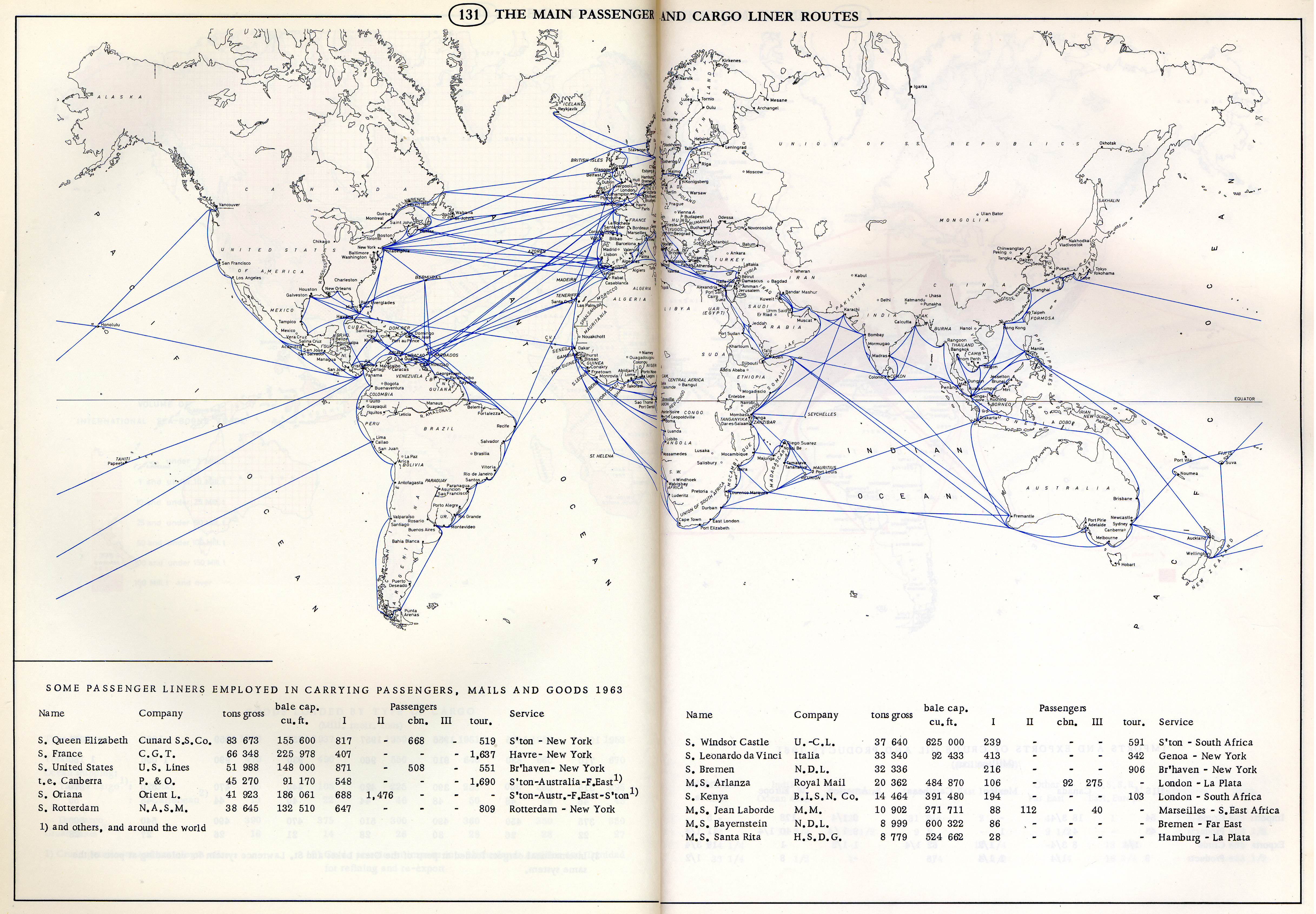
The Main Passenger and Cargo Liner Routes, 1963
Routes to United States Authorized to Foreign Air Carriers of Eastern Hemisphere – Countries under Permit December 31, 1968
Passenger kilometers (miles) flown 1994
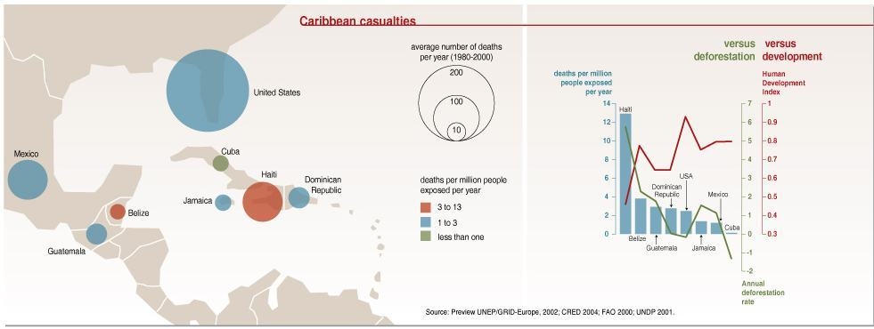
Caribbean Casualties due to Hurricanes, 2004
Post navigation


_flown_1994.jpg)