Skip to main content
Mapping Globalization
Menu
Skip to content
Data and Analysis
NetMap Studies of World Trade
Network Analysis
Maps
Narratives
Empires
Alexander the Great
Byzantine Empire
Invasion of the Goths
Migration
Asia
Eurasia
Europe
The Genetics of Prehistoric Migration
Indoeuropeans
Out of Africa
Menu
Skip to content
Contact
Tag:
Bulk Goods
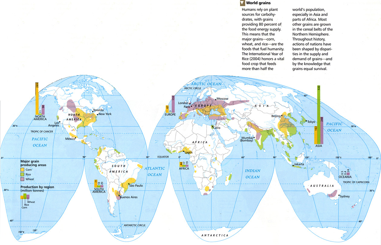
World Grains, 2005
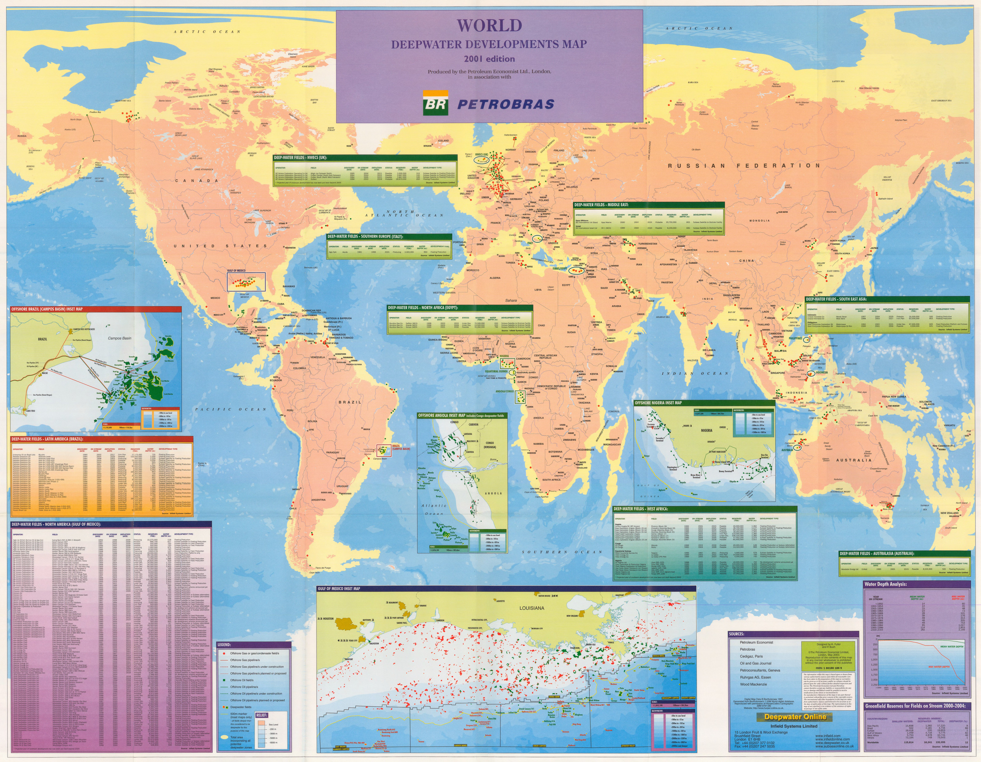
World Deepwater Developments Map, 2001
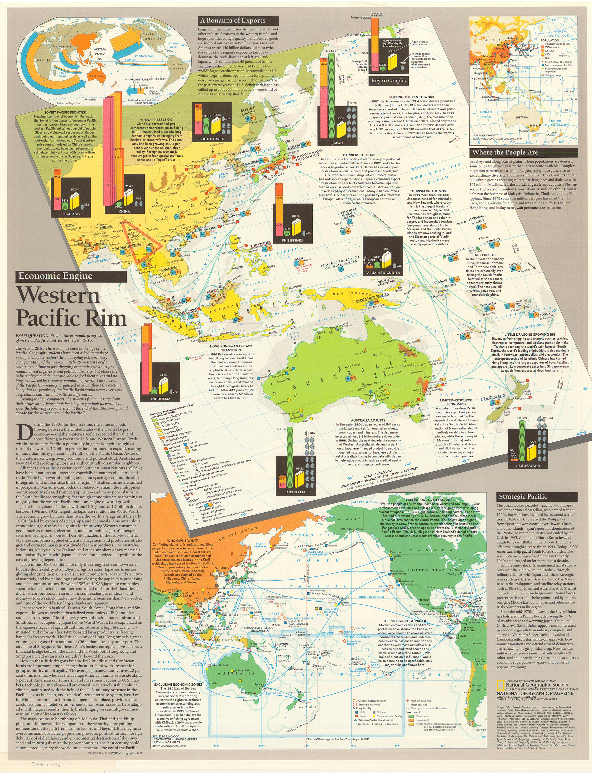
Western Pacific Rim, 1989
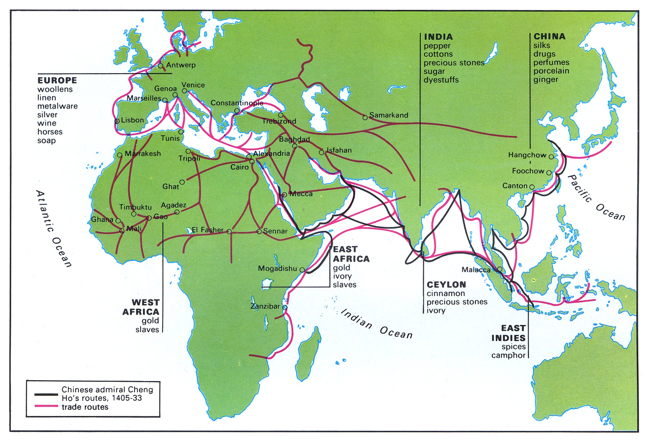
Trade Sites and Goods in the 15th Century
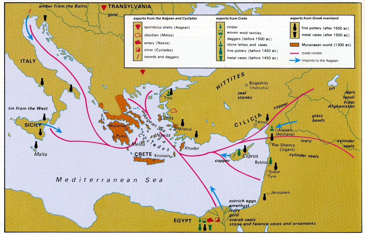
Trade in the Mycenaean World
Trade in Japan 19th – 20th centuries
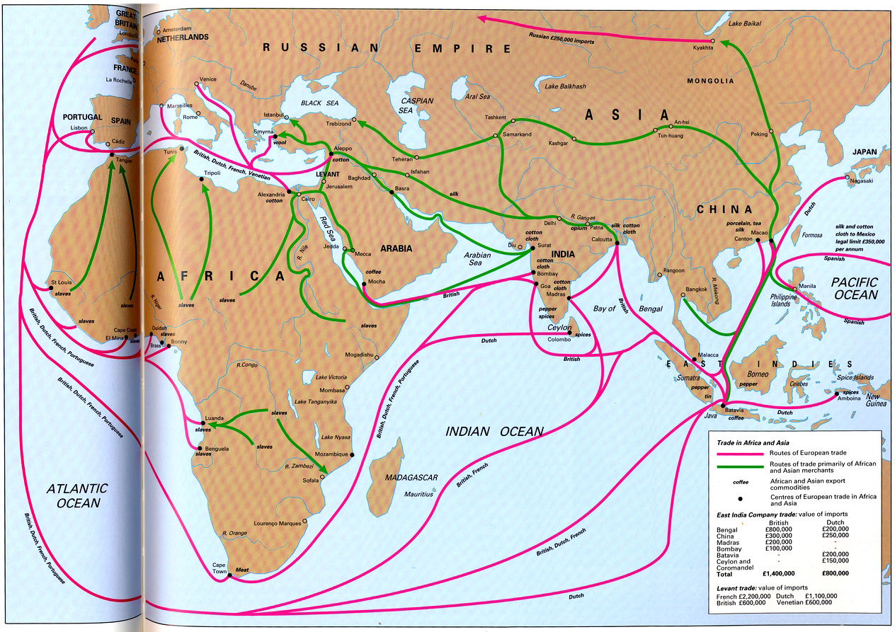
Trade in Africa and Asia
The Indian Ocean circa 390-1000
The Economy of the Hellenistic Period
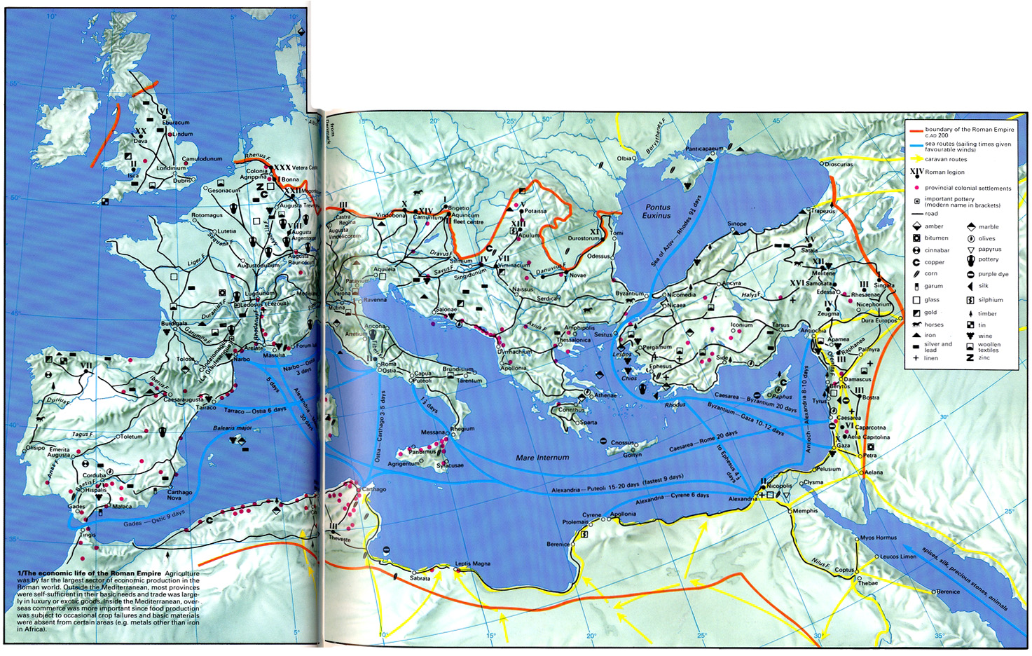
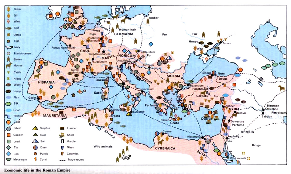
The Economic Life of the Roman Empire
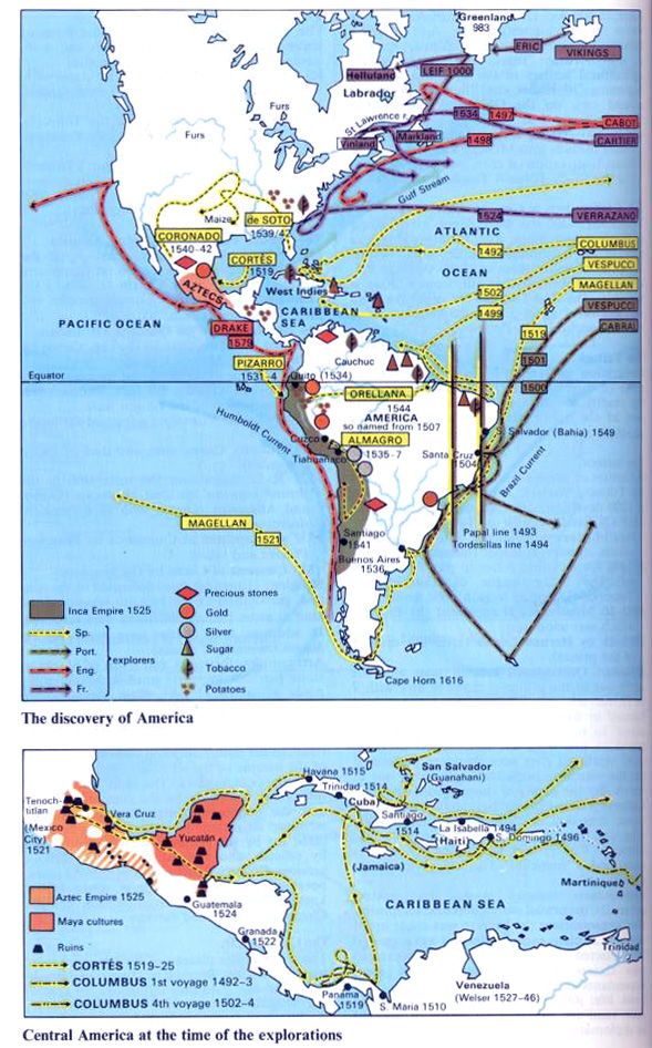
The Discovery of America and Central America at Time of the Explorations
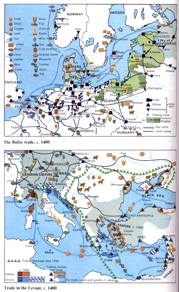
The Baltic Trade and Trade in Levant
Japanese Expansion to 1941
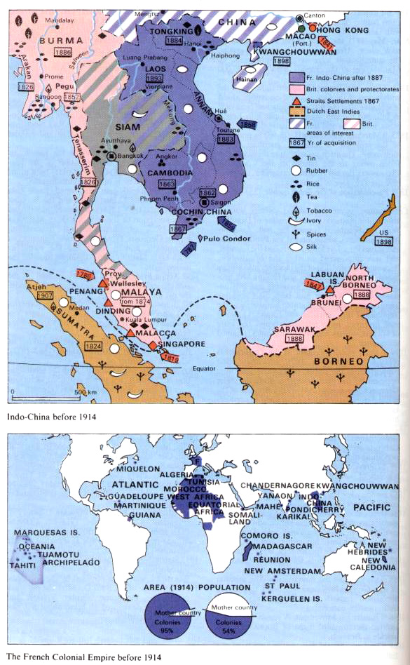
French Colonial Empire Before 1914
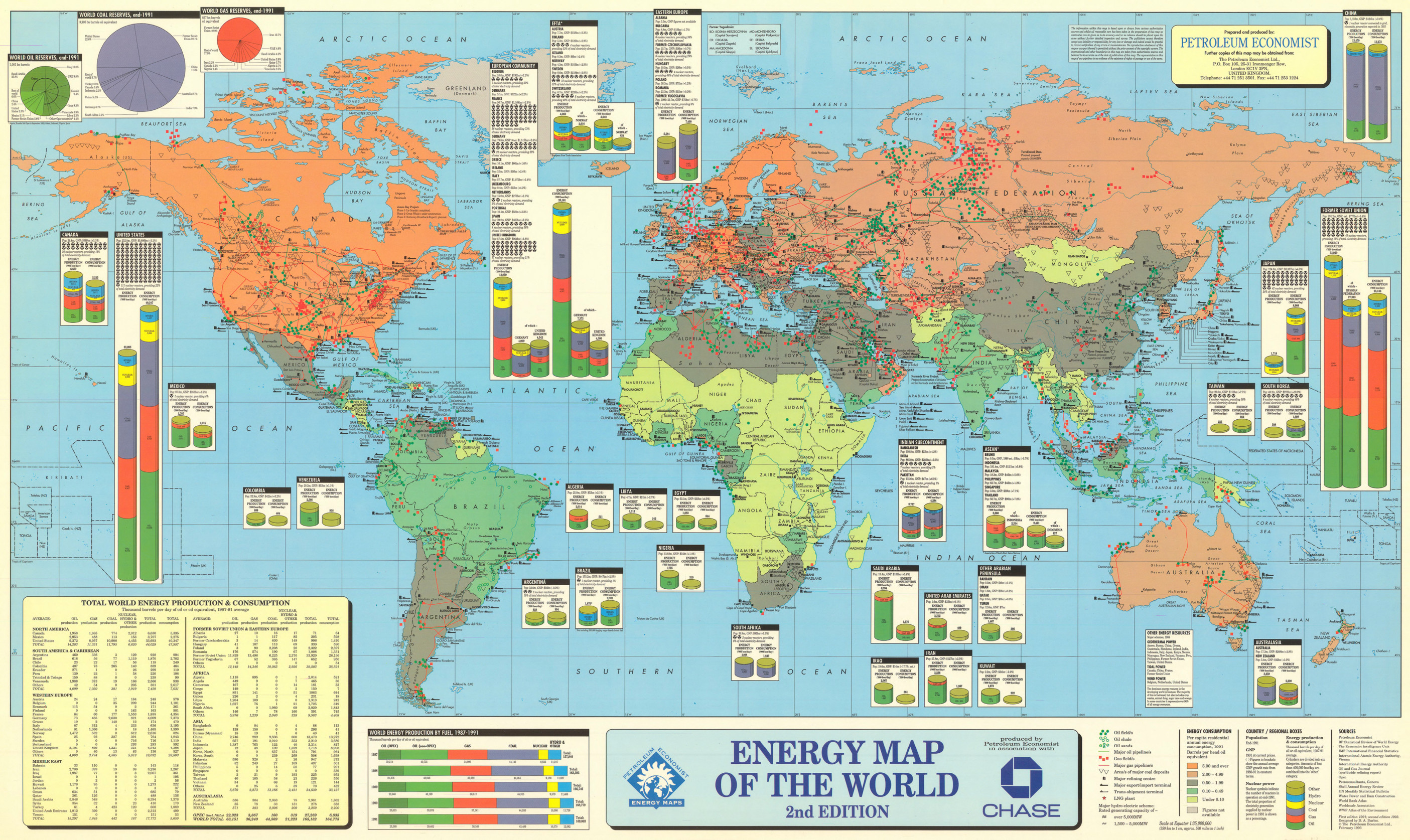
Energy Map of the World, 1993
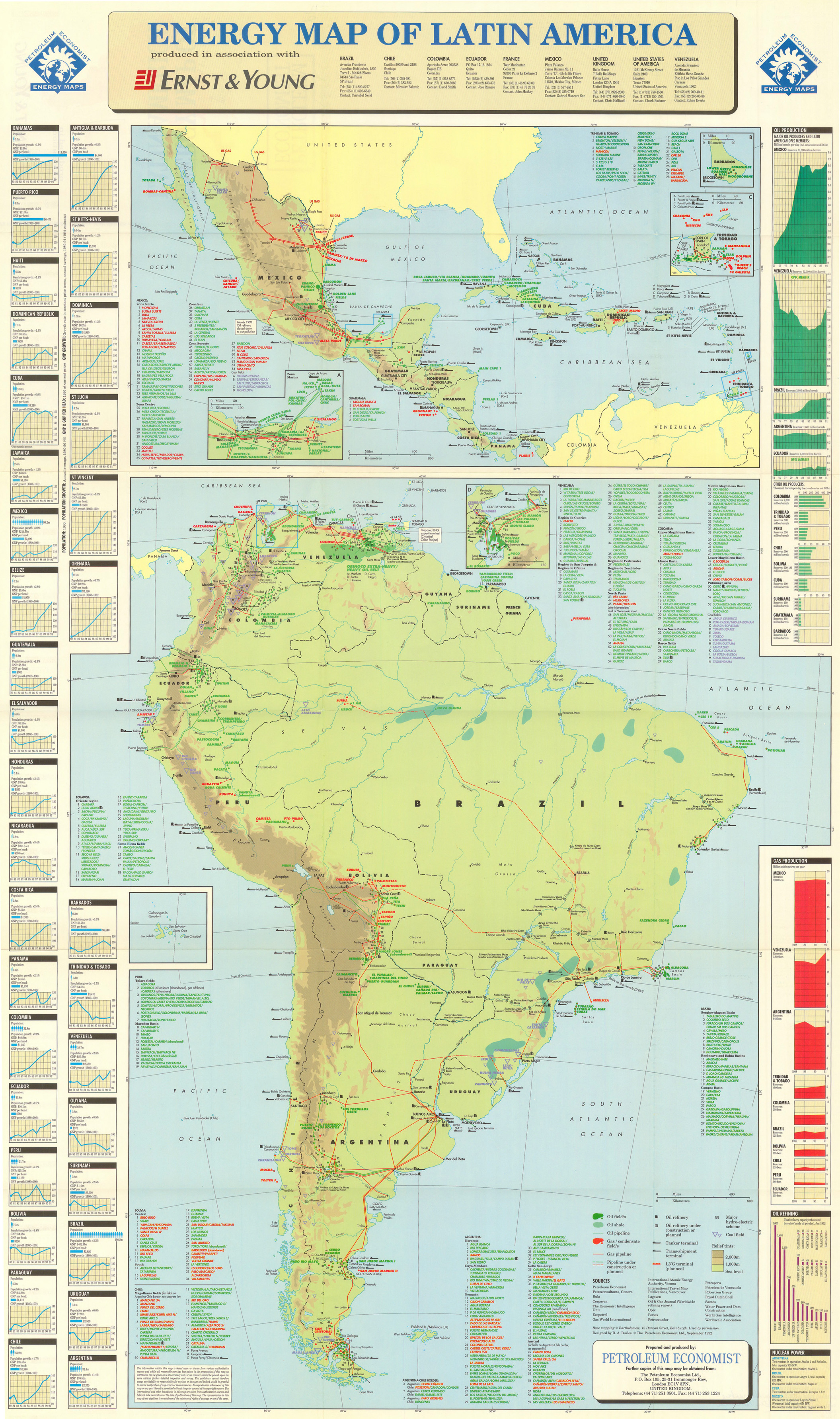
Energy Map of Latin America, 1992
Economic Life in the Roman Empire
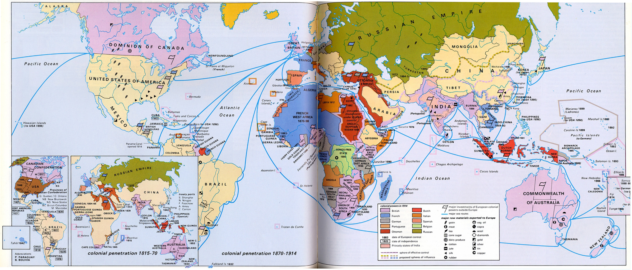
Colonial Penetration 1815 – 1914
Africa Before Colonial Partition
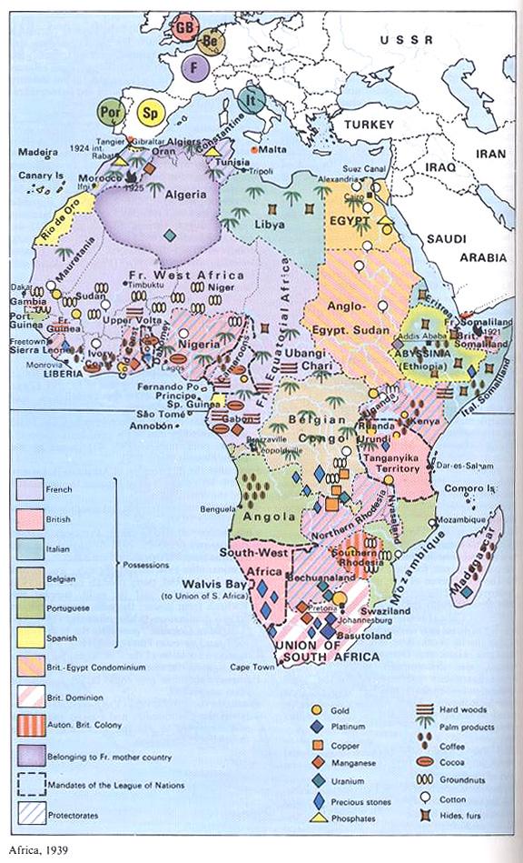
Africa 1939
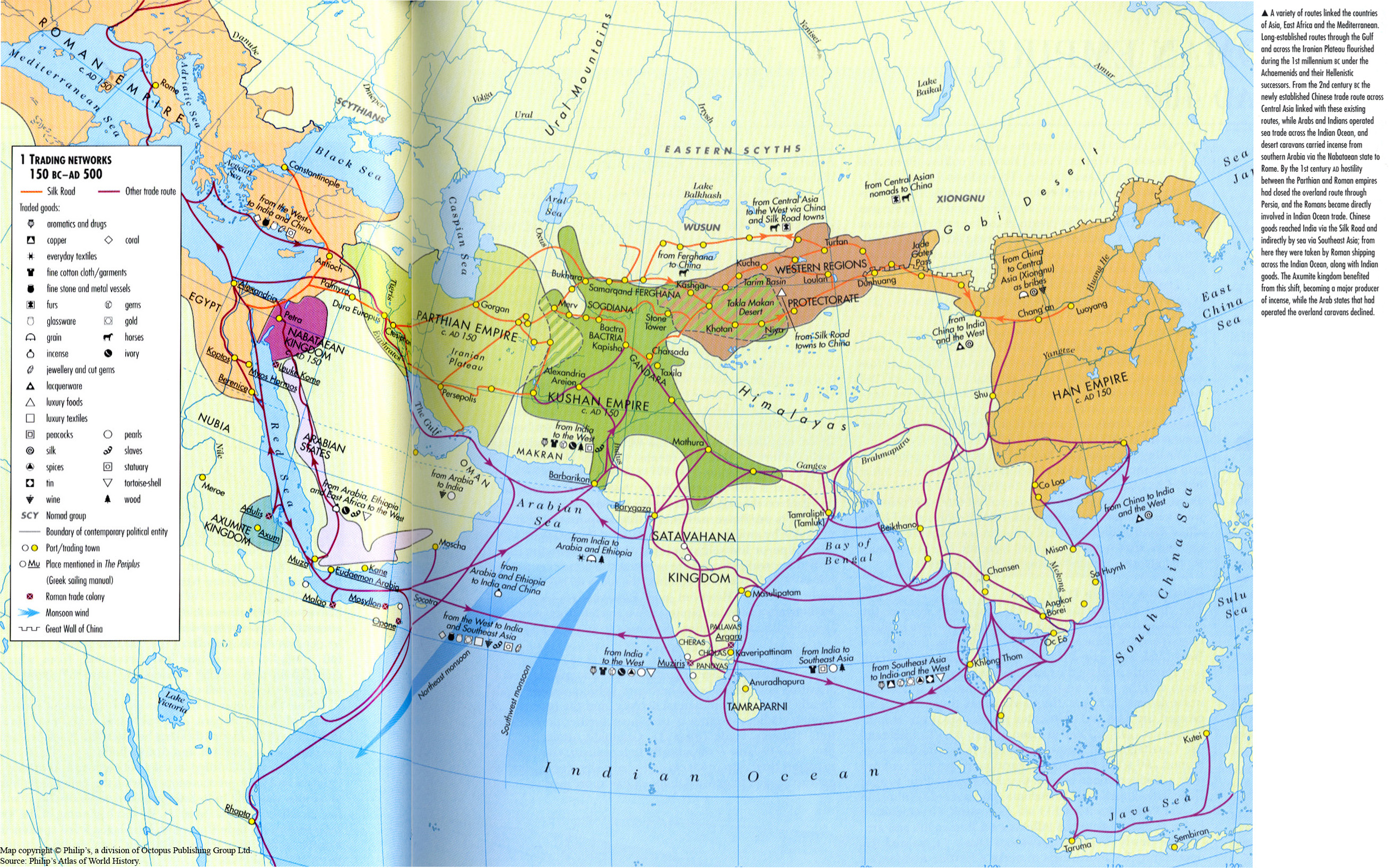
Trading Networks 150 BC-AD 500
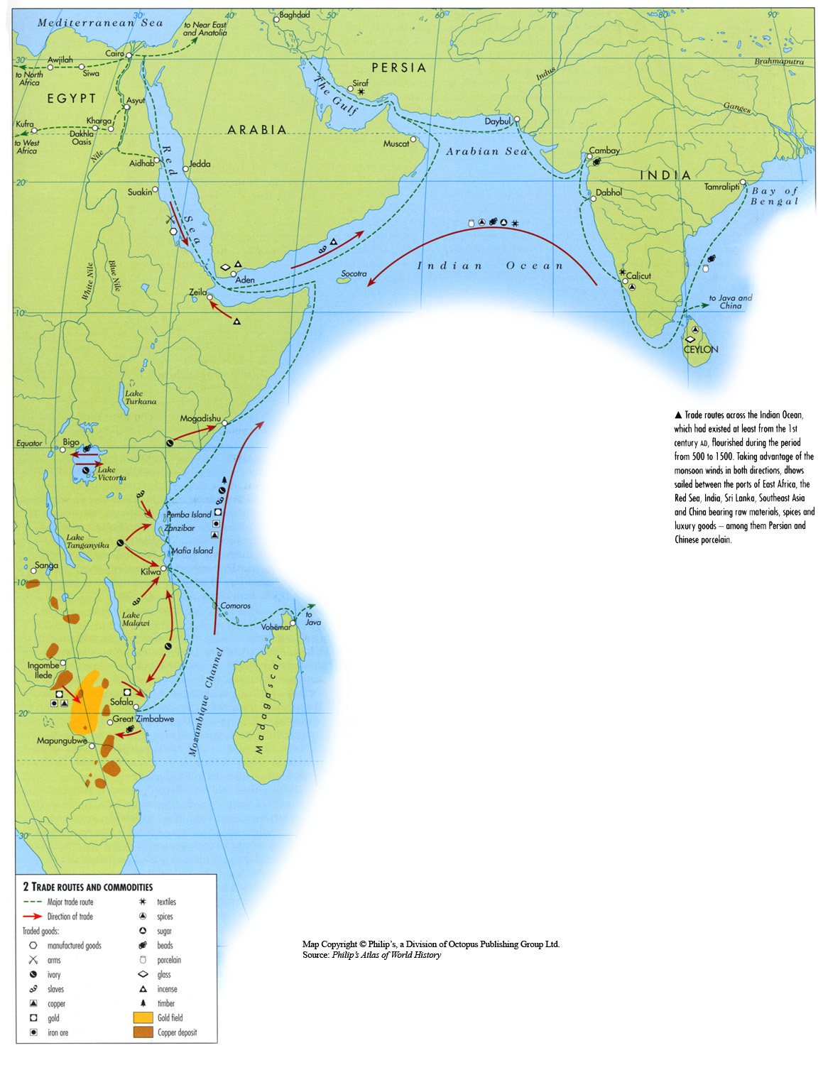
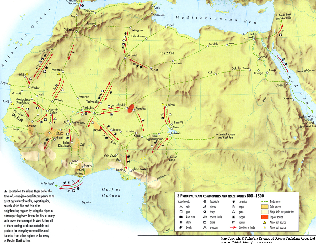
Trade Routes and Commodities, 500 to 1500
Trade and Production Centres in the Ming Period, 1600
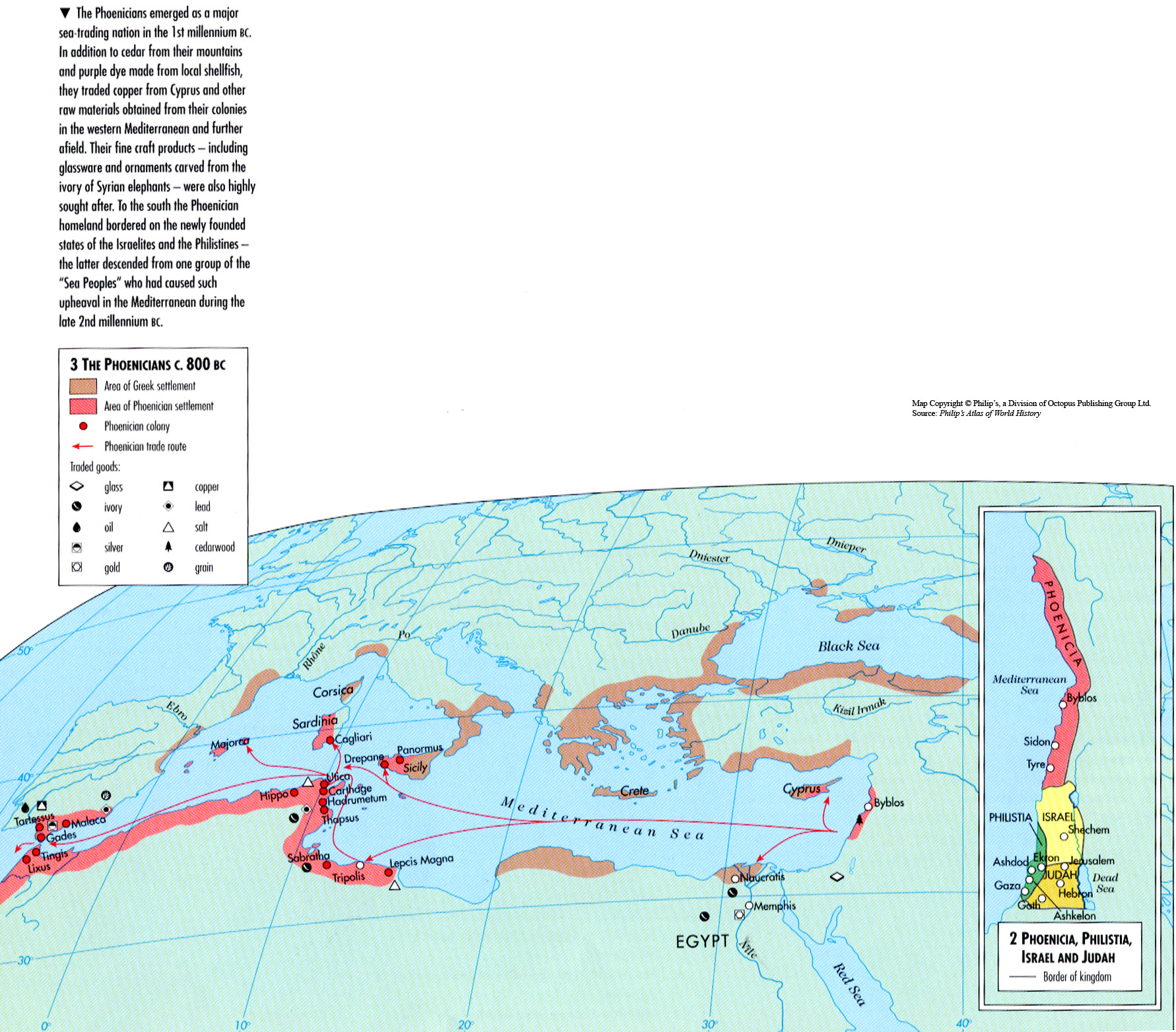
The Phoenicians c. 800 BC
The Indus Civilization, 4th Millennia to 2600 BCE
Teubners Weltwirtschaftskarten III 3
Teubners Weltwirtschaftskarten III 2
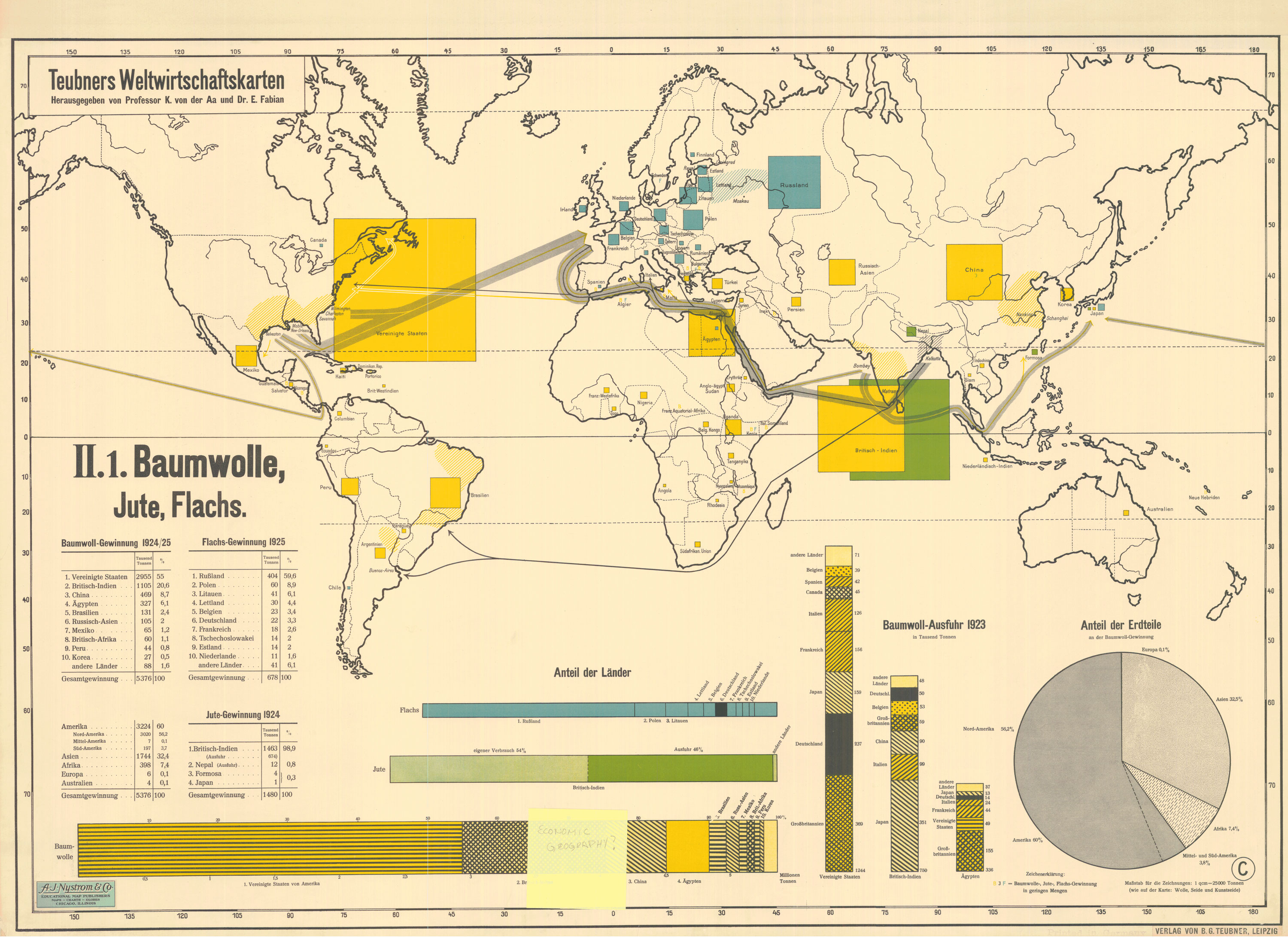
Teubners Weltwirtschaftskarten II 1
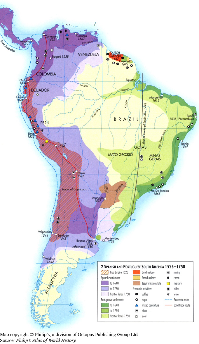
Spanish and Portuguese South America 1525-1750
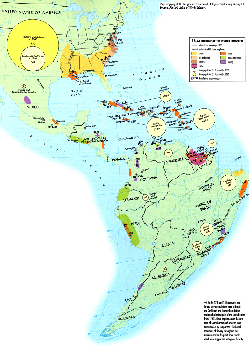
Slave Economies of the Western Hemisphere c. 1830
Principal Trade Commodities and Trade Routes 800-1500
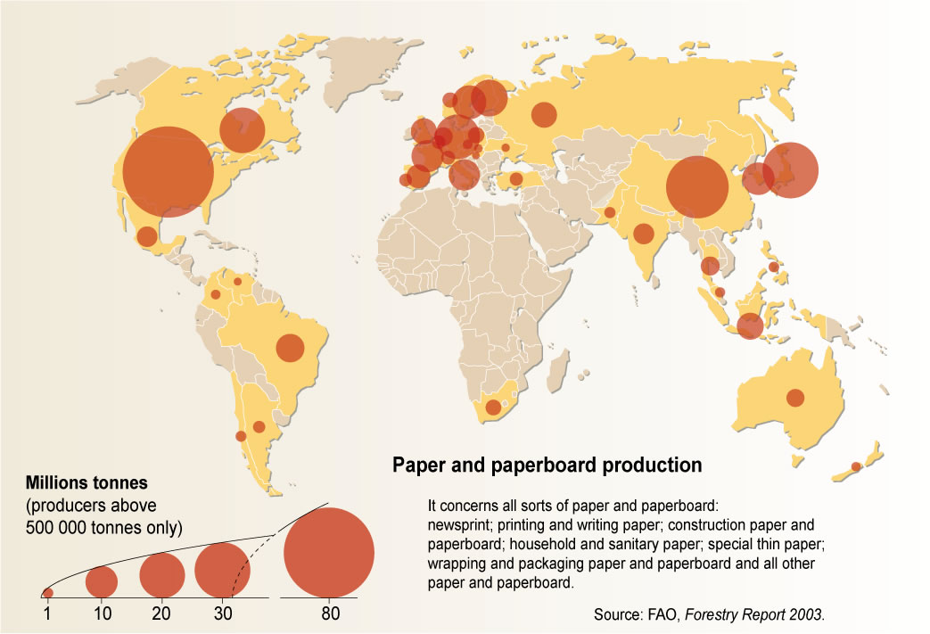
Paper and Paperboard Production in 2003
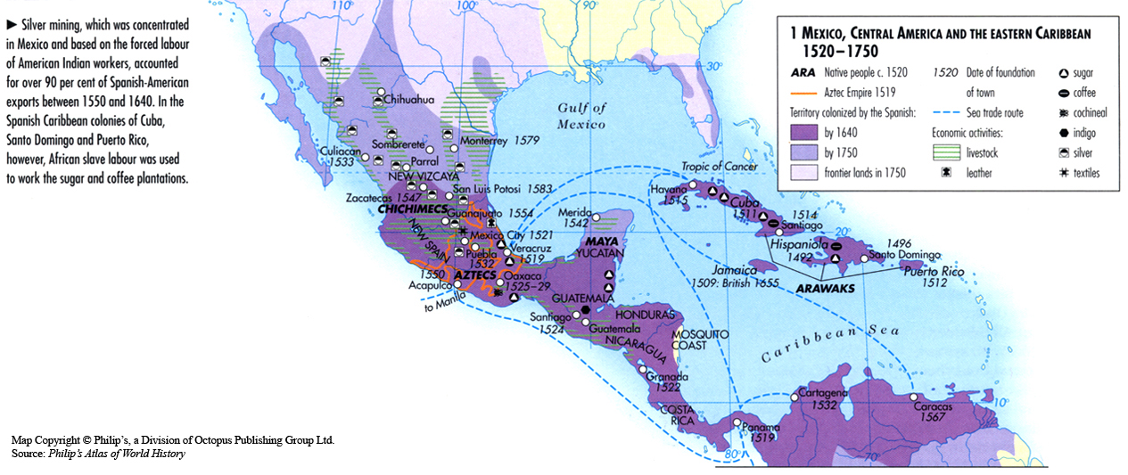
Mexico, Central America and the Eastern Caribbean 1520-1750
Map of Agriculture and Population in Asia (without USSR), 1959
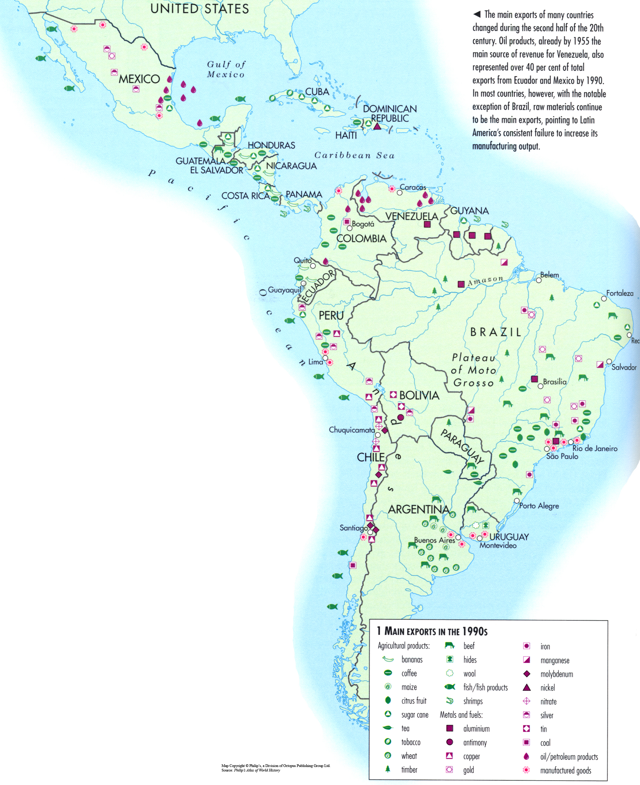
Main Exports in the 1990s
Post navigation
1
2
Next


,_1959.jpg)