
Caption
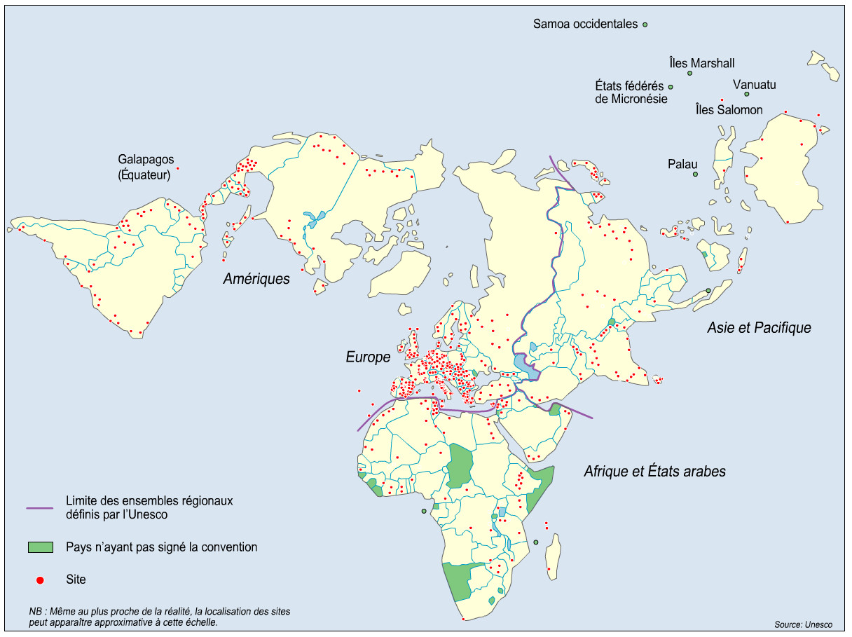
Les sites du patrimoine mondial en janvier 2000.
(World Heritage Siteswp, January 2000.)
Summary
This world map, which is drawn unconventionally from a North Pole perspective,
shows World Heritage sites in various “regional groupings” as defined by UNESCO.
The current UNESCO listing of such sites includes an interactive Flash map that shows the location of each site.
Source
The Flash file comes from
Olivier Milhaud. “Mappemonde ou la mondialisation mise en images (spécial Capes-Agrégation)”.
M@ppemonde No. 84 (4-2006).
It is in turn based on Fig. 1 on p. 13 of
Olivier Lazzarotti. «Patrimoine et tourisme: un couple de la mondialisation». Mappemonde, n°1-00, p. pp. 12-16 [1]
The original data source is Unesco.
Copyright
This work may still be under copyright and therefore care is required in its use. Its use on QED is under the “Fair Use” rule.