Skip to main content
Mapping Globalization
Menu
Skip to content
Data and Analysis
NetMap Studies of World Trade
Network Analysis
Maps
Narratives
Empires
Alexander the Great
Byzantine Empire
Invasion of the Goths
Migration
Asia
Eurasia
Europe
The Genetics of Prehistoric Migration
Indoeuropeans
Out of Africa
Menu
Skip to content
Contact
Tag:
Transportation
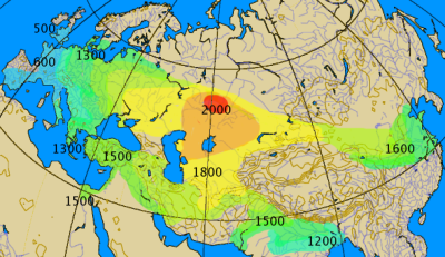
Technology: Spread of the chariot, 2000-500 BC
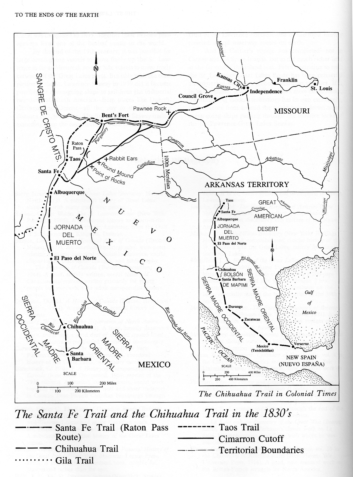
The Santa Fe Trail and the Chihuahua Trail in the 1830s
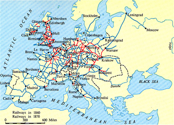
Europes Railway Network in 1840 and 1870
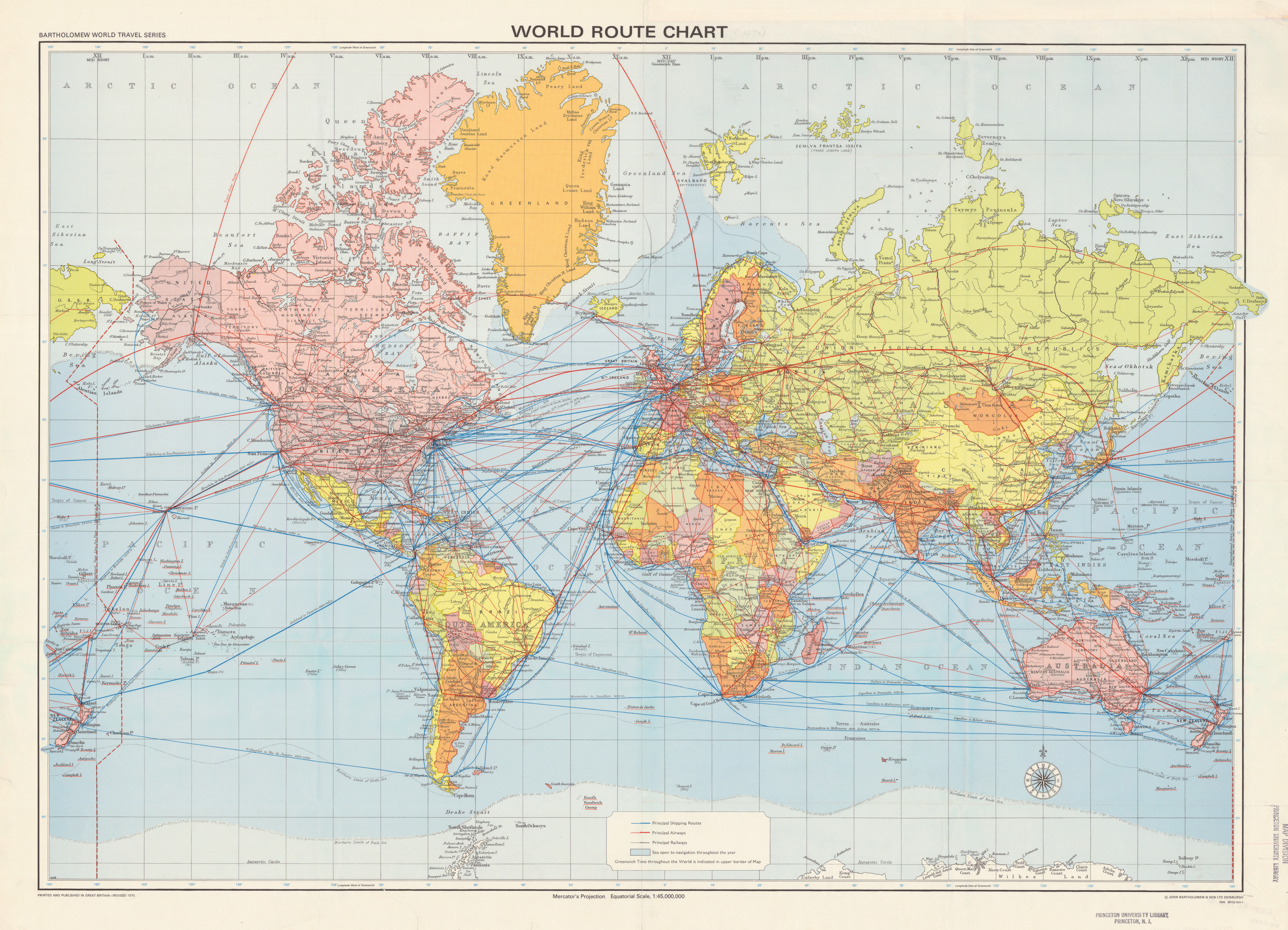
World Route Chart, 1970
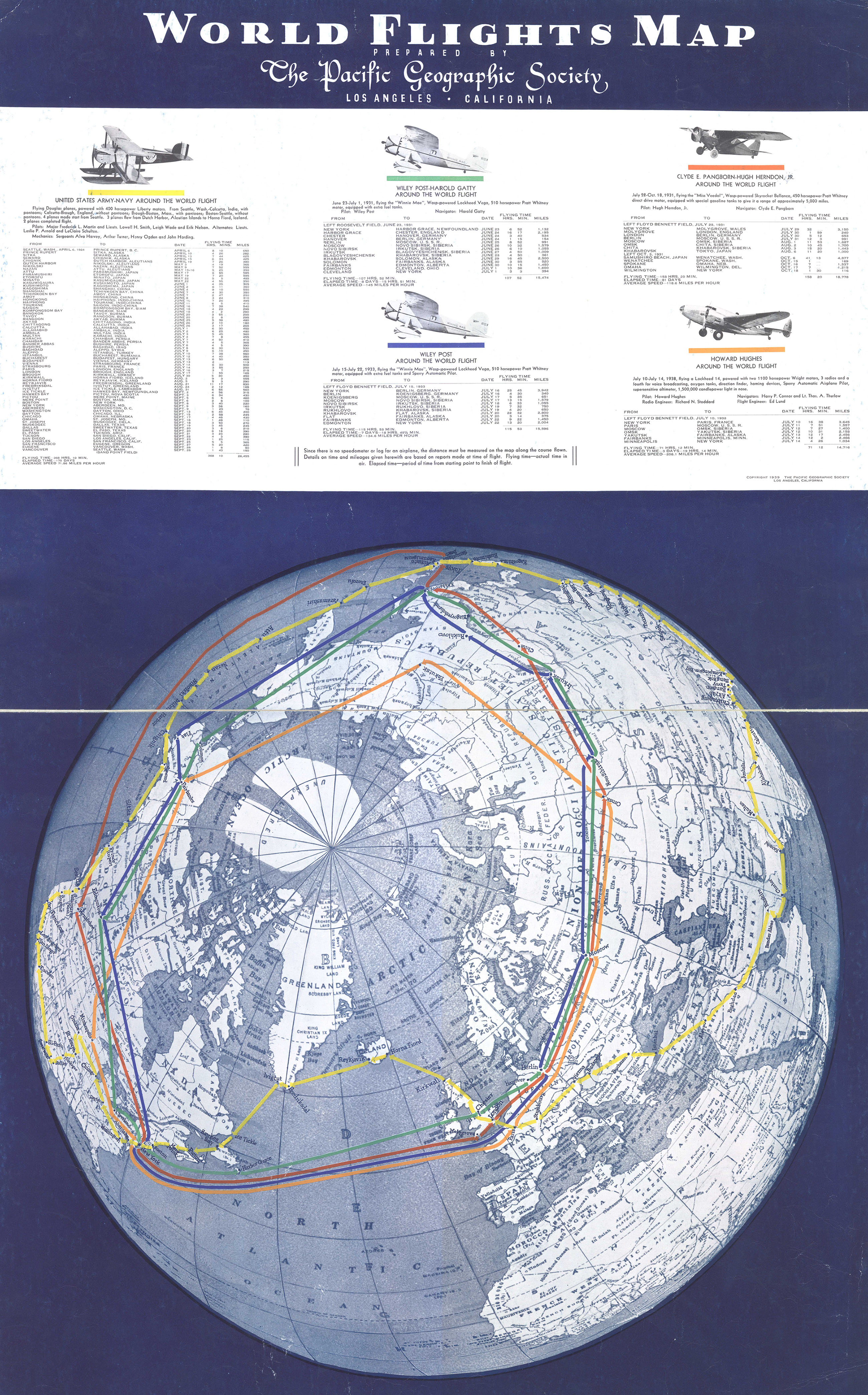
World Flights Map, 1939
World Air Transportation – Principal Routes of Scheduled Commercial Airlines, 1951
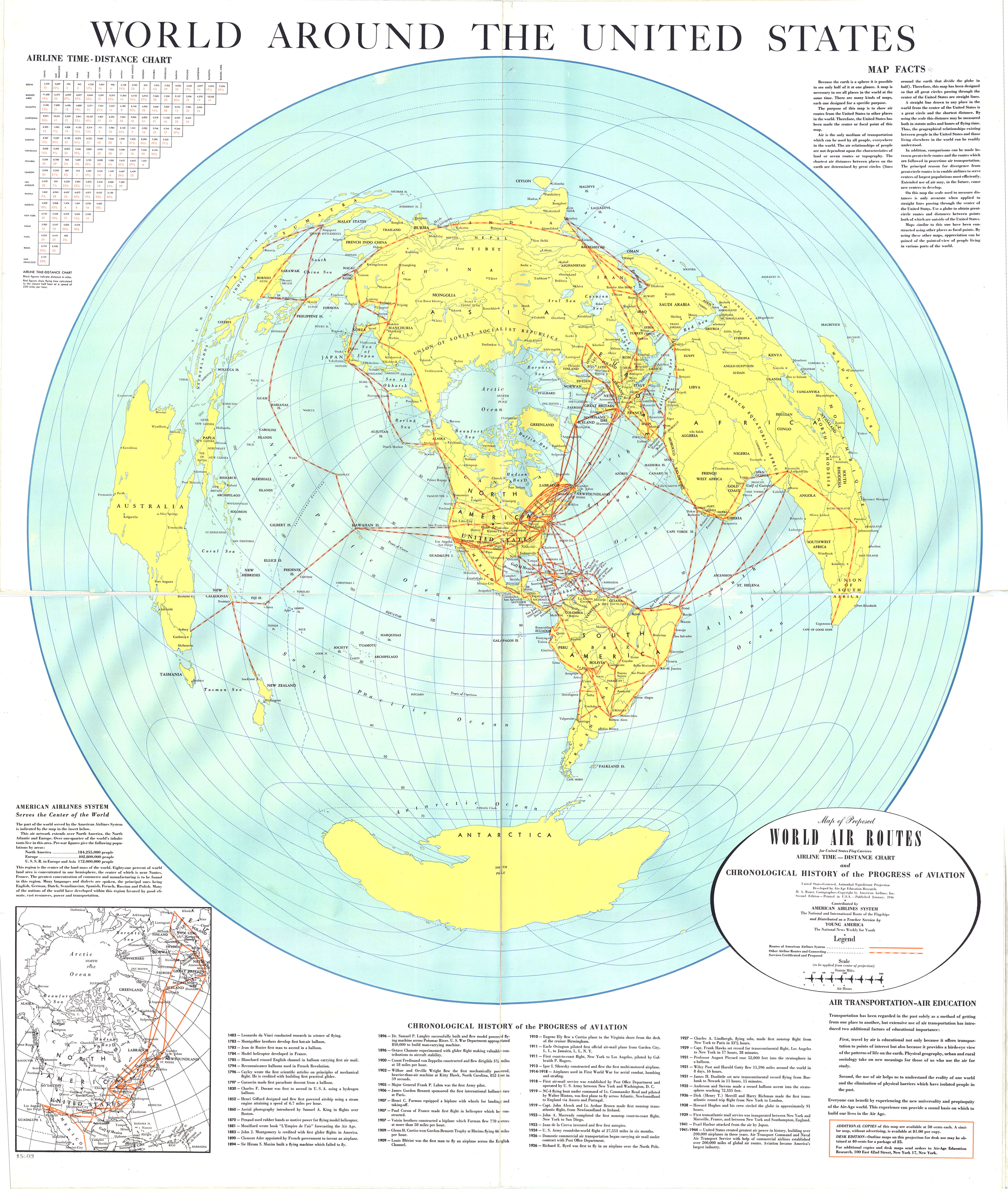
World Air Routes for United States Flag Carriers, 1946
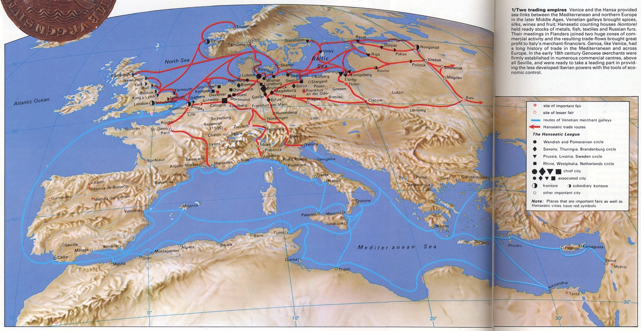
Two Trading Empires – Venice and the Hansa
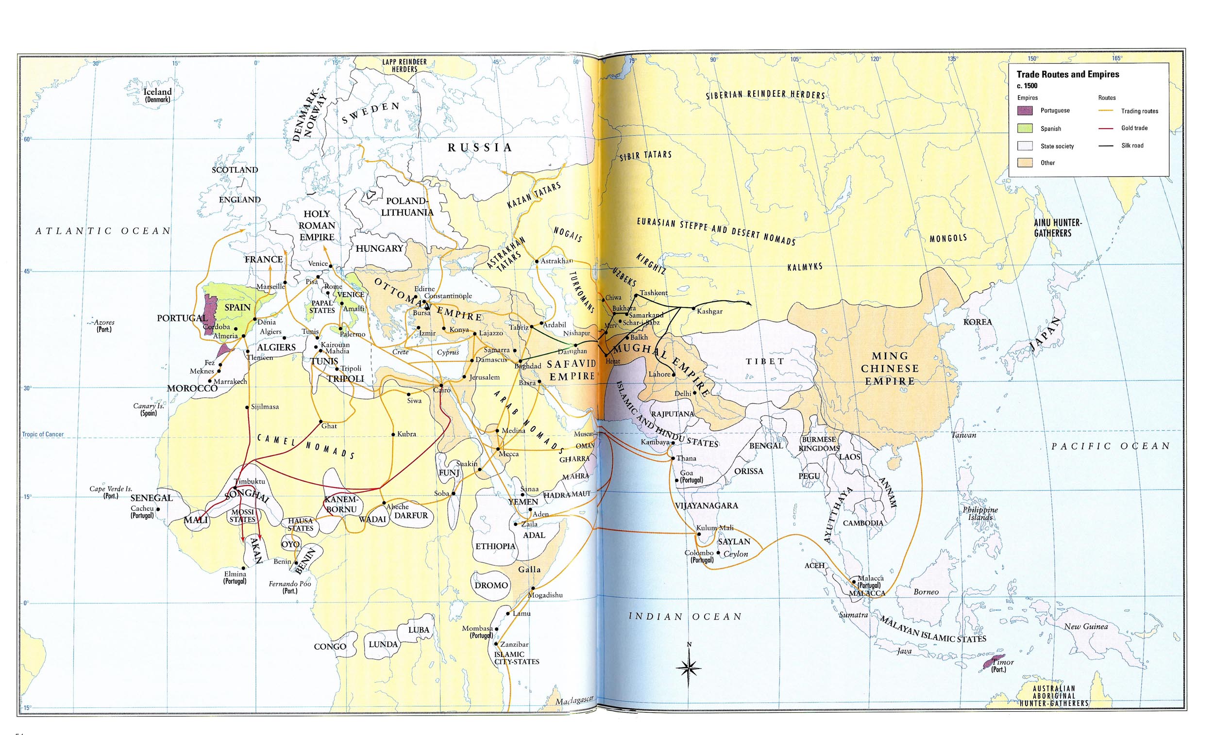
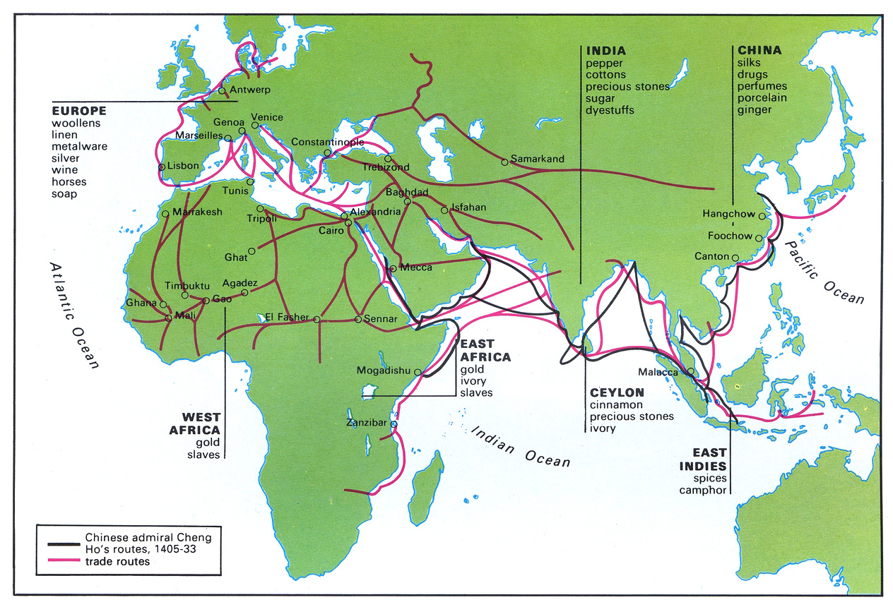
Trade Routes and Empires, 1500
Trade Sites and Goods in the 15th Century
Trade in Japan 19th – 20th centuries
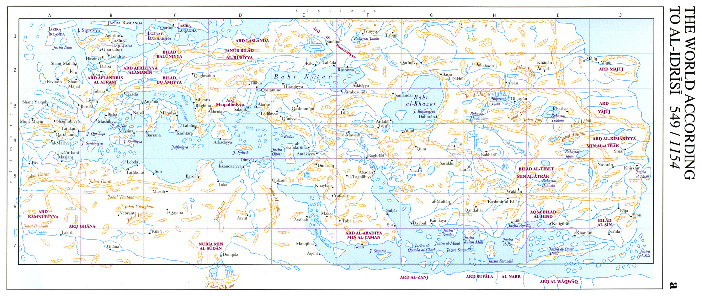
The World According to Al-Idrisi 549-1154
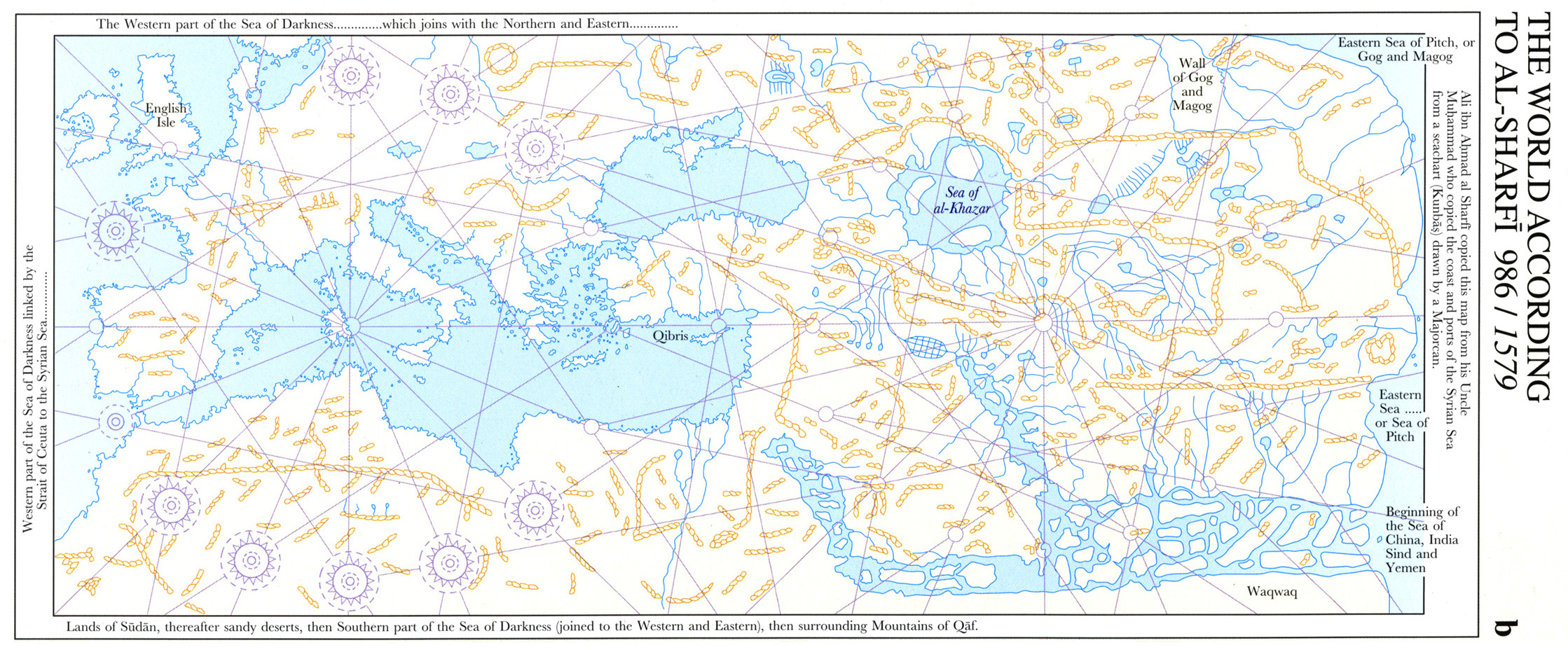
The World According to Al-Sharfi 986-1579
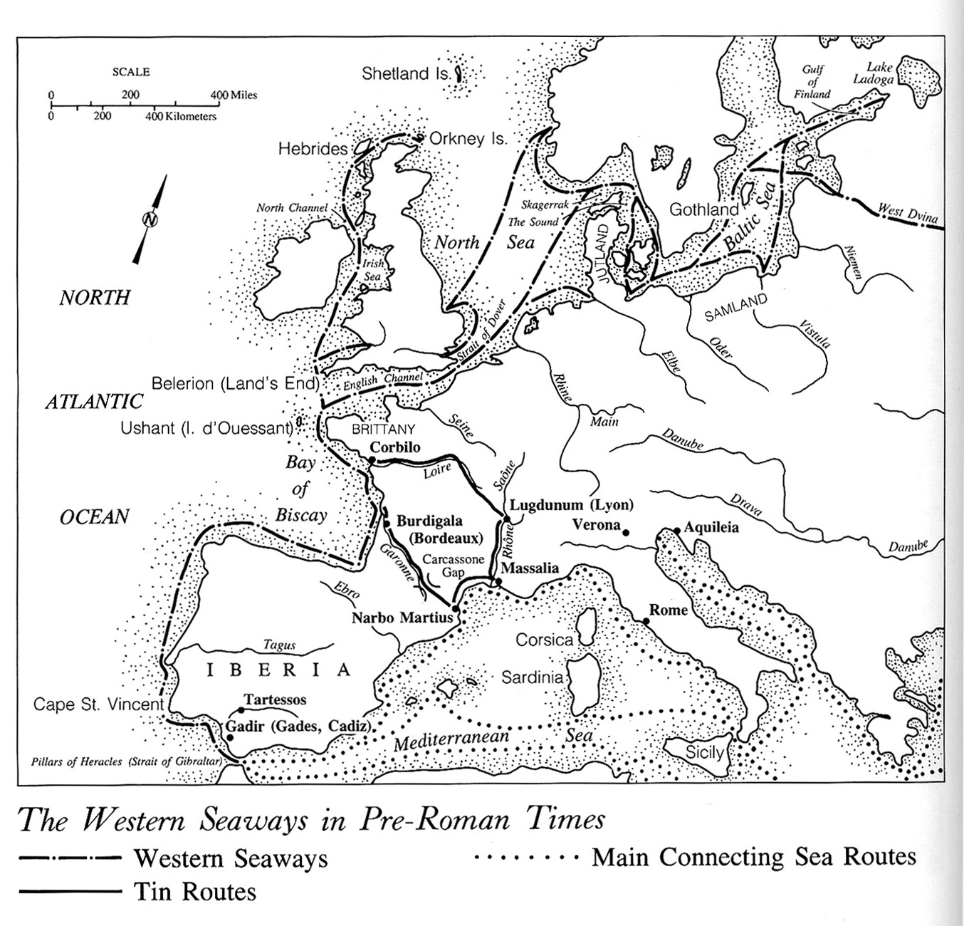
The Western Seaways in Pre-Roman Times
The Wilderness Road and Other Main Roads to the West in the Early 19th Century
The Turks and Portuguese in the Indian Ocean 10th-16th Centuries
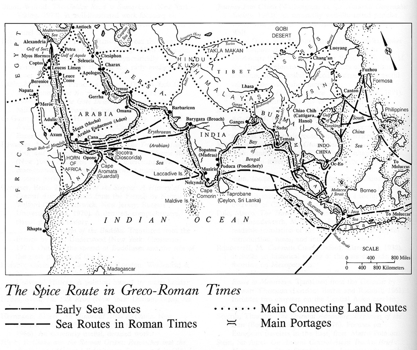
The Spice Route in Greco-Roman Times
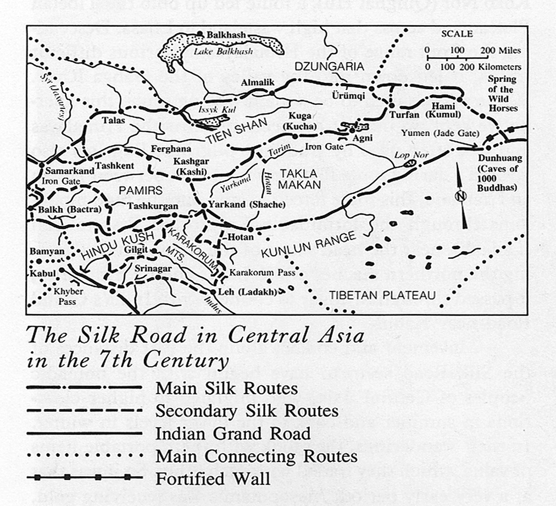
The Silk Road in Central Asia in the 7th Century
The Silk Road and Other Eurasian Routes in Greco-Roman Times
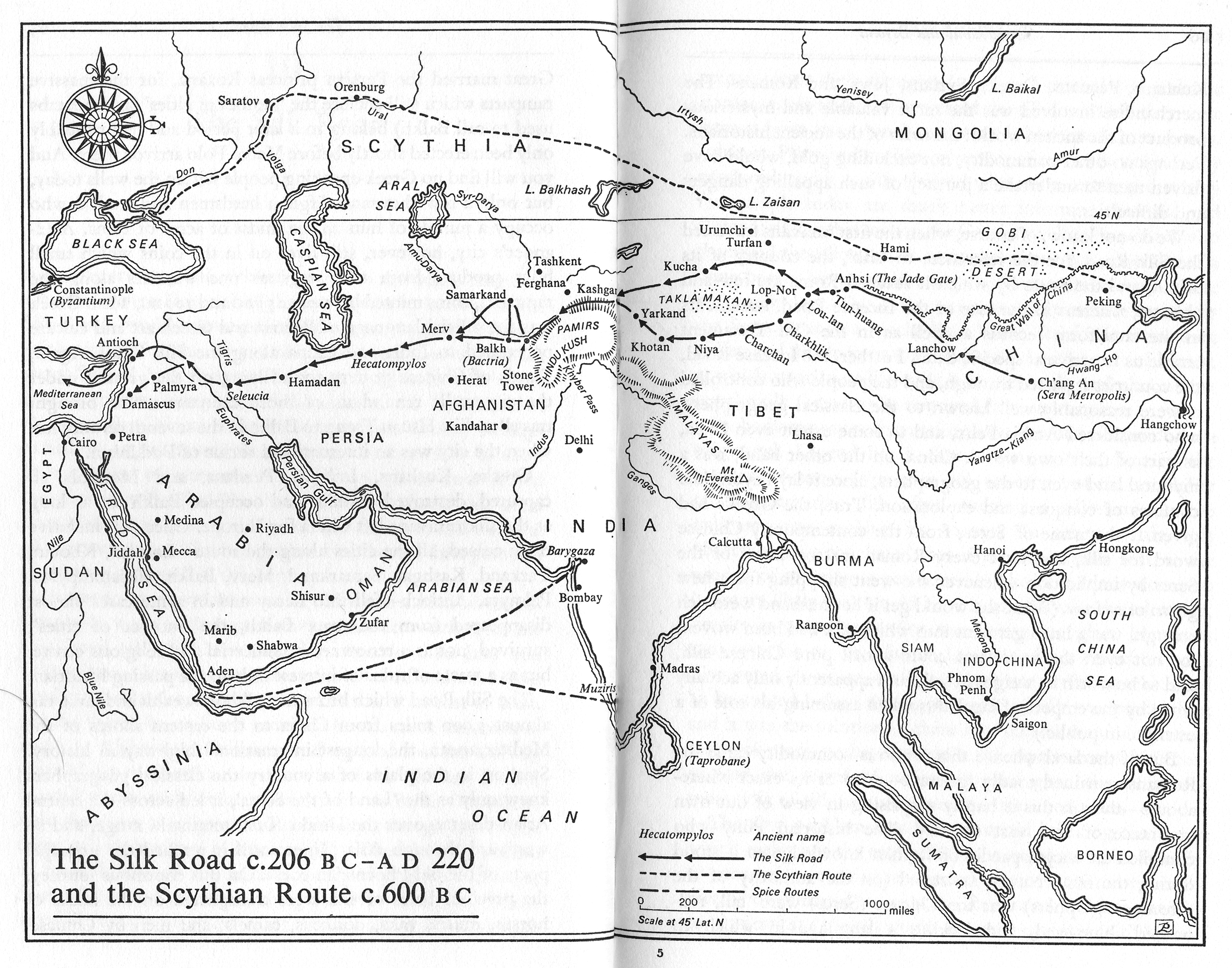
The Silk Road and the Scythian Route
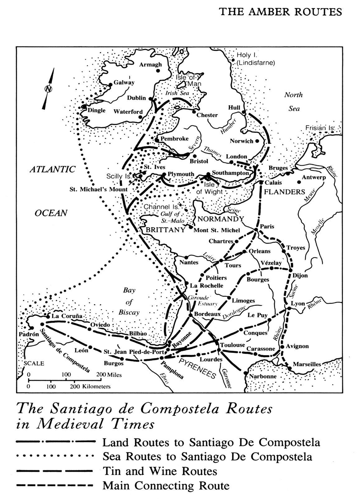
The Santiago de Compostella Routes in Medieval Times
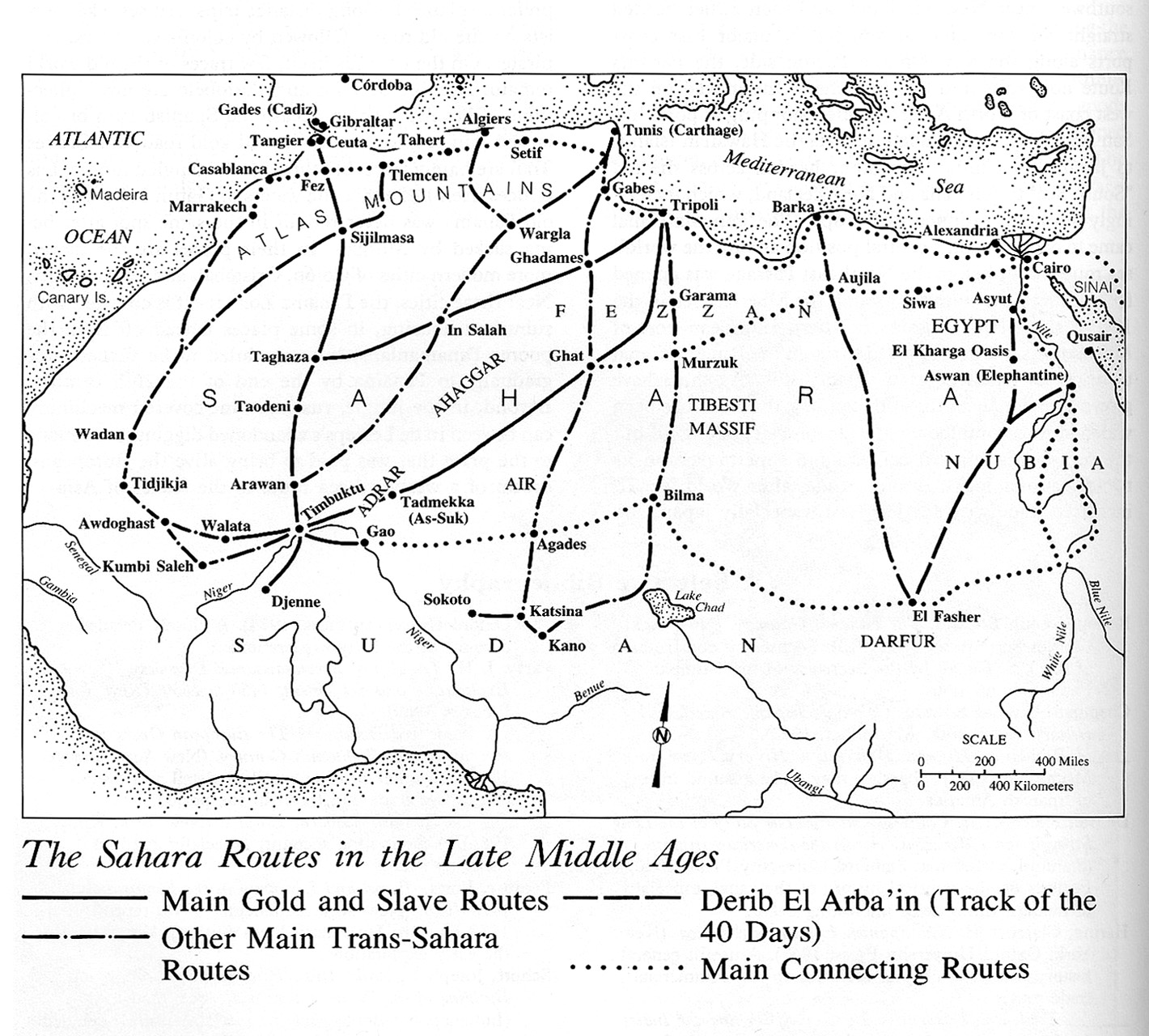
The Sahara Routes in the Late Middle Ages
The Principal Trans-Saharan Caravan Routes
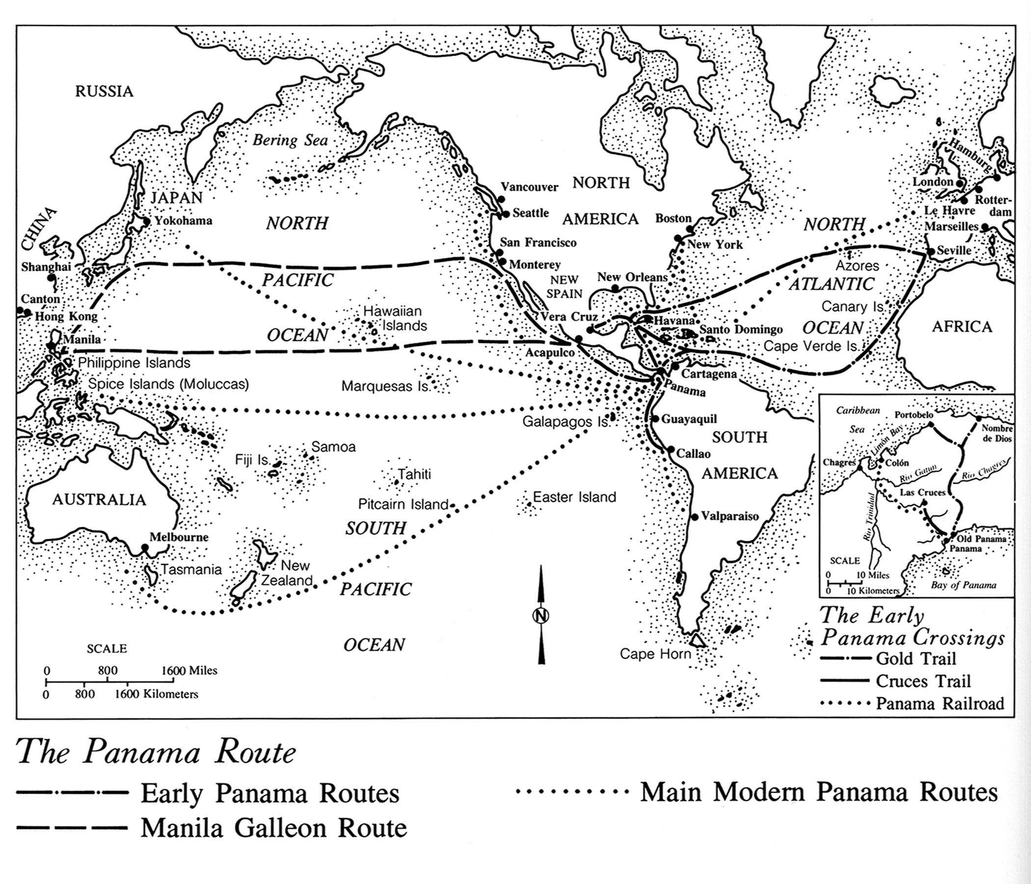
The Panama Route
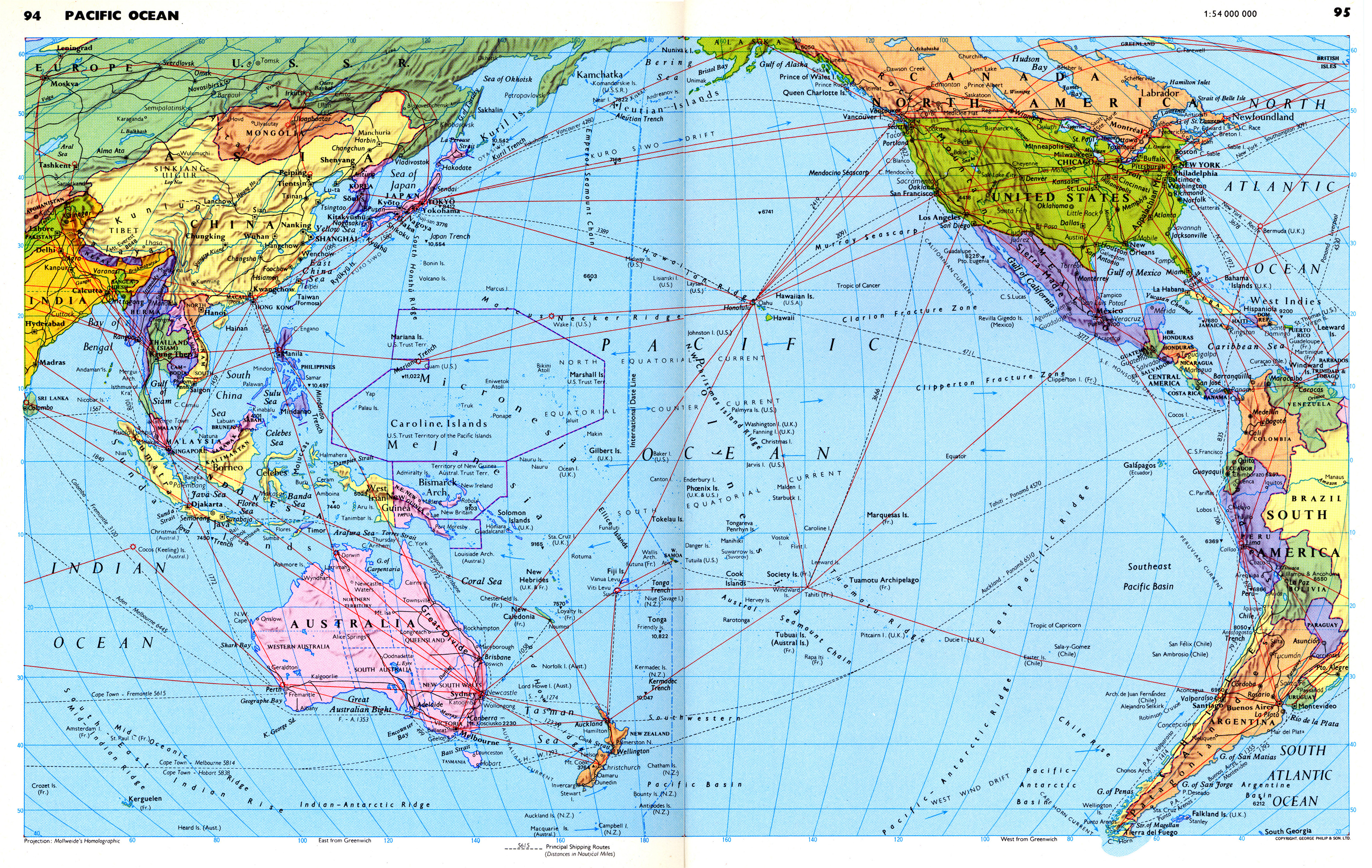
The Pacific Ocean – Maritime Shipping Routes
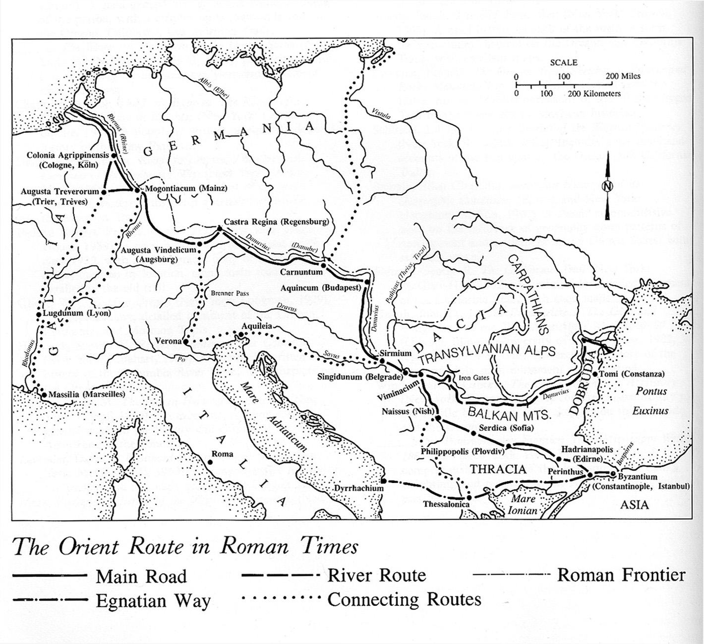
The Orient Route in Roman Times
The Northeast Passage and Trans-Siberian Railroad
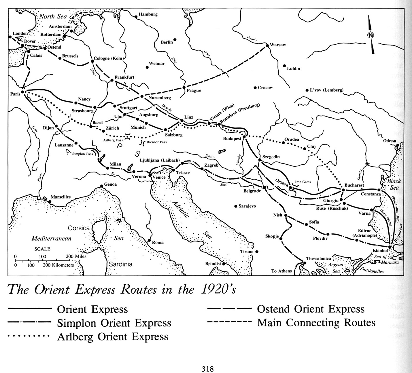
The Orient Express Routes in the 1920’s
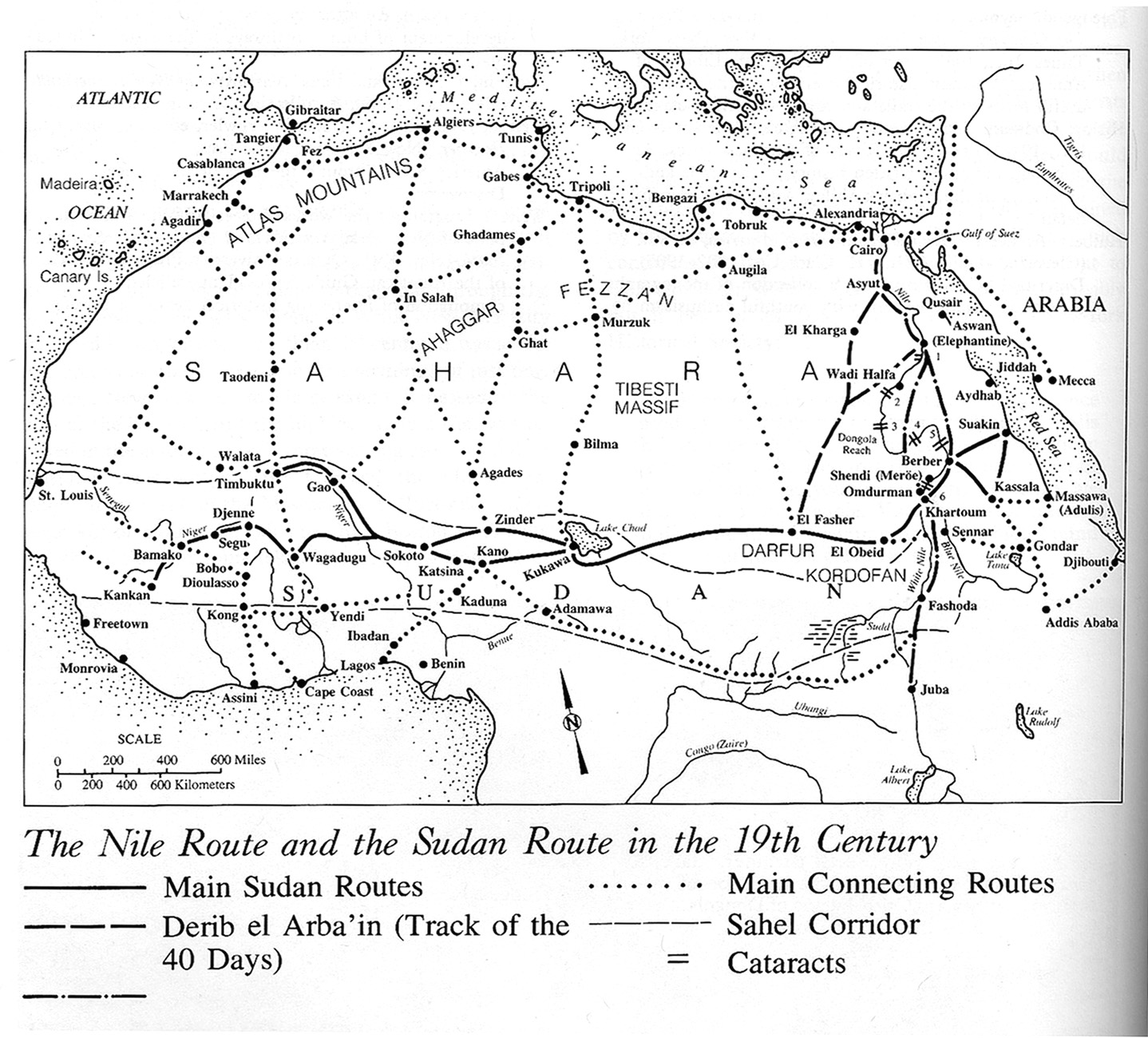
The Nile Route and Sudan Route in the 19th Century
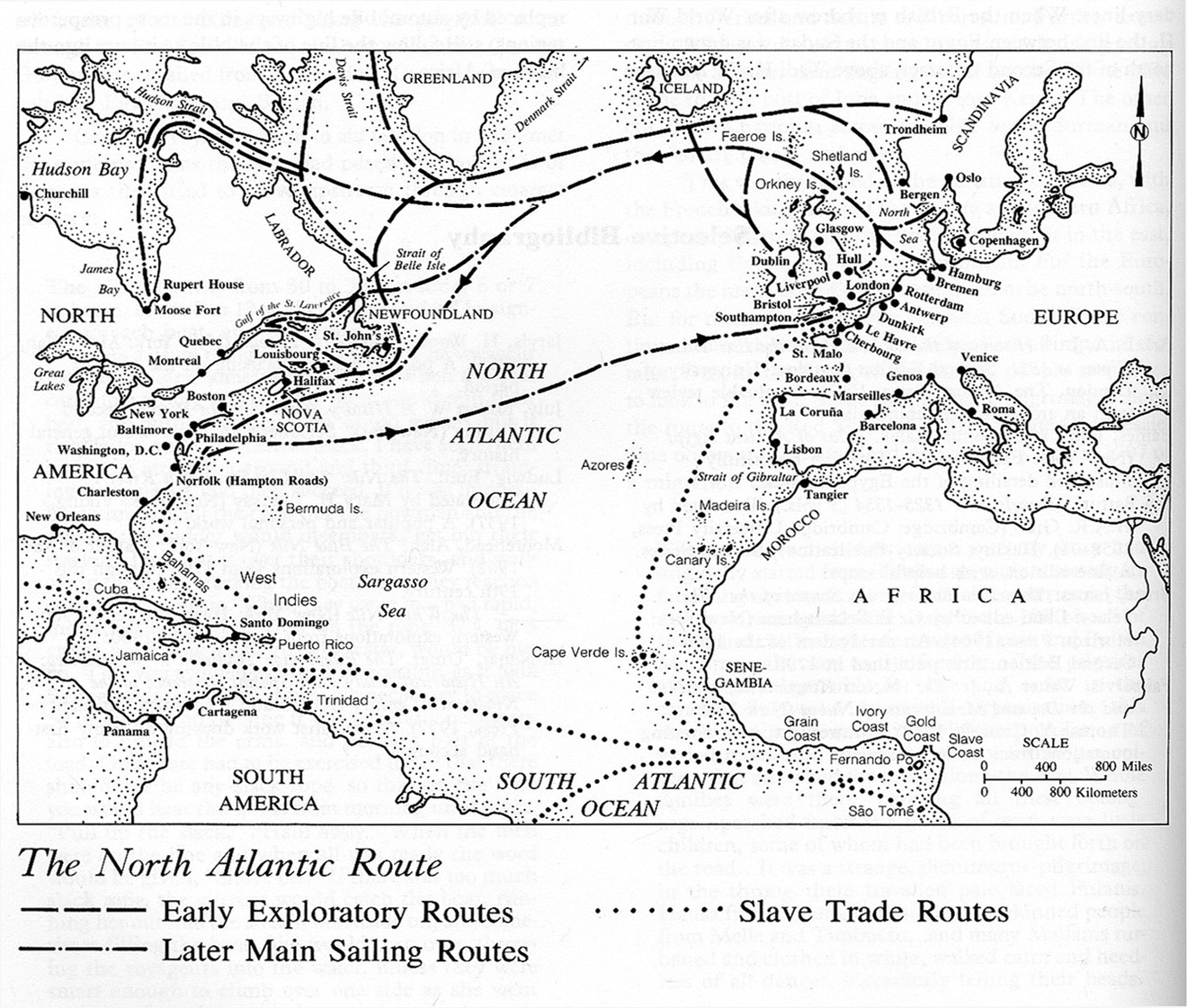
The North Atlantic Route
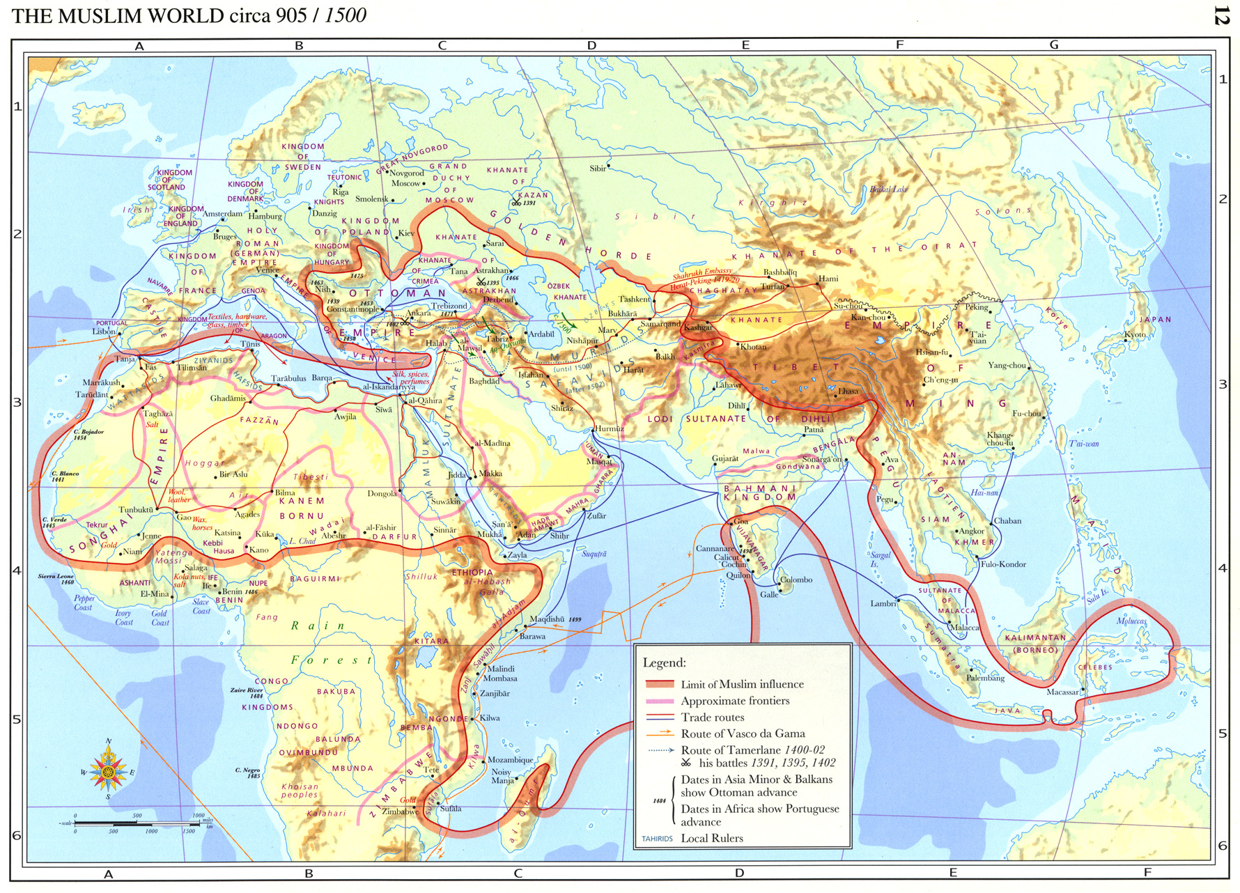
The Muslim World circa 905-1500
The Muslim World circa 403-1100
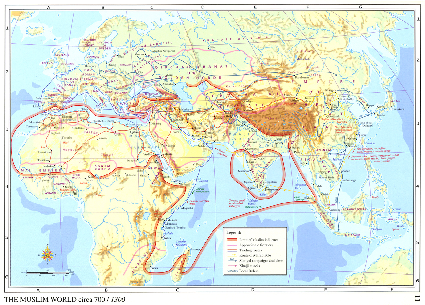
The Muslim World circa 700-1300
The Muslim World circa 1111-1700
The Muslim World circa 1317-1900
Post navigation
1
2
3
…
5
Next