Skip to main content
Mapping Globalization
Menu
Skip to content
Data and Analysis
NetMap Studies of World Trade
Network Analysis
Maps
Narratives
Empires
Alexander the Great
Byzantine Empire
Invasion of the Goths
Migration
Asia
Eurasia
Europe
The Genetics of Prehistoric Migration
Indoeuropeans
Out of Africa
Menu
Skip to content
Contact
Tag:
International Trade
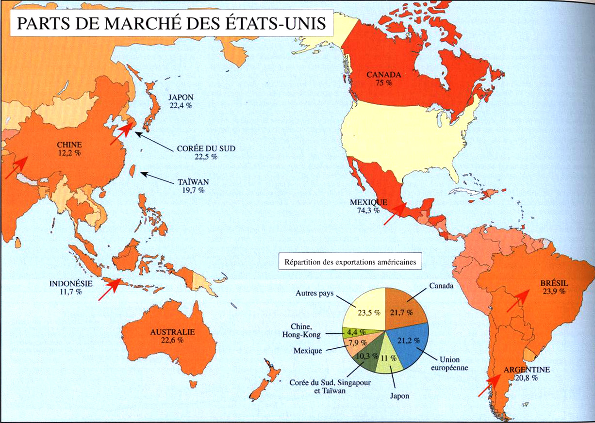
Parts de Marché des États-Unis
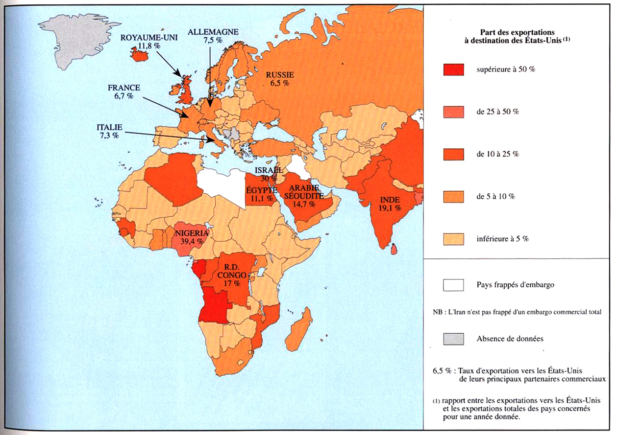
Part des exportations à destination des États-Unis
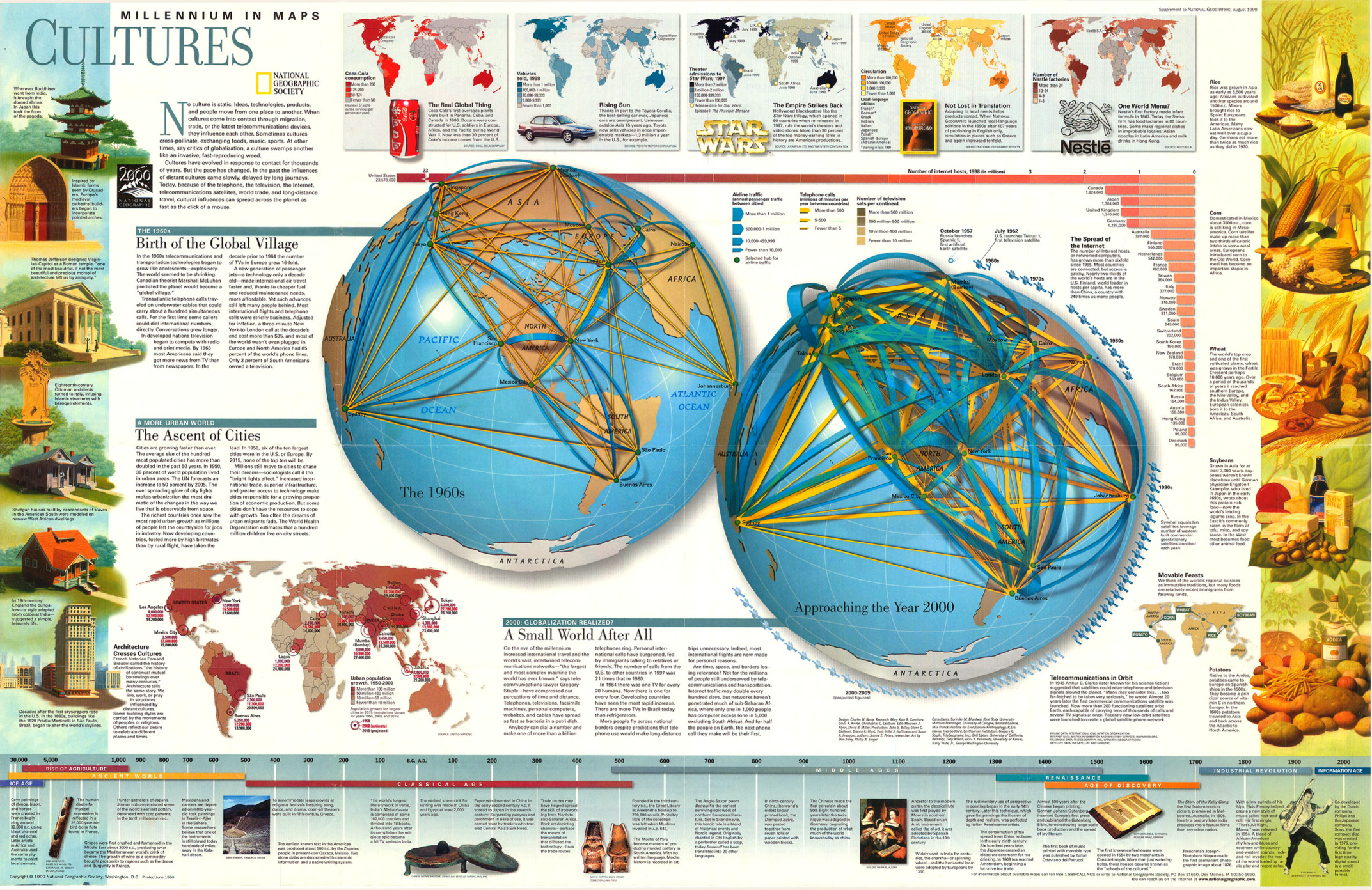
Millennium in Maps – Cultures, 1999
Le Poids du Marché Américain
Le Monde Vu Des États-Unis
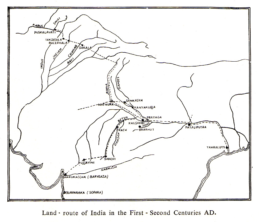
Land Route of India in the First – Second Centuries AD
La Balance Commerciale
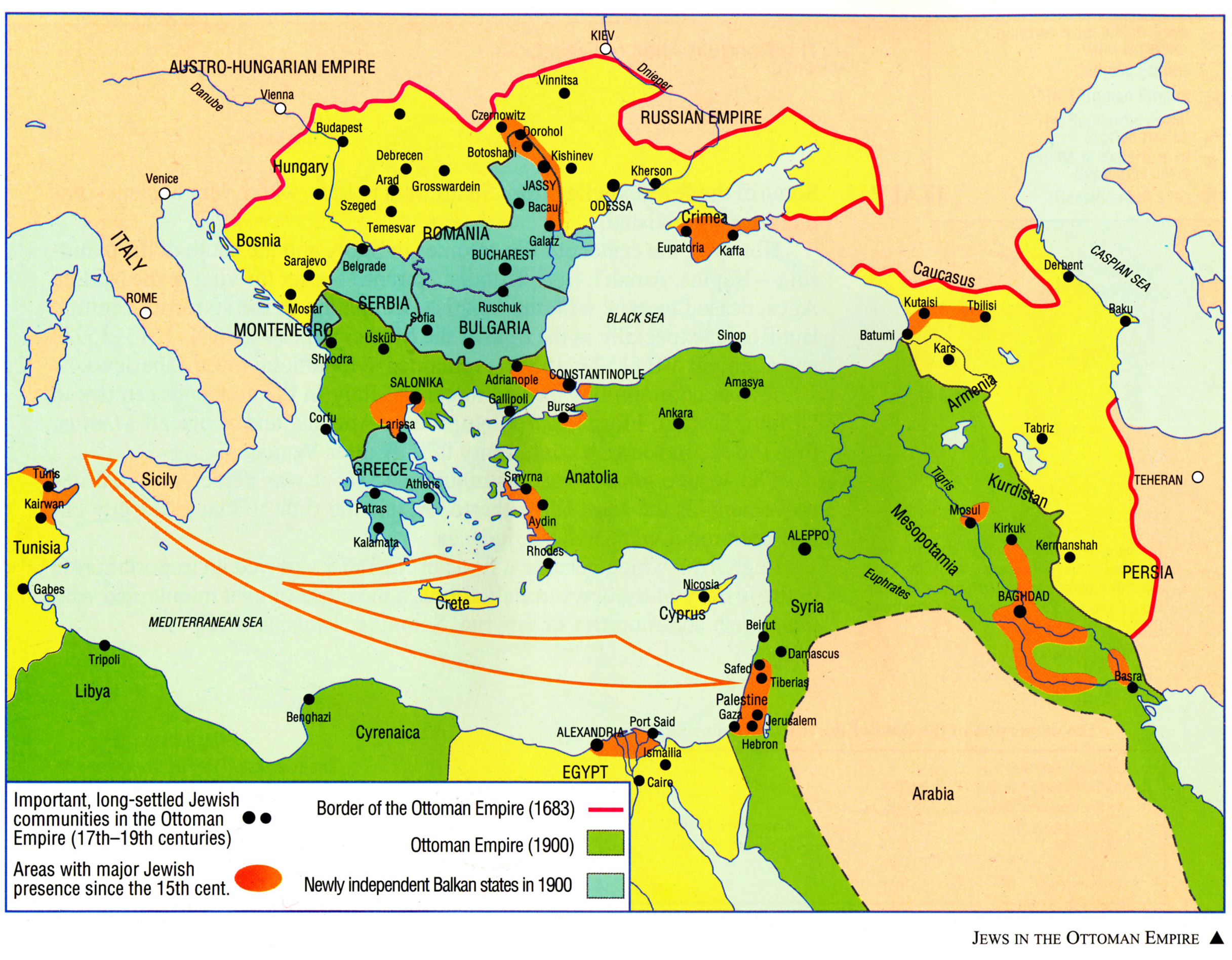
Jews in the Ottoman Empire
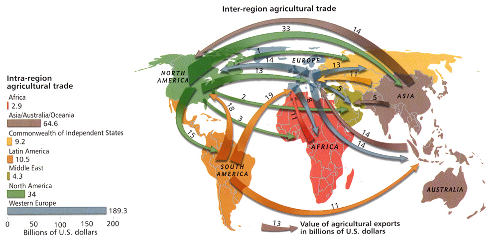
Inter-Region Agricultural Trade, 2005
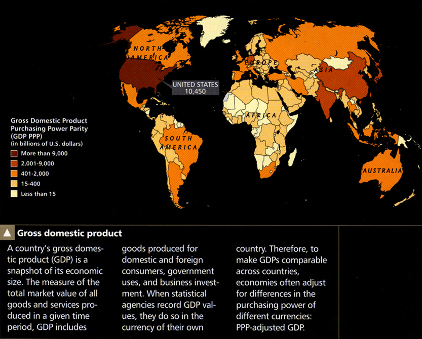
Gross Domestic Product, 2005
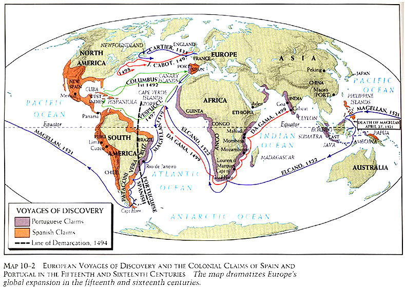
European Voyages of Discovery and the Colonial Claims of Spain and Portugal in the Fifteenth and Sixteenth Centuries
Euromoney – Country Risk Chart, 1986
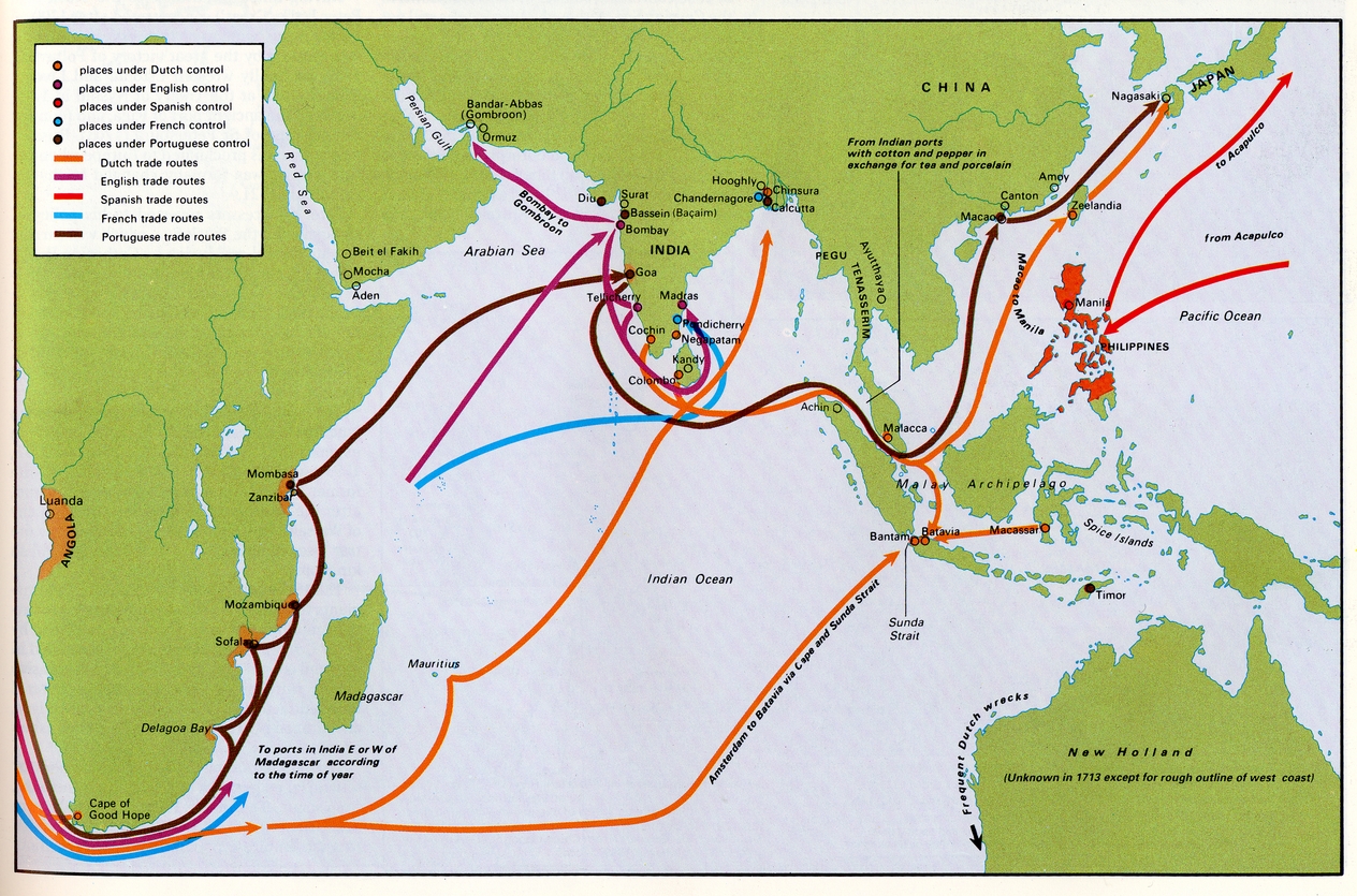
Colonial Trade in Asia and Africa in the Early 18th Century
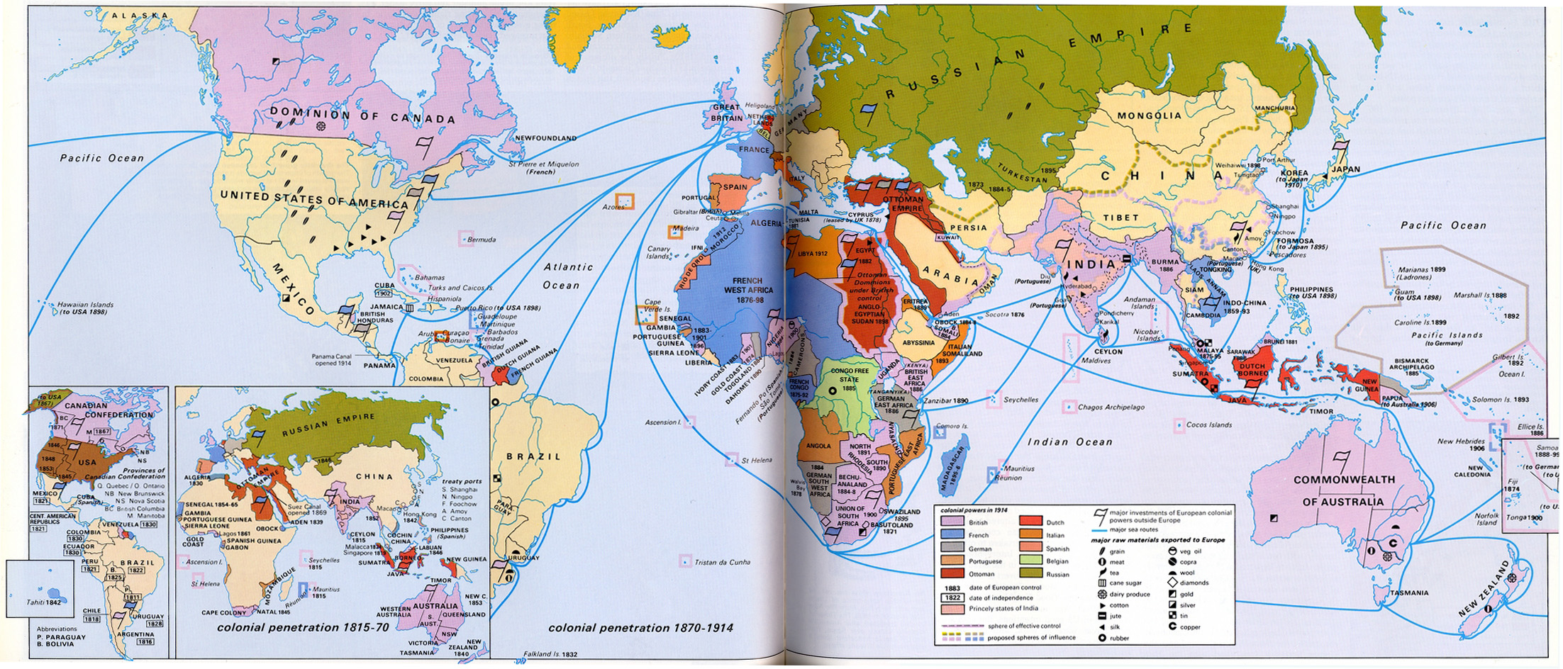
Colonial Penetration 1815 – 1914
Amsterdam Jews and International Trade
World Transportation Patterns
World Trading Empires 1770
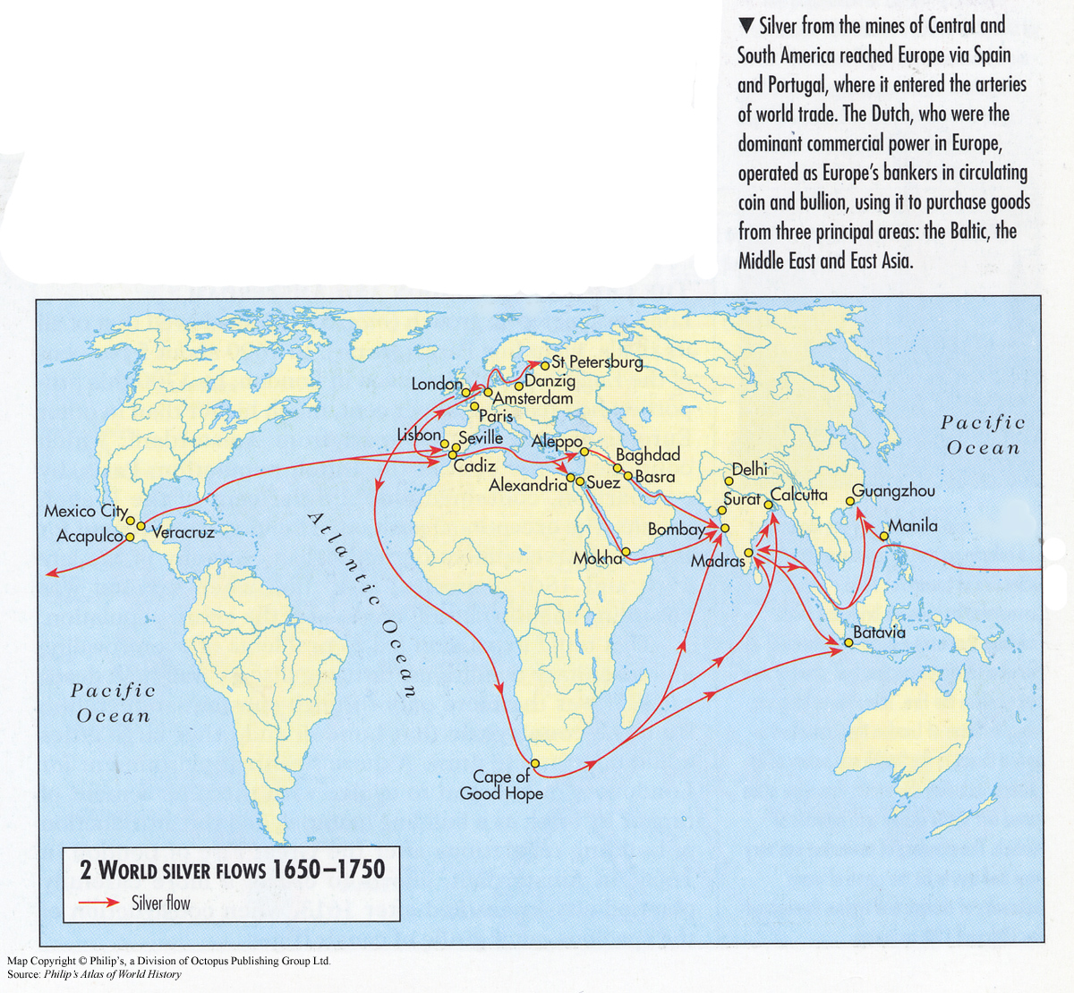
World Silver Flows 1650-1750
World oil 2004 – reserves, consumption, trade and conflicts
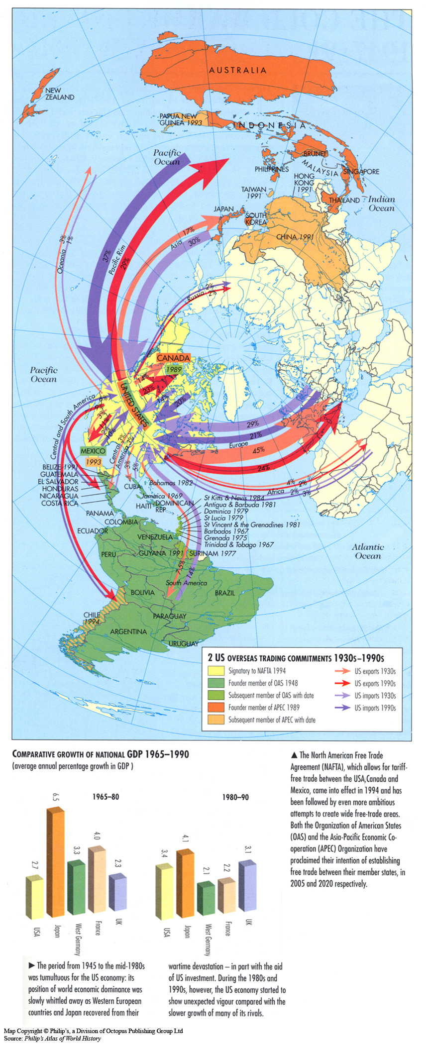
US Overseas Trading Commitments 1930s-1990s
Trade Routes by the Panama Canal and Japan’s Trade with the World in 1911
The Transatlantic Slave Trade, 1601 to 1870
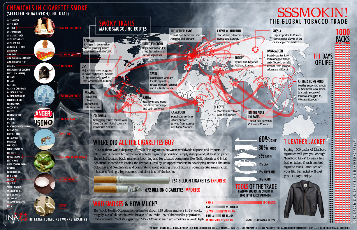
The Global Tobacco Trade
Teubners Weltwirtschaftskarten III 3
Teubners Weltwirtschaftskarten III 2
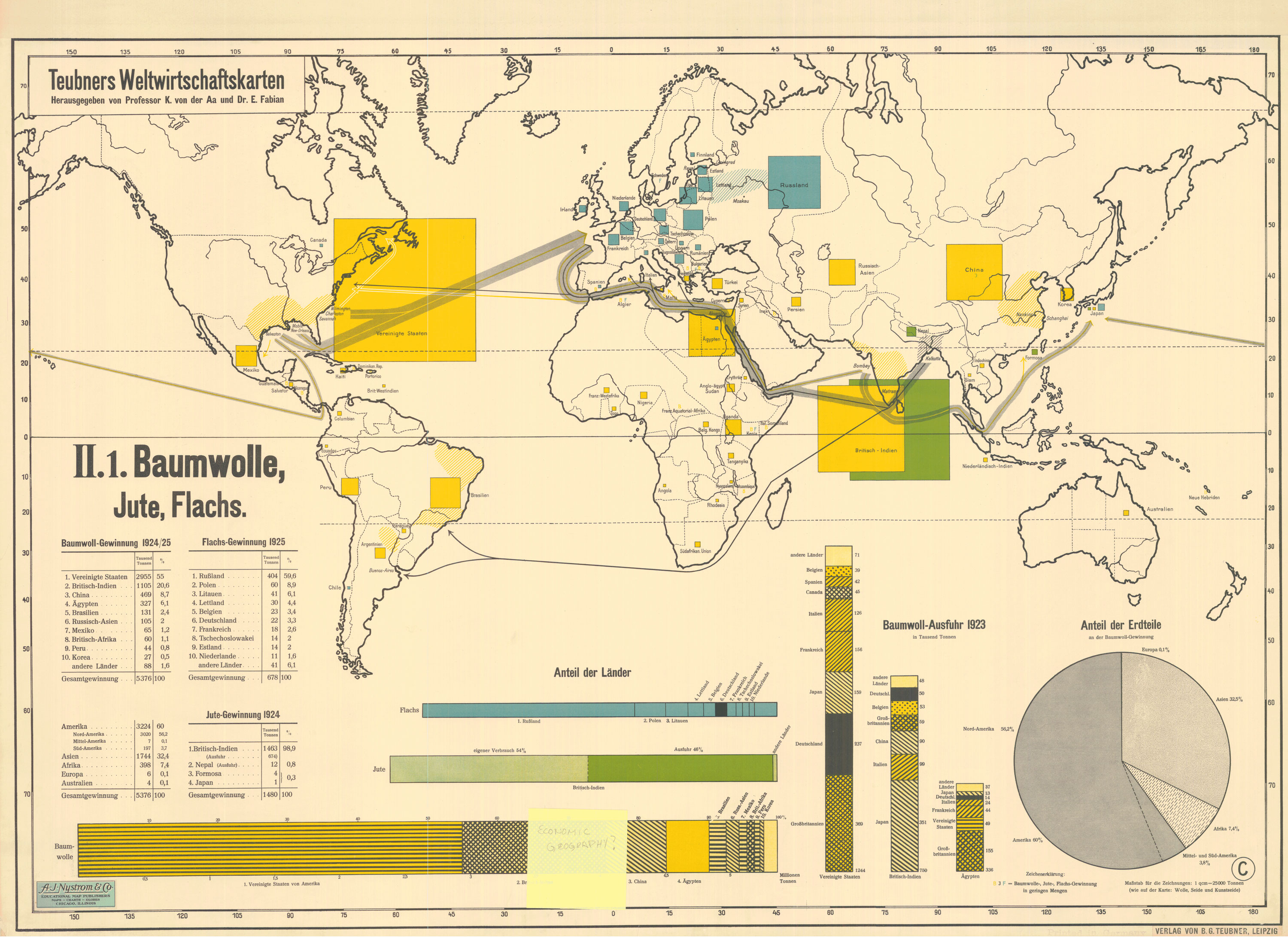
Teubners Weltwirtschaftskarten II 1
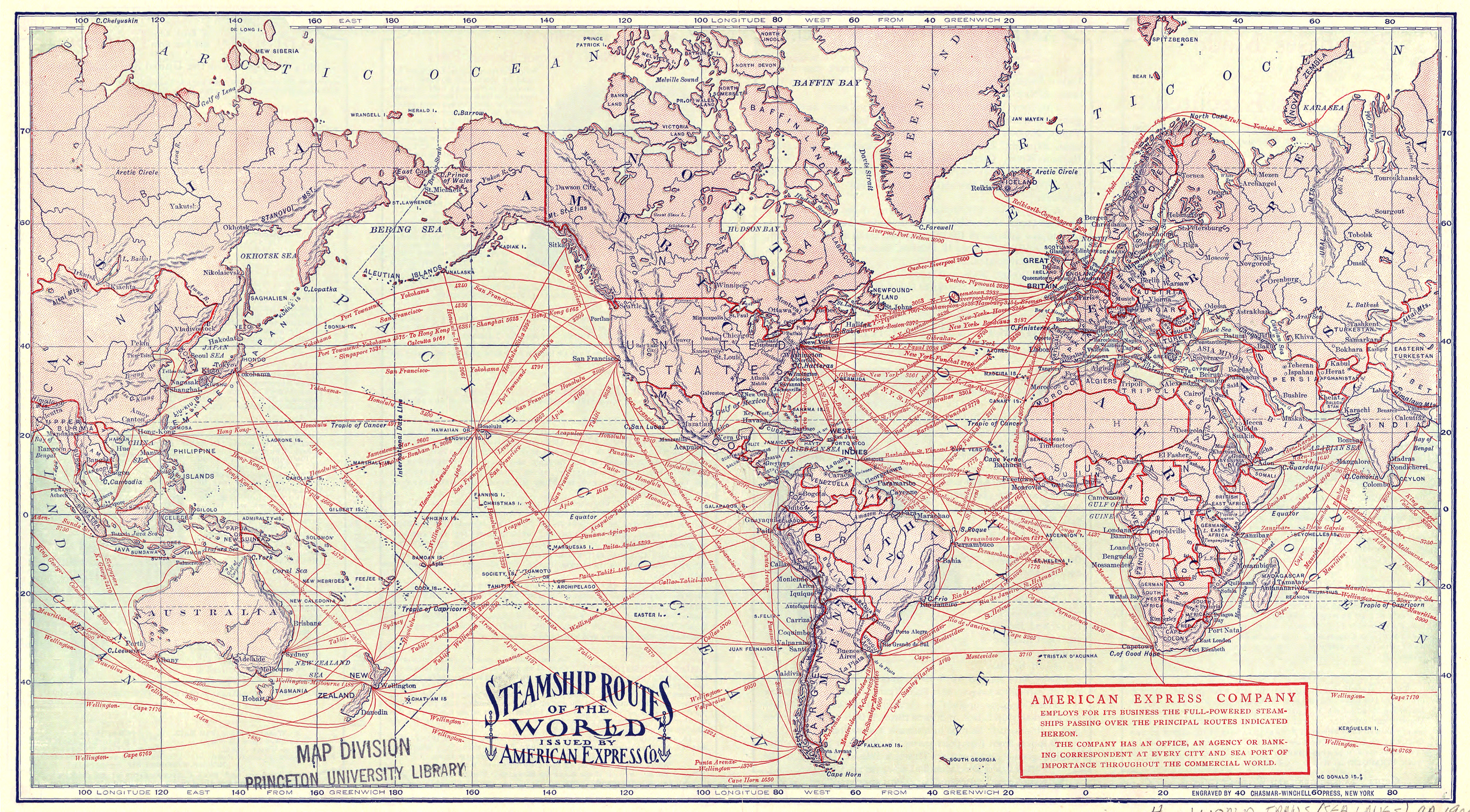
SteamshipRoutesCirca1900
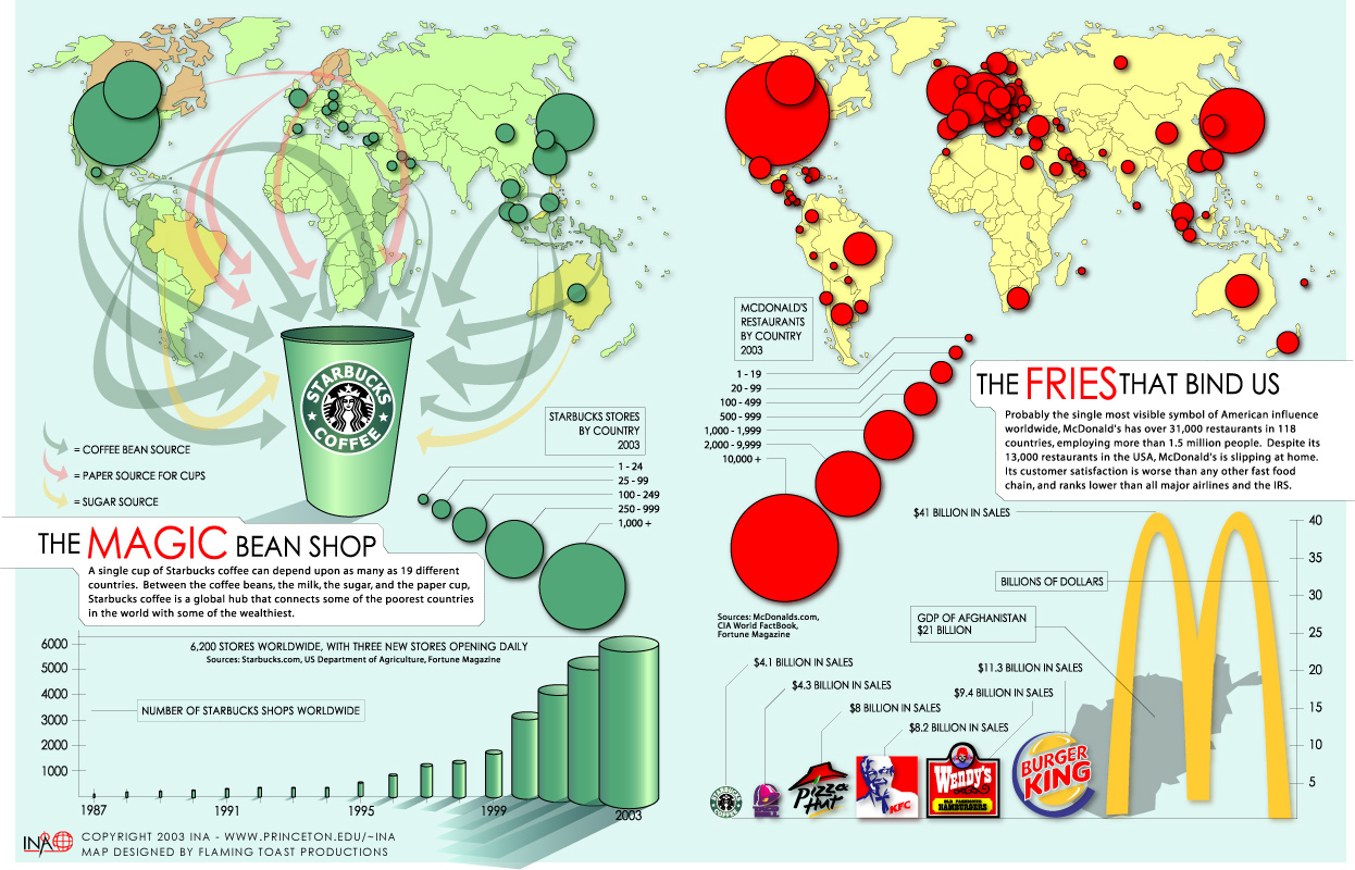
Starbucks and McDonald’s
Oil pipelines and tanker routes, 2003
Modern China-Traffic and Communications, 20th Century
Major Global Trade Flows of Dairy Products in 2003
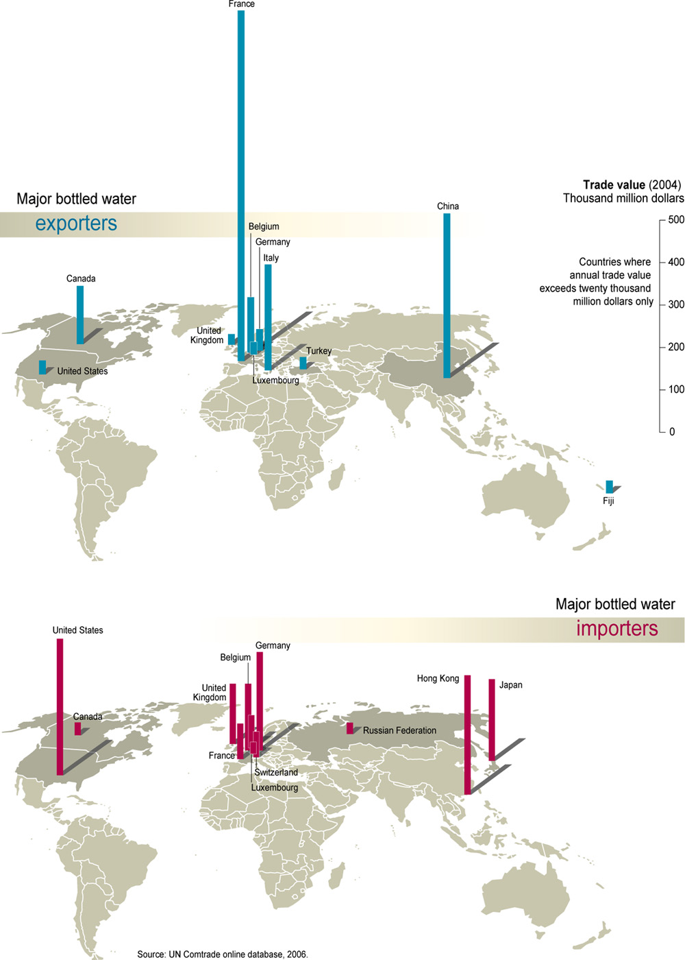
Major Bottled Water Exporters and Importers, 2006
Main Ore and Coal Movements by Sea, 1961
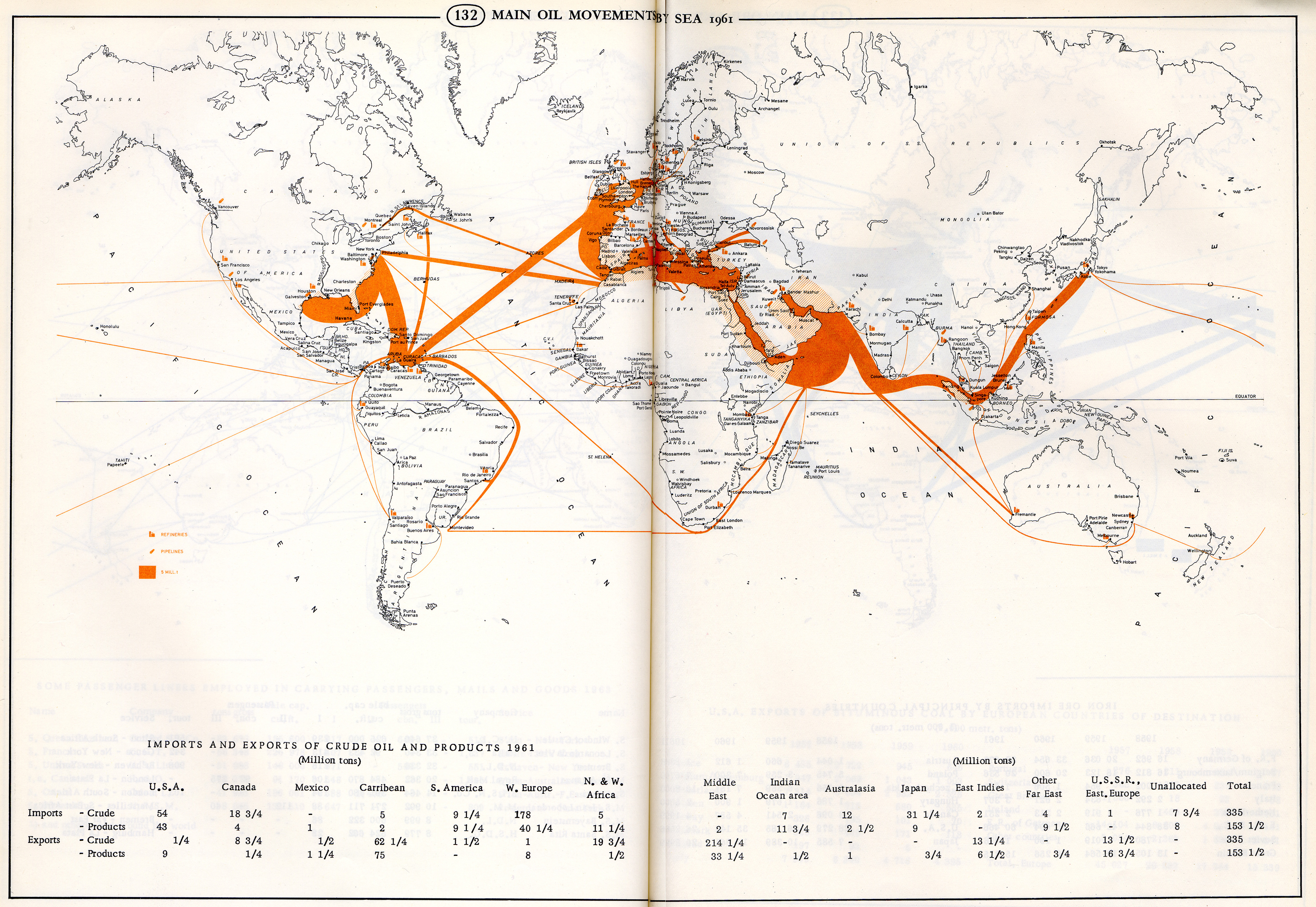
Main Oil Movements By Sea 1961
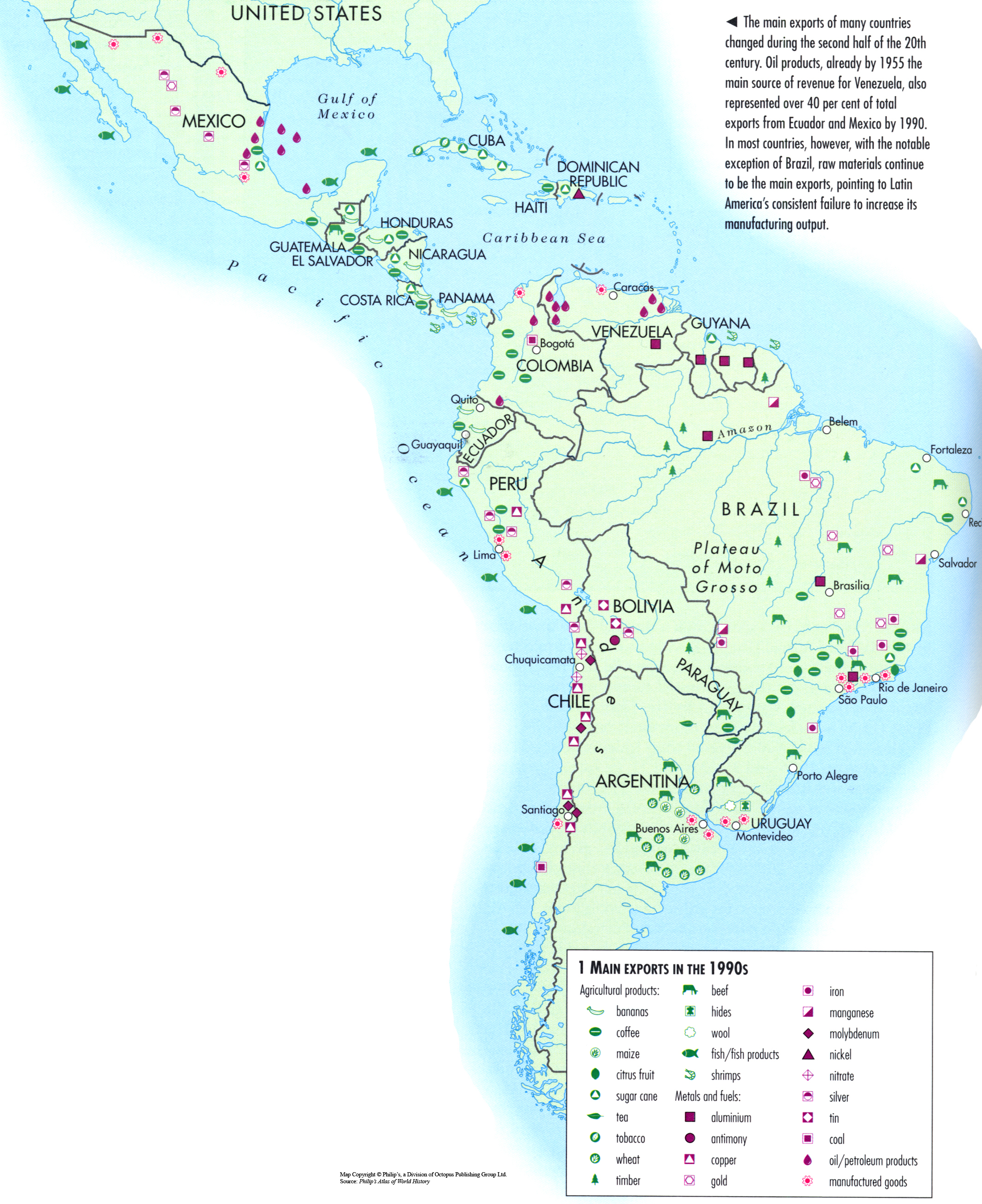
Main Exports in the 1990s
Post navigation
Previous
1
2
3
Next