
Caption
Tropical Cyclone Frequency, 1980 to 2000
Summary
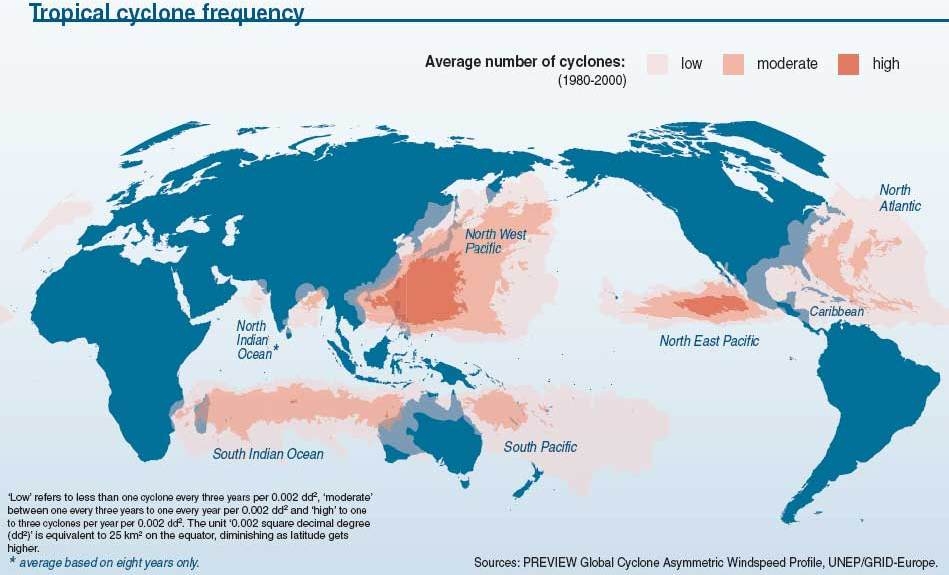
This map shows the frequency of cyclones in areas all over the world.
After forming above the ocean, cyclones can move to populated land and cause much damage.
Source
United Nations Environment Programme / GRID-Arendal[1]
Cartographer/Designer: Emmanuelle Bournay, UNEP/GRID-Arendal
Primary Source:
- PREVIEW Global Cyclone Asymmetric Windspeed Profile
- UNEP/GRID-Europe
Copyright
© 2006 UNEP / GRID-Arendal
Licensing
Used with permission.
For use constraints, see [2].
Series
This map is one in a series For a listing with flyovers, see Series:UNEP / GRID-Arendal.