
Caption
Population Migration and Displacement in the Southern Caucasus, 1988 to 2004
Summary
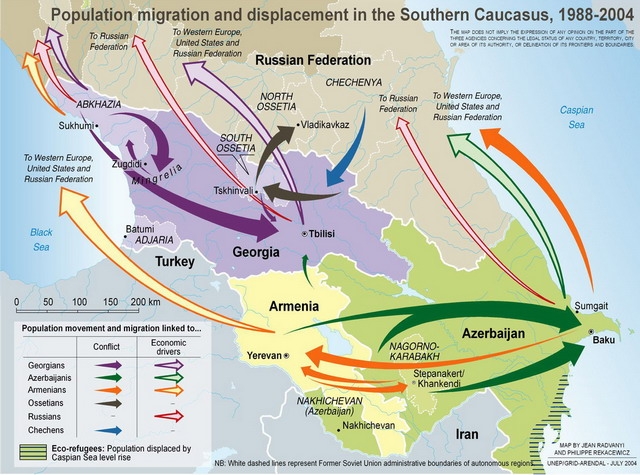
This map shows population movements within the Southern Caucasus, and from the Southern Caucasus to other destinations, from 1988 to 2004. The arrows are color-coded to distinguish between Georgians, Azerbaijanis, Armenians, Ossetians, Russians, and Chechens, and whether the migration or displacement occurred as a result of conflict or economic drivers. The map also indicates the source of “eco-refugees”” — people displaced by changes in the Caspian Sea. .
Source
United Nations Environment Programme / GRID-Arendal[1]
Cartographer/Designer: Philippe Rekacewicz, UNEP/GRID-Arendal
Copyright
© 2006 UNEP / GRID-Arendal
Licensing
For use constraints, see [2].
Series
This map is one in a series For a listing with flyovers, see Series:UNEP / GRID-Arendal.