
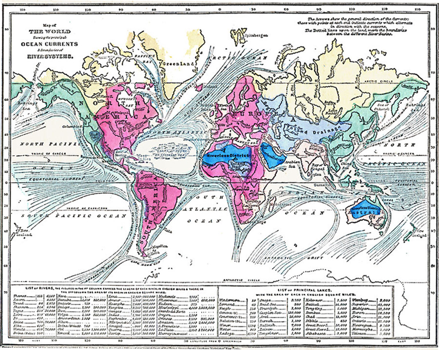
Caption
Map of World showing the principal Ocean Currents & boundaries of River Systems
Summary
Color-coded map indicates the major ocean currents and river systems. It also offers a list of rivers (with lengths and basin areas), and a list of lakes (with areas).
“The arrows show the general direction of the Currents: those with points at each end indicate currents which alternate in direction with the seasons. The dotted lines upon the land, mark the boundaries between the different River-Basins.”
Place Names: Africa, Antarctica, Asia, Australia, Europe, North America, South America
Source
George W. Fitch, Outlines of Physical Geography (New York, NY: Ivison, Phinney, Blakeman & Company, 1868) 26.
Map Credit: Courtesy The Private Collection of Roy Winkelman.
Courtesy of the
MAPS Technology Clearinghouse of the
Florida Center for Instructional Technology (FCIT) at the University of South Florida.
Copyright
The original map is public domain, but “Maps ETC is copyright © 2007 by the University of South Florida”.
See [2] for the license.