Caption
Major Merchandise Ports [and likely waste transit points]
Summary
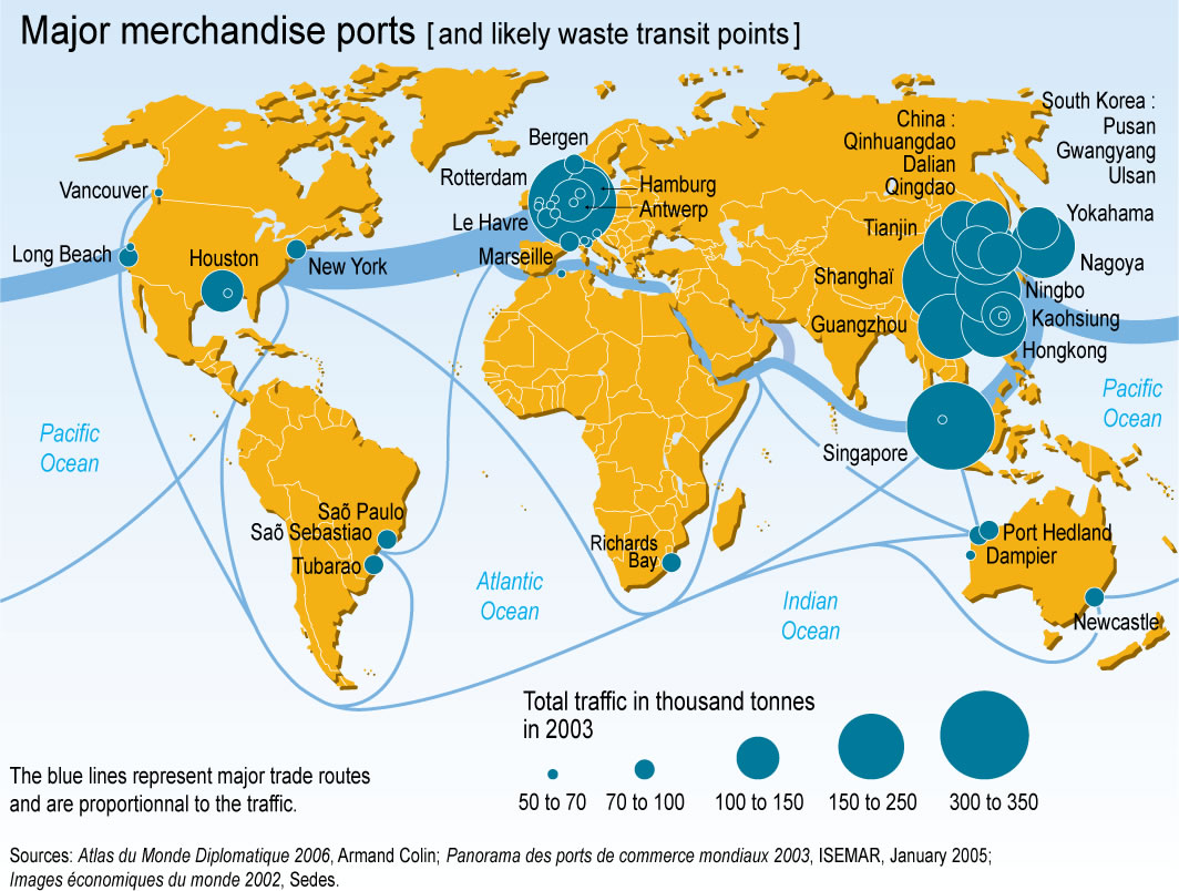
This map shows the major shipping ports of the world in 2003 together with the principal shipping routes.
The blue lines represent the major shipping routes and their widths are proportional to the volume of trade;
the circles vary in size according to the total volume of traffic in 2003.
Unscrupulous waste trade became a serious concern in the 1980s due to three converging factors: increasing amounts of hazardous waste; inadequate processing plants; and stricter regulations in the developed world as a result of growing environmental awareness.
Source
United Nations Environment Programme / GRID-Arendal [1]
Primary sources:
- Atlas du Monde Diplomatique 2006, Armand Colin; Panorama des ports de commerce mondiaux 2003, ISEMAR, January 2005;
- Images économiques du monde 2002, Sedes.
Cartographer/Designer: Philippe Rekacewicz, Emmanuelle Bournay
Copyright
© 2006 UNEP / GRID-Arendal
Licensing
For use constraints see
[2]
Series
This map is one in a series:
For a listing with flyovers, see Series:UNEP / GRID-Arendal.

