
Caption
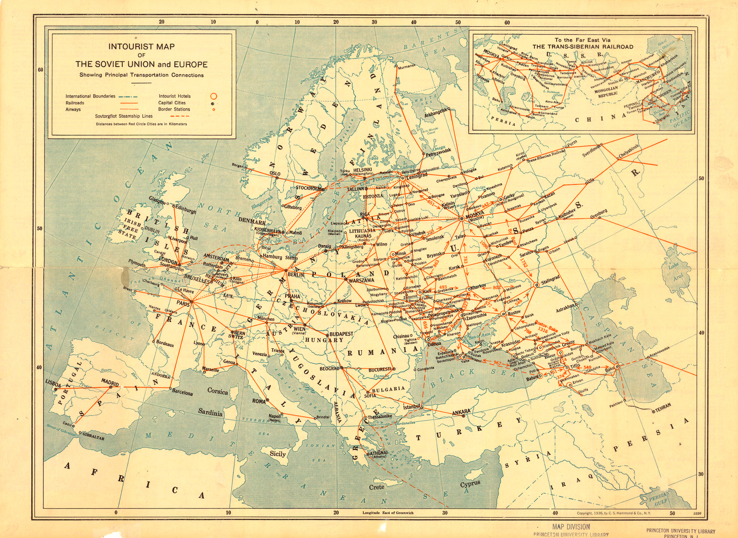
Intourist Map of Soviet Union and Europe. Showing Principal Transportation Connections
Summary
Map shows Railroads, Airways, and Steamship Lines in Europe and the Soviet Union. Distances are in kilometers. It also indicates Intourist Hotels, Capital Cities, and Border Stations. Inset map shows the Trans-Siberian Railroad in the Far East.
Copyright status
C.S. Hammond & Co., N.Y., 1936.
Source
Burland Printing Co. Inc., New York City, NY.