
Caption
Availability of Freshwater in 2000
Summary
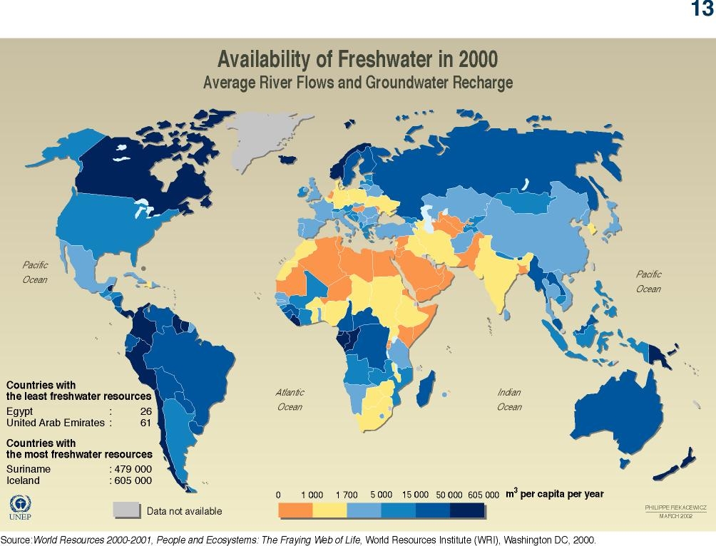
In this world map, countries are color-coded according to the volume of available freshwater per capita at the national level in 2000. Availability is defined in terms of average river flows and groundwater recharge. Details are also provided for the two countries with the least freshwater resources (Egypt and the UAE) and for the two with the most (Suriname and Iceland).
Source
United Nations Environment Programme / GRID-Arendal[1]
Cartographer/Designer: Philippe Rekacewicz, UNEP/GRID-Arendal
Primary Source:
- World Resources 2000-2001, ‘People and Ecosystems: the Fraying Web of Life’
- World Resources Institute (WRI), Washington, D.C., 2000.
Copyright
© 2006 UNEP / GRID-Arendal
Licensing
Used with permission.
For use constraints, see [2].
Series
This map is one in a series For a listing with flyovers, see Series:UNEP / GRID-Arendal.