
Caption
World Deepwater Developments Map, 2001
Summary
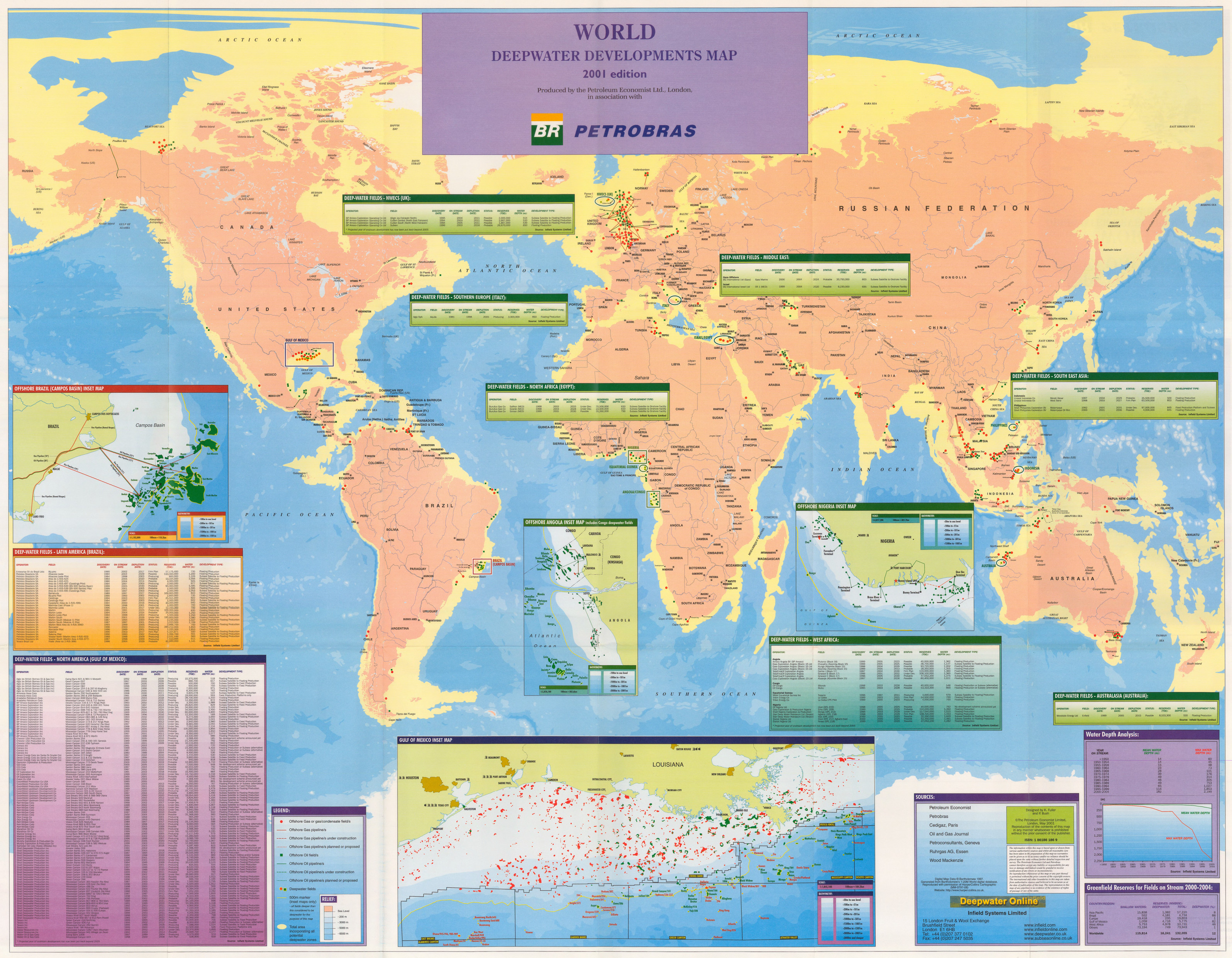
This map shows the deep-water fields of oil and gas in the different regions of the world.
Detailed inset maps of the Gulf of Mexico, Offshore Brazil (Campos Basin), Offshore Angola, and Offshore Nigeria are provided.
In addition, tables with information about deep-water fields are provided for North Africa (Egypt), Latin America (Brazil), North America (Gulf of Mexico), NWECS (UK), Southern Europe (Italy), Middle East, South East Asia, West Africa, and Australasia (Australia).
Finally, a “Water Depth Analysis” and a “Greenfield Reserves for Fields on Stream 2000-2004” are added.
Legend indicates:
- Offshore Gas or gas/condensate field/s
- Offshore Gas Pipeline/s
- Offshore Gas Pipeline/s under construction
- Offshore Gas Pipeline/s planned or proposed
- Offshore Oil Field/s
- Offshore Oil Pipeline/s
- Offshore Oil Pipeline/s under construction
- Offshore Oil Pipeline/s planned or proposed
- Deepwater fields
- 500m marker (inset maps)
- Total Area incorporating all potential deepwater zones
Source
The Petroleum Economist; Petrobras; Cedigaz, Paris; Oil and Gas Journal, Petroconsultants, Geneva, Ruhrgas AG, Essen, Wood Mackenzie.
Designed by K. Fuller and P. Bush.
ISBN: 1 86186 186 9
“Digital Map Data © Bartholomew 1997. Generated from Bartholomew’s 1:20M World digital database. Reproduced with permission of Harper Collins Cartographic (MM-0797-08). Website: http://www.harper-collins.co.uk”
This map is in the collection of copyrighted maps of the Geosciences and Map Library, Fine Hall (B level), Princeton University.
Call number: LF G3201.H8.2001.P4
Copyright
© The Petroleum Economist Limited, London, May 2001.