
Caption
Surface Communications – Rail, Liner Routes and Frequencies, Ports 2
Summary
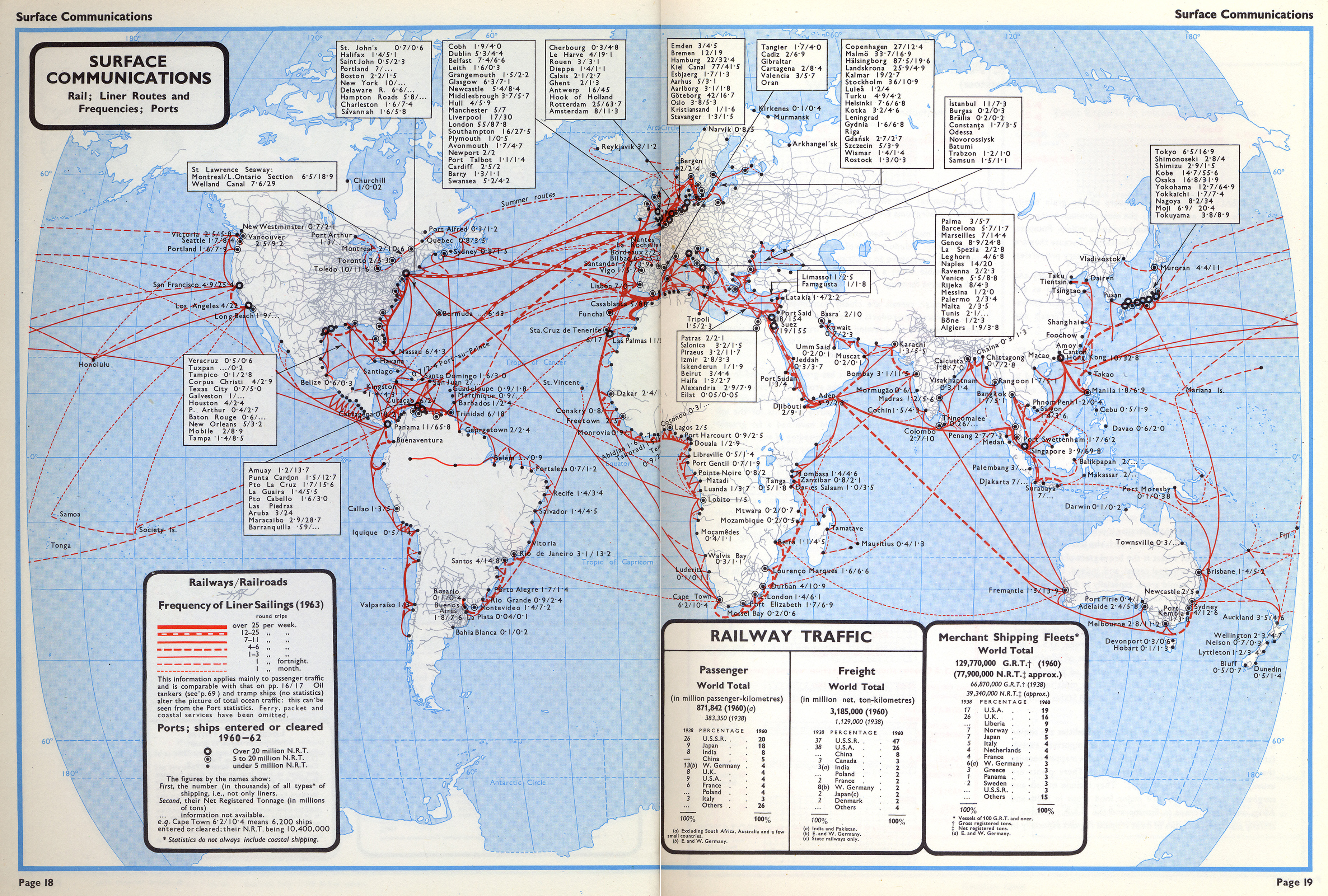
World map shows Railway Routes, Frequencies of Liner Sailings (1963), and Ports/Ships cleared (1960-62). Map additionally provides a table with Passenger and Freight Railway Traffic (1960), and Total Merchant Shipping Fleets worldwide (1960).
See also MG©Surface Communications 1.jpg.
Source
Oxford Economic Atlas of the World (p. 18)
Prepared by the Economist Intelligence Unit and the Cartographic Department of the Clarendon Press, Third Edition, 1965.
Copyright
Oxford University Press.
This is a copyrighted work. Its use on QED is under the “Fair Use” rule.