
Caption
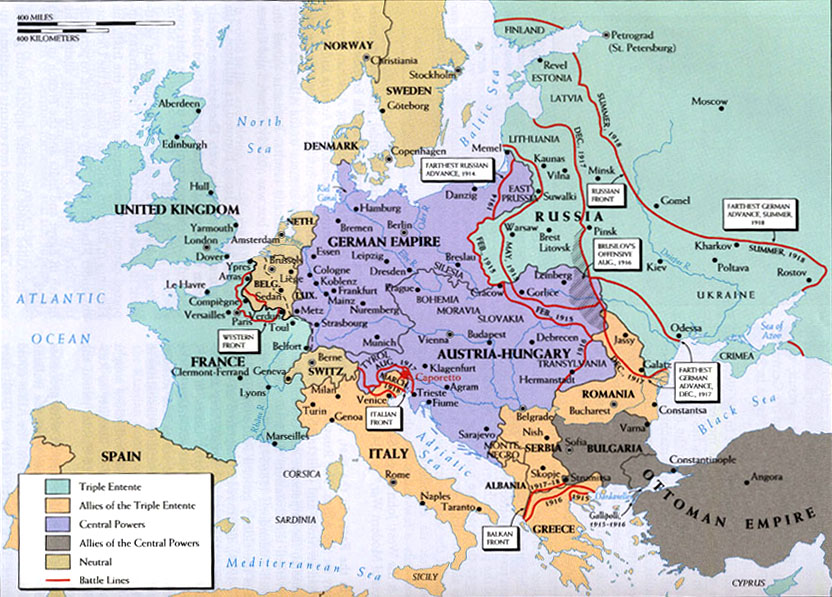
World War I in Europe
Summary
Color-coded map shows the alliances, fronts, and battle lines in Europe during World War I.
Source
Donald Kagan et al. The Western Heritage Since 1300. (p. 906)
Prentice Hall [Pearson]
Copyright
© 2004 Prentice Hall [Pearson]