
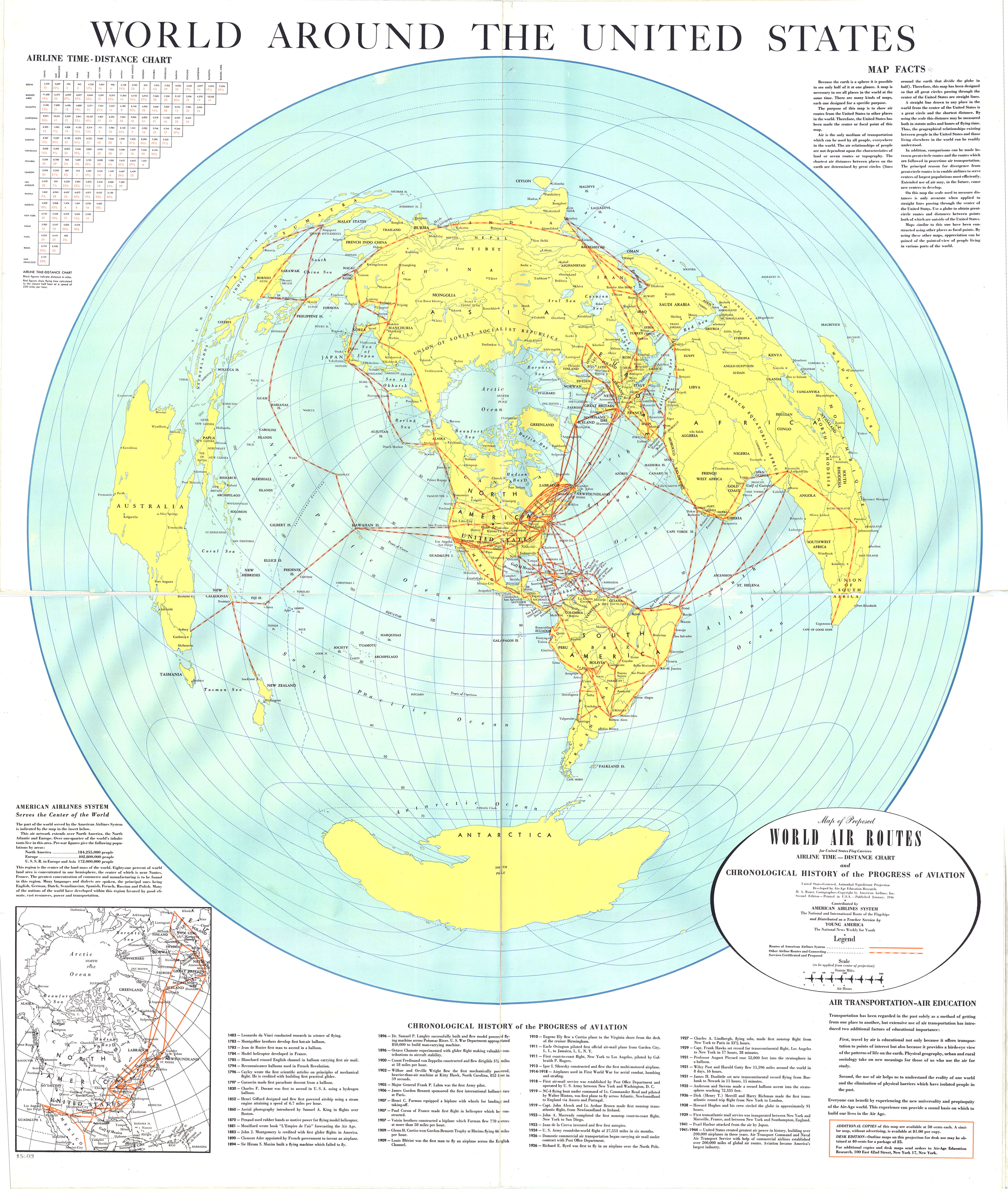
Caption
World Around the United States: World Air Routes for United States Flag Carriers
Summary
Map shows routes of American Airlines system, other airline routes and connecting services certificated and proposed. It also provides a chronological history of the progress of aviation, and an airline time-distance chart. The scale used is statute miles/air hours. Given that the purpose of the map is to show air routes from the United States to other places in the world, the United States is the focal point of this map. According to the map, the American Airlines System is deemed to serve the Center of the World. Additionally, a statement on air transportation as educational to experience the Air-Age world is provided.
Source
Developed by Air-Age Education Research. H. A. Bauer, Cartographer.
Copyright
©American Airlines, Inc.