
Caption
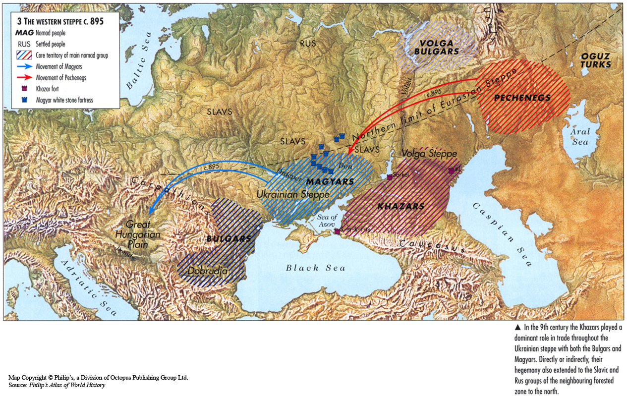
The Western Steppe c. 895
Summary
The map shows the migration routes for nomadic groups of the Magyars and the Pechenegs in eastern Europe and western Asia on the Western Steppe around 895.
Placement of their fortresses are indicated, as well as surrounding nomadic groups such as the Bulgars and the Khazars.
Source
Oxford Atlas of World History, Oxford University Press, 1999. General Editor Patrick K. O’Brien. (p. 77)
Copyright
Map copyright © Philip’s, a division of Octopus Publishing Group Ltd.
Source: Philip’s Atlas of World History
Used under license from Octopus Publishing Group.
Series
This map is one in a series of maps selected from the Oxford Atlas of World History.
A gallery using flyover images like this