
Caption
The Spread of Agricultural Settlement
Summary
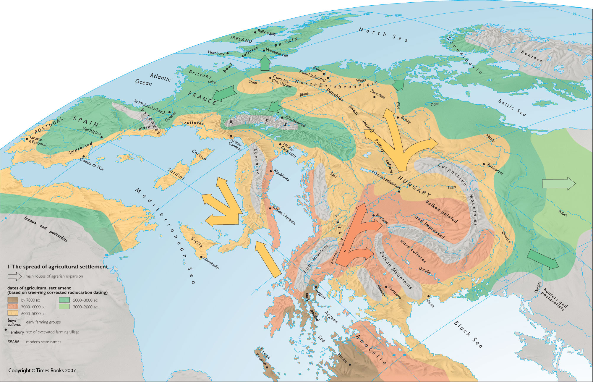
The map shows the spread of agricultural settlement in Europe and North Africa until about 2000 BCE. The map is color-coded according to the estimated date of agricultural settlement based on tree-ring corrected radiocarbon dating.
The main routes of agrarian expansion are shown. Labels indicate the locations of early farming groups as follows:
- impressed ware cultures
- bowl cultures
- funnel rim pottery cultures
- Danubian linear incised pottery cultures
- Balkan painted and impressed ware cultures
- early painted ware cultures
The locations of excavated farming villages are also indicated.
Source
The Times Complete History of the World (2007), p. 40-1.
Copyright
Copyright © Times Books 2007
Reproduced from The Times Complete History of the World by permission of HarperCollins Publishers Ltd.
Licensing
All rights reserved