
Caption
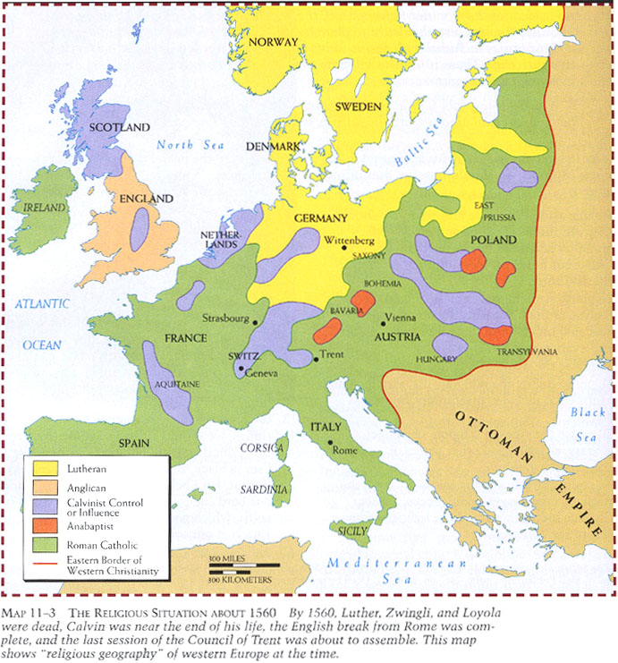
The Religious Situation about 1560
Summary
Color-coded map shows the ‘religious geography’ of Western Europe by 1560.
Source
Donald Kagan et al. The Western Heritage Since 1300. (p. 374)
Prentice Hall [Pearson]
Copyright
© 2004 Prentice Hall [Pearson]