
Caption
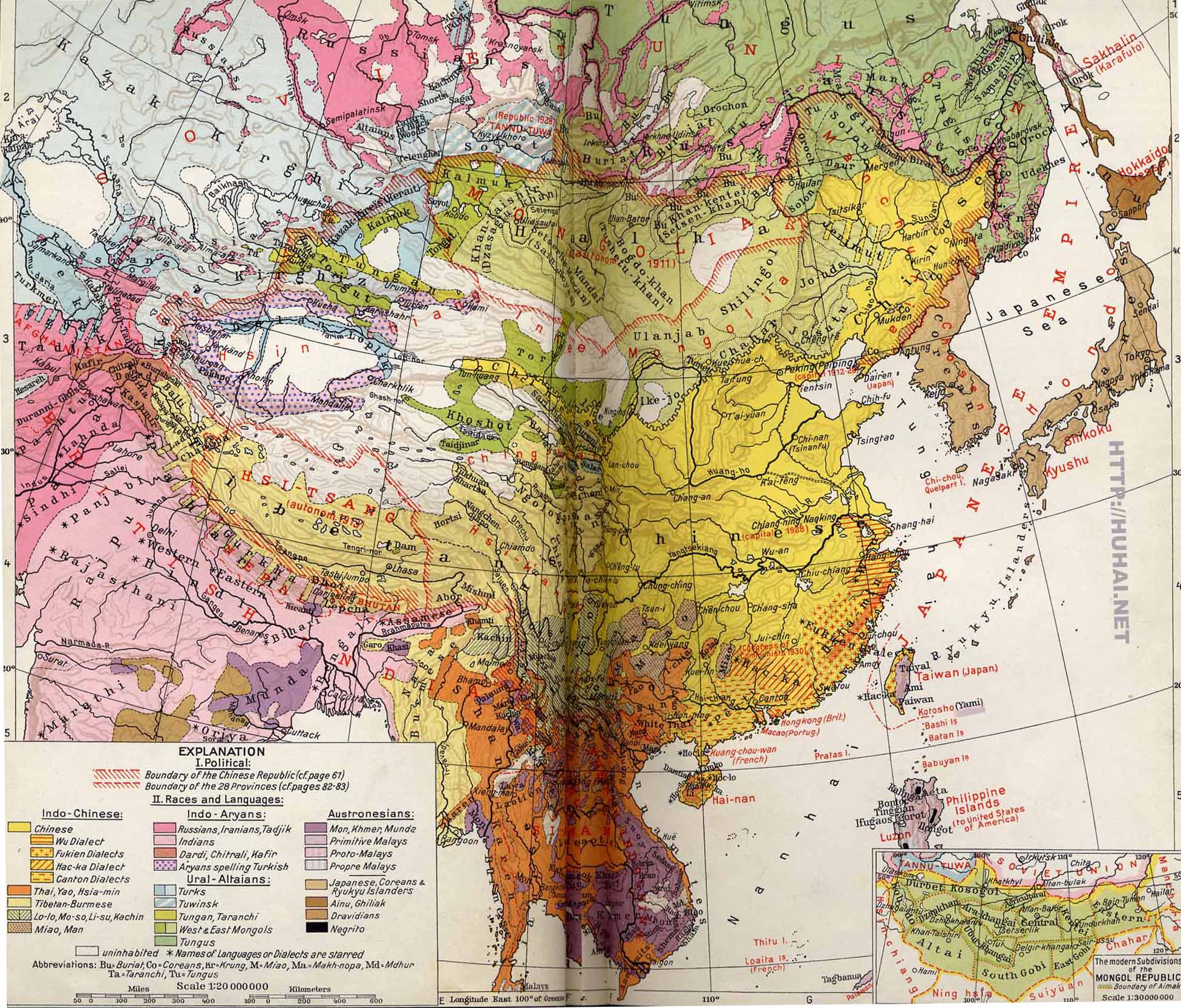
The Chinese Republic with Tibet and Mongolia – Political, Racial, and Linguistic
Inset: The modern Subdivisions of the Mongol Republic
Summary
This color-coded map indicates the various “Races and Languages” coexisting in Asia circa 1935. It also shows the political boundaries of the Chinese Republic and the 28 Provinces.
Legend for “Races and Languages”:
- Indo-Chinese
- Chinese (Wu, Fukien, Hac-ka (Hakka), Canton dialects)
- Thai, Yao, Hsia-min
- Tibetan-Burmese
- Lo-lo, Mo-so, Li-su, Kachin
- Miaso, Man
- Indo-Aryans
- Russians, Iranians, Tadjik
- Indians
- Dardi, Chitralia, Kafir
- Aryans spelling Turkish
- Ural-Altaians
- Turks
- Tuwinsk
- Tungan, Taranchi
- West and East Mongols
- Tungus
- Austronesians
- Mon, Khmer, Munda
- Primitive Malays
- Proto-Malays
- Propre Malays
- Japanese, Coreans (sic) and Ryukyu Islanders
- Ainu, Ghiliak
- Dravidians
- Negrito
Source
History and Commercial Atlas of China, Albert Herrmann, Ph.D., Harvard University Press, 1935.
See Huhai Website.
Copyright status
This work is believed to be in the public domain because its copyright is believed to have expired.
Series
This map is one in the series:
- Asia under the Mongols, 1290 A.D.
- Chinese abroad, ca. 1930 A.D.
- The Chinese Republic with Tibet and Mongolia c. 1935
- Modern China-Traffic and Communications, 20th Century
- The Manchu Empire and the European Powers, 1644-1912 A.D.
- Beginnings of the Mongol Empire-Boundaries of 1234 A.D.
- Foreign Religions in Central Asia and China up to the 14th Century A.D.