
Caption
Slavic States c. 1000
Summary
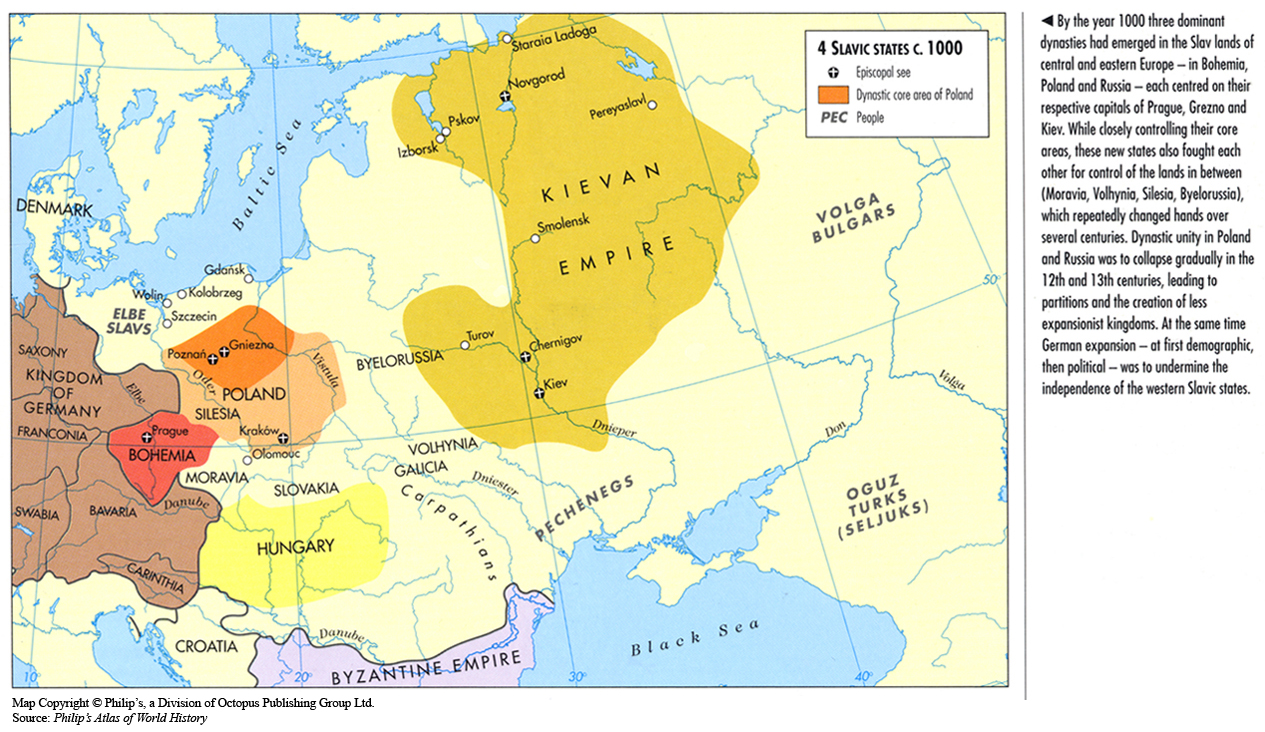
This map shows imperial boundaries in eastern Europe and western Russia in 1000.
Several Episcopal Churches are indicated on the map in Poland, Bohemia, and the Kievan Empire.
Source
Oxford Atlas of World History, Oxford University Press, 1999. General Editor Patrick K. O’Brien. (p. 71)
Copyright
Map copyright © Philip’s, a division of Octopus Publishing Group Ltd.
Source: Philip’s Atlas of World History
Used under license from Octopus Publishing Group.
Series
This map is one in a series of maps selected from the Oxford Atlas of World History.
A gallery using flyover images like this