
Caption
Railway and Steamship Tourist Map of Europe
Summary
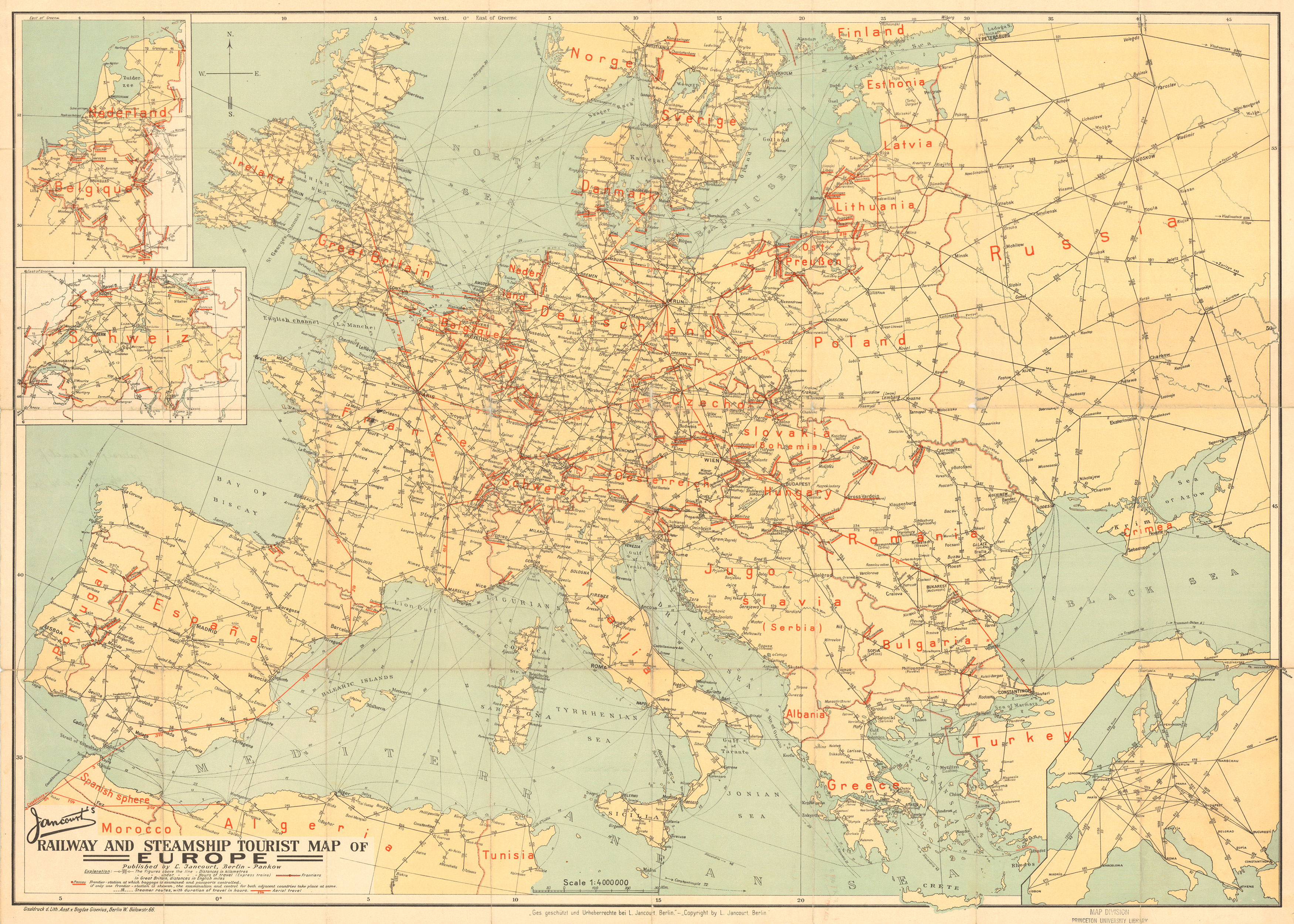
Map shows tourist railway and steamer routes in Europe providing distances in kilometers – except in Great Britain – and hours of travel. International frontiers and frontier stations at which baggage is examined and passports controlled are distinguished. Inset maps of Switzerland and of Belgium and the Netherlands.
L. Jancourt, Berlin-Pankow
Source
This map is Map Number 5956 in the collection of copyrighted maps of the Geosciences and Map Library, Fine Hall (B level), Princeton University..
Copyright
L. Jancourt, Berlin-Pankow
This work may still be under copyright and therefore care is required in its use. Its use on QED is under the “Fair Use” rule.