
Caption
Global Population Density 1994
Summary
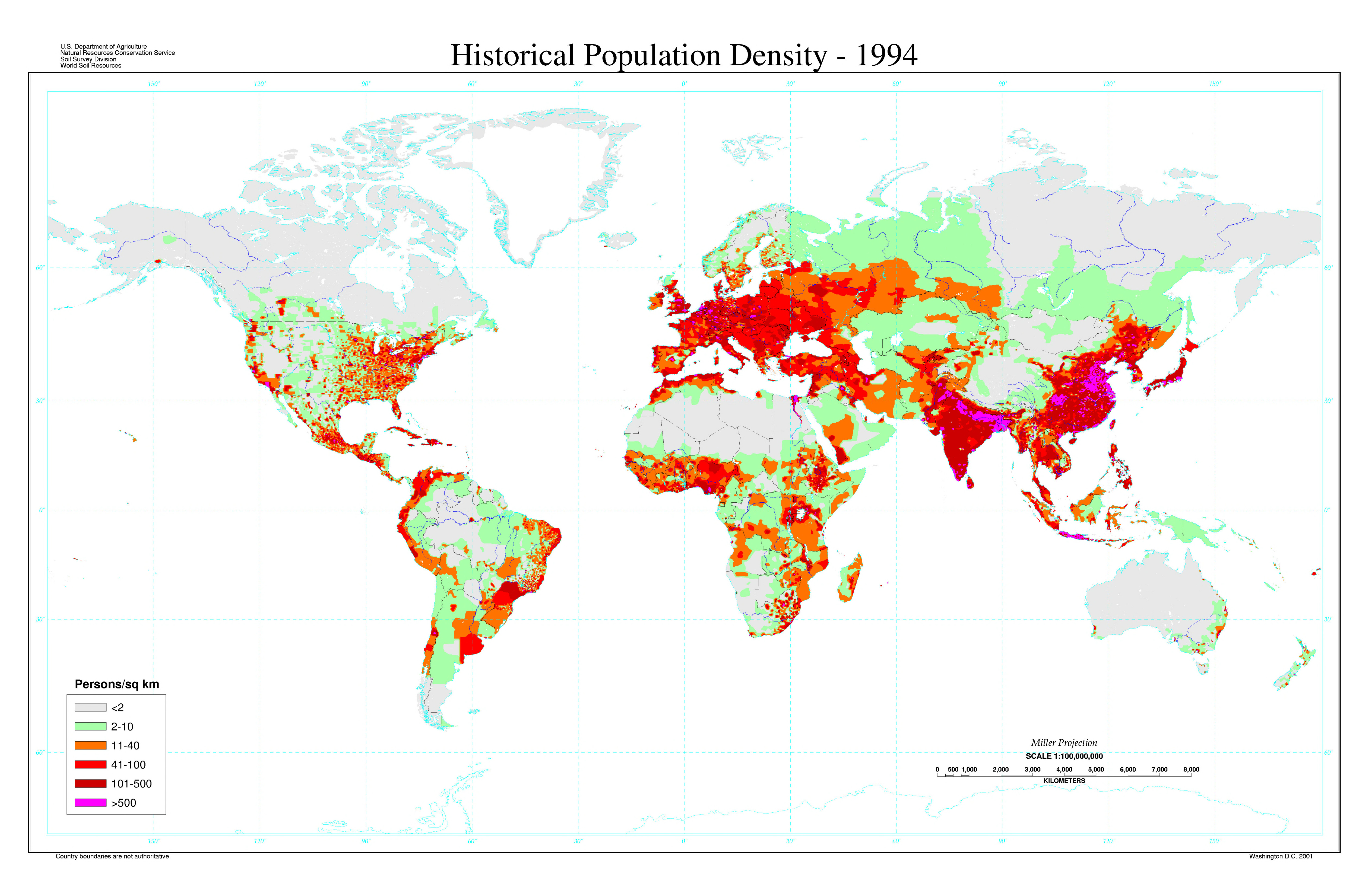
This global population density map for 1994 classifies areas into six classes based on population density. The open-ended class is defined as an area with population density greater than 500 persons per square kilometer.
Data does not extend beyond 68 degrees N latitude. Country boundaries are not authoritative.
This map is one of several global population density maps in the collection:
- Map showing density of population in various regions of the world, 1901.jpg
- Population density map 1994.djvu
See also:
Sources
U.S. Department of Agriculture, Natural Resources Conservation Service,
Soil Survey Division, World Soil Resources.
The high-resolution DjVu file was derived from the BMP file [1] at [2]:
- Source: Tobler, W., V. Deichmann, J. Gottsegen, and K. Maloy. 1995. The global demography project. Technical Report TR-95-6. National Center for Geographic Information analysis. Univ. Santa Barbara, CA. 75 pp.
- Data Aggregation and Reliability: The Population Density map data is rasterized on a 2 minute grid cell.
- Database Manager: Paul Reich, Geographer, World Soil Resources. Email: paul.reich@usda.gov
Map Production Information
- Map Identification: popden.jpg
- Production Date: 2000
- Geographic Coverage: Global
- Projection: Geographic
- Minimum Scale: 1:5,000,000