
Caption
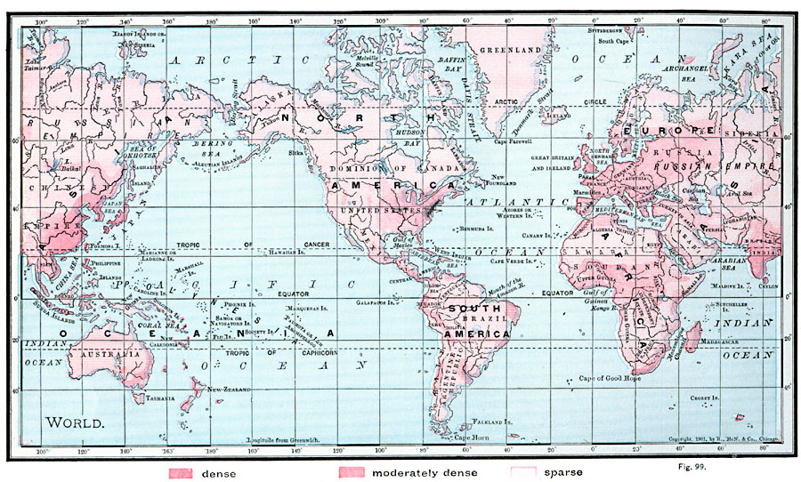
Map showing density of population in various regions of the world
Summary
Color shades on the map indicate the following population densities:
- dense
- moderately dense
- sparse
Place Names: Africa, Antarctica, Asia, Australia, Europe, North America, South America
This map is one of several global population density maps in the collection:
- Map showing density of population in various regions of the world, 1901.jpg
- Population density map 1994.djvu
See also:
Source
James A. Bowen, Grammar School Geography (Chicago, IL: Rand, McNally & Company, 1901) 58.
Map Credit: Courtesy The Private Collection of Roy Winkelman.
Courtesy of the
MAPS Technology Clearinghouse of the
Florida Center for Instructional Technology (FCIT) at the University of South Florida.
Copyright
The original map is public domain, but “Maps ETC is copyright © 2007 by the University of South Florida”.
See [2] for the license.