
Caption
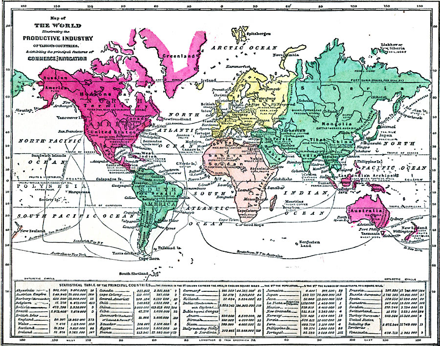
Map of the World illustrating the Productive Industry of Various Countries, & exhibiting the principal features of Commerce and Navigation
Summary
World map indicates main industrial products by country. It also shows main navigation lines.
Regions/continents are colored differently.
Map additionally offers a statistical table of the principal countries, expressing their areas, population and number of inhabitants to a square mile.
Place Names: Africa, Antarctica, Asia, Australia, Europe, North America, South America
Source
George W. Fitch, Outlines of Physical Geography (New York, NY: Ivison, Phinney, Blakeman & Company, 1868) 102.
Map Credit: Courtesy The Private Collection of Roy Winkelman.
Courtesy of the
MAPS Technology Clearinghouse of the
Florida Center for Instructional Technology (FCIT) at the University of South Florida.
Copyright
The original map is public domain, but “Maps ETC is copyright © 2007 by the University of South Florida”.
See [2] for the license.