
Caption
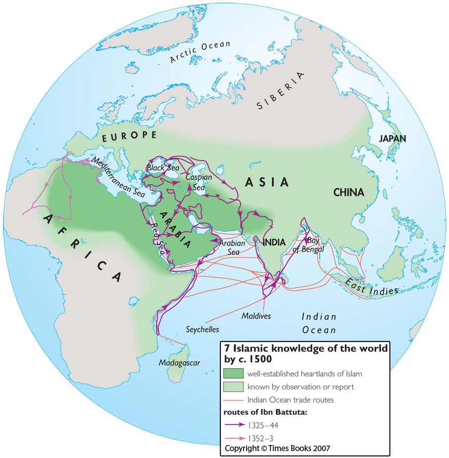
Islamic knowledge of the world by c. 1500
Summary
This map is one in a series of maps in the source book illustrating
the boundaries of geographical knowledge of different civilizations at
the time of Columbus’s voyage to the Americas.
The map distinguishes between the well-established “heartlands of Islam” and areas known by observation or report. It also indicates Indian Ocean trade routes and the routes of Ibn Battuta.
Copyright status
Copyright © Times Books 2007
Reproduced from The Times Complete History of the World by permission of HarperCollins Publishers Ltd.
Licensing
All rights reserved
Source
The Times Complete History of the World (2007), p. 171.
