
Caption
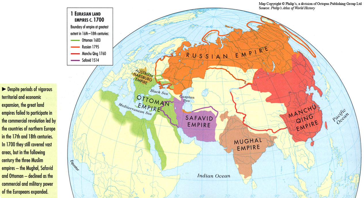
Eurasian Land Empires c. 1700
Summary
This map shows the empires in existence during the 1700s and declining in the 1800s, while the vigorous European imperial expansion took form.
Legend indicates:
- Boundary of empire at greatest extent in 16th-18th centuries:
- Ottoman 1683
- Russian 1795
- Manchu Qing 1760
- Safavid 1514
Source
Oxford Atlas of World History, Oxford University Press, 2002. General Editor Patrick K. O’Brien.
Chapter 3. The Early Modern World: “World Trade and Empires 1870-1914,” page 112.
Copyright
Map copyright © Philip’s, a division of Octopus Publishing Ltd. Source: Philip’s Atlas of World History.
Used under license from Octopus Publishing Group.
Series
This map is one in a series:
This map is one in a series of maps selected from the Oxford Atlas of World History.
A gallery using flyover images like this