
Caption
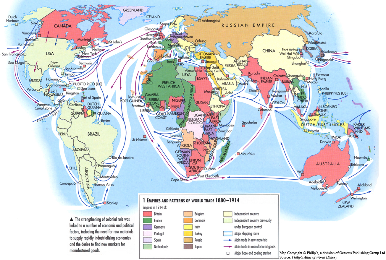
Empires and Patterns of World Trade 1880-1914
Summary
This map illustrates the integration of the world economy as the trans nationalization of trade and investment took form. During the late 19th century, Britain, France, other European countries, (and later the United States) led this process of imperial expansion.
Legend indicates:
- Empires in 1914 1525
- Britain
- France
- Germany
- Portugal
- Spain
- Netherlands
- Belgium
- Denmark
- Italy
- Turkey
- Russia
- Japan
- Independent country
- Independent country previously under European control
- Major shipping route
- Main trade in raw materials
- Land trade in manufactured goods
- Major base and cooling station
Source
Oxford Atlas of World History, Oxford University Press, 2002. General Editor Patrick K. O’Brien.
Chapter 3. The Early Modern World: “World Trade and Empires 1870-1914,” page 208.
Copyright
Map copyright © Philip’s, a division of Octopus Publishing Ltd. Source: Philip’s Atlas of World History.
Used under license from Octopus Publishing Group.
Series
This map is one in a series:
This map is one in a series of maps selected from the Oxford Atlas of World History.
A gallery using flyover images like this