
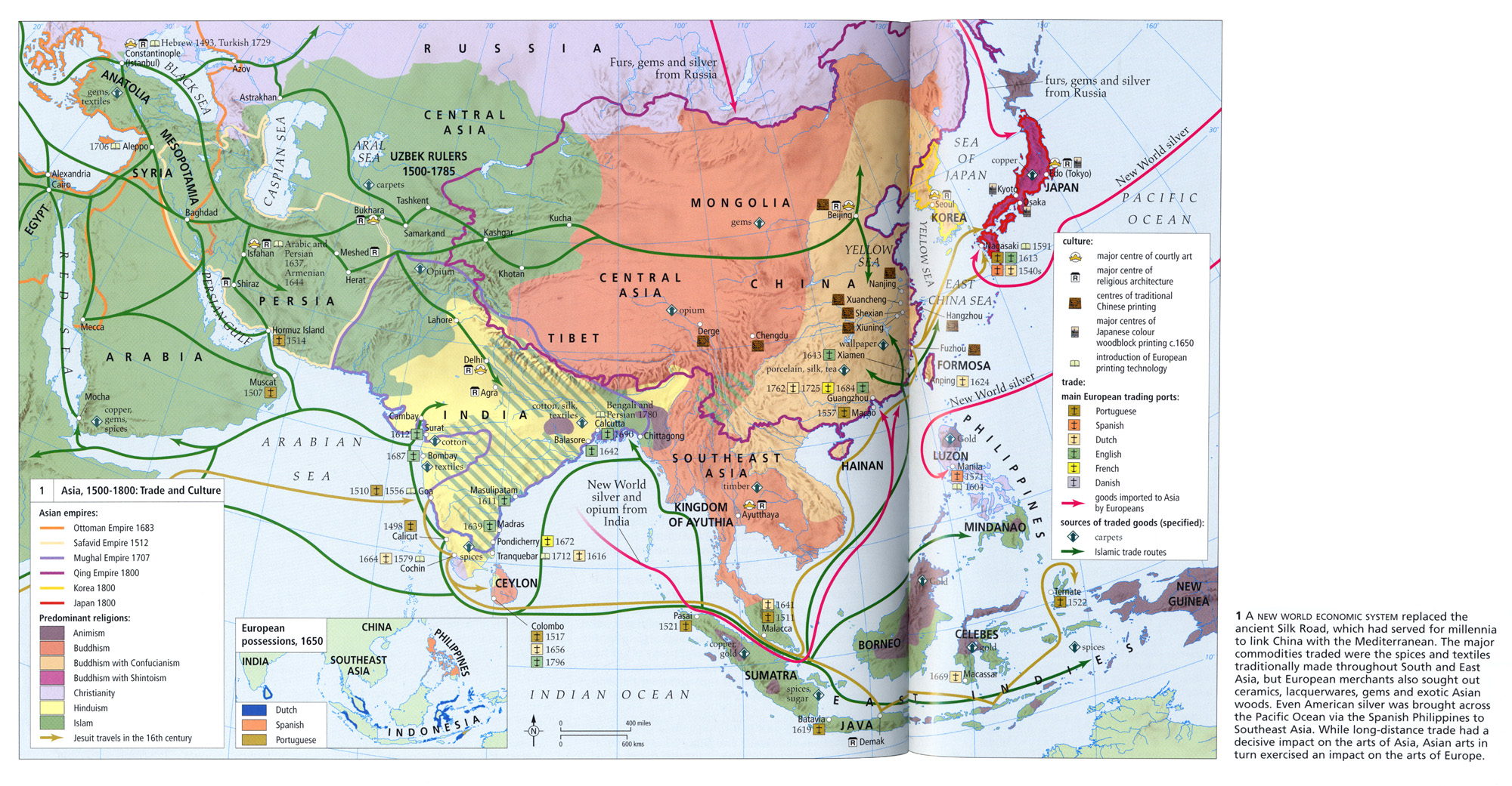
Caption
Asia, Trade and Culture, 1500-1800
Summary
This map shows the major centers of culture and trade in Asia from 1500 to 1800. Sites of courtly art, religious architecture, traditional printmaking and Japanese coloring are noted along with European trading ports and arrows indicating imported European goods to Asia. Islamic trade routes are also marked.
Additionally, predominant religions are indicated by color, along with empires, indicated by different colored lines, during this time frame.
The Inset Map, European Possessions, 1650, shows the territory ruled by the Dutch, Spanish and Portuguese in 1650. .
Source
Atlas of World Art (pp. 192-193).
Oxford University Press
Copyright
© 2004 Laurance King Publishing