
Caption
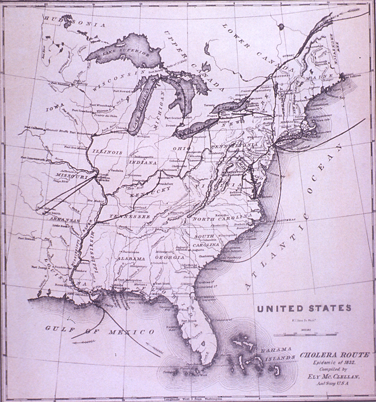
United States – Cholera Route – Epidemic of 1832
Summary
The map was made to contrast the pattern of diffusion that was evident in the cholera epidemic of 1873, when railways were
an important vector.
This map was compiled by Ely Mc.Clellan, Assistant Surgeon USA. McClellan’s maps were published in Woodworth, J.M. (1875) “The cholera epidemic of 1873 in the United States.” House of Representatives. 43d Cong. 2d Session, House Ex. Doc. No. 95.
Source
The image is from the National Library of Medicine
Cholera Online exhibit
[1].
![[1]](http://www.nlm.nih.gov/exhibition/cholera/images/a028419.jpg)
The NLM obtained the image from
Pictures of life and character in New York.
New York : G.W. Averell, 1875?.
Copyright status
The two-dimensional work of art depicted in this image is in the public domain in the United States and in those countries with a copyright term of life of the author plus 100 years. This photograph of the work is also in the public domain in the United States (see Bridgeman Art Library v. Corel Corp.).
Collection
|
Transmission Routes of Cholera (1817-1831) |
 The Progress of the Spasmodic Cholera, 1832 |
 United States Cholera Route – Epidemic of 1832 |
 Broad Street Outbreak of Cholera, London, 1854 |
 The Geographical Distribution of Health and Disease, 1856 |
 The March of Cholera in 1865 |
 The Diffusion of Cholera in the United States in 1866 |
 Diffusion of Cholera in Eastern Africa, 1864-1871 |
 Cholera Diffusion in Zanzibar c. 1869 |
 Historical cholera pathways in 1817-1823 and 1863-1869 |
 Routes of Asiatic Cholera (1885) |
 Network of cholera diffusion in India, c1931-1953 |
 Cholera, 2000-2001 |
 Cholera, 2003 |