
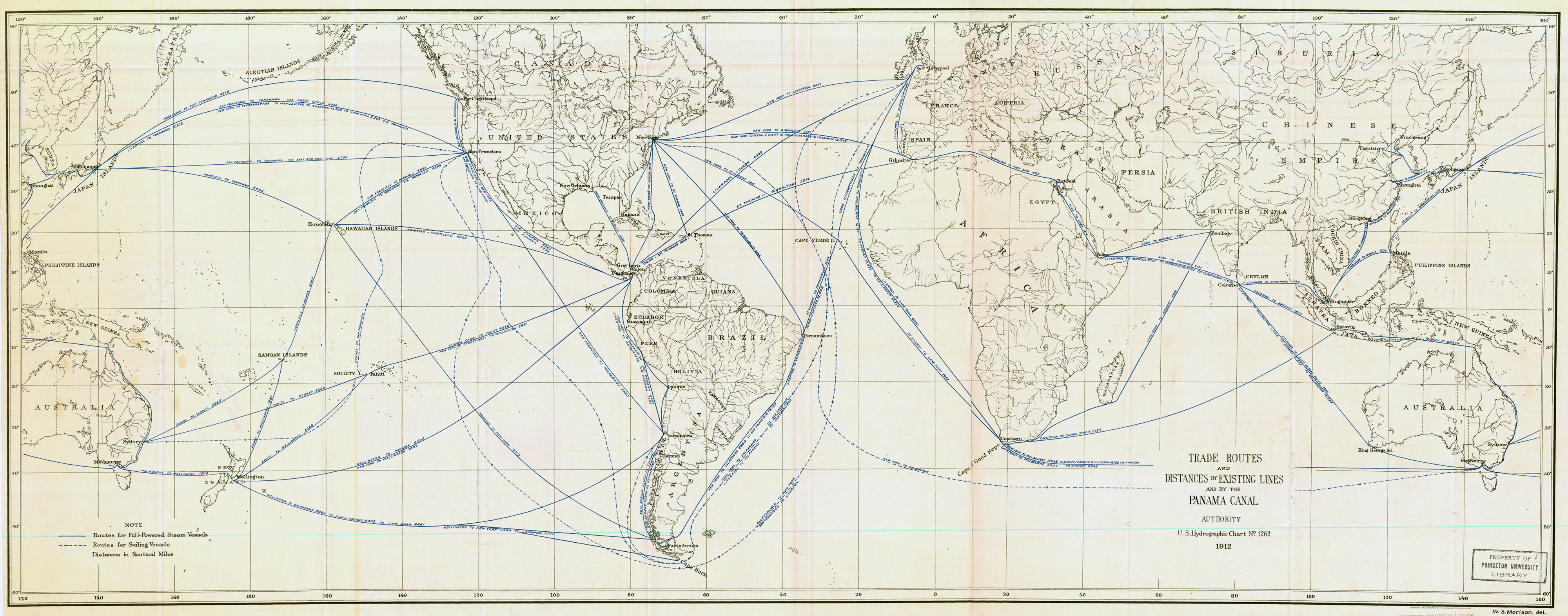
Caption
Trade Routes and Distances by Existing Lines and by the Panama Canal Authority
Summary
Map shows global routes for full-powered steam vessels and routes for sailing vessels in nautical miles.
Copyright status
The map does not appear to have a copyright notice. It was published in 1912.
Source
U.S. Hydrographic Chart, 1912. W.S. Morison.
Map was copied from the Map Division of the Princeton University Library.