
Caption
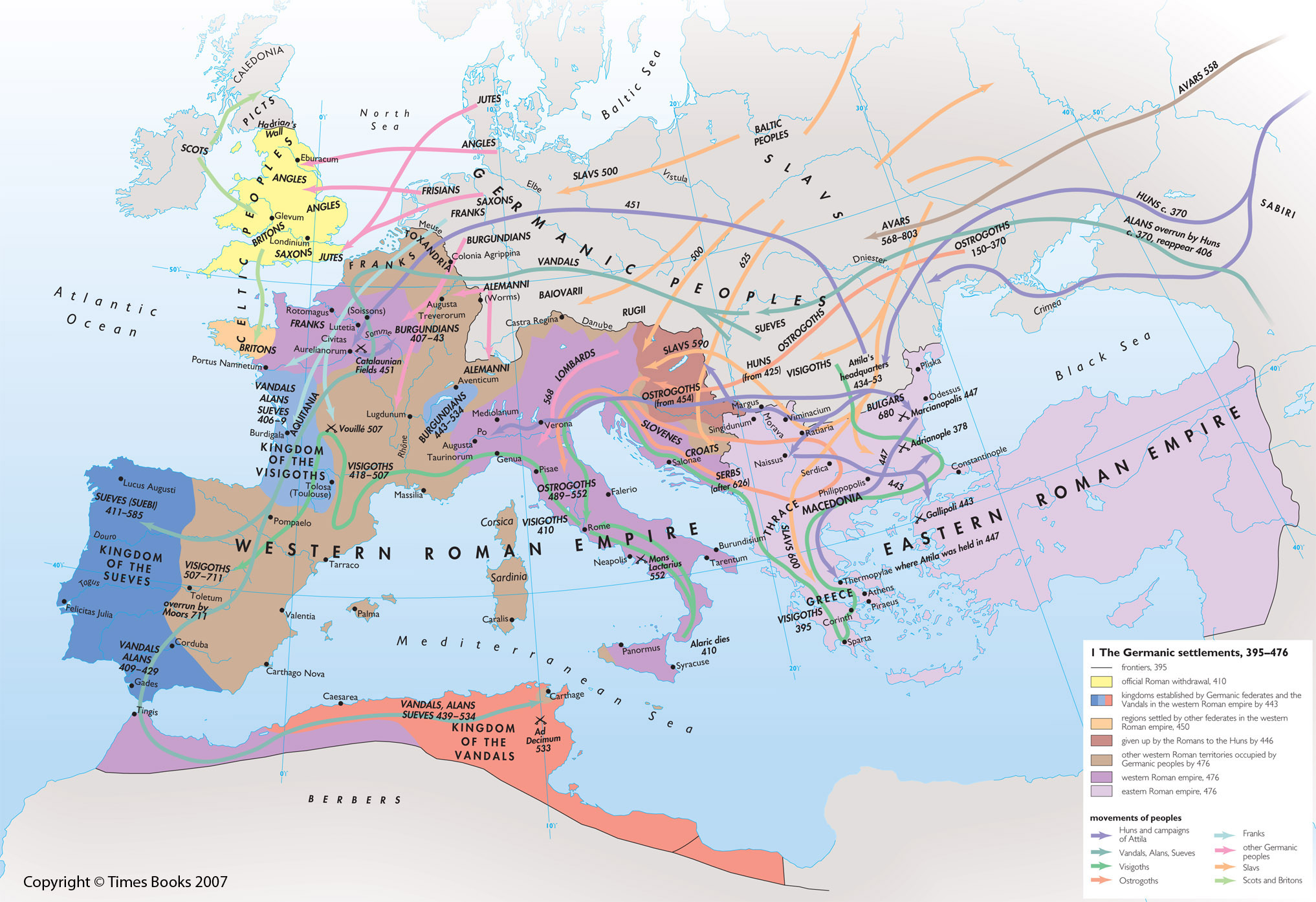
The Germanic settlements, 395-476
Summary
This map shows shows the frontiers of the Eastern and Western Roman Empires and of adjacent kingdoms as of 395 CE, and how the boundaries changed up to 476 CE.
The areas of the following kingdoms are shown:
- Kingdom of the Sueves
- Kingdom of the Visigoths
- Kingdom of the Vandals
Arrows indicate the movements of the following peoples up to about 680 CE:
- Huns
- Vandals, Alans, Sueves,
- Visigoths
- Ostrogoths
- Franks
- Other Germanic peoples (Lombards, Burgundians, Angles, Jutes, Saxons, Frisians, Alemanni))
- Slavs
- Scots and Britons
The following locations are also shown:
- Attila’s headquarters from 434-53
- where Attila was held in 447
- where Alaric died in 410
The location and date of each of the following battles are also marked:
- Adrianople (378)
- Gallipoli (443)
- Marcianopolis (447)
- Catalaunian Fields (451)
- Vouille (507)
- Ad Decimum (533)
- Mons Lactarius (552)
Copyright status
Copyright © Times Books 2007
Reproduced from The Times Complete History of the World by permission of HarperCollins Publishers Ltd.
Licensing
All rights reserved
Source
The Times Complete History of the World (2007), p. 108-9.