
Caption
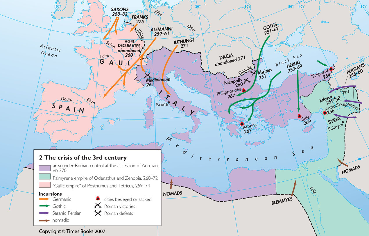
The crisis of the 3rd century
Summary
This map shows how the Mediterranean lands were divided in about 270 CE into three domains:
- area under Roman control at the accession of Aurelian, 270 CE
- Palmyrene empire of Edenathus and Zenobia, 26-72 CE
- “Gallic empire” of Posthumus and Tetricus, 259-74 CE
Arrows indicate Germanic, Gothic, Sasanid Persian and nomadic incursions from outside these
domains.
The locations of besieged or sacked cities, and of Roman victories and defeats are also shown.
Copyright status
Copyright © Times Books 2007
Reproduced from The Times Complete History of the World by permission of HarperCollins Publishers Ltd.
Licensing
All rights reserved
Source
The Times Complete History of the World (2007), p. 102.